Category:'t Haveke (Eefde)
Jump to navigation
Jump to search
| Object location | View all coordinates using:OpenStreetMap |
|---|
estate  | |||||
| Upload media | |||||
| Instance of | |||||
|---|---|---|---|---|---|
| Part of | |||||
| Location | Eefde,Lochem,Gelderland,Netherlands | ||||
| Street address |
| ||||
| Heritage designation |
| ||||
 | |||||
|
This is a category aboutrijksmonumentcomplexnumber 529053
|
Landhuis:
|
This is a category aboutrijksmonumentnumber529054
|
Historische aanleg:
|
This is a category aboutrijksmonumentnumber529055
|
Chauffeurswoning:
|
This is a category aboutrijksmonumentnumber529056
|
Bijgebouw:
|
This is a category aboutrijksmonumentnumber529057
|
Prieel:
|
This is a category aboutrijksmonumentnumber529058
|
Tuinmuur:
|
This is a category aboutrijksmonumentnumber529059
|
Hek:
|
This is a category aboutrijksmonumentnumber529060
|
| Address |
|
Media in category "'t Haveke (Eefde)"
The following 42 files are in this category, out of 42 total.
-
 Aanbouw aan achterzijde - Eefde - 20375655 - RCE.jpg 1,200 × 1,200; 347 KB
-
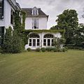
 Achtergevel - Eefde - 20067141 - RCE.jpg 1,200 × 1,195; 433 KB
-
 Bijgebouwen - Eefde - 20067142 - RCE.jpg 1,195 × 1,200; 493 KB
-
 Bijgebouwen - Eefde - 20067143 - RCE.jpg 1,188 × 1,200; 438 KB
-
 Chauffeurswoning, overzicht achtergevel - Eefde - 20375670 - RCE.jpg 1,200 × 1,200; 384 KB
-
 Eefde, 't Haveke hist tuinaanleg RM529055 (1).jpg 3,672 × 2,768; 4.11 MB
-
 Eefde, 't Haveke hist tuinaanleg RM529055 (2).jpg 2,736 × 3,648; 4.99 MB
-
 Eefde, 't Haveke hist tuinaanleg RM529055 (3).jpg 2,736 × 3,648; 5.13 MB
-
 Eefde, 't Haveke hist tuinaanleg RM529055 (4).jpg 3,648 × 2,736; 4.02 MB
-
 Eefde, 't Haveke hist tuinaanleg RM529055 (5).jpg 3,648 × 2,736; 3.82 MB
-
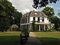 Eefde, 't Haveke hoofdgebouw RM529054 (1).jpg 3,672 × 2,768; 3.46 MB
-
 Eefde, 't Haveke hoofdgebouw RM529054 (2).jpg 3,648 × 2,736; 4.49 MB
-
 Eefde, 't Haveke hoofdgebouw RM529054 (3).jpg 3,648 × 2,736; 4.94 MB
-
 Eefde, 't Haveke hoofdgebouw RM529054 (4).jpg 3,672 × 2,768; 4.7 MB
-
 Gedeelte voorgevel - Eefde - 20375676 - RCE.jpg 1,200 × 1,200; 349 KB
-
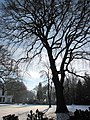
 Haveke park.jpg 2,148 × 1,476; 849 KB
-
 Haveke.jpg 2,148 × 1,488; 761 KB
-
 Hoofdgebouw, voorgevel en linker zijgevel - Eefde - 20375681 - RCE.jpg 1,200 × 1,200; 397 KB
-
 Koude bakken (kassen) in park - Eefde - 20375657 - RCE.jpg 1,200 × 1,200; 462 KB
-
 Landgoed het haveke, front.jpg 400 × 265; 16 KB
-
-
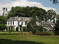
 Overzicht - Eefde - 20067137 - RCE.jpg 1,197 × 1,200; 436 KB
-
 Overzicht - Eefde - 20375664 - RCE.jpg 1,200 × 1,200; 422 KB
-
 Overzicht achtergevel - Eefde - 20375673 - RCE.jpg 1,200 × 1,200; 290 KB
-
 Overzicht achterzijde - Eefde - 20375658 - RCE.jpg 1,200 × 1,200; 278 KB
-
 Overzicht achterzijde - Eefde - 20375672 - RCE.jpg 1,200 × 1,200; 389 KB
-
 Overzicht chauffeurswoning - Eefde - 20375677 - RCE.jpg 1,200 × 1,200; 384 KB
-
 Overzicht ingang - Eefde - 20375675 - RCE.jpg 1,200 × 1,200; 316 KB
-
 Overzicht koetshuis - Eefde - 20375678 - RCE.jpg 1,200 × 1,200; 307 KB
-
 Overzicht koude bakken in park - Eefde - 20375663 - RCE.jpg 1,200 × 1,200; 469 KB
-
 Overzicht park - Eefde - 20375674 - RCE.jpg 1,200 × 1,200; 337 KB
-
 Overzicht rechter zijgevel en achtergevel - Eefde - 20375662 - RCE.jpg 1,200 × 1,200; 310 KB
-
 Overzicht rechter zijgevel met veranda - Eefde - 20375656 - RCE.jpg 1,200 × 1,200; 386 KB
-
 Overzicht tennishuisje - Eefde - 20375654 - RCE.jpg 1,200 × 1,200; 384 KB
-
 Overzicht voorgevel - Eefde - 20375669 - RCE.jpg 1,200 × 1,200; 371 KB
-
 Overzicht voorgevel - Eefde - 20375679 - RCE.jpg 1,200 × 1,200; 441 KB
-
 Prieel - Eefde - 20067144 - RCE.jpg 1,195 × 1,200; 458 KB
-
 Prieel in park - Eefde - 20375659 - RCE.jpg 1,200 × 1,200; 465 KB
-
 Toegangshek - Eefde - 20375665 - RCE.jpg 1,200 × 1,200; 479 KB
-
 Voor- en zijgevel - Eefde - 20067138 - RCE.jpg 1,190 × 1,200; 441 KB
-
 ZiJ- en achtergevel - Eefde - 20067139 - RCE.jpg 1,200 × 1,197; 415 KB
-
 Zij- en achtergevel - Eefde - 20067140 - RCE.jpg 1,192 × 1,200; 385 KB


