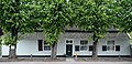
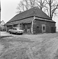
Category:'t Hofke 13, Eindhoven
Jump to navigation
Jump to search
| Object location | View all coordinates using:OpenStreetMap |
|---|
farmhouse in Eindhoven, Netherlands  | |||||
| Upload media | |||||
| Instance of | |||||
|---|---|---|---|---|---|
| Location | Eindhoven,North Brabant,Netherlands | ||||
| Street address |
| ||||
| Heritage designation |
| ||||
 | |||||
|
This is a category aboutrijksmonumentnumber14649
|
| Address |
|
Media in category "'t Hofke 13, Eindhoven"
The following 3 files are in this category, out of 3 total.
-
 Hofke13.jpg 2,636 × 1,268; 934 KB
-
 Zij- en achtergevel - Tongelre - 20209750 - RCE.jpg 1,183 × 1,200; 366 KB
-
 Zijgevel - Tongelre - 20209749 - RCE.jpg 1,195 × 1,200; 385 KB

