Category:Methlick
Jump to navigation
Jump to search
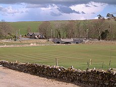
English: Methlick ( Gaelic: Maothulach) is a village in the Formartine area of Aberdeenshire, Scotland, situated on the River Ythan north-west of Ellon.
village in Aberdeenshire, Scotland, UK | |||||
| Upload media | |||||
| Instance of | |||||
|---|---|---|---|---|---|
| Location |
| ||||
| Population |
| ||||
 | |||||
Subcategories
This category has the following 2 subcategories, out of 2 total.
B
- Burnside of Gight (2 F)
T
- Tillyfar, Methlick (1 F)
Media in category "Methlick"
The following 45 files are in this category, out of 45 total.
-
A very apt sign at Andet Farm^^ - geograph.org.uk - 308839.jpg 640 × 426; 94 KB
-
Barn, Street of Monteach - geograph.org.uk - 837060.jpg 640 × 480; 73 KB
-
Cemetery to the southeast of Methlick. - geograph.org.uk - 308931.jpg 640 × 426; 114 KB
-
Clear felled woodland near Andet Farm - geograph.org.uk - 819718.jpg 640 × 480; 69 KB
-
Crofts of Haddo - geograph.org.uk - 819713.jpg 640 × 480; 58 KB
-
Crops near Methlick - geograph.org.uk - 12447.jpg 640 × 426; 199 KB
-
Footpath at Beechlea - geograph.org.uk - 433240.jpg 640 × 487; 74 KB
-
Hillhead of Ardo - geograph.org.uk - 473616.jpg 640 × 480; 63 KB
-
Methlick Bridge, Aberdeenshire.jpg 640 × 480; 82 KB
-
Methlick Motors - geograph.org.uk - 1303665.jpg 640 × 343; 180 KB
-
Methlick Parish Church - geograph.org.uk - 1196217.jpg 640 × 480; 72 KB
-
Road to Newton - geograph.org.uk - 774708.jpg 640 × 480; 97 KB
-
Along the B9005 - geograph.org.uk - 433318.jpg 640 × 480; 85 KB
-
Ancient bridge at Burnend. - geograph.org.uk - 308979.jpg 640 × 462; 225 KB
-
Boghead Farm. - geograph.org.uk - 309345.jpg 640 × 426; 105 KB
-
Braes of Gight Wood. - geograph.org.uk - 308962.jpg 640 × 471; 149 KB
-
Burn to the north of Waterside of Gight. - geograph.org.uk - 308973.jpg 640 × 428; 137 KB
-
Cottage at Waterside of Gight. - geograph.org.uk - 308969.jpg 640 × 424; 112 KB
-
Courtstone trig - geograph.org.uk - 73436.jpg 640 × 427; 140 KB
-
Courtstone trig - geograph.org.uk - 73437.jpg 640 × 427; 140 KB
-
Earlsford Farm. - geograph.org.uk - 308731.jpg 640 × 426; 77 KB
-
Gight House Hotel - geograph.org.uk - 473607.jpg 640 × 480; 83 KB
-
Gowhies Pot on the River Ythan. - geograph.org.uk - 308957.jpg 640 × 426; 115 KB
-
Hardford Farm. - geograph.org.uk - 308747.jpg 640 × 426; 78 KB
-
Heading toward Cowmorrie - geograph.org.uk - 773594.jpg 640 × 480; 65 KB
-
Hillbrae Croft by name and nature. - geograph.org.uk - 308692.jpg 640 × 426; 74 KB
-
Hillbrae Farm. - geograph.org.uk - 308739.jpg 640 × 426; 81 KB
-
Mains of Asleid Farm. - geograph.org.uk - 309350.jpg 640 × 426; 103 KB
-
Methlick, Ythanview Hotel - geograph.org.uk - 219020.jpg 640 × 480; 62 KB
-
River Ythan - geograph.org.uk - 433291.jpg 640 × 480; 66 KB
-
Road to Little Ardo - geograph.org.uk - 473615.jpg 640 × 480; 80 KB
-
Salmon Lodge and an old mill wheel. - geograph.org.uk - 309332.jpg 640 × 426; 131 KB
-
South Faddonhill in distance. - geograph.org.uk - 309679.jpg 640 × 426; 120 KB
-
The lane to Burngrains Farm. - geograph.org.uk - 308937.jpg 640 × 426; 85 KB
-
The northwest approach to Methlick. - geograph.org.uk - 308938.jpg 640 × 426; 83 KB
-
The Wood of Wardford - geograph.org.uk - 12446.jpg 640 × 426; 197 KB
-
To Bankhead Croft. - geograph.org.uk - 308835.jpg 640 × 426; 68 KB
-
Winter ploughing at Burngrains. - geograph.org.uk - 308930.jpg 640 × 426; 150 KB


