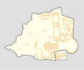
File:Vatican City location map.svg
From Wikimedia Commons, the free media repository
Jump to navigation
Jump to search

Size of this PNG preview of this SVG file:714 × 599 pixels.Other resolutions:286 × 240 pixels|572 × 480 pixels|915 × 768 pixels|1,220 × 1,024 pixels|2,440 × 2,048 pixels|1,400 × 1,175 pixels.
Original file(SVG file, nominally 1,400 × 1,175 pixels, file size: 50 KB)
File information
Structured data
Captions
Captions
Add a one-line explanation of what this file represents
Summary
[edit]| DescriptionVatican City location map.svg |
Deutsch:PositionskarteVatikanstadt,Quadratische Plattkarte, N-S-Streckung 130 %. Geographische Begrenzung der Karte:
English:Location mapVatican City,Equirectangular projection, N/S stretching 130 %. Geographic limits of the map:
|
| Date | |
| Source | Own work,OpenStreetMap,File:Citta del Vaticano.svg |
| Author | User:darkvador |
| Permission (Reusing this file) |
All OpenStreetMap data and maps areCreative Commons"CC-BY-SA 2.0" licensed |
| Other versions | Derivative works of this file:Vatican City location map ka.svg |

|
This map has been made or improved in the GermanKartenwerkstatt(Map Lab).You canpropose mapsto improve as well.
|
Licensing
[edit]I, the copyright holder of this work, hereby publish it under the following licenses:

|
Permission is granted to copy, distribute and/or modify this document under the terms of theGNU Free Documentation License,Version 1.2 or any later version published by theFree Software Foundation;with no Invariant Sections, no Front-Cover Texts, and no Back-Cover Texts. A copy of the license is included in the section entitledGNU Free Documentation License.http:// gnu.org/copyleft/fdl.htmlGFDLGNU Free Documentation Licensetruetrue |
This file is licensed under theCreative CommonsAttribution-Share Alike 3.0 Unportedlicense.
- You are free:
- to share– to copy, distribute and transmit the work
- to remix– to adapt the work
- Under the following conditions:
- attribution– You must give appropriate credit, provide a link to the license, and indicate if changes were made. You may do so in any reasonable manner, but not in any way that suggests the licensor endorses you or your use.
- share alike– If you remix, transform, or build upon the material, you must distribute your contributions under thesame or compatible licenseas the original.
You may select the license of your choice.
File history
Click on a date/time to view the file as it appeared at that time.
| Date/Time | Thumbnail | Dimensions | User | Comment | |
|---|---|---|---|---|---|
| current | 17:35, 6 February 2010 |  | 1,400 × 1,175(50 KB) | Alexrk2(talk|contribs) | recreated with more accurate OSM data |
| 15:40, 5 November 2009 |  | 2,528 × 1,945(42 KB) | Carport(talk|contribs) | {{Information |Description={{en|1=Location map of the {{w|Vatican City}}}} {{de|1=Positionskarte derVatikanstadt}} |Source={{own}}, based onFile:Citta del Vaticano.svg|Author=Carport,author of the original f |
You cannot overwrite this file.
File usage on Commons
The following 4 pages use this file:
File usage on other wikis
The following other wikis use this file:
- Usage on af.wikipedia.org
- Usage on an.wikipedia.org
- Usage on az.wikipedia.org
- Usage on ba.wikipedia.org
- Usage on be-tarask.wikipedia.org
- Usage on be.wikipedia.org
- Usage on bn.wikipedia.org
- Usage on cs.wikipedia.org
- Usage on de.wikipedia.org
- Petersdom
- Vatikanischer Hügel
- Wikipedia:Kartenwerkstatt/Positionskarten/Europa
- Governatoratspalast
- Sixtinische Kapelle
- Vorlage:Positionskarte Vatikanstadt
- Santo Stefano degli Abissini
- Päpstliches Äthiopisches Kolleg
- Domus Sanctae Marthae
- Sant’Anna dei Palafrenieri
- Mater Ecclesiae (Kloster)
- Liste der unter Sonderschutz stehenden Objekte der Haager Konvention
- Wikipedia Diskussion:Kartenwerkstatt/Positionskarten/Archiv
- Usage on de.wikivoyage.org
- Usage on el.wikipedia.org
- Usage on en.wikipedia.org
Viewmore global usageof this file.