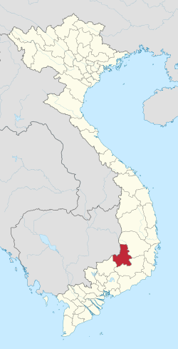
Đắk Nông,anglicizedasDaknong,is a southern mountainousprovincein theCentral Highlandsregion, theCentralofVietnam.It bordersĐắk Lắkto the north,Lâm Đồngto the southeast,Bình PhướcandMondulkiriofCambodiato the west.
Đắk Nông
Quảng Đức | |
|---|---|
| Đắk Nông province | |
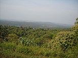
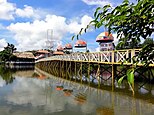
Dray Sap Falls • Mơ Nông Plateau • Dak R'Tih River • Đạo Nguyên Temple • Nam Đông Mountain | |
 Location of Đắk/Ðắc Nông within Vietnam | |
 | |
| Coordinates:11°59′N107°42′E/ 11.983°N 107.700°E | |
| Country | |
| Region | Central Highlands |
| Capital | Gia Nghĩa |
| Area | |
• Total | 6,509.27 km2(2,513.24 sq mi) |
| Population (2023)[2] | |
• Total | 781,900 |
| • Density | 120/km2(310/sq mi) |
| Demographics | |
| •Ethnicities | Vietnamese,Ê Đê,Nùng,M'Nông,Tày |
| GDP[3] | |
| • Total | VND29.227 trillion US$1.268 billion |
| Time zone | UTC+7(ICT) |
| Area codes | 261 (from 17 June 2017) 501 (until 16 July 2017) |
| ISO 3166 code | VN-72 |
| Website | www |
Name
editIts name comes from the Đăk Nông River, an upper stream of theĐồng Nai River.Daàk-nôngmeans "River of the Mnong" inMnonglanguage.
Geography
editĐắk Nông is about 500m above sea level in elevation. The terrain is lower in the west. Đắk Nông has large fields and lakes in the south. Đắk Nông has three main river systems: theBa River,theSrepok (or Sêrêpôk) river(part of theMekong riverbasin) andĐồng Nai riverdemarking the southern border of the Province, with other small rivers andtributaries.Tà Đùng National Parkhelps to provideriparian zoneprotection for the Đồng Nai River basin.
Climate
editThe average temperature is 24 degrees Celsius. The rainy season starts in May and ends in October. The dry season starts in November and ends in April the year after.
Economy
editLikeĐắk Lắk province,coffee,pepperandrubberare the most important products of Đắk Nông. Đắk Nông is a potential province of tourism. There are many beautiful sites such as Ba Tang Waterfall, Diệu Thanh Waterfall, and Nâm Nung pine hill.
Administrative divisions
editĐắk Nông is subdivided into eight district-level sub-divisions:
| Second Tier subdivisions |
Area (km2) |
Third Tier subdivisions | ||
|---|---|---|---|---|
| Ward | Township | Commune | ||
| Gia Nghĩacity | 286.64 | 5 | 3 | |
| Cư Jút District | 718.90 | 1 | 7 | |
| Đăk Glong District | 7 | |||
| Đăk Mil District | 682.70 | 1 | 9 | |
| Đăk R'Lấp District | 63.42 | 1 | 10 | |
| Đăk Song District | 808.10 | 1 | 8 | |
| Krông Nô District | 816.80 | 1 | 11 | |
| Tuy Đức District | 1123.27 | 6 | ||
They are further subdivided into five commune-level towns (or townlets), 61 communes, and five wards.
History
editUntil recently, Đắk Nông was part of the largerĐắk Lắk province,but is now fully independent. Before 1975, Đắk Nông was part ofSouth Vietnam(Republic of Vietnam) and was formerly namedQuảng Đức Province.However, after the 1975Việt Cộngvictory and reunification with southern Vietnam in theVietnam War,Quảng Đức was conjoined with Đắk Lắk Province. For Đắk Nông's history, please seeĐắk Lắk province.
References
edit- ^Biểu số 4.4: Hiện trạng sử dụng đất vùng Tây Nguyên năm 2022[Table 4.4: Current land use status in the Central Highlands in 2022](PDF)(Decision 3048/QĐ-BTNMT) (in Vietnamese).Ministry of Natural Resources and Environment (Vietnam).18 October 2023.– the data in the report are in hectares, rounded to integers
- ^Statistical Handbook of Vietnam 2014,General Statistics Office Of Vietnam
- ^"Tình hình kinh tế, xã hội Đắk Nông năm 2018".Bộ Kế hoạch và Đầu tư.Retrieved10 May2020.


