TheAdriatic Sea(/ˌeɪdriˈætɪk/) is a body of water separating theItalian Peninsulafrom theBalkan Peninsula.The Adriatic is the northernmost arm of theMediterranean Sea,extending from theStrait of Otranto(where it connects to theIonian Sea) to the northwest and thePo Valley.The countries with coasts on the Adriatic areAlbania,Bosnia and Herzegovina,Croatia,Italy,Montenegro,andSlovenia.
| Adriatic Sea | |
|---|---|
 A map of the Adriatic Sea | |
| Location | Southern Europe |
| Coordinates | 43°N15°E/ 43°N 15°E |
| Type | Sea |
| Etymology | From the ancient city ofAdria |
| Primary inflows | Adige,Buna,Drin,Krka,Neretva,Po,Soča |
| Primary outflows | Ionian Sea |
| Catchment area | 235,000 km2(91,000 sq mi) |
| Basincountries | Bordering:Italy,Albania,Croatia,Montenegro,Slovenia,andBosnia and Herzegovina Not bordering:Greece,Serbia,North Macedonia,Kosovo,Austria,SwitzerlandandFrance(drainage basinsfor inflow rivers)[1] |
| Max. length | 800 km (500 mi) |
| Max. width | 200 km (120 mi) |
| Surface area | 138,600 km2(53,500 sq mi) |
| Average depth | 252.5 m (828 ft) |
| Max. depth | 1,233 m (4,045 ft) |
| Water volume | 35,000 km3(2.8×10¹⁰acre⋅ft) |
| Residence time | 3.4±0.4 years |
| Salinity | 38–39PSU |
| Shore length1 | 3,739.1 km (2,323.4 mi) |
| Max. temperature | 28 °C (82 °F) |
| Min. temperature | 9 °C (48 °F) |
| Islands | Over 1300 |
| Settlements | Ancona,Bari,Durrës,Dubrovnik,Koper,Neum,Pescara,Rijeka,Rimini,Šibenik,Split,Trieste,Venice,Vlorë,Zadar |
| 1Shore length isnot a well-defined measure. | |
The Adriatic contains more than 1,300 islands, mostly located along the Croatian part of its eastern coast. It is divided into three basins, the northern being the shallowest and the southern being the deepest, with a maximum depth of 1,233 metres (4,045 ft). The Otranto Sill, an underwater ridge, is located at the border between the Adriatic and Ionian Seas. The prevailing currents flow counterclockwise from theStrait of Otranto,along the eastern coast and back to the strait along the western (Italian) coast. Tidal movements in the Adriatic are slight, althoughlarger amplitudesare known to occur occasionally. The Adriatic'ssalinityis lower than the Mediterranean's because the Adriatic collects a third of the fresh water flowing into the Mediterranean, acting as adilution basin.The surface water temperatures generally range from 30 °C (86 °F) in summer to 12 °C (54 °F) in winter, significantly moderating theAdriatic Basin's climate.
The Adriatic Sea sits on theApulian or Adriatic Microplate,which separated from theAfrican Platein theMesozoicera.The plate's movement contributed to theformation of the surrounding mountain chainsandApennine tectonic upliftafter itscollisionwith theEurasian plate.In theLate Oligocene,theItalian Peninsulafirst formed, separating the Adriatic Basin from the rest of the Mediterranean. All types of sediment are found in the Adriatic, with the bulk of the material transported by the Po and other rivers on the western coast. The western coast isalluvialorterraced,while the eastern coast is highly indented with pronouncedkarstification.There are dozens ofmarine protected areasin the Adriatic, designed to protect the sea's karsthabitatsandbiodiversity.The sea is abundant in flora and fauna—more than 7,000 species are identified as native to the Adriatic, many of themendemic,rare and threatened ones.
The Adriatic's shores are populated by more than 3.5 million people; the largest cities areBari,Venice,TriesteandSplit.The earliest settlements on the Adriatic shores wereEtruscan,Illyrian,andGreek.By the 2nd century BC, the region was underRome's control. In theMiddle Ages,the Adriatic shores and the sea itself were controlled, to a varying extent, by a series of states—most notably theByzantine Empire,theCroatian Kingdom,theRepublic of Venice,theHabsburg monarchyand theOttoman Empire.TheNapoleonic Warsresulted in theFirst French Empiregaining coastal control and theBritish effortto counter the French in the area, ultimately securing most of the eastern Adriatic shore and the Po Valley forAustria.FollowingItalian unification,theKingdom of Italystarted an eastward expansion that lasted until the 20th century. FollowingWorld War Iand the collapse ofAustria-Hungaryand the Ottoman Empire, the entire eastern coast's control passed toYugoslaviaand Albania, except forTriesteand surrounding area which remained under Italian control. The formerdisintegratedduring the 1990s, resulting in four new states on the Adriatic coast. Italy and Yugoslavia agreed on their maritime boundaries by 1975 and this boundary is recognised by Yugoslavia's successor states, but the maritime boundaries between Slovenia, Croatia, Bosnia and Herzegovina, and Montenegro are still disputed. Italy and Albania agreed on their maritime boundary in 1992.
Fisheriesandtourismare significant sources of income all along the Adriatic coast.Adriatic Croatia's tourism industry has grown faster economically than the rest of theAdriatic Basin's.Maritime transportis also a significant branch of the area's economy—there are 19 seaports in the Adriatic that each handle more than a milliontonnesof cargo per year. The largest Adriatic seaport by annual cargo turnover is thePort of Trieste,while thePort of Splitis the largest Adriatic seaport by passengers served per year.
Name
editTheoriginsof the nameAdriaticare linked to theIllyriansettlement ofAdria,which probably derives its name fromIllyrianadur'water, sea'.[2]Inclassical antiquity,the sea was known asMare Adriaticum(Mare Hadriaticum,also sometimes simplified toAdria) or, less frequently, asMare Superum'[the] upper sea'.[3]The two terms were not synonymous, however.Mare Adriaticumgenerally corresponds to the Adriatic Sea's extent, spanning from theGulf of Veniceto the Strait of Otranto. That boundary became more consistently defined by Roman authors—early Greek sources place the boundary between the Adriatic and Ionian seas at various places ranging from adjacent to theGulf of Veniceto the southern tip of thePeloponnese,eastern shores ofSicilyand western shores ofCrete.[4]Mare Superumon the other hand normally encompassed both the modern Adriatic Sea and the sea off the Apennine peninsula's southern coast, as far as theStrait of Sicily.[5]Another name used in the period wasMare Dalmaticum,applied to waters off the coast ofDalmatiaorIllyricum.[6]During theearly modern period,the entire sea was also known as theGulf of Venice(Italian:golfo di Venezia),[7]althoughthat nameis now informally applied only to the northern area of the sea, from Maestra Point in thePoDeltato Cape Kamenjak on theIstrian Peninsula.
The names for the sea in the languages of the surrounding countries includeAlbanian:Deti Adriatik;Emilian:Mèr Adriatic;Friulian:Mâr Adriatic;Greek:Αδριατική θάλασσα,romanized:Adriatikí thálassa;Istro Romanian:Marea Adriatică;Italian:Mare Adriatico;Serbo-Croatian:Jadransko more,Јадранско море;Slovene:Jadransko morje;Venetian:Mar Adriàtico.In Serbo-Croatian and Slovene, the sea is often referred to as simplyJadran.
Geography
editThe Adriatic Sea is a semi-enclosed sea,[8]bordered in the southwest by theApennine or Italian Peninsula,in the northwest by the Italian regions ofVenetoandFriuli-Venezia Giulia,and in the northeast bySlovenia,Croatia,Bosnia and Herzegovina,Montenegro,andAlbania—theBalkan peninsula.In the southeast, the Adriatic Sea connects to theIonian Seaat the 72-kilometre (45 mi) wideStrait of Otranto.[9]TheInternational Hydrographic Organization(IHO) defines the boundary between the Adriatic and the Ionian seas as a line running from theButrinto River's mouth (latitude39°44'N) in Albania to the Karagol Cape inCorfu,through this island to the Kephali Cape (these two capes are in latitude 39°45'N), and on to theSanta Maria di Leuca Cape(latitude 39°48'N).[10]It extends 800 kilometres (500 mi) from the northwest to the southeast and is 200 kilometres (120 mi) wide. It covers 138,600 square kilometres (53,500 sq mi) and has a volume of 35,000 cubic kilometres (8,400 cu mi). The Adriatic extends northwest from40°to45°47' north, representing theMediterranean's northernmost portion.[9]The sea is geographically divided into the Northern Adriatic, Central (or Middle) Adriatic, and Southern Adriatic.[11]
The Adriatic Seadrainage basinencompasses 235,000 square kilometres (91,000 sq mi), yielding a land–sea ratio of 1.8. The drainage basin's mean elevation is 782 metres (2,566 ft) above sea level, with a mean slope of 12.1°.[12]Major rivers discharging into the Adriatic include the Po,Soča,Krka,Neretva,Drin,Buna,andVjosë.[13][14]In the late 19th century,Austria-Hungaryestablished ageodeticnetwork with anelevation benchmarkusing the average Adriatic Sea level at the Sartorio pier inTrieste,Italy.The benchmark was subsequently retained byAustria,adopted byYugoslavia,and retained by the states that emerged afterits dissolution.[15][16]In 2016, Slovenia adopted a new elevation benchmark referring to the upgradedtide gaugestation in the coastal town ofKoper.[17]
The Alps, which also have a large meteorological impact on the Mediterranean, touch the Adriatic in the area around Trieste towardsDuinoandBarcola.[18]


| Country | Mainland | Islands | Total | Coastal fronta | |
|---|---|---|---|---|---|
| 1,777.3 | 4,058 | 5,835.3 | 526 | ||
| 1,249 | 23b | 1,272 | 926 | ||
| 396 | 10 | 406 | 265 | ||
| 249 | 11 | 260 | 92 | ||
| 46.6 | 0 | 46.6 | 17 | ||
| 21.2 | 0 | 21.2 | 10.5 | ||
| Total | 3,739.1 | 4,102 | 7,841.1 | 1,836.5 | |
| Notes:aThe distance between the extreme points of each state's coastline,bNot including islands in coastal lagoons[21] | |||||
| 1.000 mi = 1.609 km; 1.000 km = 0.621 mi | |||||
The Adriatic Sea containsmore than 1,300 islands and islets,most along the Adriatic's eastern coast—especially in Croatia, with 1,246 counted.[22]The number includes islands, islets, and rocks of all sizes, including ones emerging atebb tideonly.[23]The Croatian islands include the largest—CresandKrk,each covering about the same area of 405.78 square kilometres (156.67 sq mi)—and the tallest—Brač,whose peak reaches 780 metres (2,560 ft) above sea level. The islands of Cres and the adjacentLošinjare separated only by a narrow navigable canal dug in the time ofclassical antiquity;[24]the original single island was known to the Greeks asApsyrtides.[25]The Croatian islands include 47permanently inhabited ones,the most populous among them being Krk,Korčulaand Brač.[26]The islands along the Adriatic's western (Italian) coast are smaller and less numerous than those along the opposite coast; the best-known ones are the 117 islands on which the city ofVeniceis built.[27]The northern shore of the Greek island ofCorfualso lies in the Adriatic Sea as defined by the IHO.[28]The IHO boundary places theDiapontia Islands(northwest of Corfu) in the Adriatic Sea.[10][29]

Exclusive economic zone
editExclusive economic zonesin Adriatic Sea:[30]
| Number | Country | Area (Km2) |
|---|---|---|
| 1 | 63,600 | |
| 2 | 55,961 | |
| 3 | 11,105 | |
| 4 | 7,460 | |
| 5 | 192 | |
| 6 | 50 | |
| Total | Adriatic Sea | 138,600 |
Bathymetry
edit
The Adriatic Sea's average depth is 259.5 metres (851 ft), and its maximum depth is 1,233 metres (4,045 ft); however, the North Adriatic basin rarely exceeds a depth of 100 metres (330 ft).[19]The North Adriatic basin, extending between Venice and Trieste towards a line connectingAnconaandZadar,is only 15 metres (49 ft) deep at its northwestern end; it gradually deepens towards the southeast. It is the largest Mediterraneanshelfand is simultaneously adilution basinand a site of bottom water formation.[31]The Middle Adriatic basin is south of the Ancona–Zadar line, with the 270-metre (890 ft) deep Middle Adriatic Pit (also called the Pomo Depression or the Jabuka Pit). The 170-metre (560 ft) deep Palagruža Sill is south of the Middle Adriatic Pit, separating it from the 1,200-metre (3,900 ft) deep South Adriatic Pit and the Middle Adriatic basin from the South Adriatic Basin. Further on to the south, the sea floor rises to 780 metres (2,560 ft) to form the Otranto Sill at the boundary to the Ionian Sea. The South Adriatic Basin is similar in many respects to the Northern Ionian Sea, to which it is connected.[14]Transversely, the Adriatic Sea is also asymmetric: the Apennine peninsular coast is relatively smooth with very few islands and theMount ConeroandGarganopromontories as the only significant protrusions into the sea; in contrast, the Balkan peninsular coast is rugged with numerous islands, especially in Croatia. The coast's ruggedness is exacerbated by theDinaric Alps' proximity to the coast, in contrast to the opposite (Italian) coast where theApennine Mountainsare further away from the shoreline.[32]
Hydrology
edit
The coastal water dynamics are determined by the asymmetric coasts and the inflow of the Mediterranean seawater through the Straits of Otranto and further on along the eastern coast.[33]The smooth Italian coast (with very few protrusions and no major islands) allows the Western Adriatic Current to flow smoothly, which is composed of the relatively freshwater mass on the surface and the cold and dense water mass at the bottom.[34]The coastal currents on the opposite shore are far more complex owing to the jagged shoreline, several large islands and the proximity of the Dinaric Alps to the shore. The last produces significant temperature variations between the sea and the hinterland, which leads to the creation of local jets.[32]The tidal movement is normally slight, usually remaining below 30 centimetres (12 in). Theamphidromic pointis at the mid-width east of Ancona.[35]
The normal tide levels are known to increase significantly in a conducive environment, leading tocoastal flooding;this phenomenon is most famously known in Italy—especially Venice—asacqua alta.Such tides can exceed normal levels by more than 140 centimetres (55 in),[36]with the highest tide level of 194 centimetres (76 in) observed on 4 November 1966.[37]Such flooding is caused by a combination of factors, including the alignment of theSunandMoon,meteorological factors such assiroccorelated storm surges,[38]and the basin's geometric shape (which amplifies or reduces the astronomical component). Moreover, the Adriatic's long and narrow rectangular shape is the source of an oscillating water motion (French:seiche) along the basin's minor axis.[39]Finally, Venice is increasingly vulnerable to flooding due to coastal area soilsubsidence.[40]Such unusually high tides resulting in flooding have also been observed elsewhere in the Adriatic Sea, and have been recorded in recent years in the towns ofKoper,Zadar andŠibenikas well.[41][42][43]

It is estimated that the Adriatic's entire volume is exchanged through the Strait of Otranto in 3.4±0.4 years, a comparatively short period. (For instance, approximately 500 years are necessary to exchange all theBlack Sea's water.) This short period is particularly important as the rivers flowing into the Adriaticdischargeup to 5,700 cubic metres per second (200,000 cu ft/s). This rate of discharge amounts to 0.5% of the total Adriatic Sea volume, or a 1.3-metre (4 ft 3 in) layer of water each year. The greatest portion of the discharge from any single river comes from thePo(28%),[44]with an average discharge from it alone of 1,569 cubic metres per second (55,400 cu ft/s).[45]In terms of the annual total discharge into the entire Mediterranean Sea, the Po is ranked second, followed by the Neretva andDrin,which rank as third and fourth.[46]Another significant contributor of freshwater to the Adriatic is thesubmarine groundwater dischargethrough submarine springs (Croatian:vrulja); it is estimated to comprise 29% of the total water flux into the Adriatic.[47]The submarine springs includethermal springs,discovered offshore near the town ofIzola.The thermal spring water is rich withhydrogen sulfide,has a temperature of 22 to 29.6 °C (71.6 to 85.3 °F), and has enabled the development of specific ecosystems.[48]The inflow of freshwater, representing a third of the freshwater volume flowing into the Mediterranean,[14]makes the Adriatic adilution basinfor the Mediterranean Sea.[49]The Middle andSouth Adriatic Gyres(SAG), are significantcyclonic circulationfeatures, with the former being intermittent and the latter permanent. The SAG measures 150 kilometres (93 miles) in diameter. It contributes to the flow ofbottom waterfrom the Adriatic to theLevantine Basinthrough the Ionian Sea. Through that process, the Adriatic Sea produces most of the East Mediterranean deep water.[50]
Temperature and salinity
editThe Adriatic's surface temperature usually ranges from 22 to 30 °C (72 to 86 °F) in the summer, or 12 to 14 °C (54 to 57 °F) in the winter, except along the western Adriatic coast's northern part, where it drops to 9 °C (48 °F) in the winter. The distinct seasonal temperature variations, with a longitudinal gradient in the Northern and transversal gradient in the Middle and Southern Adriatic,[51]are attributed to the continental characteristics of the Adriatic Sea: it is shallower and closer to land than are oceans.[52]During particularly cold winters,sea icemay appear in the Adriatic's shallow coastal areas, especially in theVenetian Lagoonbut also in isolated shallows as far south asTisno(south of Zadar).[53][54]The Southern Adriatic is about 8 to 10 °C (14 to 18 °F) warmer during the winter than the more northerly regions.[55]The Adriatic'ssalinityvariation over the year is likewise distinct:[52]it ranges between 38 and 39PSUs.[51]The southern Adriatic is subjected to saltier water from the Levantine Basin.[55]
Climate
edit
According to theKöppen climate classification,the upper half of the Adriatic is classified ashumid subtropical climate(Cfa), with wetter summers and colder and drier winters, and the southern Adriatic are classified ashot-summer Mediterranean climate (Csa).[56][57]The air temperature can fluctuate by about 20 °C (36 °F) during a season.[51]
The predominant winter winds are theboraandsirocco(calledjugoalong the eastern coast). The bora is significantly conditioned by wind gaps in the Dinaric Alps bringing cold and dry continental air; it reaches peak speeds in the areas of Trieste,Senj,andSplit,with gusts of up to 180 kilometres per hour (97 kn; 110 mph). The sirocco brings humid and warm air, often carryingSaharansand causingrain dust.[58]
| City | Mean temperature (daily high) | Mean total rainfall | ||||||||
|---|---|---|---|---|---|---|---|---|---|---|
| January | July | January | July | |||||||
| °C | °F | °C | °F | mm | in | days | mm | in | days | |
| Bari | 12.1 | 53.8 | 28.4 | 83.1 | 50.8 | 2.00 | 7.3 | 27.0 | 1.06 | 2.6 |
| Dubrovnik | 12.2 | 54.0 | 28.3 | 82.9 | 95.2 | 3.75 | 11.2 | 24.1 | 0.95 | 4.4 |
| Rijeka | 8.7 | 47.7 | 27.7 | 81.9 | 134.9 | 5.31 | 11.0 | 82.0 | 3.23 | 9.1 |
| Split | 10.2 | 50.4 | 29.8 | 85.6 | 77.9 | 3.07 | 11.1 | 27.6 | 1.09 | 5.6 |
| Venice | 5.8 | 42.4 | 27.5 | 81.5 | 58.1 | 2.29 | 6.7 | 63.1 | 2.48 | 5.7 |
| Source:World Meteorological Organization[59] | ||||||||||
Population
edit
|
Rank | City | Country | Region/County | Population (urban) |
|
|---|---|---|---|---|---|---|
| 1 | Bari | Italy | Apulia | 320,475 | ||
| 2 | Venice | Italy | Veneto | 270,884 | ||
| 3 | Trieste | Italy | Friuli-Venezia Giulia | 205,535 | ||
| 4 | Durrës | Albania | Durrës | 199,073 | ||
| 5 | Split | Croatia | Split-Dalmatia | 178,102 | ||
| 6 | Rimini | Italy | Emilia-Romagna | 150,009 | ||
| 7 | Rijeka | Croatia | Primorje-Gorski Kotar | 128,384 | ||
| 8 | Pescara | Italy | Abruzzo | 123,103 | ||
| 9 | Vlorë | Albania | Vlorë | 117,850 | ||
| 10 | Ancona | Italy | the Marches | 101,210 | ||
| Sources: 2011 Croatian census,[60]Italian National Institute of Statistics (2011),[61]2011 Albanian Census[62] | ||||||


On the Adriatic Sea's coasts and islands, there are numerous small settlements and a number of larger cities. Among the largest are (counterclockwise) Trieste, Venice, Rimini, Ancona, Pescara and Bari in Italy; Vlorë and Durrës in Albania; Split, Zadar and Rijeka in Croatia; Koper in Slovenia. In total, more than 3.5 million people live on the Adriatic coasts.[63]There are also some larger cities that are located very near the coast, such as the Italian cities ofRavennaandLecce.
Coastal management
edit
Venice,which was originally built on islands off the coast, is most at risk due to subsidence, but the threat is present in the Podeltaas well. The causes are a decrease insedimentationrate due to loss of sediment behind dams, the deliberate excavation of sand for industrial purposes, agricultural use of water, and removal of ground water.[64][65]
The sinking of Venice slowed afterartesian wellswere banned in the 1960s, but the city remains threatened by theacqua altafloods. Recent studies have suggested that the city is no longer sinking,[66][67]but a state of alert remains in place. In May 2003, then-Prime MinisterSilvio Berlusconiinaugurated theMOSE project(Italian:Modulo Sperimentale Elettromeccanico), an experimental model for evaluating the performance of inflatable gates. The project proposes laying a series of 79 inflatablepontoonsacross the sea bed at the three entrances to theVenetian Lagoon.When tides are predicted to rise above 110 centimetres (43 in), the pontoons will be filled with air and block the incoming water from the Adriatic Sea. This engineering work was due to be completed by 2014,[68]but as of November 2020 is expected to be completed in 2021.[69] Implemented for the first time on October 3, 2020,[69]the barriers are made to seal off three inlets that lead to the Venetian Lagoon and counteract floods of up to ten feet; in addition to protecting the city from flooding, the barrier system is also intended to stabilize Venice's water levels so as to minimize erosion of the brick walls and, subsequently, the foundations of various buildings in the city. However, concern has been raised regarding the frequency of its use—while only necessary a few days a year, the worst-case sea level rise scenario between 2050 and 2100 would prompt deployment up to 187 days a year, essentially cutting off the Venetian Lagoon from the Adriatic Sea. Among other possible adverse effects, this can be expected to lower the lagoon's oxygen levels and trap pollution inside of the city.
Geology
edit
Geophysical and geological information indicate that the Adriatic Sea and thePo Valleyare associated with atectonicmicroplate—identified as theApulian or Adriatic Plate—that separated from theAfrican Plateduring theMesozoicera.This separation began in theMiddleandLate Triassic,whenlimestonebegan to be deposited in the area. Between theNorianandLate Cretaceous,theAdriaticandApulia Carbonate Platformsformed as a thick series of carbonate sediments (dolomitesand limestones), up to 8,000 metres (26,000 ft) deep.[70]Remnants of the former are found in the Adriatic Sea, as well as in the southernAlpsand theDinaric Alps,and remnants of the latter are seen as theGargano Promontoryand theMaiellamountain. In theEoceneand earlyOligocene,the plate moved north and north-east, contributing to theAlpine orogeny(along with theAfricanandEurasian Plates' movements) via thetectonic upliftof the Dinarides and Alps. In theLate Oligocene,the motion was reversed and theApennine Mountains' orogenytook place.[71]An unbroken zone of increased seismic activity borders the Adriatic Sea, with a belt ofthrust faultsgenerally oriented in the northeast–southwest direction on the east coast and the northeast–southwest normal faults in the Apennines, indicating an Adriatic counterclockwise rotation.[72]
An active 200-kilometre (120 mi)faulthas been identified to the northwest of Dubrovnik, adding to theDalmatianislands as the Eurasian Plate slides over the Adriatic microplate. Furthermore, the fault causes the Apennine peninsula's southern tip to move towards the opposite shore by about 0.4 centimetres (0.16 in) per year. If this movement continues, the seafloor will be completely consumed and the Adriatic Sea closed off in 50–70 million years.[73]In the Northern Adriatic, the coast of theGulf of Triesteand westernIstriais gradually subsiding, having sunk about 1.5 metres (4 ft 11 in) in the past two thousand years.[74]In the Middle Adriatic Basin, there is evidence ofPermianvolcanism in the area ofKomižaon the island ofVisand the volcanic islands ofJabukaandBrusnik.[75]Earthquakes have been observed in the region since the earliest historical records.[76]A recent strong earthquake in the region was the1979 Montenegro earthquake,measuring 7.0 on theRichter scale.[77]Historical earthquakesin the area include the 1627 Gargano peninsula and the1667 Dubrovnikearthquakes, both followed by strong tsunamis.[78]In the last 600 years, fifteen tsunamis have occurred in the Adriatic Sea.[79]
Seafloor sediment
edit
All types ofseafloor sedimentsare found in the Adriatic Sea. The Northern Adriatic's comparatively shallow seabed is characterised by relict sand (from times when the water level was lower and the area was a sandy beach), while a muddy bed is typical at depths below 100 metres (330 ft).[33][80]There are fivegeomorphologicalunits in the Adriatic: the Northern Adriatic (up to 100 metres (330 ft) deep); the North Adriatic islands area protected against sediments filling it in by outer islands (pre-Holocenekarstrelief); the Middle Adriatic islands area (large Dalmatian islands); the Middle Adriatic (characterized by the Middle Adriatic Depression); and the Southern Adriatic consisting of a coastalshelfand the Southern Adriatic Depression. Sediments deposited in the Adriatic Sea today generally come from the northwest coast, being carried by the Po,Reno,Adige,Brenta,Tagliamento,Piaveand Soča rivers. The volume of sediments carried from the eastern shore by theRječina,Zrmanja,Krka,Cetina,Ombla,Dragonja,Mirna,RašaandNeretvarivers is negligible, because these sediments are mostly deposited at the river mouths. The Adriatic's western shores are largely eitheralluvialorterraced,whereas the eastern shores are predominantly rocky, except for the southernmost part of the shore located in Albania that consists of sandy coves and rocky capes.[71]
Coasts
edit
The eastern Adriatic shore's Croatian part is the most indented Mediterranean coastline.[81]Most of the eastern coast is characterised by a karst topography, developed from the Adriatic Carbonate Platform's exposure to weathering. Karstification there largely began after the Dinarides' final uplift in the Oligocene and theMiocene,whencarbonate depositswere exposed to atmospheric effects; this extended to the level of 120 metres (390 ft) below the present sea level, exposed during theLast Glacial Maximum.It is estimated that some karst formations are from earlier sea level drops, most notably theMessinian salinity crisis.[70]Similarly, karst developed inApuliafrom the Apulian Carbonate Platform.[82]

The largest part of the eastern coast consists of carbonate rocks, whileflysch(a particular type of sedimentary rock) is significantly represented in the Gulf of Trieste coast, especially along Slovenia's coast where the 80-metre (260 ft)Strunjan cliff—the highest cliff on the entire Adriatic and the only one of its type on the eastern Adriatic coast—is located,[83]on theKvarner Gulfcoast opposite Krk, and in Dalmatia north of Split.[84]Rocks of the same type are found in Albania and on the western Adriatic coast.[85][86]
There are alternations of maritime and alluvialsedimentsoccurring in thePo Valley,at the Adriatic's north-west coast, and as far west asPiacenza,dating to thePleistoceneas the sea advanced and receded over the valley. An advance began after the Last Glacial Maximum, which brought the Adriatic to a high point at about 5,500 years ago.[87]Since then, the Po delta has beenprograding(expanding/extending). The rate of coastal zone progradation between 1000 BC and 1200 AD was 4 metres (13 ft) per year.[88]In the 12th century, the delta advanced at a rate of 25 metres (82 ft) per year. In the 17th century, the delta began to become a human-controlled environment, as the excavation of artificial channels started; the channels and newdistributariesof the Po have been prograding at rates of 50 metres (160 ft) per year or more since then.[89]There are more than 20 other rivers flowing into the Adriatic Sea in Italy alone, also formingalluvialcoastlines,[90]including the lagoons ofVenice,GradoandCaorle.[91]There are smaller eastern Adriatic alluvial coasts—in the deltas of the Dragonja,[92]Bunaand Neretva rivers.[93][94]
Biogeography and ecology
editThe Adriatic Sea is a unique water body in respect of its overallbiogeochemicalphysiognomy. It exports inorganic nutrients and imports particulate organic carbon and nitrogen through the Strait of Otranto—acting as a mineralization site. The exchange of the substances is made more complex by bathymetry of the Adriatic Sea—75% of water flowing north through the strait recirculates at the Palagruža Sill and North Adriatic adds no more than 3–4% of water to the South Adriatic.[95]This is reflected in itsbiogeographyandecology,and particularly in the composition and properties of itsecosystems.[96]Its main biogeographic units are the Northern Adriatic, the Central Adriatic, and the Southern Adriatic.[97]
Flora and fauna
editThe unique nature of the Adriatic gives rise to an abundance ofendemicflora and fauna. The Croatian National Biodiversity Strategy Action Plan identified more than 7,000 animal and plant species in the Adriatic Sea. The Central Adriatic is especially abundant in endemic plant species, with 535 identified species ofgreen,brownandred algae.[98]Four out of five Mediterraneanseagrassspecies are found in the Adriatic Sea. The most common species areCymodocea nodosaandZostera noltii,whileZostera marinaandPosidonia oceanicaare comparatively rare.[99]
A number ofrareandthreatened speciesare also found along the Adriatic's eastern coast; it is relatively clearer and less polluted than the western Adriatic coast—in part because the sea currents flow through the Adriatic in a counterclockwise direction, thus bringing clearer waters up the eastern coast and returning increasingly polluted water down the western coast. This circulation has significantly contributed to the biodiversity of the countries along the eastern Adriatic coast; thecommon bottlenose dolphinis frequent in the eastern coast's waters only, and the Croatian coast provides refuge for the critically endangeredmonk sealand sea turtles.[98]Recent studies revealed thatcetaceansand other marinemegafaunas,that were once thought to be vagrants to Adriatic Sea, migrate and live in the semi-closed sea on larger scales.[100]Largest of these live normally is thefin whale,[101]andsperm whale,[102]the largest of toothed whales also migrate but less common than fin whales, followed byCuvier's beaked whales.[100]Basking sharks[103]andmanta raysare some of migrant species to the sea.[104][105][106]Historical presences of depleted or extinct species such asNorth Atlantic right whales(extinct or functionally extinct),Atlantic gray whales(extinct), andhumpback whaleshave been speculated as well.[107]
Tuna has been caught by the locals in the upper Adriatic for thousands of years. The very large schools consisted mainly oflittle tunnyand moved as far as theGulf of Trieste.However, increasing fishing prevented the migration of large schools of fish to the north. The last major tuna catch was made there in 1954 by the fishermen from Santa Croce, Contovello andBarcola.[108]
The Northern Adriatic in particular is rich in endemic fish fauna.[14]Around thirty species of fish are found in only one or two countries bordering the Adriatic Sea. These are particularly due to or dependent upon thekarstmorphology of the coastal or submarine topography; this includes inhabiting subterranean habitats, karst rivers, and areas around freshwater springs.[109]There are 45 knownsubspeciesendemic to the Adriatic's coasts and islands. In the Adriatic, there are at least 410 species and subspecies of fish, representing approximately 70% of Mediterranean taxa, with at least 7 species endemic to the Adriatic. Sixty-four known species are threatened with extinction, largely because of overfishing.[98]Only a small fraction of the fish found in the Adriatic are attributed to recent processes such asLessepsian migration,and escape frommariculture.[110]
Protected areas
edit
The biodiversity of the Adriatic is relatively high, and severalmarine protected areashave been established by countries along its coasts. In Italy, these areMiramarein the Gulf of Trieste (in the Northern Adriatic),Torre del CerranoandTremiti Islandsin the Middle Adriatic basin andTorre Guacetoin southern Apulia.[111][112]The Miramare protected area was established in 1986 and covers 30 hectares (74 acres) of coast and 90 hectares (220 acres) of sea. The area encompasses 1.8 kilometres (1.1 mi) of coastline near the Miramare promontory in the Gulf of Trieste.[113]The Torre del Cerrano protected area was created in 2009, extending 3 nautical miles (5.6 km; 3.5 mi) into the sea and along 7 kilometres (4.3 mi) of coastline. Various zones of the protected area cover 37 square kilometres (14 sq mi) of sea surface.[114]The Tremiti Islands reserve has been protected since 1989, while the Tremiti islands themselves are part of theGargano National Park.[115]The Torre Guaceto protected area, located nearBrindisiandCarovigno,covers a sea surface of 2,227 hectares (5,500 acres) and is adjacent to the Torre Guaceto State Reserve covering 1,114 hectares (2,750 acres) of coast and sharing an 8-kilometre (5.0 mi) coastline with the marine protected area.[116]Furthermore, there are 10internationally important (Ramsar) wetland reservesin Italy located along the Adriatic coast.[117]

There are seven marine protected areas in Croatia:Brijuniand theLim Canaloff the Istria peninsula's coast, nearPulaandRovinjrespectively;KornatiandTelašćicain the Middle Adriatic basin, nearZadar;andLastovo,Bay of Mali Ston(Croatian:Malostonski zaljev) andMljetin southern Dalmatia.[111]The Brijuninational parkencompasses the 743.3-hectare (1,837-acre) archipelago itself and 2,651.7 hectares (6,552 acres) of surrounding sea;[118]it became a national park in 1999.[119]The Lim Canal is a 10-kilometre (6.2 mi)riaof thePazinčicariver.[120]The Kornati national park was established in 1980; it covers approximately 220 square kilometres (85 sq mi), including 89 islands and islets. The marine environment encompasses three-quarters of the total area, while the island shores' combined length equals 238 kilometres (148 mi).[121]Telašćica is a nature park established onDugi Otokin 1988. The park covers 69 kilometres (43 mi) of coastline, 22.95 square kilometres (8.86 sq mi) of land and 44.55 square kilometres (17.20 sq mi) of sea.[122]The Bay of Mali Ston is located at the border of Croatia and Bosnia–Herzegovina, north of thePelješacpeninsula. The marine protected area covers 48 square kilometres (19 sq mi).[111]The Lastovo nature park was established in 2006, and it includes 44 islands and islets, 53 square kilometres (20 sq mi) of land and 143 square kilometres (55 sq mi) of sea surface.[123]The Mljet national park was established in 1960, covering a 24-square-kilometre (9.3 sq mi) marine protection area.[111]In addition, there is a Ramsar wetland reserve in Croatia—theNeretva river's delta.[124]

In Slovenia, the marine and coastal protected nature areas are theSečovlje Salina Landscape Park,Strunjan Landscape Park,Škocjan Inlet Nature Reserve,and theDebeli Rtič,Cape MadonaandLakes in Fiesanatural monuments.[125][126]The Sečovlje Salina Landscape Park was established in 1990, covers 721 hectares (1,780 acres), and includes fournature reserves.[127][128]In 1993, the area was designated a Ramsar site;[125]it is also a site of international importance forwaterbirdspecies.[129]The 429-hectare (1,060-acre) Strunjan Landscape Park was established in 2004 and comprises two nature reserves.[125][127]It includes a 4 kilometres (2.5 mi) long cliff, the northernmost Mediterraneansalt fieldand the only Slovenianlagoonsystem.[130]It is also the northernmost point of growth of some Mediterranean plant species.[131]The Škocjan Inlet Nature Reserve was established in 1998 and covers 122 hectares (300 acres).[132]The Debeli Rtič natural monument covers 24 hectares (59 acres),[133]the Cape Madona natural monument covers 12 hectares (30 acres),[134]and the Lakes in Fiesa natural monument, with the coastal lake as the onlybrackish lakein Slovenia,[135]covers 2.1 hectares (5.2 acres).[136]
In 2010, Albania established its first marine protection area, theKaraburun-Sazan National Marine Parkat theKaraburun Peninsulawhere the Adriatic and Ionian Seas meet. The park covers a total of 12,570 hectares (31,100 acres).[137]Two additional marine protection areas are planned in Albania: theCape of Rodon(Albanian:Kepi i Rodonit) andPorto Palermo.[111]In addition, Albania is home to two Ramsar wetland reserves:Karavasta Lagoon,andButrint.[138]Neither Bosnia–Herzegovina nor Montenegro have or plan to establish any marine protection areas.[111]
Pollution
editThe Adriatic Sea ecosystem is threatened by excessive input of nutrients through drainage from agricultural land and wastewater flowing from cities; this includes both along its coast and from rivers draining into the sea—especially from thePo River.[139]Venice is often cited as an example of polluted coastal waters where shipping, transportation, farming, manufacturing and wastewater disposal contribute to polluting the sea.[140]A further risk is presented byballast water dischargeby ships, especiallytankers.Still, since most of the cargo handled by the Adriatic ports, and virtually all liquid (tanker) cargo handled by the ports, is coming to—not coming from—the Adriatic Basin, the risk from ballast water (from tankers expelling ballast water then loading in the Adriatic) remains minimal. However, proposed export oil pipelines were objected to specifically because of this issue. Oil spills are a major concern in terms of potential environmental impact and damage to tourism and fisheries.[141]It is estimated that if a major oil spill happened, a million people would lose their livelihoods in Croatia alone.[142]An additional risk is presented by oil refineries in the Po River basin where oil spills have occurred before,[143]in addition to accidents occurring in the Adriatic already, so far with no significant environmental consequences.[144]Since 2006, Italy has been considering the construction of an offshore and an onshoreLNGterminal in theGulf of Trieste,as well as a pipeline, in the immediate vicinity of the Slovenian–Italian border.[145]The Slovenian government and municipalities,[146]the municipal council of Trieste,[147]and non-governmental organisations have voiced concern over their environmental hazards, effect on transport and effect on tourism.[148][149]
Another source of pollution of the Adriatic is solid waste. Drifting waste—occasionally relatively large quantities of material, especially waste plastic—is transported northwest by the sirocco.[150]Air pollution in theAdriatic Basinis associated with the large industrial centres in the Po River valley and the large industrial cities along the coast.[151][152]
Italy and Yugoslavia established a joint commission to protect the Adriatic Sea from pollution in 1977; the organization later changed with Slovenia, Croatia and Montenegro replacing Yugoslavia.[153]Future pollution hazards are addressed and pollution hotspots are assessed not only by nations in the basin but also through regional projects withWorld Banksupport. 27 such hotspots have been determined as of 2011, 6 warranting an urgent response.[154]
History
edit
Settlements along the Adriatic dating to between 6100 and 5900 BC appear in Albania and Dalmatia on the eastern coast, related to theCardium potteryculture.[155]During classical antiquity,Illyriansinhabited the eastern Adriatic coast,[156]and the western coast was inhabited by thepeoples of Ancient Italy,mainly Etruscans, before theRoman Republic's rise.[157]Greekcolonisation of the Adriatic dates back to the 7th and 6th centuries BC whenEpidamnosandApolloniawere founded. The Greeks soon expanded further north establishing several cities, includingAncona,Black Corcyra,Epidaurus,Issa,with trade established as far north as thePoRiver delta, where theemporion(trading station) ofAdriawas founded.[158]
Roman era
editRoman economic and military influence in the region began to grow with the creation by 246 BC of a major naval base at Brundisium (nowBrindisi), which was established to barCarthaginianships from the Adriatic during thePunic Wars.This led to conflict with theIllyrians,who lived in a collection of semi-Hellenizedkingdoms that covered much of the Balkans and controlled the eastern shore of the sea, resulting in theIllyrian Warsfrom 229 to 168 BC. The initial Roman intervention in 229 BC, motivated in part by a desire to suppress Illyrian piracy in the Adriatic, marked the first time that theRoman navycrossed that sea to launch a military campaign.[159][160]Those wars ended with the eastern shore becoming a province of the Roman Republic.[161]However, resistance to Roman rule continued sporadically and Rome did not completely consolidate control of the region untilAugustus's generalTiberiusput down theGreat Illyrian Revolt,a bitter struggle waged from 6 to 9 AD.[160][162]Following the repression of the revolt the Roman province ofIllyricumwas split intoDalmatiaandPannonia.Most of the eastern shore of the Adriatic was part of Dalmatia, except for the southernmost portion, part of the province ofMacedonia,and the peninsula ofIstriaon the northern part of the eastern shore; Istria contained the important Roman colony atPulaand was incorporated into the province ofItaly.[citation needed]
During the Roman period, Brundisium, on the western shore, and Apollonia and Dyrrachium (originally called Epidamnos, nowDurrësin Albania) on the eastern shore became important ports. Brundisium was linked by theVia Appiaroad to the city of Rome, and Dyrrachium and Apollonia were both on theVia Egnatia,a road that by about 130 BC the Romans had extended eastward across the Balkans to Byzantium (laterConstantinople,nowIstanbul).[163][164]This made the sea passage across the Adriatic between Brundisium and Dyrrachium (or Apollonia) a link in the primary route for travelers, trade, and troop movements, between Rome and the East. This route played a major role in some of the military operations that marked the end of the Roman Republic and the start of theimperial period.Sullaused it during theFirst Mithridatic War.[165]DuringCaesar's Civil War,there was a three-month delay inCaesar'sBalkan campaign againstPompeycaused when winter storms on the Adriatic and a naval blockade held upMark Antonyfrom reaching him from Brundisium with reinforcements; after the reinforcements finally arrived Caesar made an unsuccessfulattempt to capture Dyrrachiumbefore the campaign moved inland.[166]Marc Antony and Octavian (later Augustus) crossed the Adriatic to Dyrrachium with their armies in their campaign against two of Caesar's assassins,BrutusandCassius,that culminated in theBattle of Philippi.[167]Brundisium and Dyrrachium remained important ports well after the Roman period, but an earthquake in the 3rd century AD changed the path of a river causing Apollonia's harbor to silt up, and the city to decline.[168]
Another city on the Italian coast of the Adriatic that increased in importance during the Roman era wasRavenna.During the reign of Augustus, it became a major naval base as part of his program to re-organize the Roman navy to better protect commerce in the Mediterranean.[169]During the 4th century AD the emperors of theWestern Roman Empirehad moved their official residence north from Rome toMediolanum(nowMilan) in order to be better able to control the military frontier with the Germanic tribes. In 402 AD, during a period of repeated Germanic invasions of Italy, the capital was shifted to Ravenna because nearby marshes made it more defensible, and the Adriatic provided an easy escape path by sea.[170]When the Western Empire fell in 476 AD Ravenna became the capital of theOstrogothic Kingdomof Italy.[171]
Middle Ages
edit
In theEarly Middle Ages,after theRoman Empire's decline,the Adriatic's coasts were ruled byOstrogoths,Lombardsand theByzantine Empire.[172][173]The Ostrogothic Kingdom ruled Italy following the fall of the Western Roman Empire in 476 AD. However, during the reign ofJustinianthe Byzantine Empire sent an army under the generalBelisariusto regain control of Italy, resulting in theGothic War (535–554).The Byzantines established theExarchate of Ravennaand by 553 AD their viceroy (Exarch) ruled almost the entire Italian peninsula from that city. In 568 AD the Lombards invaded northern Italy, and over the course of the next century or so the importance of the Exarchate declined as the territory under Lombard control expanded and as the Byzantine outpost ofVenicebecame increasingly independent. In 752 AD the Lombards overthrew the Exarchate, ending the influence of the Byzantine Empire on the western shore of the Adriatic for a few centuries.[174]
The last part of the period saw the rise of theCarolingian Empireand then theFrankish Kingdom of Italy,which controlled the Adriatic Sea's western coast,[175]whileByzantine Dalmatiaon the east coast gradually shrunk intoDalmatian city-statesfollowing theAvarandCroatianinvasions starting in the 7th century.[176]TheRepublic of Venice,one of themaritime republics,was founded during this period and went on to become a significant maritime power after receiving a Byzantine tax exemption in 1082.[177]The end of the period brought about theHoly Roman Empire's control over the Kingdom of Italy (which would last until thePeace of Westphaliain 1648),[178]the establishment of an independentKingdom of Croatiaand the Byzantine Empire's return to the southern Apennine peninsula.[179][180]In addition, thePapal Stateswere carved out in the area aroundRomeand central Italy in the 8th century.[181]

TheHigh Middle Agesin the Adriatic Sea basin saw further territorial changes, including theNorman conquest of southern Italyending the Byzantine presence on the Apennine peninsula in the 11th and 12th centuries (the territory would become theKingdom of Naplesin 1282)[182][183]and the control of a substantial part of the eastern Adriatic coast by theKingdom of Hungaryafter apersonal unionwas established between Croatia and Hungary in 1102.[184]In this period, the Republic of Venice began to expand its territory and influence.[185]In 1202, theFourth Crusadewas diverted to conquerZadarat the behest of the Venetians—the first instance of aCrusader forceattacking aCatholiccity—before proceeding to sackConstantinople.[186]In the 13th century, Venice established itself as a leadingmaritime nation.During much of the 12th and 13th centuries, Venice and theRepublic of Genoawereengaged in warfareculminating in theWar of Chioggia,ousting the Genoese from the Adriatic.[187]Still, the 1381 Treaty of Turin that ended the war required Venice to renounce claims to Dalmatia, after losing the territory to Hungary in 1358. In the same year, theRepublic of Ragusawas established in Dubrovnik as a city-state after it was freed from Venetian suzerainty.[188]
Venice regained Dalmatia in 1409 and held it for nearly four hundred years, with the republic's apex of trading and military power in the first half of the 15th century.[189]The 15th and the 16th centuries brought about the Byzantine Empire's destruction in 1453 and theOttoman Empire's expansion that reached Adriatic shores in present-day Albania and Montenegro as well as the immediate hinterland of the Dalmatian coast,[190][191]defeating the Hungarian and Croatian armies atKrbavain 1493 andMohácsin 1526.[192]These defeats spelled the end of an independent Hungarian kingdom, and bothCroatianandHungariannobility choseFerdinand Iof theHouse of Habsburgas their new ruler, bringing theHabsburg monarchyto the shore of the Adriatic Sea, where it would remain for nearly four hundred years.[193]The Ottomans and Venetians fought aseries of wars,but until the 17th century these were not fought in the Adriatic area.[194]Ottoman raids on the Adriatic coasts effectively ceased after the massive setback in theBattle of Lepantoin October 1571.[195]
Early modern period
edit
[196]The 17th century's final territorial changes were caused by theMorean or Sixth Ottoman–Venetian War,when in 1699 Venice slightly enlarged its possessions in Dalmatia.[197]In 1797, the Republic of Venice was abolished after theFrench conquest.[198]The Venetian territory was then handed over toAustriaand briefly ruled as part of theArchduchy of Austria.The territory was turned back over to France after thePeace of Pressburgin 1805 when the territory in thePo valleybecame an integral part of the newNapoleonic Kingdom of Italy.[199]The new kingdom included the province ofRomagna,thus removing the Papal State from the Adriatic coast;[200]however, Trieste, Istria and Dalmatia were joined into a set of separate provinces of theFrench Empire:theIllyrian Provinces.[199]These were created in 1809 through theTreaty of Schönbrunn;they represented the end of Venetian rule on the eastern Adriatic coast, as well as the end of the Republic of Ragusa.[201]The Adriatic Sea was a minortheatrein the Napoleonic Wars; theAdriatic campaign of 1807–1814involved theBritishRoyal Navy contesting the Adriatic's control by the combined navies of France, Italy and the Kingdom of Naples. During the campaign, theRoyal Navyoccupied Vis and established its base there inPort St. George.[202]The campaign reached its climax in the 1811Battle of Lissa,[citation needed]and ended with British andAustriantroops seizing the coastal cities on the eastern Adriatic coast from the French.[203]Days before the Battle of Waterloo, theCongress of Viennaawarded the Illyrian Provinces (spanning from the Gulf ofTriesteto theBay of Kotor) to Austria.[204]The Congress of Vienna also created theKingdom of Lombardy–Venetiawhich encompassed the city of Venice, the surrounding coast and a substantial hinterland, and was controlled by Austria.[205]In the Apennine peninsula's south, theKingdom of the Two Sicilieswas formed in 1816 by unifying the kingdoms of Naples andSicily.[206]
Modern period
edit
The process ofItalian unificationculminated in theSecond Italian War of Independence,resulting in theKingdom of Sardiniaannexing all territories along the western Adriatic coast south ofVenetiain 1860, and the 1861 establishment of theKingdom of Italyin its place. The Kingdom of Italy expanded in 1866: itannexed Venetia,[207]butits navywas defeated in the Adriatic nearVis.[208]Following theAustro-Hungarian Compromise of 1867and theCroatian–Hungarian Settlementof 1868, the control of much of the eastern Adriatic coast was redefined. Thecisleithanian(Austrian) part of Austria-Hungary spanned from theAustrian Littoralto the Bay of Kotor, with the exception of theCroatian Littoralmainland. In the territory outside the Austrian Littoral,special statuswas given toFiume(modern-dayRijeka) as a separate part of theKingdom of Hungary.The rest of the territory was made a part of theKingdom of Croatia-Slavonia,which in turn was also in theTransleithanianpart of the dual monarchy.[184]The Adriatic coastline controlled by the Ottoman Empire was reduced by theCongress of Berlinin 1878, through recognition of the independence of thePrincipality of Montenegro,which controlled the coast south of the Bay of Kotor to the Bojana River.[209]The Ottoman Empire lost all territories along the Adriatic following theFirst Balkan Warand consequent1913 Treaty of Londonthat established an independent Albania.[210]

TheWorld War I Adriatic Campaignwas largely limited to blockade attempts by theAlliesand theeffortof theCentral Powersto thwart the British, French and Italian moves.[211]Italy joined the Allies in April 1915 with theTreaty of London,which promised Italy the Austrian Littoral, northern Dalmatia, theport of Vlorë,most of the eastern Adriatic islands and Albania as aprotectorate.[212]The treaty provided the basis for all the following divisions between Italy and Yugoslavia.[213]In 1918, the Montenegrin national assembly voted to unite with theKingdom of Serbia,giving the latter access to the Adriatic.[214]Another short-lived, unrecognised state established in 1918 was theState of Slovenes, Croats and Serbs,formed from parts of Austria-Hungary, comprising most of the former monarchy's Adriatic coastline. Later that year, the Kingdom of Serbia and the State of Slovenes, Croats and Serbs formed theKingdom of Serbs, Croats and Slovenes—subsequently renamed Yugoslavia. The proponents of the new union in theCroatian parliamentsaw the move as a safeguard against Italian expansionism as stipulated in the Treaty of London.[215]The treaty was largely disregarded by Britain andFrancebecause of conflicting promises made to Serbia and a perceived lack of Italian contribution to the war effort outside Italy itself.[216]The 1919Treaty of Saint-Germain-en-Layedid transfer the Austrian Littoral and Istria to Italy but awarded Dalmatia to Yugoslavia.[217]Following the war, aprivate forceof demobilized Italian soldiers seized Rijeka and set up theItalian Regency of Carnaro—seen as a harbinger ofFascism—in order to force the recognition of Italian claims to the city.[218]After sixteen months of the Regency's existence, the1920 Treaty of Rapalloredefined the Italian–Yugoslav borders, among other things transferring Zadar and the islands of Cres, Lastovo andPalagružato Italy, securing the island of Krk for Yugoslavia and establishing theFree State of Fiume;this new state was abolished in 1924 by theTreaty of Romethat awarded Fiume (modern Rijeka) to Italy andSušakto Yugoslavia.[219]
Late 20th century
edit
DuringWorld War II,the Adriatic saw onlylimited naval action,starting with theItalian invasion of Albaniaand the jointAxis invasion of Yugoslavia.The latter led to the annexation of a large part of Dalmatia and nearly all the eastern Adriatic islands by Italy and the establishment of twopuppet states,theIndependent State of Croatiaand theKingdom of Montenegro,which controlled the remainder of the former Yugoslav Adriatic coast.[220]In 1947, after theArmistice between Italy and Allied armed forcesand the war's end, Italy (now arepublic) and theAlliessigned theTreaty of Peace with Italy.The treaty reversed all wartime annexations, guaranteed the independence of Albania, created theFree Territory of Trieste(FTT) as a city-state, and gavecommunist Yugoslaviamost of theSlovenian Littoral,as well as Istria, the islands of Cres, Lastovo and Palagruža, and the cities of Zadar and Rijeka.[221]The FTT was partitioned in 1954: Trieste itself and the area to the North of it were placed under Italian control, while the rest came under Yugoslav control. This arrangement was made permanent in the 1975Treaty of Osimo.[222]
During theCold War,the Adriatic Sea became the southernmost flank of theIron Curtainas Italy joinedNATO,[223]while theWarsaw Pactestablished bases in Albania.[224]After thefall of communism,Yugoslavia broke apart:SloveniaandCroatiadeclared independence in 1991,[225]and Bosnia–Herzegovina followed in 1992,[226]while Montenegro remained in a federation with Serbia, officially calledSerbia and Montenegro.[227]The ensuingCroatian War of Independenceincluded limited naval engagements and a blockade of Croatia's coast by theYugoslav Navy,[228]leading to theBattle of the Dalmatian channelsand a later withdrawal of Yugoslav vessels.[229]Montenegro declared itself independent in 2006, effectively land-locking Serbia.[227]The period also saw the Adriatic Sea as the theatre of several NATO operations, including theblockade of Yugoslavia,[citation needed]intervention in Bosnia and Herzegovinaand the1999 bombing of Yugoslavia.[230][231]
Boundaries
editItaly and Yugoslavia defined their Adriatic continental shelf delimitation in 1968,[232]with an additional agreement signed in 1975 on the Gulf of Trieste boundary, following the Treaty of Osimo. The boundary agreed in 1968 extends 353 nautical miles (654 km; 406 mi) and consists of 43 points connected by straight lines or circulararc segments.The additional boundary agreed upon in 1975 consists of 5 points, extending from an end point of the 1968 line. All successor states of former Yugoslavia accepted the agreements. In the Adriatic's southernmost areas the border was not determined in order to avoid prejudicing the location of thetripointwith the Albanian continental shelf border, which remains undefined. Before the breakup of Yugoslavia, Albania, Italy and Yugoslavia initially proclaimed 15-nautical-mile (28 km; 17 mi)territorial waters,subsequently reduced to international-standard 12 nautical miles (22 km; 14 mi) and all sides adoptedbaselinesystems (mostly in the 1970s). Albania and Italy determined their sea border in 1992 according to theequidistance principle.[233]FollowingCroatian EU membership,the Adriatic became aninternal seaof the EU.[234]TheUnited Nations Convention on the Law of the Seadefines the Adriatic Sea as an enclosed or semi-enclosed sea.[235]
Adriatic Euroregion
edit
TheAdriatic Euroregionwas established in Pula in 2006 to promote trans-regional and trans-national cooperation in the Adriatic Sea area and serve as an Adriatic framework to help resolve issues of regional importance. The Adriatic Euroregion consists of 23 members: the Apulia,Molise,Abruzzo,the Marches,Emilia-Romagna,Veneto and Friuli-Venezia Giulia regions of Italy; the municipality of Izola in Slovenia; theIstria,Primorje-Gorski Kotar,Lika-Senj,Zadar,Šibenik-Knin,Split-DalmatiaandDubrovnik-Neretvacounties of Croatia; theHerzegovina-Neretva Cantonof Bosnia–Herzegovina; the municipalities ofKotorandTivatin Montenegro; theFier,Vlorë,Tirana,Shkodër,DurrësandLezhëcounties of Albania; and the Greek prefectures ofThesprotiaandCorfu.[236]
Disputes
editThe former Yugoslav republics' land borders were decided by demarcation commissions implementing theAVNOJdecisions of 1943 and 1945,[237][238]but the exact course has not been agreed upon by the successor states, which makes the maritime boundaries' definition difficult;[239]the maritime borders were not defined at all in the time of Yugoslavia.[240]In addition, the maritime boundary between Albania and Montenegro was not defined before the 1990s.[233]
Croatia and Slovenia started negotiations to define maritime borders in theGulf of Piranin 1992 but failed to agree, resulting in a dispute. Both countries also declared their economic zones, which partially overlap.[233][241]Croatia's application to become anEU member statewas initially suspended pending resolution of itsborder disputes with Slovenia.[233]These disputes with Slovenia were eventually settled with an agreement to accept the decision of aninternational arbitrationcommission set up via theUN,enabling Croatia to progress towards EU membership.[242][243][244]Aside from the EU membership difficulty, even before its settling the dispute has caused no major practical problems.[233]
The maritime boundary between Bosnia–Herzegovina and Croatia was formally settled in 1999, but a few issues are still in dispute—theKlek peninsulaand two islets in the border area. The Croatia–Montenegro maritime boundary is disputed in the Bay of Kotor, at thePrevlakapeninsula. This dispute was exacerbated by the peninsula's occupation by theYugoslav People's Armyand later by the (Serbian–Montenegrin)FR Yugoslav Army,which in turn was replaced by aUnited Nations observer missionthat lasted until 2002. Croatia took over the area with an agreement that allowed Montenegrin presence in the bay's Croatian waters, and the dispute has become far less contentious since Montenegro's independence in 2006.[233]
Economy
editFishing
edit
The Adriatic Seafishery's production is distributed among countries in the basin.[245]In 2000, the nominal—on a live weight basis—total landings of all Adriatic fisheries reached 110,000tonnes(108,000long tons).[246]Overfishingis a recognised problem—450 species of fish live in the Adriatic Sea, including 120 species threatened by excessive commercial fishing, a problem exacerbated by pollution andglobal warming.Overexploited species includecommon dentex,red scorpionfish,monkfish,John Dory,blue shark,spiny dogfish,[247]mullet,red mullet,Norway lobster,[248]as well asEuropean hake,[249]andsardines.[250]Turtlesandcommon bottlenose dolphinsare also being killed by fishing nets. The depleted fish stock, and Croatia'sEcological and Fisheries Protection Zone(ZERP) contributed to accusations of overfishing exchanged between Italian and Croatian fishermen.[247]ZERP was introduced in 2003, but its application to EU member states was suspended in 2004.[234]The depleted stocks of fish are being addressed through a new proposed EU fisheries policy that was scheduled to take effect in 2013, whenCroatia acceded to the EU,[251]and restore the stocks to sustainable levels by 2015.[252]
The largest volume of fish harvesting was in Italy, where the total production volume in 2007 stood at 465,637 tonnes (458,283 long tons).[245]In 2003, 28.8% of Italian fisheries production volume was generated in the Northern and central Adriatic, and 24.5% in Apulia (from the Southern Adriatic and Ionian Sea). Italian fisheries, including those operating outside the Adriatic, employed 60,700 in theprimary sector,includingaquaculture(which comprises 40% of the total fisheries production). The total fisheries output's gross value in 2002 was $1.9 billion.[253]

In 2007, Croatia's production in live weight reached 53,083 tonnes (52,245 long tons).[245]In 2006, the total Croatian fisheries production volume was 37,800 tonnes (37,200 long tons) of catch and 14,200 tonnes (14,000 long tons) from marine aquaculture. Croatian fisheries employed approximately 20,000. The 2006 marine capture catch in Croatian waters consisted ofsardines(44.8%),anchovies(31.3%),tunas(2.7%), otherpelagic fish(4.8%),hake(2.4%),mullet(2.1%), otherdemersal fish(8.3%),crustaceans(largelylobsterandNephrops norvegicus) (0.8%),shellfish(largelyoystersandmussels) (0.3%),cuttlefish(0.6%),squids(0.2%) andoctopusesand othercephalopods(1.6%). Croatian marine aquaculture production consisted of tuna (47.2%), oysters and mussels (28.2% combined) andbassandbream(24.6% combined).[254]
In 2007, Albanian fisheries production amounted to 7,505 tonnes (7,386 long tons),[245]including aquaculture production, which reached 1,970 tonnes (1,940 long tons) in 2006. At the same time, Slovenian fisheries produced a total of 2,500 tonnes (2,460 long tons) with 55% of the production volume originating in aquaculture, representing the highest ratio in the Adriatic. Finally, the Montenegrin fisheries production stood at 911 tonnes (897 long tons) in 2006, with only 11 tonnes coming from aquaculture.[255]In 2007, the fisheries production in Bosnia–Herzegovina reached volume of 9,625 and 2,463 tonnes (9,473 and 2,424 long tons) in Slovenia.[245]
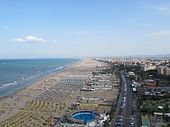
Tourism
editThe countries bordering the Adriatic Sea are significant tourist destinations. The largest number of tourist overnight stays and the most numerous tourist accommodation facilities are recorded in Italy, especially in the Veneto region (around Venice). Veneto is followed by the Emilia-Romagna region and by theAdriatic Croatiancounties.The Croatian tourist facilities are further augmented by 21,000 nautical ports andmoorings;nautical touristsare attracted to various types of marineprotected areas.[111]
All countries along the Adriatic coast, except Albania and Bosnia–Herzegovina, take part in theBlue Flag beachcertification programme (of theFoundation for Environmental Education), for beaches andmarinasmeeting strict quality standards including environmental protection, water quality, safety and services criteria.[256]As of January 2012, the Blue Flag has been awarded to 103 Italian Adriatic beaches and 29 marinas, 116 Croatian beaches and 19 marinas, 7 Slovenian beaches and 2 marinas, and 16 Montenegrin beaches.[257]Adriatic tourism is a significant source of income for these countries, especially in Croatia and Montenegro where the tourism income generated along the Adriatic coast represents the bulk of such income.[258][259]The direct contribution of travel and tourism to Croatia's GDP stood at 5.1% in 2011, with the total industry contribution estimated at 12.8% of the national GDP.[260]For Montenegro, the direct contribution of tourism to the national GDP is 8.1%, with the total contribution to the economy at 17.2% of Montenegrin GDP.[261]Tourism in Adriatic Croatia has recently exhibited greater growth than in the other regions around the Adriatic.[262]
-
 Riminiis a major seaside tourist resort in Italy.
 -
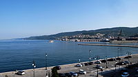
![The Barcolana regatta in Trieste, Italy, was named "the greatest sailing race" by the Guinness World Record for its 2,689 boats and over 16,000 sailors on the starting line.[263]](https://upload.wikimedia.org/wikipedia/commons/thumb/c/cc/Triestebarcolana.jpg/233px-Triestebarcolana.jpg) TheBarcolana regattainTrieste,Italy, was named "the greatest sailing race" by theGuinness World Recordfor its 2,689 boats and over 16,000 sailors on the starting line.[263]
TheBarcolana regattainTrieste,Italy, was named "the greatest sailing race" by theGuinness World Recordfor its 2,689 boats and over 16,000 sailors on the starting line.[263] -
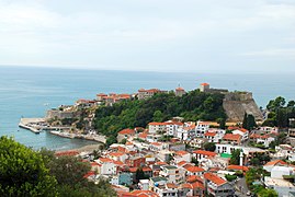 View ofUlcinj,Montenegro
 -
 TheZlatni Rat(Golden Cape) on the island ofBrač
 -

-
 The coast ofNeum,the only town to be situated along Bosnia and Herzegovina's 20 km (12 mi) of coastline
 -
 Portorožis the largest seaside tourist centre in Slovenia.

![The Barcolana regatta in Trieste, Italy, was named "the greatest sailing race" by the Guinness World Record for its 2,689 boats and over 16,000 sailors on the starting line.[263]](/translate/en.m.wikipedia.org?u=https%3A%2F%2Fen.m.wikipedia.org%2Fwiki%2FFile%3ATriestebarcolana.jpg&t=hv)


| Country | Region | CAF beds* | Hotel beds | Overnight Stays |
|---|---|---|---|---|
| Albania | — | ? | ? | 2,302,899 |
| Bosnia and Herzegovina | Neummunicipality | c.6,000 | 1,810 | 280,000 |
| Croatia | Adriatic Croatia | 1,028,793 | 119,042 | 67,231,198 |
| Italy | Friuli-Venezia Giulia | 152,847 | 40,921 | 8,656,077 |
| Veneto | 692,987 | 209,700 | 60,820,308 | |
| Emilia-Romagna | 440,999 | 298,332 | 37,477,880 | |
| the Marches | 193,965 | 66,921 | 10,728,507 | |
| Abruzzo | 108,747 | 50,987 | 33,716,112 | |
| Molise | 11,711 | 6,383 | 7,306,951 | |
| Apulia** | 238,972 | 90,618 | 12,982,987 | |
| Montenegro | — | 40,427 | 25,916 | 7,964,893 |
| Slovenia | Seaside municipalities | 24,080 | 9,330 | 1,981,141 |
| *Beds in all collective accommodation facilities; includes "Hotel beds" figure also shown separately **Includes both Adriatic and Ionian sea coasts | ||||
Transport
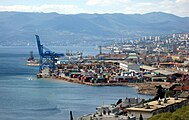
editThere are nineteen Adriatic Sea ports (in four different countries) that each handles more than a million tonnes of cargo per year. The largest cargo ports among them are thePort of Trieste(the largest Adriatic cargo port in Italy), the Port of Venice, thePort of Ravenna,thePort of Koper(the largest Slovenian port),[272]thePort of Rijeka(the largest Croatian cargo port), and thePort of Brindisi.

The largest passenger ports in the Adriatic are thePort of Split(the largest Croatian passenger port) and ports inAncona(the largest Italian passenger seaport in the Adriatic).[273][274][275][276]The largest seaport in Montenegro is thePort of Bar.[277]In 2010, the Northern Adriatic seaports of Trieste, Venice, Ravenna, Koper and Rijeka founded theNorth Adriatic Ports Associationto position themselves more favourably in the EU's transport systems.[278][279]
The port of Trieste is of particular importance for Central Europe because this is where theTransalpine Pipelinebegins, supplying 100 percent of southern Germany, 90 percent of Austria and 50 percent of the Czech Republic with crude oil.[280]
| Port | Country, Region/County | Cargo (tonnes) | Passengers |
|---|---|---|---|
| Ancona | Italy,the Marches | 10,573,000 | 1,483,000 |
| Bari | Italy,Apulia | 3,197,000 | 1,392,000 |
| Barletta | Italy, Apulia | 1,390,000 | — |
| Brindisi | Italy, Apulia | 10,708,000 | 469,000 |
| Chioggia | Italy,Veneto | 2,990,000 | — |
| Durrës | Albania,Durrës | 3,441,000 | 770,000 |
| Koper | Slovenia,Slovenian Istria | 18,000,000 | 100,300 |
| Manfredonia | Italy, Apulia | 1,277,000 | — |
| Monfalcone | Italy,Friuli-Venezia Giulia | 4,544,000 | — |
| Ortona | Italy,Abruzzo | 1,340,000 | — |
| Ploče | Croatia,Dubrovnik-Neretva | 5,104,000 | 146,000 |
| Porto Nogaro | Italy, Friuli-Venezia Giulia | 1,475,000 | — |
| Rabac | Croatia,Istria | 1,090,000 | 669,000 |
| Ravenna | Italy,Emilia-Romagna | 27,008,000 | — |
| Rijeka | Croatia,Primorje-Gorski Kotar | 15,441,000 | 219,800 |
| Split | Croatia,Split-Dalmatia | 2,745,000 | 3,979,000 |
| Trieste | Italy, Friuli-Venezia Giulia | 39,833,000 | — |
| Venice | Italy,Veneto | 32,042,000 | 1,097,000 |
| *Ports handling more than a million tonnes of cargo or serving more than a million passengers per year Sources:National Institute of Statistics(2007 data, Italian ports, note: the Port of Ancona includes Ancona andFalconara Marittima;[281]passenger traffic below 200,000 is not reported),[273]Croatian Bureau of Statistics(2008 data, Croatian ports, note: the Port of Rijeka includes the Rijeka,Bakar,BršicaandOmišaljterminals;[282]the Port of Ploče includes thePločeandMetkovićterminals),[274][283]Durrës' Chamber of Commerce and Industry – Albania (2007 data, Port of Durrës),[275]SEOnet (2011 data, Port of Koper)[284] | |||
Oil and gas
editNatural gasis produced through several projects, including a joint venture of theEniandINAcompanies that operates two platforms—one is in Croatian waters and draws gas from six wells, and the other (which started operating in 2010) is located in Italian waters. The Adriatic gas fields were discovered in the 1970s,[285]: 265 but their development commenced in 1996. In 2008, INA produced 14.58 millionBOEper day of gas.[286]About 100 offshore platforms are located in the Emilia-Romagna region,[111]along with 17 in the Northern Adriatic.[287]Eni estimated itsconcessionsin the Adriatic Sea to hold at least 40,000,000,000 cubic metres (1.4×10¹²cu ft) of natural gas, adding that they may even reach 100,000,000,000 cubic metres (3.5×10¹²cu ft). INA estimates, however, are 50% lower than those supplied by Eni.[288]Oil was discovered in the Northern Adriatic at a depth of approximately 5,400 metres (17,700 ft); the discovery was assessed as not viable because of its location, depth and quality.[289]These gas and oil reserves are part of thePo basinProvince of Northern Italy and the Northern Mediterranean Sea.[290]
In the 2000s, investigation works aimed at discovering gas and oil reserves in the Middle and Southern Adriatic basins intensified, and by the decade's end, oil and natural gas reserves were discovered southeast of the Bari, Brindisi—Rovesti and Giove oil discoveries. Surveys indicate reserves of 3 billionbarrelsofoil in placeand 5.7×10¹⁰cubic metres (2,000,000,000,000 cu ft) of gas in place.[291]The discovery was followed by further surveys off the Croatian coast.[292]In January 2012, INA commenced prospecting for oil off Dubrovnik, marking the resumption of oil exploration along the eastern Adriatic coast after surveys commenced in the late 1980s around the island of Brač were cancelled because of Yugoslavia's breakup andwar in Croatia.Montenegro is also expected to look for oil off its coast.[293]As of January 2012, only 200exploration wellshad been sunk off the Croatian coast, with all but 30 in the Northern Adriatic basin.[294]
Gallery
edit- Ports in the Adriatic
-
 Port of Durrës,the largest port in Albania
 -
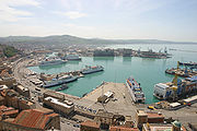
 Port of Rijeka,the largest cargo port in Croatia
 -
 Port of Koper,the largest port inSlovenia
 -
 Port of Trieste,the largest cargo port in the Adriatic
 -
 Port of Bar,the largest seaport in Montenegro
 -
 Port ofAncona,a large passenger port


See also
editReferences
edit- ^Drainage Basin of the Mediterranean Sea(PDF)(Report).UNECE.p. 253.Retrieved30 March2023.
- ^Room 2006,p. 20.
- ^Playfair, James (November 1812)."System of Geography".The British Critic.40.F. and C. Rivington: 504.
- ^Calmet & Taylor 1830,pp. 53–54.
- ^Anthon 2005,p. 20.
- ^Tacitus 1853,p. 380.
- ^"Adria",Cyclopedia of Biblical, Theological, and Ecclesiastical Literature,New York: Harper & Bros., 1880.
- ^Moranta et al. 2008,p. 3.
- ^abCushman-Roisin, Gačić & Poulain 2001,pp. 1–2.
- ^ab"Limits of Oceans and Seas"(PDF)(3 ed.).International Hydrographic Organization.1953. Archived fromthe original(PDF)on 8 October 2011.Retrieved28 December2020.
- ^Lipej & Dulčić 2004,p. 291.
- ^Ludwig, Wolfgang; Dumont, Egon; Meybeck, Michel; Heussnera, Serge (2009). "River discharges of water and nutrients to the Mediterranean and Black Sea: Major drivers for ecosystem changes during past and future decades?".Progress in Oceanography.80(3–4): 199.Bibcode:2009PrOce..80..199L.doi:10.1016/j.pocean.2009.02.001.
- ^"Drainage Basin of the Mediterranean Sea"(PDF).United Nations Economic Commission for Europe.Retrieved27 January2012.
- ^abcdBombace 1992,pp. 379–382.
- ^Koler 2006,pp. 224–225.
- ^Tutić, Dražen; Lapaine, Miljenko (2011)."Cartography in Croatia 2007–2011 – National Report to the ICA"(PDF).International Cartographic Association.Retrieved5 February2012.
- ^"S pomočjo mareografske postaje v Kopru do novega geodetskega izhodišča za Slovenijo"[With the Help of a Tide Gauge Station in Koper to A New Geodetic Origin Point for Slovenia] (in Slovenian). Slovenian Environment Agency. 23 November 2016.
- ^Die Alpen: Hydrologie und Verkehrsübergänge (German)
- ^abBlake, Topalović & Schofield 1996,pp. 1–5.
- ^"Territory and climate"(PDF).Statistical Yearbook of the Republic of Slovenia 2011.Statistical Office of the Republic of Slovenia.p. 38 ( "Length of the state border" ).ISSN1318-5403.Archived fromthe original(PDF)on 15 May 2013.Retrieved2 February2012.
- ^"Isole Tremiti"[Tremiti Islands] (in Italian). 24 August 2008.Retrieved30 March2012.
- ^Duplančić Leder, Tea; Ujević, Tin; Čala, Mendi (June 2004)."Coastline lengths and areas of islands in the Croatian part of the Adriatic Sea determined from the topographic maps at the scale of 1: 25 000".Geoadria.9(1).Zadar:5–32.doi:10.15291/geoadria.127.Retrieved24 November2019.
- ^Faričić, Josip; Graovac, Vera; Čuka, Anica (June 2010)."Croatian small islands – residential and/or leisure area".Geoadria.15(1).University of Zadar:145–185.doi:10.15291/geoadria.548.
- ^"Pravilnik za luku Osor"[Port of Osor ordinance] (in Croatian). Lošinj Port Authority. 23 December 2005. Archived fromthe originalon 12 February 2012.Retrieved25 March2012.
- ^Regan, Krešimir; Nadilo, Branko (2010)."Stare crkve na Cresu i Lošinju te okolnim otocima"[Old churches on Cres and Lošin and nearby islands](PDF).Građevinar(in Croatian).62(2). Croatian association of civil engineers.ISSN0350-2465.Archived fromthe original(PDF)on 15 July 2012.Retrieved25 March2012.
- ^Ostroški, Ljiljana, ed. (December 2015).Statistički ljetopis Republike Hrvatske 2015[Statistical Yearbook of the Republic of Croatia 2015](PDF).Statistical Yearbook of the Republic of Croatia (in Croatian and English). Vol. 47. Zagreb:Croatian Bureau of Statistics.p. 47.ISSN1333-3305.Retrieved27 December2015.
- ^Garwood 2009,p. 481.
- ^Hughes et al. 2010,p. 58.
- ^Google(29 January 2012)."Cape Kephali, Corfu, Greece – the southernmost point of the Adriatic Sea"(Map).Google Maps.Google.Retrieved29 January2012.
- ^"Sea Around Us | Fisheries, Ecosystems and Biodiversity".www.seaaroundus.org.Retrieved27 October2020.
- ^Cushman-Roisin, Gačić & Poulain 2001,p. 122.
- ^abCushman-Roisin, Gačić & Poulain 2001,pp. 2–6.
- ^abMannini, Piero; Massa, Fabio; Milone, Nicoletta."Adriatic Sea Fisheries: outline of some main facts"(PDF).FAO AdriaMed.Retrieved29 January2012.
- ^Del Negro 2001,p. 478.
- ^Cushman-Roisin, Gačić & Poulain 2001,p. 218.
- ^Valiela 2006,pp. 49–56.
- ^Gower 2010,p. 11.
- ^Camuffo 2001,pp. 107–108.
- ^Ferla 2005,p. 101.
- ^Standish 2011,pp. 5–6.
- ^"U Sloveniji more poplavilo obalu"[Sea floods shore in Slovenia].Nova TV (Croatia)(in Croatian). 9 November 2010.Retrieved26 January2012.
- ^"Zadar: Zbog velike plime more poplavilo obalu"[Zadar: Sea floods shore because of high tide].Nova TV (Croatia)(in Croatian). 25 December 2009.Retrieved26 January2012.
- ^"Jugo i niski tlak: More poplavilo šibensku rivu"[Sirocco and low pressure: Sea floods Šibenik quay].Vijesti(in Croatian). 1 December 2010.Retrieved26 January2012.
- ^Franić, Zdenko; Petrinec, Branko (September 2006)."Marine Radioecology and Waste Management in the Adriatic".Archives of Industrial Hygiene and Toxicology.57(3). Institute for Medical Research and Occupational Health: 347–352.ISSN0004-1254.PMID17121008.
- ^Saliot 2005,p. 6.
- ^Tockner, Uehlinger & Robinson 2009,section 11.6.1..
- ^Taniguchi, Makoto; Burnett, William C; Cable, Jaye E; Turner, Jeffrey V (2002)."Investigation of submarine groundwater discharge"(PDF).Hydrological Processes.16(11).John Wiley & Sons:2115–2159.Bibcode:2002HyPr...16.2115T.doi:10.1002/hyp.1145.ISSN1099-1085.S2CID13234853.
- ^Žumer, Jože (2004)."Odkritje podmorskih termalnih izvirov"[Discovery of submarine thermal springs](PDF).Geografski Obzornik(in Slovenian).51(2). Association of the Geographical Societies of Slovenia: 11–17.ISSN0016-7274.(in Slovene)
- ^Cushman-Roisin, Gačić & Poulain 2001,p. 145.
- ^Cushman-Roisin, Gačić & Poulain 2001,pp. 126–130.
- ^abcArtegiani, A; Paschini, E; Russo, A; Bregant, D; Raicich, F; Pinardi, N (1997)."The Adriatic Sea General Circulation. Part I: Air–Sea Interactions and Water Mass Structure".Journal of Physical Oceanography.27(8).American Meteorological Society:1492–1514.Bibcode:1997JPO....27.1492A.doi:10.1175/1520-0485(1997)027<1492:TASGCP>2.0.CO;2.ISSN0022-3670.
- ^abZore-Armanda 1979,p. 43.
- ^Lionello, Malanotte-Rizzoli & Boscolo 2006,pp. 47–53.
- ^"Led okovao svjetionik, u Tisnom smrznulo more"[Ice covers a lighthouse, sea freezes at Tisno].RTL Televizija(in Croatian). 16 December 2010. Archived fromthe originalon 31 July 2013.Retrieved2 February2012.
- ^abLipej & Dulčić 2004,p. 293.
- ^Lionello, Piero."Mediterranean climate: Background information"(PDF).University of Salento.Archived fromthe original(PDF)on 30 July 2013.Retrieved27 January2012.
- ^Šegota, Tomislav; Filipčić, Anita (June 2003)."Köppenova podjela klima i hrvatsko nazivlje"[Köppen climate classification and Croatian terminology].Geoadria(in Croatian).8(1).University of Zadar:17–37.doi:10.15291/geoadria.93.
- ^Cushman-Roisin, Gačić & Poulain 2001,pp. 6–8.
- ^"World Weather Information Service".World Meteorological Organization.Retrieved27 January2012.
- ^"Population in major towns and municipalities, 2011 census".Census of Population, Households and Dwellings 2011.Zagreb:Croatian Bureau of Statistics.December 2012.
- ^"Vista per singola area"[Individual area review] (in Italian).National Institute of Statistics (Italy).2011. Archived fromthe originalon 25 September 2011.Retrieved30 January2012.
- ^"Population and Housing Census in Albania page 17"(PDF).Institute of Statistics of Albania. 2011. Archived fromthe original(PDF)on 12 January 2012.Retrieved21 June2012.
- ^Sekulić, Bogdan; Sondi, Ivan (December 1997)."Koliko je Jadran doista opterećen antropogenim i prirodnim unosom tvari?"[To What Extent is the Adriatic Sea Actually Burdened with Man-induced and Natural Inflow of Substances].Hrvatski geografski glasnik(in Croatian).59(1). Croatian Geographic Society.ISSN1331-5854.
- ^"Facing Water Challenges in the Po River Basin, Italy: A WWDR3 Case Study".waterwiki.net. 2009. Archived fromthe originalon 1 August 2009.Retrieved6 April2009.
- ^Raggi, Meri; Ronchi, Davide; Sardonini, Laura; Viaggi, Davide (4 April 2006)."Po Basin Case study status report"(PDF).AquaMoney. Archived fromthe original(PDF)on 14 June 2020.Retrieved21 March2012.
- ^"Technology: Venetians put barrage to the test against the Adriatic".New Scientistmagazine.No. 1660. 15 April 1989. Archived fromthe originalon 11 October 2007.Retrieved10 October2007.
- ^"Venice's 1,500-year battle with the waves".BBC Online News.17 July 2003.Retrieved10 October2007.
- ^"'Moses project' to secure future of Venice ".Telegraph News.11 January 2012.Retrieved11 January2012.
- ^ab"Venice's MOSE flood barriers rise for the first time".The Architect's Newspaper.14 October 2020.Retrieved23 November2020.
- ^abSurić, Maša (June 2005)."Submerged Karst – Dead or Alive? Examples from the eastern Adriatic Coast (Croatia)".Geoadria.10(1).University of Zadar:5–19.doi:10.15291/geoadria.71.ISSN1331-2294.
- ^ab"Mladen Juračić"[Geology of the sea, Mediterranean and Adriatic](PDF)(in Croatian).University of Zagreb,Faculty of Science, Geology Department.Retrieved28 January2012.[dead link]
- ^Muço 2006,p. 352.
- ^Goudarzi, Sara (25 January 2008)."New Fault Found in Europe; May" Close Up "Adriatic Sea".National Geographic.National Geographic Society.Archived fromthe originalon 28 January 2008.Retrieved28 January2012.
- ^Antonioli, F.; Anzidei, M.; Lambeck, K.; Auriemma, R.; Gaddi, D.; Furlani, S.; Orrù, P.; Solinas, E.; Gaspari, A.; Karinja, S.; Kovačić, V.; Surace, L. (2007). "Sea-level change during the Holocene in Sardinia and in the northeastern Adriatic (central Mediterranean Sea) from archaeological and geomorphological data".Quaternary Science Reviews.26(19–21): 2463–2486.Bibcode:2007QSRv...26.2463A.doi:10.1016/j.quascirev.2007.06.022.
- ^Vukosav, Branimir (30 April 2011)."Ostaci prastarog vulkana u Jadranu"[Remains of an ancient volcano in the Adriatic Sea].Zadarski list(in Croatian).Retrieved24 February2012.
- ^Muço 2006,p. 351.
- ^"Historical Seismicity of Montenegro".Montenegro seismological observatory.Retrieved6 February2012.
- ^Soloviev et al. 2000,pp. 47–52.
- ^Pasarić, Mira; Brizuela, B; Graziani, L; Maramai, A; Orlić, M (2012). "Historical tsunamis in the Adriatic Sea".Natural Hazards.61(2). International Society for the Prevention and Mitigation of Natural Hazards: 281–316.Bibcode:2012NatHa..61..281P.doi:10.1007/s11069-011-9916-3.ISSN1573-0840.S2CID128392992.
- ^Schwartz 2005,p. 575.
- ^Randić 2002,pp. 155–156.
- ^Parise, Mario (2011)."Surface and subsurface karst geomorphology in the Murge (Apulia, Southern Italy)".Acta Carsologica.40(1).Slovenian Academy of Sciences and Arts:73–93.doi:10.3986/ac.v40i1.30.ISSN0583-6050.
- ^"Zavarovano območje narave: Krajinski park Strunjan / Area prottetta: Parco naturale di Strugnano"[Protected Area of Nature: Strunjan Landscape Park](PDF).Institute of the Republic of Slovenia for Nature Conservation. 2008. Archived fromthe original(PDF)on 31 March 2017.Retrieved5 February2012.
- ^Tomljenović et al. 2008,pp. 146–149.
- ^Beccaluva et al. 1997,pp. 7–16.
- ^Vezzani, Festa & Ghisetti 2010,pp. 6–56.
- ^McKinney 2007,pp. 123–132.
- ^Syvitski, James P M; Kettner, Albert J; Correggiari, Anna; Nelson, Bruce W (October 2005). "Distributary channels and their impact on sediment dispersal".Marine Geology.222–223 (15).Elsevier:75–94.Bibcode:2005MGeol.222...75S.doi:10.1016/j.margeo.2005.06.030.ISSN0025-3227.(subscription required)
- ^"Geological processes in the Anthropocene: the Po River Delta".Theseus Project.Retrieved28 January2012.
- ^Barrocu 2003,p. 210.
- ^Renato Sconfietti (November 2003)."Ecological indicators of estuarine features on hard substrata in the large North Adriatic lagoons"(PDF).Proceedings of the International Conference on Southern European Coastal Lagoons: The Influence of River Basin-Coastal Zone interactions.Institute for Environment and Sustainability Inland and Marine Waters Unit.Retrieved31 March2012.
- ^"Slovenian Sea".Government of Slovenia.Archived fromthe originalon 19 July 2009.Retrieved3 February2012.
- ^"Rapid assessment of the Ecological Value of the Bojana-Buna Delta"(PDF).EURONATUR. Archived fromthe original(PDF)on 2 December 2013.Retrieved3 February2012.
- ^Mužinić, Jasmina (April 2007)."The Neretva Delta: Green Pearl of Coastal Croatia".Croatian Medical Journal.48(2). Medicinska Naklada: 127–129.PMC2121601.
- ^Gačić, Civitarese & Ursella 1999,p. 356.
- ^Lipej & Dulčić 2004,pp. 291–300.
- ^Bianchi 2007,p. 10.
- ^abcChemonics International Inc (31 December 2000)."Biodiversity assessment for Croatia".Natural Resources Management & Development Portal. Archived fromthe originalon 2 December 2013.Retrieved31 January2012.
- ^Koce, Jasna Dolenc; Vilhar, Barbara; Bohanec, Borut; Dermastia, Marina (2003)."Genome size of Adriatic seagrasses"(PDF).Aquatic Botany.77(1): 17–25.Bibcode:2003AqBot..77...17K.doi:10.1016/S0304-3770(03)00072-X.ISSN0304-3770.
- ^abD. Holcer D.. Fortuna M.C.. Mackelworth C. P.. 2014.Status and Conservation of Cetaceans in the Adriatic Sea(pdf).United Nations Environment Programme.Mediterranean Action Plan. Regional Activity Centre for Specially Protected Areas. Retrieved on 4 September 2017
- ^"Fin whales in the Adriatic - Tethys Research Institute".25 April 2016. Archived fromthe originalon 25 April 2016.
- ^Neven Cukrov (9 September 2014)."Kitovi kod Tijata".Archivedfrom the original on 14 November 2021 – via YouTube.
- ^Alessandro Vatalakis (16 April 2015)."Incontro ravvicinato nel Mar Adriatico con uno squalo di 8 metri".Archived fromthe originalon 3 January 2017 – via YouTube.
- ^"On the presence of basking shark (Cetorhinus maximus) in the Mediterranean Sea"(PDF).
- ^Grlograb Brudi (9 May 2011)."Morski pas kod Ilovika".Archivedfrom the original on 14 November 2021 – via YouTube.
- ^"Jadransko more je puno morskih pasa, kitova, kornjača i dupina".Archived fromthe originalon 27 August 2010.Retrieved14 April2016.
- ^The MORSE Project –Ancient whale exploitation in the Mediterranean: species mattersArchived20 December 2016 at theWayback Machine
- ^Andrea Di Matteo "Santa Croce, 1954: ultima grande pescata di tonni", Il Piccolo, 23. August 2014.
- ^Vukšić, Ivna (18 May 2009)."Fourth national report of the Republic of Croatia to the Convention on Biological Diversity"(PDF).Ministry of Culture (Croatia).Archived fromthe original(PDF)on 26 August 2009.Retrieved22 March2012.
- ^Lipej & Dulčić 2004,p. 300.
- ^abcdefgh"The potential of Maritime Spatial Planning in the Mediterranean Sea – Case study report: The Adriatic Sea"(PDF).European Union.5 January 2011.Retrieved30 January2012.
- ^"Dove Siamo"[Where We Are].Torre del Cerrano(in Italian). 2010.Retrieved24 March2012.
- ^"La Riserva"[The reserve] (in Italian). La Riserva Marina di Miramare. Archived fromthe originalon 18 September 2004.Retrieved31 January2012.
- ^"The Marine Protected Area".Marine Protected Area Torre Cerrano. Archived fromthe originalon 14 May 2013.Retrieved31 January2012.
- ^"Riserva Marina delle Isole Tremiti"[Tremiti Islands Marine Reserve] (in Italian). tremiti.eu.Retrieved31 January2012.
- ^"Protected Area".Consorzio di Gestione di Torre Guaceto.Retrieved31 January2012.
- ^"The Annotated Ramsar List: Italy".Ramsar Convention.Archived fromthe originalon 7 July 2013.Retrieved3 February2012.
- ^"General Info".Brijuninational park. Archived fromthe originalon 14 January 2012.Retrieved31 January2012.
- ^"Documents and reports".Brijuninational park. Archived fromthe originalon 2 December 2013.Retrieved31 January2012.
- ^"Limski kanal"[Lim Canal] (in Croatian). City ofRovinj.Retrieved31 January2012.
- ^"About Park".Kornatinational park. Archived fromthe originalon 9 August 2013.Retrieved2 December2013.
- ^"Nature Park Telašćica".Telašćica nature park. Archived fromthe originalon 23 July 2009.Retrieved31 January2012.
- ^"About Us".Lastovo nature park. Archived fromthe originalon 2 December 2013.Retrieved22 April2012.
- ^"The Annotated Ramsar List: Croatia".Ramsar Convention.Archived fromthe originalon 2 December 2013.Retrieved3 February2012.
- ^abcVidmar, Barbara; Turk, Robert (September 2011)."Marine protected areas in Slovenia: How far are we from the 2012/2020 target?"(PDF).Varstvo Narave.Suppl. (1). Nature Conservation Institute of the Republic of Slovenia: 159–170.ISSN0506-4252.Archived fromthe original(PDF)on 31 March 2017.Retrieved10 August2012.
- ^"Naravni spomenik Jezeri v Fiesi"[The Fiesa Lakes Natural Monument] (in Slovenian). Nature Conservation Institute of the Republic of Slovenia. Archived fromthe originalon 10 March 2007.Retrieved4 February2012.(in Slovene)
- ^ab"Territory and climate"(PDF).Statistical Yearbook of the Republic of Slovenia 2011.Statistical Office of the Republic of Slovenia. p. 40 ( "Enlarged protected areas of nature – natural parks" ).ISSN1318-5403.Archived fromthe original(PDF)on 15 May 2013.Retrieved4 February2012.
- ^Pipan, Primož."Sečoveljske soline"[Sečovlje Saltworks]. In Šmid Hribar, Mateja; Torkar, Gregor; Golež, Mateja; Podjed, Dan; Kladnik, Drago; Erhartič, Bojan; Pavlin, Primož; Jerele, Ines (eds.).Enciklopedija naravne in kulturne dediščine na Slovenskem – DEDI(in Slovenian). Archived fromthe originalon 15 July 2012.Retrieved3 February2012.(in Slovene)
- ^"Report of the Republic of Slovenia on the implementation of the Agreement in the period 2005–2007"(PDF).Agreement on the Conservation of African-Eurasian Migratory Waterbirds.2008. Archived fromthe original(PDF)on 20 November 2012.Retrieved21 June2012.
- ^Bratina Jurkovič, Nataša (April 2011)."Saltpans of Strunjan, Slovenia – proposal"(PDF).Landscape Management Methodologies: Synthesis report of thematic studies.United Nations Environment Programme.pp. 286–291. Archived fromthe original(PDF)on 24 September 2015.Retrieved5 February2012.
- ^Putrle, Dejan (September 2011)."Landscape Park Strunjan"(PDF).Varstvo Narave.Suppl. (1). Nature Conservation Institute of the Republic of Slovenia: 187.ISSN0506-4252.Archived fromthe original(PDF)on 31 March 2017.Retrieved5 February2012.
- ^"Osebna izkaznica"[Identity Card] (in Slovenian). Bird Watching and Bird Study Society of Slovenia.Retrieved4 February2012.(in Slovene)
- ^"Zavarovana območja: Debeli rtič"[Protected Areas: Debeli Rtič].Geopedia.si(in Slovenian). Agencija RS za okolje; Zavod Republike Slovenije za varstvo narave; Synergise, d. o. o. May 2007.Retrieved31 August2012.
- ^"Zavarovana območja: Rt Madona v Piranu"[Protected Areas: Cape Madona in Piran].Geopedia.si(in Slovenian). Agencija RS za okolje; Zavod Republike Slovenije za varstvo narave; Synergise, d. o. o. May 2007.Retrieved31 August2012.
- ^Krivograd Klemenčič, Aleksandra; Vrhovšek, Danijel; Smolar-Žvanut, Nataša (31 March 2007)."Microplanktonic and Microbenthic Algal Assemblages in the Coastal Brackish Lake Fiesa and the Dragonja Estuary (Slovenia)".Natura Croatica.16(1). Croatian Natural History Museum.
- ^"Zavarovana območja: Jezeri v Fiesi"[Protected Areas: Lakes in Fiesa].Geopedia.si(in Slovenian). Agencija RS za okolje; Zavod Republike Slovenije za varstvo narave; Synergise, d. o. o. May 2007.Retrieved31 August2012.
- ^"Vendim për shpalljen" Park Kombëtar "të ekosistemit natyror detar pranë gadishullit të Karaburunit dhe ishullit të Sazanit"[Decision to declare as a "National Park" the maritime natural ecosystem of Karaburun Peninsula and Sazan Island] (in Albanian). shqiperia.com.Retrieved31 January2012.(in Albanian)
- ^"The Annotated Ramsar List: Albania".Ramsar Convention.Archived fromthe originalon 25 May 2012.Retrieved3 February2012.
- ^Chin 2006,pp. 5–6.
- ^"Woes of Venice Lagoon tackled in U.S."CNN.23 September 1999. Archived fromthe originalon 2 November 2010.Retrieved27 March2012.
- ^Jelavić, Vedran; Radan, Damir (2004)."Ecologic risks from crude oil tankers in Croatian part of Adriatic Sea"(PDF).University of Zagreb.Archived fromthe original(PDF)on 2 December 2013.Retrieved27 March2012.
- ^Trajković, Sergej; Horvat, Nevenka (14 May 2010)."Tankerska havarija u Jadranu bez prihoda bi ostavila milijun ljudi"[A tanker disaster in the Adriatic would cost a million people their livelihood].Jutarnji list(in Croatian). Archived fromthe originalon 12 January 2012.Retrieved27 March2012.
- ^"Environmental disaster warning as oil spill reaches the Po, Italy's biggest river".The Guardian.24 February 2010.Retrieved27 March2012.
- ^Budimir, M (22 September 2009)."Havarija tankera na Hvaru: pijani kormilar vozio, kapetan boravio u – zahodu"[Tanker disaster on Hvar: drunken crewmember at the helm while the captain went to the toilet].Slobodna Dalmacija(in Croatian).Retrieved27 March2012.
- ^Malačič, Faganeli & Malej 2008,pp. 375–376.
- ^"Coastal Town Mayors Protest over Italy's Gas Terminal".STA: Slovenian Press Agency.25 July 2011. Archived fromthe originalon 9 January 2015.Retrieved27 March2012.
- ^"Minister Welcomes Trieste Council Decision against Gas Terminals".STA: Slovenian Press Agency.21 February 2012. Archived fromthe originalon 2 December 2013.
- ^"Environmental NGO Labels Trieste Gas Terminal Time Bomb".STA: Slovenian Press Agency.21 July 2009. Archived fromthe originalon 9 January 2015.Retrieved27 March2012.
- ^"Slovenia slams Italy's Trieste LNG plans".United Press International.11 August 2011.Retrieved27 March2012.
- ^Kalajdžić, Ahmet (26 December 2011)."Nevrijeme i Božićni blagdani: smeće u starom Portu"[Poor weather and Christmas holidays: waste in the old port].Slobodna Dalmacija(in Croatian).Retrieved27 March2012.
- ^Rosenthal, Elisabeth (11 June 2007)."Made in Italy: Fashion, food, Fiat, pollution".The New York Times.Retrieved27 March2012.
- ^Glavan, Marinko (12 October 2011)."Kvaliteta zraka u Rijeci: Mlaka, Urinj i Viševac crne točke zagađenja"[Quality of air in Rijeka: Mlaka, Urinj and Viševac are black spots of pollution].Novi list(in Croatian).Retrieved27 March2012.
- ^"The Joint Commission for the protection of the Adriatic Sea and coastal area from pollution".Ministry of Environment and Nature Protection (Croatia).2008. Archived fromthe originalon 15 July 2012.Retrieved27 March2012.
- ^"Addressing Adriatic Hot Spots: A Proposed Adriatic Environmental Program"(PDF).Western Balkans Investment Framework. November 2011. Archived fromthe original(PDF)on 15 March 2016.Retrieved27 March2012.
- ^Cunliffe 2008,pp. 115–116.
- ^Wilkes 1995,pp. 91–104.
- ^Hall 1996,pp. 2–14.
- ^Gruen 1986,p. 359.
- ^Grant 1978,pp. 131–132.
- ^ab"Illyricum – Dalmatia".UNRV.Retrieved13 August2012.
- ^Cabanes 2008,pp. 155–186.
- ^"Bosnia-Herzegovina".Retrieved13 August2012.
- ^"Via Egnatia".Crandall University. Archived fromthe originalon 20 March 2001.Retrieved15 August2012.
- ^"Via Egnatia: a journey across the lower Balkans through time".Montclair State: The College of Humanities and Social Sciences.Retrieved15 August2012.
- ^"Via Egnatia".Livius. Archived fromthe originalon 18 September 2012.Retrieved15 August2012.
- ^Grant 1978,p. 231.
- ^Grant 1978,pp. 242–243.
- ^"Apollonia, Illyria".Albanian Canadian Information Service.Retrieved16 August2012.
- ^Grant 1978,pp. 263–264.
- ^Grant 1978,pp. 395–427.
- ^Grant 1978,p. 464.
- ^Paul the Deacon 1974,pp. 326–328.
- ^Burns 1991,pp. 126–130.
- ^"Byzantine Exarchate of Ravenna AD 552 – 754".The History Files.Retrieved22 August2012.
- ^Goodrich 1856,p. 773.
- ^Paton 1861,pp. 218–219.
- ^Buckley, Hebbert & Hughes 2004,pp. 360–362.
- ^Nanjira 2010,pp. 188–190.
- ^Posavec, Vladimir (March 1998)."Povijesni zemljovidi i granice Hrvatske u Tomislavovo doba"[Historical maps and borders of Croatia in age of Tomislav].Radovi Zavoda Za Hrvatsku Povijest(in Croatian).30(1): 281–290.ISSN0353-295X.Retrieved16 October2011.
- ^Norwich 1997,pp. 250–253.
- ^Hinson 1995,pp. 296–298.
- ^Brown 2003,pp. 3–5.
- ^Fremont-Barnes 2007,p. 495.
- ^abHeka, Ladislav (October 2008)."Hrvatsko-ugarski odnosi od sredinjega vijeka do nagodbe iz 1868. s posebnim osvrtom na pitanja Slavonije"[Croatian-Hungarian relations from the Middle Ages to the Compromise of 1868, with a special survey of the Slavonian issue].Scrinia Slavonica(in Croatian).8(1). Hrvatski institut za povijest – Podružnica za povijest Slavonije, Srijema i Baranje: 152–173.ISSN1332-4853.Retrieved16 October2011.
- ^Norwich 1997,p. 72.
- ^Sethre 2003,pp. 43–54.
- ^Braudel 1992,pp. 118–119.
- ^Shaw 1976,p. 48.
- ^Crouzet-Pavan & Cochrane 2005,p. 79.
- ^Browning 1992,p. 133.
- ^Reinert 2002,p. 270.
- ^Frucht 2005,pp. 422–423.
- ^"Povijest saborovanja"[History of parliamentarism] (in Croatian).Sabor.Archivedfrom the original on 2 December 2010.Retrieved18 October2010.
- ^Crouzet-Pavan & Cochrane 2005,pp. 80–82.
- ^Prothero, Leathes & Ward 1934,p. 495.
- ^King 2003,p. 241.
- ^Ivetic 2011,p. 66.
- ^Martin & Romano 2002,p. 219.
- ^abStephens 2010,pp. 192, 245.
- ^Levillain 2002,p. 1103.
- ^Grab 2003,pp. 188–194.
- ^Henderson 1994,p. 112.
- ^James & Lambert 2002,p. 180.
- ^Nicolson 2000,pp. 180, 226.
- ^Schjerve 2003,p. 200.
- ^Sarti 2004,p. 601.
- ^Noble et al. 2010,pp. 619–622.
- ^Monzali 2009,pp. 73–76.
- ^Ćirković 2004,p. 225.
- ^Tucker 2009,p. 1553.
- ^Tucker 2005,p. 39.
- ^Tucker 1996,p. 440.
- ^Lipušček 2005,p. 446.
- ^Palmer 2000,p. 298.
- ^Tomasevich 2001,pp. 4–16.
- ^Burgwyn 1997,pp. 4–6.
- ^Lee 2003,p. 318.
- ^D'Agostino 2004,pp. 127–128.
- ^Singleton 1985,pp. 135–137.
- ^Tomasevich 2001,pp. 130–139, 233–234.
- ^Klemenčič & Žagar 2004,pp. 198–202.
- ^"History".NATO.Retrieved1 February2012.
- ^Polmar & Noot 1991,pp. 169–170.
- ^Chuck Sudetic(26 June 1991)."2 Yugoslav States Vote Independence To Press Demands".The New York Times.Archivedfrom the original on 10 November 2012.Retrieved12 December2010.
- ^"Bosnia-Hercegovina timeline".BBC Online News.Retrieved1 February2012.
- ^ab"Timeline: Montenegro".BBC Online News.Retrieved1 February2012.
- ^O'Shea 2005,pp. 21–25.
- ^Bernardić, Stjepan (15 November 2004)."Admiral Letica je naredio: Raspali!"[Admiral Letica ordered: Fire!].Slobodna Dalmacija(in Croatian).Retrieved1 February2012.
- ^Cohen, Roger (27 November 1994)."NATO and the UN quarrel in Bosnia as Serbs press on".The New York Times.Retrieved1 February2012.
- ^"Heart of Belgrade bombed".BBC Online News.3 April 1999.Retrieved1 February2012.
- ^Blake, Topalović & Schofield 1996,pp. 11–13.
- ^abcdefKlemenčić, Mladen; Topalović, Duško (December 2009)."The maritime boundaries of the Adriatic Sea".Geoadria.14(2).University of Zadar:311–324.doi:10.15291/geoadria.555.ISSN1331-2294.
- ^abBajruši, Robert (6 December 2007)."ZERP je nepotrebna avantura"[ZERP is a needless adventure] (in Croatian).Nacional (weekly).Archived fromthe originalon 30 July 2013.Retrieved2 February2012.
- ^Vukas 2006,p. 205.
- ^"About the Adriatic Euroregion".Adriatic Euroregion.Archived fromthe originalon 9 September 2012.Retrieved21 March2012.
- ^Kraljević, Egon (November 2007)."Prilog za povijest uprave: Komisija za razgraničenje pri Predsjedništvu Vlade Narodne Republike Hrvatske 1945–1946"[Contribution to the history of public administration: commission for the boundary demarcation at the government's presidency of the People's Republic of Croatia, 1945–1946].Arhivski vjesnik(in Croatian).50(50).Croatian State Archives:121–130.ISSN0570-9008.
- ^Tomaić, Tatjana (October 2011)."Kriza međunarodnih odnosa – studija slučaja: Hrvatska i Slovenija – granica u Istri"[International relations crisis – a case study: Croatia and Slovenia – border in Istria].Časopis Za Suvremenu Povijest(in Croatian).43(2). Croatian Institute of History: 391–414.ISSN0590-9597.
- ^Blake, Topalović & Schofield 1996,p. 20.
- ^Vukas 2007,pp. 553–566.
- ^"Chronology of Events 2005"(PDF).Government Communication Office, Republic of Slovenia. Archived fromthe original(PDF)on 19 July 2013.Retrieved25 February2012.
- ^"Slovenia unblocks Croatian EU bid".BBC News Online.11 September 2009.Retrieved12 September2009.
- ^"Slovenia backs Croatia border deal in referendum vote".BBC News Online.6 June 2010.Retrieved7 June2010.
- ^"Croatia and Slovenia submit arbitration agreement to UN".Durham University.Retrieved14 March2012.
- ^abcde"Fishery and Aquaculture Statistics"(PDF).FAO Yearbook.Rome:Food and Agriculture Organization.2011.ISSN2070-6057.Retrieved11 August2012.[permanent dead link]
- ^Mannini, Piero; Massa, Fabio; Milone, Nicoletta."Adriatic Sea Fisheries: outline of some main facts"(PDF).FAO AdriaMed.Retrieved30 January2012.
- ^abDamir Herceg (29 April 2011)."Talijanski ribari optužuju hrvatsku flotu da im kradu ribu"[Italian fishermen accuse Croatian fleet of fish theft].Vjesnik(in Croatian). Archived fromthe originalon 30 April 2011.Retrieved10 May2012.
- ^Houde et al. 1999,p. 344.
- ^Lola Wright (26 August 2003)."U Jadranu je 40 posto manje ribe"[Adriatic Sea fish stock drops 40 percent].Slobodna Dalmacija(in Croatian).Retrieved10 May2012.
- ^"Prosvjed zbog prekomjernog izlova srdele"[Protest over overfishing of sardines] (in Croatian).Nova TV (Croatia).30 September 2011.Retrieved10 May2012.
- ^Bruno Lopandić (9 December 2011)."Potpisan pristupni ugovor: budućnost EU-a i u hrvatskim je rukama"[Accession Treaty Signed: EU Fortune is in Croatian Hands too].Vjesnik(in Croatian). Archived fromthe originalon 26 May 2024.Retrieved7 January2012.
- ^Alen Legović (14 July 2011)."Kako ispraviti promašaj ribolovne politike?"[How to fix failure of fisheries policy?].Vjesnik(in Croatian). Archived fromthe originalon 26 May 2024.Retrieved10 May2012.
- ^"Fishery and Aquaculture Country Profiles – Italy"(PDF).Food and Agriculture Organization.Archived fromthe original(PDF)on 18 May 2017.Retrieved2 December2013.
- ^"Fishery Country Profiles – Croatia"(PDF).Food and Agriculture Organization.Archived fromthe original(PDF)on 18 May 2017.Retrieved30 January2012.
- ^"Country Fishery Information".FAO AdriaMed.Retrieved30 January2012.
- ^"FEE is".Foundation for Environmental Education.Archived fromthe originalon 15 August 2008.Retrieved30 January2012.
- ^"Blue Flag Beaches and Marinas".Foundation for Environmental Education.Archived fromthe originalon 9 June 2011.Retrieved30 January2012.
- ^ab"Tourism".Statistical office of Montenegro.Retrieved30 January2012.
- ^Krasić, Davor; Gatti, Petra; Gledec, Mladen; Jugović, Alen; Kesić, Blanka; Klarić, Zoran; Krešić, Damir; Kunst, Ivo; Kušen, Eduard; Milojević, Dubravko; Pavlin, Stanislav (November 2011). Horak, Siniša (ed.)."Glavni plan i strategija razvoja turizma Republike Hrvatske"[General plan and strategy of development of tourism in the Republic of Croatia](PDF)(in Croatian). Institute for Tourism (Croatia). Archived fromthe original(PDF)on 25 July 2012.Retrieved30 January2012.
- ^"Croatia – Key Facts at a Glance".World Travel and Tourism Council.Archived fromthe originalon 6 November 2011.Retrieved30 January2012.
- ^"Montenegro – Key Facts at a Glance".World Travel and Tourism Council.Archived fromthe originalon 2 December 2011.Retrieved30 January2012.
- ^Quintiliani, Fabio."International tourism in the coastal regions of five Mediterranean countries"(PDF).TheRiminiCentre for Economic Analysis. Archived fromthe original(PDF)on 14 October 2012.Retrieved30 January2012.
- ^"Barcolana, the largest regatta in the world is presented in London".Sail World.
- ^"Eurostat – Tourism".Eurostat.Archived fromthe originalon 16 October 2012.Retrieved30 January2012.
- ^"Intervju: Načelnik općine Neum dr. Živko Matuško za BH. Privrednik"[Interview: Municipal mayor dr. Živko Matuško for BH Privrednik] (in Bosnian).Neummunicipality. 17 October 2011. Archived fromthe originalon 9 January 2015.Retrieved30 January2012.
- ^"Pregled sektora turizma"[A review of tourism sector](PDF)(in Bosnian). Chamber of Economy of the Federation of Bosnia and Herzegovina. 2011. Archived fromthe original(PDF)on 2 December 2013.Retrieved30 January2012.
- ^"Treguesit statistikorë të turizmit"[Tourism statistical indicators] (in Albanian).Ministry of Tourism, Cultural Affairs, Youth and Sports (Albania).Archived fromthe originalon 19 January 2012.Retrieved30 January2012.(in Albanian)
- ^"Tourism"(PDF).Statistical Yearbook of the Republic of Slovenia 2011.Statistical Office of the Republic of Slovenia. p. 423.ISSN1318-5403.Archived fromthe original(PDF)on 15 May 2013.Retrieved25 March2012.
- ^Statistical Office of the Republic of Slovenia (27 September 2011)."Tourism – Hotels, Slovenia, 2008–2010 – final data"(PDF).Statistične Informacije – Rapid Reports.16:5.ISSN1854-1275.Retrieved25 March2012.
- ^"Turizam u 2021"[Tourism, 2021](PDF).Državni zavod za statistiku(in Croatian and English). 28 June 2022. p. 60.Retrieved8 January2022.
- ^"Turizam u brojkama 2021"[Tourism in numbers in 2021](PDF).Hrvatska turistička zajednica(in Croatian). 31 August 2021. p. 16.Retrieved8 January2023.
- ^"Transport"(PDF).Statistical Office of the Republic of Slovenia.2011.Retrieved2 February2012.
- ^ab"Trasporti e telecomunicazioni"[Transport and communications](PDF)(in Italian).National Institute of Statistics (Italy).Archived fromthe original(PDF)on 12 August 2011.Retrieved2 February2012.
- ^ab"Traffic of ships, passengers and goods by harbour master's offices and statistical ports, 2008"(PDF).Croatian Bureau of Statistics.Retrieved1 February2012.
- ^ab"Durrës, a good business choice"(PDF).Durrës' Chamber of Commerce and Industry – Albania. p. 14. Archived fromthe original(PDF)on 13 May 2013.Retrieved2 February2012.
- ^"Slovenia's Luka Koper 2011 Cargo Throughput Up 11%".limun.hr.Raiffeisen Zentralbank.17 January 2012. Archived fromthe originalon 2 December 2013.Retrieved2 February2012.
- ^"Serbia eyes Montenegro's largest port".B92.26 August 2009. Archived fromthe originalon 29 August 2009.Retrieved2 February2012.
- ^"Signed the founding of the NAPA in Trieste, Rijeka is expected to join in".Ministarstvo pomorstva, prometa i infrastrukture.Zagreb:Ministry of Maritime Affairs, Transport and Infrastructure (Croatia).2 March 2010. Archived fromthe originalon 15 December 2012.Retrieved21 March2012.
- ^"Port of Rijeka – Fifth Star of NAPA".North Adriatic Ports Association.29 November 2010.Retrieved27 August2011.
- ^Thomas Fromm "Pipeline durch die Alpen: Alles im Fluss" In: Süddeutsche Zeitung, 26 December 2019.
- ^"Rapporto statistico 2011"[Statistical report 2011](PDF)(in Italian). Port of Ancona Authority.Retrieved22 May2012.
- ^"General information".Port of RijekaAuthority. Archived fromthe originalon 9 January 2015.Retrieved22 May2012.
- ^"Capacities".Port of PločeAuthority. Archived fromthe originalon 21 January 2012.Retrieved22 May2012.
- ^"Ladijski pretovor v letu 2011"[Ship Transloading in 2011] (in Slovenian). Port of Koper. 17 January 2012.(in Slovene)
- ^Ianniello, A., Bolelli, W., and Di Scala, L., 1992, Barbara Field, Adriatic Sea, Offshore Italy, In Giant Oil and Gas Fields of the Decade, 1978–1988, AAPG Memoir 54, Halbouty, M.T., editor, Tulsa: American Association of Petroleum Geologists,ISBN0-89181-333-0
- ^"Annamaria offshore oil rig starts trial run"(PDF).INA.2009. Archived fromthe original(PDF)on 26 February 2014.Retrieved30 January2012.
- ^Biočina, Marko (7 February 2012)."Muški život na plinskoj kraljici"[A bachelors' life on a gas queen].Nacional (weekly)(in Croatian). Archived fromthe originalon 30 July 2013.Retrieved9 February2012.
- ^"Natural gas reserves in the Adriatic may be up to 100 billion cubic meters".limun.hr.Raiffeisen Zentralbank.22 July 2008. Archived fromthe originalon 2 December 2013.Retrieved30 January2012.
- ^Sečen, Josip; Prnić, Žarko (December 1996)."Istraživanje i proizvodnja ugljikovodika u Hrvatskoj"[Oil exploration and production in Croatia].Rudarsko-geološko-naftni Zbornik(in Croatian).8(1).University of Zagreb:19–25.ISSN0353-4529.
- ^"Petroleum Systems of the Po Basin Province of Northern Italy and the Northern Adriatic Sea".United States Geological Survey.Retrieved30 January2012.
- ^Ashcroft, Jamie (29 July 2011)."Northern Petroleum to expand exploration of Rovesti and Giove oil discoveries".Proactive Investors Australia. Archived fromthe originalon 2 December 2013.Retrieved2 December2012.
- ^Grandić, Sanjin; Kolbah, Slobodan (2009)."New Commercial Oil Discovery at Rovesti Structure in South Adriatic and its Importance for Croatian Part of Adriatic Basin".Nafta.60(2).Croatian Academy of Sciences and Arts,Scientific commission for oil: 68–82.ISSN0027-755X.
- ^Mrvaljević, Jasmina (11 January 2012)."Naftu i plin vadit ćemo kod Dubrovnika"[Oil and gas will be pumped near Dubrovnik].Slobodna Dalmacija(in Croatian).Retrieved30 January2012.
- ^Dobrašin, Miho (3 January 2012)."Milanović poništio Kosoričin natječaj za istraživanje nafte i plina"[Milanović cancels Kosor's oil and gas exploration tender procedure] (in Croatian).Business.hr.Archived fromthe originalon 20 February 2012.Retrieved31 January2012.
Bibliography
edit- Anthon, Charles(2005).A Classical Dictionary: Containing the Principle Proper Names Mentioned in Ancient Authors.Kessinger Publishing.ISBN978-1-4179-7654-6.
- Barrocu, Giovanni (2003). "Seawater Intrusion in Coastal Aquifers of Italy". In Geta, Juan Antonio López (ed.).Coastal Aquifers Intrusion Technology: Mediterranean Countries.Instituto Geológico y Minero de España.ISBN978-84-7840-471-1.
- Beccaluva, L.; Shallo, M.; Coltorti, M.; Premti, I; Siena, F (1997)."Albania".In Moores, Eldridge M; Fairbridge, Rhodes Whitmore (eds.).Encyclopedia of European and Asian regional geology.Springer.ISBN978-0-412-74040-4.
- Bianchi, Carlo Nike (2007). "Biodiversity issues for the forthcoming tropical Mediterranean Sea". In Relini, Giulio; Ryland, J (eds.).Biodiversity in enclosed seas and artificial marine habitats: proceedings of the 39th European Marine Biology Symposium, held in Genoa, Italy, 21–24 July 2004.Developments in Hydrobiology. Vol. 193.ISBN978-1-4020-6155-4.
- Blake, Gerald Henry; Topalović, Duško; Schofield, Clive H (1996).The maritime boundaries of the Adriatic Sea.IBRU.ISBN978-1-897643-22-8.
- Bombace, Giovanni (1992). "Fisheries of the Adriatic Sea". In Colombo, Giuseppe (ed.).Marine Eutrophication and Population Dynamics: With a Special Section on the Adriatic Sea: 25th European Marine Biology Symposium, Institute of Zoology, University of Ferrara.Olsen&Olsen.ISBN978-87-85215-19-2.
- Braudel, Fernand(1992).Civilization and Capitalism, 15th–18th Century.University of California Press.ISBN978-0-520-08116-1.
- Brown, Gordon S. (2003).The Norman conquest of Southern Italy and Sicily.McFarland.ISBN978-0-7864-1472-7.
- Browning, Robert (1992).The Byzantine Empire.CUA Press.ISBN978-0-8132-0754-4.
- Buckley, Jonathan; Hebbert, Charles; Hughes, Kate (2004).The Rough Guide to Venice & the Veneto.Rough Guides.ISBN978-1-84353-302-3.
- Burgwyn, H. James (1997).Italian foreign policy in the interwar period, 1918–1940.Greenwood Publishing Group.ISBN978-0-275-94877-1.
- Burns, Thomas S. (1991).A history of the Ostrogoths.Indiana University Press.ISBN978-0-253-20600-8.
- Cabanes, Pierre (2008). "Greek colonisation in the Adriatic". In Tsetskhladze, Gocha R. (ed.).Greek colonisation.BRILL.ISBN978-90-04-15576-3.
- Calmet, Antoine Augustin;Taylor, Charles (1830).Calmet's dictionary of the Holy Bible.
- Camuffo, Dario (2001). "Lunar influences on climate". In Cesare Barbieri; Francesca Rampazzi (eds.).Earth-Moon Relationships: Proceedings of the Conference Held in Padova, Italy at the Accademia Galileiana Di Scienze Lettere Ed Arti, November 8–10, 2000.Springer.ISBN978-0-7923-7089-5.
- Chin, David A. (2006).Water-quality engineering in natural systems.John Wiley and Sons.ISBN978-0-471-71830-7.
- Crouzet-Pavan, Elisabeth; Cochrane, Lydia G. (2005).Venice Triumphant.JHU Press.ISBN978-0-8018-8189-3.
- Cunliffe, Barry(2008).Europe Between the Oceans.Yale University Press.ISBN978-0-300-11923-7.
- Cushman-Roisin, Benoit; Gačić, Miroslav; Poulain, Pierre-Marie (2001).Physical oceanography of the Adriatic Sea.Springer.ISBN978-1-4020-0225-0.
- Ćirković, Sima M. (2004).The Serbs.John Wiley & Sons.ISBN978-0-631-20471-8.
- D'Agostino, Peter R. (2004).Rome in America.University of North Carolina Press. pp. 127–128.ISBN978-0-8078-5515-7.
- Del Negro, Paola (2001). "Bacterial Abundance in the Adriatic Sea". In Faranda, Francesco; Guglielmo, Letterio; Spezie, Giancarlo (eds.).Mediterranean Ecosystems: structures and processes.Springer.ISBN978-88-470-0114-5.
- Ferla, Maurizio (2005). "APAT duties and techno-scientific activities". In Fletcher, Caroline; Spencer, Tom (eds.).Flooding and environmental challenges for Venice and its lagoon: state of knowledge.Cambridge University Press.ISBN978-0-521-84046-0.
- Fremont-Barnes, Gregory (2007).Encyclopedia of the Age of Political Revolutions and New Ideologies, 1760–1815: Volume 1.Greenwood. p. 495.ISBN978-0-313-33446-7.
- Frucht, Richard C. (2005).Eastern Europe: An Introduction to the People, Lands, and Culture.ABC-CLIO.ISBN978-1-57607-800-6.
- Gačić, Miroslav; Civitarese, Giuseppe; Ursella, Laura (1999). "Spatial and seasonal variability of water and biogeochemical fluxes in the Adriatic Sea". InPaola Malanotte-Rizzoli;Valery N. Eremeev (eds.).The Eastern Mediterranean As a Laboratory Basin for the Assessment of Contrasting Ecosystems.Springer.ISBN978-0-7923-5586-1.
- Garwood, Duncan (2009).Mediterranean Europe.Lonely Planet.ISBN978-1-74104-856-8.
- Goodrich, Samuel Griswold (1856).A history of all nations, from the earliest periods to the present time.Miller, Orton & Mulligan.
- Gower, Jim F.R. (2010). "Oceans from Space, a Once-a-Decade Review of Progress: Satellite Oceanography in a Changing World". In Barale, Vittorio; Gower, Jim F.R.; Alberotanza, L. (eds.).Oceanography from Space: Revisited.Springer.ISBN978-90-481-8680-8.
- Grab, Alexander I. (2003).Napoleon and the transformation of Europe.Palgrave Macmillan.ISBN978-0-333-68274-6.
- Grant, Michael(1978).History of Rome.Schribners.ISBN0-684-15986-4.
- Gruen, Erich S. (1986).The Hellenistic world and the coming of Rome.University of California Press.ISBN978-0-520-05737-1.
- Hall, John Franklin (1996).Etruscan Italy.Indiana University Press.ISBN978-0-8425-2334-9.
- Henderson, James (1994).The frigates.Leo Cooper.ISBN978-0-85052-432-1.
- Hinson, E. Glenn (1995).The church triumphant.Mercer University Press.ISBN978-0-86554-436-9.
- Houde, E. D.; Jukić-Peladić, S.; Brandt, S. B.; Leach, S. D. (1999). "Fisheries: Trends in Catches, Abundance and Management". In Malone, Thomas C. (ed.).Ecosystems at the Land-Sea Margin: Drainage Basin to Coastal Sea.American Geophysical Union.ISBN978-0-87590-269-2.
- Hughes, Holly; Flippin, Alexis Lipsitz; Murphy, Sylvie; Duchaine, Julie (2010).Frommer's 500 Extraordinary Islands.John Wiley & Sons.ISBN978-0-470-50070-5.
- Ivetic, Egidio (2011). "The Peace of Passarowitz in Venice's Balkan Policy". In Ingrao, Charles; Samardžić, Nikola; Pešalj, Jovan (eds.).The Peace of Passarowitz, 1718.West Lafayette: Purdue University Press. pp. 63–72.ISBN9781557535948.
- James, William M.; Lambert, Andrew D. (2002).The Naval History of Great Britain, Volume 6, 1811–1827.Conway Maritime.ISBN978-0-85177-910-2.
- King, Margaret L.(2003).The Renaissance in Europe.Laurence King Publishing.ISBN978-1-85669-374-5.
- Klemenčič, Matjaž; Žagar, Mitja (2004).The former Yugoslavia's diverse peoples.ABC-CLIO.ISBN978-1-57607-294-3.
- Koler, Božo (2006). "Historic measurements of leveling networks in Slovenia". In Pinter, Nicholas; Grenerczy, Gyula; Weber, John; Stein, Seth; Medak, Damir (eds.).The Adria microplate: GPS geodesy, tectonics and hazards.Springer.ISBN978-1-4020-4234-8.
- Lee, Stephen J. (2003).Europe, 1890–1945.Routledge.ISBN978-0-415-25455-7.
- Levillain, Philippe, ed. (2002).The Papacy: Gaius-Proxies.Routledge.p. 1103.ISBN978-0-415-92230-2.
- Lionello, Piero; Malanotte-Rizzoli, Paola; Boscolo, Roberta (2006).Mediterranean climate variability.Elsevier.ISBN978-0-444-52170-5.
- Lipej, Lovrenc; Dulčić, Jakov (2004). "Fish Biodiversity in the Adriatic Sea". In Griffiths, Huw I; Kryštufek, Boris; Reed, Jane M (eds.).Balkan Biodiversity: Pattern and Process in the European Hotspot.Springer.ISBN978-1-4020-2853-3.
- Lipušček, Uroš (2005).""You Will Not Be Robbed": Slovenes and Great Powers from the Treaty of London in 1915 to the Memorandum of London in 1954 "(PDF).In Pirjevec, Jože (ed.).War and Peace: From the Capitulation of Italy in 1943 Until the Memorandum of London in 1954.University of Primorska;Annales Publishing House; Scientific and Research Institute Koper; The Historical Society for the Southern Littoral. p. 446.ISBN961-6033-67-0.Archived fromthe original(PDF)on 13 May 2013.
- Malačič, V.; Faganeli, J.; Malej, A. (2008).Environmental Impact of LNG Terminals in the Gulf of Trieste (Northern Adriatic)(PDF).Springer.ISBN978-1-4020-6575-0.Archived fromthe original(PDF)on 9 January 2015.
- Martin, John Jeffries; Romano, Dennis (2002).Venice reconsidered.JHU Press.ISBN978-0-8018-7308-9.
- McKinney, Frank Kenneth (2007). "Chapter 6: Pleistocene and Holocene Sediments".The northern Adriatic ecosystem: Deep time in a shallow sea(illustrated ed.). Columbia University Press.ISBN978-0-231-13242-8.
- Moranta, Joan; Quetglas, Antoni; Massutí, Enric; Guijarro, Beatriz; Ordines, Francesc; Valls, María (2008). "Research trends on demersal fisheries oceanography in the Mediterranean". In Rades, Charles V.; Tilesman, Evan B. (eds.).Advances in Environmental Research.Nova Publishers.ISBN978-1-60456-413-6.
- Monzali, Luciano (2009).The Italians of Dalmatia.University of Toronto Press.ISBN978-0-8020-9621-0.
- Muço, Betim (2006). "Seismicity of the Adriatic microplate and a possible triggering: geodynamic implication". In Pinter, Nicholas; Grenerczy, Gyula; Weber, John; Stein, Seth; Medak, Damir (eds.).The Adria microplate: GPS geodesy, tectonics and hazards.Springer.ISBN978-1-4020-4234-8.
- Room, Adrian (2006).Placenames of the world.McFarland & Company.ISBN978-0-7864-2248-7.
- Nanjira, Daniel Don (2010).African Foreign Policy and Diplomacy.ABC-CLIO.ISBN978-0-313-37982-6.
- Navone, John J. (1996).The land and the spirit of Italy.Legas / Gaetano Cipolla.ISBN978-1-881901-12-9.
- Nicolson, Harold (2000).The Congress of Vienna.Grove Press.ISBN978-0-8021-3744-9.
- Noble, Thomas F. X.; Strauss, Barry S.; Osheim, Duane J.; Neuschel, Kristen B.; Accampo, Elinor Ann (2010).Western Civilization: Beyond Boundaries.Cengage Learning.ISBN978-1-4240-6962-0.
- Norwich, John Julius (1997).A short history of Byzantium.Knopf.ISBN978-0-679-77269-9.
- O'Shea, Brendan (2005).The modern Yugoslav conflict 1991–1995.Routledge.ISBN978-0-415-35705-0.
- Palmer, Alan (2000).Victory 1918.Grove Press.ISBN978-0-8021-3787-6.
- Paul the Deacon(1974). Peters, Edward (ed.).History of the Lombards.University of Pennsylvania Press.ISBN978-0-8122-1079-8.
- Paton, Andrew Archibald (1861).Researches on the Danube and the Adriatic.Trübner.
- Polmar, Norman; Noot, Jurrien (1991).Submarines of the Russian and Soviet navies, 1718–1990.Naval Institute Press.ISBN978-0-87021-570-4.
- Prothero, George Walter; Leathes, Stanley; Ward, Adolphus William (1934).The Cambridge modern history.Cambridge University Press Archive.
- Saliot, Alain (2005).The Mediterranean Sea.Birkhäuser.ISBN978-3-540-25018-0.
- Randić, Andrija (2002). "Prospects for integrated coastal management development in Croatia". In Cicin-Sain, Biliana; Pavlin, Igor; Belfiore, Stefano (eds.).Sustainable coastal management: a transatlantic and Euro-Mediterranean perspective.Springer.ISBN978-1-4020-0888-7.
- Reinert, Stephen W. (2002). "Fragmentation (1204–1453". In Mango, Cyril (ed.).The Oxford History of Byzantium.Oxford: Oxford University Press.ISBN0-19-814098-3.
- Sarti, Roland (2004).Italy.Infobase Publishing.ISBN978-0-8160-4522-8.
- Schjerve, Rosita Rindler (2003).Diglossia and power.Walter de Gruyter.ISBN978-3-11-017654-4.
- Schwartz, Maurice L, ed. (2005).Encyclopedia of coastal science.Encyclopedia of earth sciences. Vol. 24. Springer.ISBN978-1-4020-1903-6.
- Sethre, Janet (2003).The souls of Venice.McFarland.ISBN978-0-7864-1573-1.
- Shaw, Stanford J. (1976).History of the Ottoman Empire and Modern Turkey.Cambridge University Press.ISBN978-0-521-29163-7.
- Singleton, Frederick Bernard (1985).A short history of the Yugoslav peoples.Cambridge University Press.ISBN978-0-521-27485-2.
- Soloviev, Sergey Leonidovich; Solovieva, Olga N.; Go, Chan N.; Kim, Khen S.; Shchetnikov, Nikolay A. (2000).Tsunamis in the Mediterranean Sea, 2000 B.C.-2000 A.D.Springer.ISBN978-0-7923-6548-8.
- Standish, Dominic (2011).Venice in Environmental Peril?: Myth and Reality.University Press of America.ISBN978-0-7618-5664-1.
- Stephens, H. Morse (2010).Europe.Forgotten Books.ISBN978-1-4400-6217-9.
- Tacitus, Cornelius(1853). Anthon, Charles (ed.).The Germania and Agricola, and also selections from the Annals, of Tacitus.Harper.
- Tockner, Klement; Uehlinger, Urs; Robinson, Christopher T (2009). "1.6 Hydrology and Biogeochemistry".Rivers of Europe.Academic Press.ISBN978-0-12-369449-2.
- Tomasevich, Jozo (2001).War and revolution in Yugoslavia, 1941–1945.Stanford University Press.ISBN978-0-8047-3615-2.
- Tomljenović, Bruno; Csontos, László; Márton, Emő; Márton, Péter (2008). "Tectonic evolution of the northwestern Internal Dinarides as constrained by structures and rotation of Medvednica Mountains, North Croatia". In Siegesmund, Siegfried; Fügenschuh, Bernhard; Froitzheim, Niko (eds.).Tectonic aspects of the Alpine-Dinaride-Carpathian system.Geological Society.ISBN978-1-86239-252-6.
- Tucker, Spencer C., ed. (2009).A global chronology of conflict.ABC-CLIO.ISBN978-1-85109-667-1.
- Tucker, Spencer C. (2005).World War I.ABC-CLIO.ISBN978-1-85109-420-2.
- Tucker, Spencer C. (1996).The European powers in the First World War.Taylor & Francis.ISBN978-0-8153-0399-2.
- Valiela, Ivan (2006).Global coastal change.John Wiley & Sons.ISBN978-1-4051-3685-3.
- Vezzani, Livio; Festa, Andrea; Ghisetti, Francesca C. (2010).Geology and tectonic evolution of the central-southern Apennines, Italy.Geological Society of America.ISBN978-0-8137-2469-0.Retrieved3 February2012.
- Vukas, Budislav (2007). "Sea Boundary Delimitation and Internal Waters". In Mensah, Thomas A; Ndiaye, Malick Tafsir; Wolfrum, Rüdiger (eds.).Law of the Sea, Environmental Law, and Settlement of Disputes: Liber Amicorum Judge Thomas A. Mensah.Martinus Nijhoff Publishers. pp. 553–566.ISBN978-90-04-16156-6.
- Vukas, Budislav (2006). "Maritime Delimitation in a Semi-enclosed Sea: The Case of the Adriatic Sea". In Lagoni, Rainer; Vignes, Daniel (eds.).Maritime Delimitation.Brill Publishers.ISBN978-90-04-15033-1.
- Wilkes, John (1995).The Illyrians.Wiley-Blackwell.ISBN978-0-631-19807-9.
- Zore-Armanda,Mira (1979)."Oceanographic Time Series in the Adriatic Sea".Bruun memorial lectures: The importance and application of satellite and remotely sensed data to oceanography.UNESCO.ISBN978-92-3-101746-9.
Further reading
edit- Kovačić, Darko (1986)."Kitovi Jadranskog mora"[Whales of the Adriatic Sea].Priroda: popularni časopis hrvatskog prirodoslovnog društva.Vol. 74, no. 9–10. pp. 281–283.ISSN0351-0662.
External links
edit- Region 5 – Western Africa, Mediterranean, Black Sea Nautical Chartsfrom theNational Geospatial-Intelligence Agency
- Nautical Chart 54131 (Adriatic Sea)from the National Geospatial-Intelligence Agency
- the seashore of our posterity– video recording of Albanian, Croatian, and Montenegrin coasts