Berlicumis a town in the south of theNetherlands,located inNorth Brabant'sMeierijregion near the city of's-Hertogenboschand the riverAa.The town was most likely founded between 600 and 700 AD. It was amunicipalityalong with the village ofMiddelrodeuntil a large-scale municipal reorganisation in 1996, when Berlicum and neighbouringDen Dungenmerged with the municipality ofSint-Michielsgestel.In 2009, Berlicum had 9,743 inhabitants.
Berlicum | |
|---|---|
 'De Plaets' (1845), former town hall | |
 Flag  Coat of arms | |
 Berlicum Location in the province of North Brabant in the Netherlands  Berlicum Berlicum (Netherlands) | |
| Coordinates:51°40′N5°23′E/ 51.667°N 5.383°E | |
| Country | Netherlands |
| Province | North Brabant |
| Municipality | Sint-Michielsgestel |
| Area | |
| • Total | 8.31 km2(3.21 sq mi) |
| Elevation | 19 m (62 ft) |
| Population (2021)[1] | |
| • Total | 3,400 |
| • Density | 410/km2(1,100/sq mi) |
| Time zone | UTC+1(CET) |
| • Summer (DST) | UTC+2(CEST) |
| Postal code | 5258[1] |
| Dialing code | 073 |
| Major roads | A59,A2,N279 |
History
editThe historic town centre is 'Raadhuisplein' (town hall square), on the northwestern edge of the town. The square is dominated by the neoclassical former town hall, known as 'De Plaets' (1845). Another notable building at the square is former mayor's mansion at number 18, with its distinctly white facade. Behind the former town hall is theProtestant'Samen-op-Weg' church, a national monument dating back to the 14th century. The building was originally aRoman Catholicchurch under the care of priests from the nearby norbertineBerne Abbey.It became a Protestant church in 1648, when the region became part of theDutch Republicafter thePeace of Westphalia.Under the peace treaty, Catholics were allowed to exercise their religion in private. Aclandestine churchwas built in 1676. In 1837, this church was replaced by a neogotical church building. Funding was provided by a government programme to compensate the loss of historically catholic church buildings during theReformationperiod. The new church, named afterSaint Peter('R.K. Sint-Petruskerk') and located at Kerkwijk 44, was subsequently enlarged several times.
Both churches were heavily damaged duringOperation Market Gardenat the end of the Second World War, along with many other historic buildings in Berlicum, but were restored after the war. The new Saint Peter's church was substantially smaller than its predecessor and was provided with atraditionalistfacade. An additional catholic church inneoromanesquestyle was built in the nearby village of Middelrode.
Modern town
editAfter the Second World War, Berlicum became a commuter town. In the 1970s a modern shopping centre, 'Mercuriusplein' square, was created in the geographical heart of the town. Most of the retail stores, three supermarkets and a weekly food market are located here. On the northern side of the square is the new town hall, established in 1982 and in use until the municipal reorganisation in 1996. The building was then transformed into apartments and stores.
In the face of secularization and rising maintenance costs, thediocese of 's-Hertogenboschdecided to close the church of Saint Peter in 2012.[3]Catholic religious services are now provided at the Sacraments church in Middelrode.
Transportation
editThe N279 highway along theZuid-Willemsvaartcanal connects the town with the two major commercial and industrial hubs in the region:'s-Hertogenboschto the northwest andVeghelto the southeast. Regular public transport between these cities is provided byArrivabus line 158, which has multiple stops in Berlicum.
Famous inhabitants
edit- Herman de Man(1898–1946), novelist
- Miriam Oremans(1972), tennis player
- Esther Verhoef(1968), writer
- Jordens Peters(1987), soccer player
- Romijn Conen(1967), actor
- Henriëtte Ronner-Knip(1821–1909), painter
- Stef Doedée(1987), soccer goalkeeper
Gallery
edit-
 Berlicum, former town hall (De Plaets)
 -
 Berlicum, Protestant church
 -
 Berlicum, former mayor's mansion
 -
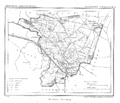 Berlicum, municipality in 1866
 -
 Berlicum, Saint Peter's church in 1933


References
edit- ^abc"Kerncijfers wijken en buurten 2021".Central Bureau of Statistics.Retrieved18 April2022.
two entries
- ^"Postcodetool for 5091AA".Actueel Hoogtebestand Nederland(in Dutch). Het Waterschapshuis.Retrieved18 April2022.
- ^"Bisdom: Petruskerk Berlicum mag dicht".Brabants Dagblad. March 19, 2012.