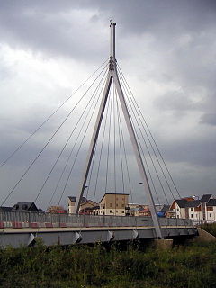
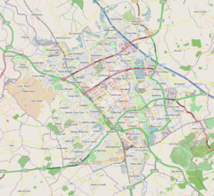
Broughton(/ˈbrɔːtən/,[2]BRAW-tən) is a historic village, modern district andcivil parishinMilton Keynes,Buckinghamshire,England, approximately 3 miles (4.8 km) east ofCentral Milton Keynes.It is governed byBroughton and Milton Keynes Joint Parish Council,shared with the neighbouringMilton Keynes parish.Broughton district was developed during the 2000s and 2010s largely to the south and east of the historic village.
| Broughton | |
|---|---|
 Bridge in Broughton | |
Location withinBuckinghamshire | |
| Population | 2,493 (2011 Census)[1] |
| OS grid reference | SP895399 |
| Civil parish |
|
| Unitary authority | |
| Ceremonial county | |
| Region | |
| Country | England |
| Sovereign state | United Kingdom |
| Post town | MILTON KEYNES |
| Postcode district | MK10 |
| Dialling code | 01908 |
| Police | Thames Valley |
| Fire | Buckinghamshire |
| Ambulance | South Central |
| UK Parliament | |
History and location
editThe name isOld Englishand meant 'brook farm'.[3]In theDomesday Book,it is listed as owned by a Walter Giffard and the tenant was a Hugh de Bolbec. In the 6th century, its name was speltBrotone.[4]
TheNorthamptonto Londonturnpikecame through the village and joinedWatling Street,now theA5 road,atHockcliffe.TheA50,London Road,the original route through the centre of the old village[5]was bypassed in the early 1970s. The new road, comprisingFen Streetand part ofNewport Roadwas numberedA5130,but is now declassified. The bypass was the former eastern boundary of the built up area.
Over a 14 month period in 1958–9, 200,000 tons of gravel were dug from a 14-acre (5.7 ha) field at Manor Farm, Broughton for the construction of theM1 motorway,by a Newport Pagnell business under contract toJohn Laing and Sons.The field was then made good for agriculture.[6]
TheMilton Keynes grid road,Child's Way (H6), forms the district's northern boundary, Chaffron Way (H7) the southern, Tongwell Street (V11) its western, and the M1 motorway its eastern (accessible from Junction 14, roughly 1 mile (1.6 km) to the north, via theA509).
The district can be split into at least three areas. The original Broughton village forms part of aconservation areaat the northern end, bounded by the brook and Newport Road.Atterburyis an area of new build housing, predominantly between the western side of the brook and Tongwell Street (V11). Broughton Gate and Brooklands, are part of the 'Milton Keynes Eastern Expansion area' east of the brook. A smallcable-stayed bridgeis one of two main road crossings across Broughton Brook, the third and newest is the extension of H7 Chaffron Way (as 'Countess Way') between Brooklands andKingston.
Education
editBroughton Fields Primary School[7]and Brooklands Farm Primary School[8]serve the area, whilst secondary education is provided byOakgrove Schoolin nearbyMiddletonand theWalton High Schoolcampus in Brooklands. Broughton Manor Preparatory School,[9]a privateprep school,is also situated near the old village.
Facilities
editThe facilities in the area include a 'Hungry Horse' chain public house, and a range of small shops, hair dressers and convenience stores.
Milton Keynes Coachwayand theKingston Shopping Centre– which includes one of the UK's largerTescostores, a variety of retail outlets, a branch library and a community centre – are nearby.
Broughton Pavilion is a community recreational and sports facility owned and managed by the parish council, which is based there. The building features aliving roof.[10][11]
The Broughton Brooklinear parkand Brooklands Meadow park provide green space for recreation.[12][13]The northern tip of Broughton is open space and a conservation area.
Civil parish
editBroughton civil parish formerly totalled 936 acres (379 ha) and included land east of what is now the M1 motorway. TheVictoria County Historyof Buckingham, cites aBoard of Agriculturefigure from 1905 stating 75 per cent of the parish was grassland.[4]
The current area of the parish is 279.99 hectares (691.9 acres).[14]
Broughton and Milton Keynes Parish Council is a jointparish councilcovering the parishes of Broughton andMilton Keynes (village).[15][16]Broughton includes the village of Broughton as well as the modern districts of Broughton Gate and Brooklands, which are part of the 'Eastern Expansion Area' and consequently have 'city streets' rather than grid roads.
Brooklandsis primarily a housing area: a building of note is the Brooklands Campus ofWalton High School,whose main campus is inWalnut Tree.
Pinehamis a small district enclosed by the M1, Portway (H5/A509) and Tongwell Street (V11). Most of its area is taken up byAnglian Water's sewage treatment plant and aBMXtrack.
The name 'Pineham' was used for an electoral ward forMilton Keynes Council electionsfrom 1976 (to 2002). It consisted of the parishes ofWoolstone-cum-Willen,Moulsoe,Broughton, Milton Keynes andWalton.[17]
St Lawrence's Church
editSt Lawrence's Church in Broughton is a 14th-century church with a 15th-century tower. A series of wall paintings covering large parts of the north and south walls, discovered during an 1849 restoration, is the chief interest of the church. The paintings include a 14th-centuryPietà,a Doom, St Helena and St Eligius, and St George slaying the Dragon.[4][18] Therectorsof St Lawrence are recorded from the end of 1261 to date, and many may beinterredwithin the grounds of St Lawrence.[19]
Canal development
editIts promoters hope that aproposed new waterwaybetween Milton Keynes andBedfordwill run along the line of Broughton Brook.[20]
References
edit- ^UK Census(2011)."Local Area Report – Broughton (E04012179)".Nomis.Office for National Statistics.Retrieved17 November2019.
- ^Hanks, Patrick;Flavia Hodges; A. D. Mills; Adrian Room (2002).The Oxford Names Companion.Oxford: Oxford University Press. pp. 961–962.
- ^"Broughton (Survey of English Place-Names)".English Place-name Society.Retrieved23 December2021.
- ^abcWilliam Page, ed. (1927)."Parishes: Broughton".A History of the County of Buckingham.Victoria History of the Counties of England.Vol. 4. London:Constable & Co. Ltd.pp. 303–308.
- ^"Bartholomew's Revised Half-Inch Map, Herts and Bucks - Great Britain, sheet 15 1940-47".maps.nls.uk.John Bartholomew & Son Ltd.Retrieved8 May2024.
- ^"Broughton's reclaimed acres bring favourable comment".Bedfordshire Times and Standard.2 October 1959. p. 10.Retrieved9 May2024– viaBritish Newspaper Archive.
- ^Broughton Fields Primary School
- ^Brooklands Farm Primary School
- ^Broughton Manor Preparatory School
- ^"Broughton Pavilion".www.broughtonandmkv-pc.gov.uk.Retrieved7 May2024.
- ^Broughton Pavilion
- ^"Broughton Brook".The Parks Trust.Retrieved10 May2024.
- ^"Brooklands Meadow Park".The Parks Trust.Retrieved10 May2024.
- ^"E04 Civil parish Broughton".Office for National Statistics, Geography linked data.Retrieved9 May2024.
- ^"About us: Parish Overview".Broughton and Milton Keynes Parish Council.Retrieved16 May2019.
- ^"Parish Map".www.broughtonandmkv-pc.gov.uk.Retrieved7 May2024.
- ^Report No. 124(PDF)(Report). Local Government Boundary Commission For England. 27 November 1975. p. 8.
- ^"St Lawrence's Church, Broughton, Buckinghamshire".visitchurches.org.uk.Retrieved23 December2021.
- ^"Rectors of St Lawrence Broughton since 1261".Milton Keynes Heritage Association.
- ^Bedford-MK Waterway
External links
edit- Website of the joint Broughton and Milton Keynes civil parish council
- VisitChurches.org entry for St Lawrences
- Media related toBroughton, Milton Keynesat Wikimedia Commons


