TheChambly Canalis aNational Historic Site of Canadain the Province ofQuebec,[1]running along theRichelieu RiverpastSaint-Jean-sur-Richelieu,Carignan,andChambly.Building commenced in 1831 and the canal opened in 1843.[2]It served as a major commercial route during a time of heightened trade between the United States and Canada. Trade dwindled after World War I, and as of the 1970s, traffic has been replaced by recreational vessels.
| Chambly Canal | |
|---|---|
 Chambly Canal and multipurpose path,Saint-Jean-sur-Richelieu | |
| Specifications | |
| Locks | 9 |
| Navigation authority | Parks Canada |
| History | |
| Construction began | September 5, 1831 |
| Date of first use | June 9, 1843 |
| Date completed | 1843 |
| Geography | |
| Start point | Chambly |
| End point | Saint-Jean-sur-Richelieu |
| Official name | Chambly Canal National Historic Site of Canada |
| Designated | 1929 |
It is part of a waterway that connects theSaint Lawrence Riverwith theHudson Riverin the United States.Lake Champlainand theChamplain Canalform the U.S. portion of theLakes to Locks Passage.
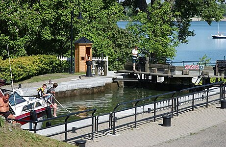
The Canal has 10 bridges—8 of which are hand operated—and nine hydrauliclocks.
- Draft: 6.5 ft (1.98 m)
- Clearance: 29 ft (8.84 m)
- Canal Length: 20 km (12 mi)[3]
- Dimensions of smallest lock: 110 ft × 21 ft (33.53 m × 6.40 m)
- Passage time: 3 to 5 hours
Gallery
edit-
 Locks in Chambly
 -
 Lock in Chambly, viewed in winter.
 -
 Lock in Saint-Jean-sur-Richelieu flooded during the2011 Lake Champlain and Richelieu River Floods


References
edit- ^Chambly Canal.Canadian Register of Historic Places.Retrieved 18 March 2012.
- ^"Chambly Canal National Historic Site | Route du Richelieu".Retrieved2020-09-14.
- ^Parks Canada Agency, Government of Canada (2020-09-09)."Chambly Canal National Historic Site".www.pc.gc.ca.Retrieved2020-09-14.
External links
editWikimedia Commons has media related toChambly Canal.