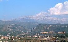
D59is a state road connecting the city ofKninwithD8state road nearPirovac.
| D59 state road | |
|---|---|
| Route information | |
| Length | 53.6 km (33.3 mi) |
| Major junctions | |
| From | |
| To | |
| Location | |
| Country | Croatia |
| Counties | Zadar,Šibenik-Knin |
| Major cities | Knin,Pirovac |
| Highway system | |

The road also serves as a connecting road to the A1 motorway as it is connected to Pirovac interchange via a short connector road.[1]The northern terminus of the road is located immediately to the west of Knin, and the road is normally considered to run to the city itself. Likewise, the southern terminus is immediately to the south ofPirovac.The intersection withD8 state road,where D59 terminates, also represents the northern terminus ofD121 state roadtoMurter.The road is 53.6 km (33.3 mi) long.[2]
The road, as well as all other state roads in Croatia, is managed and maintained byHrvatske ceste,a state-owned company.[3]
Traffic volume
editTraffic is regularly counted and reported byHrvatske ceste,operator of the road.[4]Substantial variations between annual (AADT) and summer (ASDT) traffic volumes are attributed to the fact that the road serves as a connection toA1 motorwayand it carries substantial tourist traffic.
| D59 traffic volume | ||||
| Road | Counting site | AADT | ASDT | Notes |
| D59 | 5006 Radučić east | 1,184 | 1,839 | Adjacent to Ž6054 junction. |
| D59 | 5302 Kistanje | 1,177 | 1,904 | Adjacent to Ž6074 junction. |
| D59 | 5319 Čista Mala south | 1,921 | 3,892 | Between Ž6071 andD27junctions. |
Road junctions and populated areas
editThis article contains a bulleted list or table of intersections whichshould be presented in a properly formatted junction table.(November 2021) |
| D59 junctions/populated areas | |
| Type | Slip roads/Notes |
| D1toKnin(to the east) and toGračac(to the west). | |
| L65008 to Oćestovo | |
| Radučić Ž6054 to Mokro Polje | |
| Ž6055 toOklaj | |
| L65005 to Ivoševci | |
| Kistanje | |
| Ž6074 toVarivode | |
| Đevrske Ž6070 to Dobropoljci | |
| Bribirske Mostine D56westwards to Žažvić andBenkovac D56eastwards to Piramatovci andSkradin D56 and D59 form two junctions, 300 m (980 ft) apart, and on this short section they areconcurrent. | |
| As of 2008[update],there is 3 km (1.9 mi) of gravel road between the southern intersection in Bribirske Mostine and the northern entrance to Krković Alternate routes via L65018/L65017 Žažvić/Međare/Cicvare or via Ž6073 Piramatovci | |
| Krković | |
| Lađevci | |
| A1in Pirovac interchange reached via a short connector road. | |
| Ž6071 to Čista Mala and Gaćelezi | |
| D27to Grabovci (to the east) and toStankovci(to the west). | |
| Putičanje | |
| Dazlina | |
| Dubrava kod Tisna | |
| D8toVodice(to the east) and toPirovac(to the west). D121toTisnoandMurter. | |
See also
editSources
edit- ^"Regulation on motorway markings, chainage, interchange/exit/rest area numbers and names".Narodne novine(in Croatian). April 24, 2003. Archived fromthe originalon October 4, 2011.RetrievedMay 18,2010.
- ^"Decision on categorization of public roads as state roads, county roads and local roads".Narodne novine(in Croatian). February 17, 2010.
- ^"Public Roads Act".Narodne novine(in Croatian). December 14, 2004.
- ^"Traffic counting on the roadways of Croatia in 2009 - digest"(PDF).Hrvatske ceste.May 1, 2010. Archived fromthe original(PDF)on July 21, 2011.
