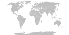
Size of this PNG preview of this SVG file:800 × 411 pixels.Other resolutions:320 × 164 pixels|640 × 329 pixels|1,024 × 526 pixels|1,280 × 657 pixels|2,560 × 1,314 pixels|863 × 443 pixels.
Original file(SVG file, nominally 863 × 443 pixels, file size: 1.6 MB)
File history
Click on a date/time to view the file as it appeared at that time.
| Date/Time | Thumbnail | Dimensions | User | Comment | |
|---|---|---|---|---|---|
| current | 20:49, 2 August 2024 |  | 863 × 443(1.6 MB) | Delusion23 | Bahrain green due to Passport Island |
| 11:15, 25 September 2023 |  | 863 × 443(1.55 MB) | Seabourn101 | Reverted to version as of 22:34, 31 May 2023 (UTC) | |
| 18:55, 12 September 2023 |  | 863 × 443(1.55 MB) | Taekhosong | Reverted to version as of 09:33, 1 August 2018 (UTC) | |
| 22:34, 31 May 2023 |  | 863 × 443(1.55 MB) | Przemub | Reverted to version as of 16:20, 5 April 2023 (UTC). Another land border there is the one with Akrotiri and Dhekelia, which is internationally recognised. | |
| 08:27, 7 April 2023 |  | 863 × 443(1.59 MB) | Discombobulates | Cyprus shouldn't have a land border, the TRNC is recognised only by one country, its occupier | |
| 16:20, 5 April 2023 |  | 863 × 443(1.55 MB) | Jeffhardyfan08 | wrong file | |
| 16:20, 5 April 2023 |  | 1,000 × 514(27 KB) | Jeffhardyfan08 | Added Greenland | |
| 06:38, 25 April 2022 |  | 863 × 443(1.55 MB) | Seabourn101 | Reverted to version as of 15:08, 1 September 2018 (UTC)- revert Unexplained reversion | |
| 04:26, 20 April 2022 |  | 863 × 443(1.55 MB) | Vodi.Dino.Eri | Reverted to version as of 20:31, 18 December 2015 (UTC) | |
| 15:08, 1 September 2018 |  | 863 × 443(1.55 MB) | Hành đáo thủy cùng xử | Reverted to version as of 16:05, 15 August 2018 (UTC) (as discussed) |
File usage
The following 5 pages use this file:
Global file usage
The following other wikis use this file:
- Usage on af.wikipedia.org
- Usage on ar.wikipedia.org
- Usage on az.wikipedia.org
- Usage on bn.wikipedia.org
- Usage on bs.wikipedia.org
- Usage on ca.wikipedia.org
- Usage on ckb.wikipedia.org
- Usage on da.wikipedia.org
- Usage on de.wikipedia.org
- Usage on eo.wikipedia.org
- Usage on et.wikipedia.org
- Usage on eu.wikipedia.org
- Usage on fa.wikipedia.org
- Usage on fa.wikibooks.org
- Usage on fi.wikipedia.org
- Usage on fr.wikipedia.org
- Usage on fr.wiktionary.org
- Usage on gag.wikipedia.org
- Usage on gl.wikipedia.org
- Usage on he.wikipedia.org
- Usage on hi.wikipedia.org
- Usage on hu.wikipedia.org
- Usage on ia.wikipedia.org
- Usage on id.wikipedia.org
- Usage on ig.wikipedia.org
- Usage on ilo.wikipedia.org
- Usage on incubator.wikimedia.org
- Usage on inh.wikipedia.org
- Usage on is.wiktionary.org
- Usage on it.wikipedia.org
- Usage on ja.wikipedia.org
- Usage on ko.wikipedia.org
- Usage on la.wikipedia.org
- Usage on lld.wikipedia.org
- Usage on lt.wikipedia.org
- Usage on lv.wikipedia.org
- Usage on min.wikipedia.org
Viewmore global usageof this file.

