Iquique(Spanish pronunciation:[iˈkike]) is a portcityandcommunein northernChile,capital of both theIquique ProvinceandTarapacá Region.It lies on thePacific coast,west of thePampa del Tamarugal,which is part of theAtacama Desert.It has a population of 191,468 according to the 2017 census.[2]It is also the main commune ofGreater Iquique.The city developed during the heyday of thesaltpetremining in the Atacama Desert in the 19th century. Once a Peruvian city with a large Chilean population, it was conquered by Chile in theWar of the Pacific(1879–1883). Today it is one of only twofree portsof Chile, the other one beingPunta Arenas,in the country's far south.
Iquique | |
|---|---|
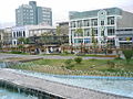
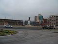
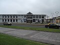
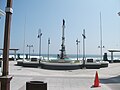
 Montage of images of Iquique. | |
 Flag  Coat of arms  Map of Iquique in Tarapacá Region  Iquique Location in Chile | |
| Coordinates:20°13′S70°9′W/ 20.217°S 70.150°W | |
| Country | |
| Region | |
| Province | Iquique |
| Founded | 16th Century |
| Government | |
| • Type | Municipal council |
| •Alcalde | Mauricio Soria Macchiavello |
| Area | |
| • Total | 2,242.1 km2(865.7 sq mi) |
| Elevation | 1 m (3 ft) |
| Population (2017 Census)[2] | |
| • Total | 191,468 |
| • Density | 85/km2(220/sq mi) |
| Time zone | UTC−4(CLT) |
| • Summer (DST) | UTC−3(CLST) |
| Postal code | 1100000 |
| Climate | BWh |
| Website | Official website(in Spanish) |

History
editAlthough the city was founded in the 16th century, there is evidence of habitation in the area by theChangopeople as early as 7,000 BC. During colonial times, Iquique was part of theViceroyalty of Peruas much of South America was at the time, and remained part ofPeruvianterritory until the end of the 19th century. Iquique's early development was due in large part to the discovery of mineral riches, particularly the presence of large deposits ofsodium nitratein theAtacama Desert(then part of Peruvian territory); and guano.[3]
In July 1835,Charles Darwin,during his voyage on theBeagle,traveled to Iquique and described it as a town "very much in want of everyday necessities, such as water and firewood". These necessities had to be brought in from considerable distances. Darwin also visited thesaltpetre works.
The city has been devastated by several earthquakes, including the1868 Arica earthquake,the1877 Iquique earthquake,and the2005 Tarapacá earthquake.The2014 Iquique earthquakeoccurred with amoment magnitudeof 8.2 on April 1, 2014.

Territorial disputesbetween Bolivia and Chile triggered theWar of the Pacificin 1879. TheBattle of Iquiquewas fought in the harbor of Iquique on May 21, 1879, now commemorated asNavy Day,an annualpublic holiday in Chile.The outcome of the war gave Chile this portion of the Peruvian territory.
Over the years there was substantial emigration from other parts of Chile to this area which was called theNorte Grande.In subsequent years the further exportation of Chilean saltpetre (mainly to European countries) significantly helped in the development of the city, attracting foreigners and rapidly expanding housing projects.
In December 1907, the city was marred by theSanta María de Iquique Massacrewhen theChilean Army,under the command of Gen.Roberto Silva Renard,opened fire on thousands of saltpetre miners, and their wives and children, who assembled inside the Santa María School. The workers had marched into town to protest their working conditions and wages. Somewhere between 500 and 2,000 people were killed. The folk groupQuilapayúnrecorded an album in remembrance of the event (Cantata Santa María de Iquique) in 1970. In December 2007 a series of cultural and ceremonial activities were planned, culminating in the week between December 14 to 21, to commemorate the centenary year of the massacre.
Mars 96 was launched by Russia in 1996, but failed to leave the Earth orbit, and re-entered the atmosphere a few hours later. The two RTGs onboard carried 200 g of plutonium in total and are assumed to have survived the re-entry as they were designed to do. They are thought to now lie somewhere in a northeast-southwest running oval 320 km (199 mi) long by 80 km (50 mi) wide, which is centred 32 km (20 mi) east of Iquique, Chile.[4]
Prior to becoming Chilean territory, Iquique was home to some of the greatest Peruvian heroes, namelyAlfonso Ugarte(who was elected mayor in 1876),Ramon Zavala,a rich saltpetre entrepreneur;Guillermo Billinghurst,later President of Peru (who after being overthrown in 1914 came to Iquique – then already under Chilean rule – to live out his last years), andRamon Castilla,three times president of Peru, who was born inSan Lorenzo de Tarapacáand died in the Desert of Tiviliche,Tarapacá,who lived in Iquique during his mandate as Governor of Tarapacá in 1825.
Governance
editAs a commune, Iquique is a third-leveladministrative division of Chileadministered by amunicipal council,headed by analcaldewho is directly elected every four years. The 2012–2016 alcalde is Jorge Soria.[1]
Within theelectoral divisions of Chile,Iquique is represented in theChamber of Deputiesby Marta Isasi (Ind.) and Hugo Gutiérrez (PC) as part of the 2nd electoral district, which includes the entireTarapacá Region.The commune is represented in theSenatebyJosé Miguel Insulza(PS, 2018–2026) and José Durana (UDI, 2018–2026) as part of the 1st senatorial constituency (Arica and Parinacota Regionand Tarapacá Region).

Economy
editIquique has one of the largest duty-free commercial port centers of South America, theZona Franca of Iquique(free zone of Iquique) which has been traditionally calledZofri.There are around 2.4 square kilometres (0.93 sq mi) of warehouses, banking branches, and restaurants.
Copper mining, mainly in Quebrada Blanca, Cerro Colorado, and Doña Inés de Collahuasí, is also an important industry in Iquique.
Demographics
edit
According to the 2002 census ofNational Statistics Institute(INE), the commune of Iquique had an area of 2,835.3 km2(1,095 sq mi)[2]and 216,419 inhabitants (108,897 men and 107,522 women). Of these, 214,586 (99.2%) lived in urban areas and 1,833 (0.9%) in rural areas. The township has an area of 2,262.4 km2(874 sq mi) and a population of 166,204 inhabitants. The population grew by 42.7% (64,742 persons) between the 1992 and 2002 censuses.[2]Iquique is home to 56% of the total population of the Tarapacá region. In 2008, the city had 226,204 inhabitants.
Iquique commune is divided into the following districts:[5]
| District | 2002 Population Census | Area (km2) |
|---|---|---|
| Port | 3,721 | 0.8 |
| Industrial District | 12,800 | 65.4 |
| Hospital | 11,087 | 5.1 |
| Caupolicán | 19,486 | 2.2 |
| Playa Brava | 18,580 | 2.1 |
| Cavancha | 13,729 | 1.4 |
| Parque Balmaceda | 10,843 | 1.1 |
| Arturo Prat | 10,773 | 1.0 |
| Punta Lobos | 1,592 | 2,127.8 |
| Gómez Carreño | 23,165 | 1.7 |
| La Tirana | 40,428 | 33.5 |

There is a significant percentage of ethnic group colony residents. The most numerous communities areCroatian,Italian,Greek,Chinese,Arabicnationalities,PeruviansandBolivians,British peoples (i.e.Scots), and the French.
In the 1910s and 1920s, about a thousandEast Indian(from India andPakistani)Chile saltpetremine workers hired by British mine companies appeared in Iquique and today, their descendants are mixed into the local population.[citation needed]Lately, a wave ofNorth Americanand Australian immigrants came to retire and enjoy the city's beach climate. Immigrants currently correspond to 9.2% of the total population.[6]
| Year | 1992 | 2002 |
|---|---|---|
| Population | 146,089 | 166,204 |
| Year | 1992 | 2002 |
|---|---|---|
| Population | 145,139 | 164,396 |
Climate
editIquique has an unusually mild to warmdesert climate(Köppen:BWh) with low extremes of temperatures all year round and almost no rainfall. Due to its abundant cloudiness and coastal location, the climate is often abbreviated toBWn,as opposed to the usualBWhorBWk.[7]It is common for this place to have completely dry years without any precipitation day, making it one of the driest cities in the world, along withArica.
| Climate data for Iquique (1991–2020, extremes 1981–present) | |||||||||||||
|---|---|---|---|---|---|---|---|---|---|---|---|---|---|
| Month | Jan | Feb | Mar | Apr | May | Jun | Jul | Aug | Sep | Oct | Nov | Dec | Year |
| Record high °C (°F) | 31.2 (88.2) |
30.6 (87.1) |
31.1 (88.0) |
30.4 (86.7) |
28.0 (82.4) |
24.1 (75.4) |
33.4 (92.1) |
31.0 (87.8) |
23.4 (74.1) |
24.2 (75.6) |
25.5 (77.9) |
27.8 (82.0) |
33.4 (92.1) |
| Mean daily maximum °C (°F) | 25.4 (77.7) |
25.9 (78.6) |
24.9 (76.8) |
22.7 (72.9) |
20.5 (68.9) |
18.7 (65.7) |
17.8 (64.0) |
17.8 (64.0) |
18.5 (65.3) |
19.8 (67.6) |
21.5 (70.7) |
23.5 (74.3) |
21.4 (70.5) |
| Daily mean °C (°F) | 22.0 (71.6) |
22.2 (72.0) |
21.3 (70.3) |
19.5 (67.1) |
17.8 (64.0) |
16.5 (61.7) |
15.6 (60.1) |
15.6 (60.1) |
16.1 (61.0) |
17.1 (62.8) |
18.6 (65.5) |
20.3 (68.5) |
18.6 (65.5) |
| Mean daily minimum °C (°F) | 18.9 (66.0) |
18.9 (66.0) |
18.1 (64.6) |
16.5 (61.7) |
15.3 (59.5) |
14.5 (58.1) |
13.9 (57.0) |
13.9 (57.0) |
14.4 (57.9) |
15.2 (59.4) |
16.2 (61.2) |
17.5 (63.5) |
16.1 (61.0) |
| Record low °C (°F) | 14.8 (58.6) |
14.7 (58.5) |
13.0 (55.4) |
11.7 (53.1) |
9.9 (49.8) |
8.5 (47.3) |
8.3 (46.9) |
7.6 (45.7) |
9.0 (48.2) |
8.5 (47.3) |
11.9 (53.4) |
12.4 (54.3) |
7.6 (45.7) |
| Averageprecipitationmm (inches) | 0.0 (0.0) |
0.0 (0.0) |
0.0 (0.0) |
0.1 (0.00) |
0.3 (0.01) |
0.0 (0.0) |
0.1 (0.00) |
0.2 (0.01) |
0.0 (0.0) |
0.0 (0.0) |
0.0 (0.0) |
0.1 (0.00) |
0.8 (0.03) |
| Average precipitation days(≥ 1.0 mm) | 0.0 | 0.0 | 0.0 | 0.0 | 0.0 | 0.0 | 0.1 | 0.1 | 0.0 | 0.0 | 0.0 | 0.0 | 0.2 |
| Averagerelative humidity(%) | 66 | 66 | 68 | 70 | 71 | 71 | 71 | 72 | 71 | 70 | 68 | 67 | 69 |
| Mean monthlysunshine hours | 317.8 | 296.2 | 297.9 | 252.5 | 211.4 | 161.0 | 151.2 | 158.2 | 189.7 | 235.6 | 275.7 | 315.1 | 2,862.3 |
| Source 1: Dirección Meteorológica de Chile[8][9][10][11] | |||||||||||||
| Source 2:NOAA(precipitation days 1991–2020)[12] | |||||||||||||
Transport
editIquique is served byDiego Aracena International Airport(Spanish: Aeropuerto Internacional Diego Aracena) (IATA: IQQ, ICAO: SCDA). The airport is on the Pacific coast 48 kilometers (30 mi) south of the city.
Sport
editIquique is home to football teamDeportes Iquique.It hosted the2016 FIRS Women's Roller Hockey World Cup.
Notable residents
edit- Juan Zanelli(1906–1944) racing driver, born in Iquique
- Arturo Godoy(1912–1986) professional boxer, born in Iquique
- Tomasa del Real(1986) Neoperreo/Reggaeton artist
Gallery
edit-
 Baquedano Boulevard
 -
 Downtown Iquique
 -
 Municipal Theater of Iquique
 -
 Iquique Municipal Theatre at night
 -
 Plaza Prat
 -
 Mall Zofri at Night
 -
 21-May Square
 -
 Trans-Atacama Tour Train
 -
 Arturo Prat University (Main campus from Chile)
 -
 Arturo Prat University's Architecture-Faculty campus.
 -
 Santo Tomas University Iquique campus.
 -
 Slava Square.
 -
 Iquique Skatepark.
 -
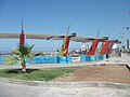
 Cavancha Beach's Craft Market.
 -
 Cavancha beach at the end of Cavancha peninsula
 -
 The underwater-themed mural situated in Cavancha Peninsula
 -
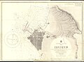 1934 nautical chart of Iquique


References
edit- ^ab"Municipality of Iquique"(in Spanish).RetrievedOctober 31,2010.
- ^abcdef"National Statistics Institute"(in Spanish).RetrievedSeptember 9,2010.
- ^[1]
- ^Mars 96 timeline,NASA
- ^abc"Territorial division of Chile"(PDF).Archived fromthe original(PDF)on March 8, 2013.RetrievedOctober 31,2010.
- ^http://latercera.com/contenido/680_194898_9.shtmlArchivedJuly 13, 2011, at theWayback Machine Iquique has almost 10% of its foreign population.
- ^Cereceda, P.; Larrain, H.; osses, P.; Farias, M.; Egaña, I. (2008). "The climate of the coast and fog zone in the Tarapacá Region, Atacama Desert, Chile".Atmospheric Research.87(3–4): 301–311.Bibcode:2008AtmRe..87..301C.doi:10.1016/j.atmosres.2007.11.011.hdl:10533/139314.
- ^"Datos Normales y Promedios Históricos Promedios de 30 años o menos"(in Spanish). Dirección Meteorológica de Chile.Archivedfrom the original on May 21, 2023.RetrievedMay 20,2023.
- ^ "Temperaturas Medias y Extremas en 30 Años-Entre los años: 1991 al 2020-Nombre estación: Diego Aracena Iquique Ap"(in Spanish). Dirección Meteorológica de Chile. Archived fromthe originalon May 21, 2023.RetrievedMay 21,2023.
- ^"Temperatura Histórica de la Estación Diego Aracena Iquique Ap. (200006)"(in Spanish). Dirección Meteorológica de Chile. Archived fromthe originalon May 21, 2023.RetrievedMay 20,2023.
- ^"Estadistica Climatologica Tomo I"(PDF)(in Spanish). Dirección General de Aeronáutica Civil. March 2001. Archived fromthe original(PDF)on June 30, 2017.RetrievedJanuary 4,2013.
- ^"Diego Aracena Aeropuerto Iquique Climate Normals 1991–2020".World Meteorological Organization Climatological Standard Normals (1991–2020).National Oceanic and Atmospheric Administration.Archived fromthe originalon August 4, 2023.RetrievedAugust 4,2023.
External links
edit Iquiquetravel guide from Wikivoyage
- Portal with useful information about Iquique.
- ..1914.