Neshkorois a village inMarquette County,Wisconsin,United States. The population was 434 at the2010 census.The village is located within theTown of Neshkoro.
Neshkoro, Wisconsin | |
|---|---|
 Looking south at downtown Neshkoro | |
 Location of Neshkoro in Marquette County, Wisconsin. | |
| Coordinates:43°57′10″N89°12′56″W/ 43.95278°N 89.21556°W | |
| Country | |
| State | |
| County | Marquette |
| Area | |
| • Total | 2.10 sq mi (5.43 km2) |
| • Land | 2.01 sq mi (5.20 km2) |
| • Water | 0.09 sq mi (0.23 km2) |
| Elevation | 810 ft (247 m) |
| Population | |
| • Total | 434 |
| • Estimate (2019)[4] | 429 |
| • Density | 213.65/sq mi (82.48/km2) |
| Time zone | UTC-6(Central (CST)) |
| • Summer (DST) | UTC-5(CDT) |
| Area code | 920 |
| FIPS code | 55-56150[5] |
| GNISfeature ID | 1570185[2] |
Geography
editNeshkoro is located at43°57′49″N89°13′0″W/ 43.96361°N 89.21667°W(43.963867, -89.216712).[6]
According to theUnited States Census Bureau,the village has a total area of 2.10 square miles (5.44 km2), of which, 2.01 square miles (5.21 km2) of it is land and 0.09 square miles (0.23 km2) is water.[7]
Demographics
edit| Census | Pop. | Note | %± |
|---|---|---|---|
| 1910 | 379 | — | |
| 1920 | 396 | 4.5% | |
| 1930 | 342 | −13.6% | |
| 1940 | 301 | −12.0% | |
| 1950 | 361 | 19.9% | |
| 1960 | 368 | 1.9% | |
| 1970 | 385 | 4.6% | |
| 1980 | 386 | 0.3% | |
| 1990 | 384 | −0.5% | |
| 2000 | 453 | 18.0% | |
| 2010 | 434 | −4.2% | |
| 2019 (est.) | 429 | [4] | −1.2% |
| U.S. Decennial Census[8] | |||
2010 census
edit
As of thecensus[3]of 2010, there were 434 people, 205 households, and 119 families living in the village. Thepopulation densitywas 215.9 inhabitants per square mile (83.4/km2). There were 230 housing units at an average density of 114.4 per square mile (44.2/km2). The racial makeup of the village was 97.7%White,0.7%Native American,0.7%Asian,and 0.9% from two or more races.HispanicorLatinoof any race were 4.6% of the population.
There were 205 households, of which 20.0% had children under the age of 18 living with them, 48.8% weremarried couplesliving together, 6.3% had a female householder with no husband present, 2.9% had a male householder with no wife present, and 42.0% were non-families. 36.6% of all households were made up of individuals, and 18.1% had someone living alone who was 65 years of age or older. The average household size was 2.12 and the average family size was 2.76.
The median age in the village was 49.2 years. 18.4% of residents were under the age of 18; 6.2% were between the ages of 18 and 24; 17.6% were from 25 to 44; 34.1% were from 45 to 64; and 23.7% were 65 years of age or older. The gender makeup of the village was 48.8% male and 51.2% female.
2000 census
editAs of thecensus[5]of 2000, there were 453 people, 185 households, and 130 families living in the village. Thepopulation densitywas 191.7 people per square mile (74.1/km2). There were 219 housing units at an average density of 92.7 per square mile (35.8/km2). The racial makeup of the village was 99.12%White,0.66%Asian,and 0.22% from two or more races. 0.66% of the population wereHispanicorLatinoof any race.
There were 185 households, out of which 25.9% had children under the age of 18 living with them, 58.4% weremarried couplesliving together, 7.0% had a female householder with no husband present, and 29.7% were non-families. 25.9% of all households were made up of individuals, and 14.1% had someone living alone who was 65 years of age or older. The average household size was 2.32 and the average family size was 2.78.
In the village, the population was spread out, with 21.2% under the age of 18, 5.7% from 18 to 24, 24.9% from 25 to 44, 23.6% from 45 to 64, and 24.5% who were 65 years of age or older. The median age was 44 years. For every 100 females, there were 98.7 males. For every 100 females age 18 and over, there were 96.2 males.
The median income for a household in the village was $39,167, and the median income for a family was $43,661. Males had a median income of $27,391 versus $19,583 for females. Theper capita incomefor the village was $17,206. About 5.8% of families and 5.5% of the population were below thepoverty line,including 14.0% of those under age 18 and 4.9% of those age 65 or over.
History
editNeshkoro was founded in 1848.[9]The village was named after two pioneer settlers, Nash and Kora.[10]
Images
edit-
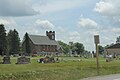 Church and cemetery in Neshkoro
 -
 Neshkoro Area Fire Protection District station


References
edit- ^"2019 U.S. Gazetteer Files".United States Census Bureau.Archivedfrom the original on October 9, 2020.RetrievedAugust 7,2020.
- ^ab"US Board on Geographic Names".United States Geological Survey.October 25, 2007.Archivedfrom the original on February 4, 2012.RetrievedJanuary 31,2008.
- ^ab"U.S. Census website".United States Census Bureau.Archivedfrom the original on December 27, 1996.RetrievedNovember 18,2012.
- ^ab"Population and Housing Unit Estimates".United States Census Bureau. May 24, 2020.Archivedfrom the original on April 20, 2021.RetrievedMay 27,2020.
- ^ab"U.S. Census website".United States Census Bureau.Archivedfrom the original on December 27, 1996.RetrievedJanuary 31,2008.
- ^"US Gazetteer files: 2010, 2000, and 1990".United States Census Bureau.February 12, 2011.Archivedfrom the original on August 24, 2019.RetrievedApril 23,2011.
- ^"US Gazetteer files 2010".United States Census Bureau.Archived fromthe originalon January 25, 2012.RetrievedNovember 18,2012.
- ^"Census of Population and Housing".Census.gov.Archivedfrom the original on July 1, 2021.RetrievedJune 4,2015.
- ^"Facts".Archived fromthe originalon October 7, 2010.
- ^Chicago and North Western Railway Company (1908).A History of the Origin of the Place Names Connected with the Chicago & North Western and Chicago, St. Paul, Minneapolis & Omaha Railways.p. 106.