Sillery(French pronunciation:[silʁi]), aformer independent cityfounded in 1637, is one of 35 administrative sectors (French:quartiers), which are unincorporated places, located in the post-expansion jurisdiction of the City ofQuebec,Quebec,Canada.[5][6][7]Sillery was one of multiple self-governing municipalitiesamalgamatedinto a vastly expandedQuebec City,that went into legal effect on January 1, 2002, as part of the province-wide2000–06 municipal reorganization in Quebec.Located alongside in what pre-merger was the southwestern border of Quebec City, Sillery is a constituent district (French:quartier) of theborough(French:arrondissement) ofSainte-Foy–Sillery–Cap-Rouge.The territorially expanded City of Quebec consists of six boroughs.
Sillery | |
|---|---|
District (French:quartier) | |
 | |
 Coat of arms | |
| Etymology:Noël Brûlart de Sillery | |
| Motto: Latin:Non multa sed multum(Not many things but much)
 Sillery, outlined | |
 Sillery Sillery within Québec City | |
| Coordinates:46°46′25″N71°15′40″W/ 46.77361110000004°N 71.26111109999994°W[1][2] | |
| Country | |
| Province | |
| City | |
| Founded | 1637 |
| District ofSainte-Foy–Sillery | 1 January 2002 |
| District ofSainte-Foy–Sillery–Cap-Rouge | 1 November 2009 |
| Founded by |
|
| Government | |
| • Body | Conseil de quartier |
| Area | |
• Total | 755 ha (1,866 acres) |
| Elevation | 72 m (236 ft) |
| Population (2016) | |
• Total | 13,570 |
| • Density | 1,800/km2(4,700/sq mi) |
| Demonym | Sillerois(e)[4] |
| Time zone | UTC−05:00(EST) |
| • Summer (DST) | UTC−04:00(EDT) |
| Postal Code FSA | |
| Area codes | 418, 581, 367 |
| Website | (in French) |
Four heritage sites are located within Quebec City, one of which is situated in Sillery.[7]The neighbourhood of Sillery contains theSillery Heritage Site,which was recognized as heritage district by the provincial government on 5 February 1964.[8]On 22 June 2006, thefederal government'sParks Canadaincluded Sillery's historic district on itsCanadian Register of Historic Places.[9]In 2013, Quebec City changed the name of the historic district toSillery Heritage Site(French:site patrimonial de Sillery), as part of its preparation for the provincial government's transfer of responsibility for the district's management to it.[8]
The City of Quebec has 27 neighbourhood councils (French:conseils de quartiers) spread across its territorial jurisdiction.[10]Sillery has city representation and citizen participation throughle conseil de quartier de Sillery.The council has public meetings, at Sillery's community centre, which on average are scheduled once a month. Sillery elects a total of 10 board members in staggered terms of office holding.[11]
History
editSillery was named forNoël Brûlart de Sillery(1577–1640),Knight of Malta.A wealthy and successful Frenchdiplomat,he renounced worldly goods and became aCatholicpriest.He provided the funds for the establishment in 1637–1638 of a settlement forFirst Nationsconverts to Catholicism.[7][12]
The community was established at a cove where theAlgonquingathered for summer to fish for eels. Originally named in honour of Saint Joseph and called Kamiskouaouangachit in theAlgonquin language,the settlement became the home of up to 40 Algonquin Christian families who lived there most of the year, excluding the hunting season. The formation of this settlement came as a result of longterm Algonquin interest in agriculture, conversions to Christianity, and pressure from the ongoingBeaver War.[13]The residents included Algonquins from as far away as the Ottawa river valley.[13]
MissionariestoNew France,such asJacques Gravier,studied with the indigenous residents of Sillery to learn their languages before going to more distant settlements. By the early 18th century, he had compiled a nearly 600–page dictionary ofKaskaskiaIllinois–French.By 1640, the Augustinian sisters established a convent in the community, which hosted non-permanent residents of the community, especially refugees of the Beaver War or seasonal visitors in winter.[13]Many of the community's natives fell victim toepidemicsof newinfectious diseases,to which they had no natural immunity. The settlement was largely depopulated by the late 1680s.[6]
Renamed Sillery in honour of its financier, the town later became important as a port for thelumberindustry. The city of Sillery's motto wasnon multa sed multum,theLatinproverb of "not many things, but much," a fit descriptor for the small enclave. From the land at the water's edge, includingAnse-au-Foulon,site of the disembarkation ofGeneral Wolfe's successful army in theBattle of the Plains of Abraham,the community spread up to the top of the heights overlooking theSaint Lawrence River.In 1760, during theFrench and Indian War,theBattle of Sainte-Foywas fought near Sillery, as part of a French attempt to re-capture Quebec City, which had been taken by the British the previous year.
Sillery housesBois-de-Coulonge Park,once the viceregal residence of Quebec. Avillaknown asSpencer Woodwas built in 1854 by the government of theProvince of Canada,and was purchased by the Quebec Government in 1870 to serve as the residence of Quebec's Lieutenant-Governors until 1966, when a major fire destroyed the main residence. Originally an estate (French:domaine) named in honour of the assassinatedUnited KingdomPrime MinisterSpencer Perceval,in 1815, by his nephew, Michael Henry Perceval, it was renamed Bois-de-Coulonge in 1950.[14][15]
Commanding the bluffs just west of the city of Québec, in modern times Sillery was known principally for its quiet tree-lined streets, historic churches such asSaint-Michel de Sillery Church,views of the river, and several very old schools run by a variety ofreligious institutes.[16]Its coat of arms consisted of a red shield with a white Maltese cross in the upper right hand corner and a three-masted ship in the lower left.
Profile
edit
On January 1, 2002, as part of a legislatedamalgamation of cities across Quebec,Sillery ceased to exist as an independentmunicipality.Its territory became a part of the Sainte-Foy—Sillery—Cap-Rouge Borough of Quebec. Of the former municipalities that now comprise Quebec, Sillery was relatively linguistically diverse. In 2006, 4.95% of its population had at least English for mother tongue, and 5.75% for languages other than French or English,[17]while for thecensus metropolitan areaof Quebec City, it was respectively 1.75% and 2.93%.[18]
Sillery is also known as one of the most affluent area of Quebec City, as residential properties sold on average forCA$570,000in 2017, and where live a number of professors of nearbyLaval University.[19]Nonetheless, there is still a pocket of modest and small apartment buildings.[20]
According to thestatistics agency of Quebec,in 2001 the average income of Sillery households wasCA$113,091,and 58% of them earned more thanCA$80,000per year (in both case the highest figure in theCapitale-Nationaleregion.)[21]In 2012, the personal average income wasCA$55,645,still the highest in the Quebec City region.[22]
2006 Census data
editThe city of Sillery was dissolved in 2002, butStatistics Canadastill provided information up to theCensus of 2006:[17]
- Population: 11,803 (-0.9% change since 2001)
- Number of private dwellings: 4,856
- Average household size: 2.3 persons
- Median household income (for 2005):CA$107,142
- Percentage of Canadian citizens: 94.15%
- Percentage ofvisible minority:5%
- Population over 15 years of age without a certificate, diploma or degree: 8.06%
- Area: 6.7 km²
- Density: 1,761.3 persons per km²
2016 Sociodemographic and economic profile
editIn January 2019, theCity of Québecpublished alongitudinalsociodemographic (French:sociodémographique) and economic profile of Sillery, utilizingStatistics Canada's census data for the years1996,2006,and2016.[5]
- Population: 13,570 (-3.3% change since 1996)
- Number of private dwellings: 5,625
- Average household size: 2.3 persons
- Median household income (for 2015):CA$149,206
- Percentage of Canadian citizens: 90.2%
- Population over 15 years of age without a certificate, diploma or degree: 6.1%
Gallery
edit-
 Thetimber tradeatSillery Covein 1900.
 -
 Lumberman on the banks of Sillery Cove,c. 1900
 -
 Panoramicview of Sillery
 -
 The eastern portion of Sillery, from an 1879 atlas
 -
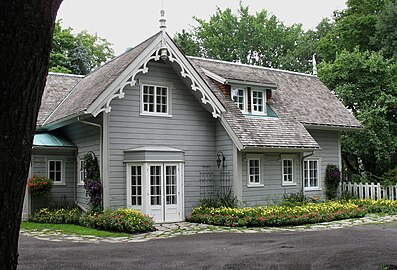 Villa Bagatelle,a 19th century cottage, functions as an art gallery and a museum
 -


See also
editExternal links
edit- Official website
 (in French)
  Geographic data related toSilleryatOpenStreetMap
- "Ville de Québec - Carte mobile"[Interactive Map of the Sillery District] (in Canadian French).Ville de Québec.
- Rainville, Candide (2012-02-27)."Limite du quartier de Sillery"[Boundary Map of the Sillery Sector](PDF).Conseil de quartier de Sillery(map provided as a citizen service by the Sillery Neighbourhood Council) (in Canadian French). Service de l'ingénierie, Division de l'arpentage et de la cartographie.Ville de Québec.
- "Conseil de quartier de Sillery Facebook Page"[Sillery Neighbourhood Council].Facebook.com.
References
edit- ^Sillery – ERKFD – Geographic Names.Retrieved2018-11-04.
{{cite book}}:|work=ignored (help) - ^"ERKFD, Sillery, Geographic Names, HTML format".geogratis.gc.ca(HTML). Toponymic Feature ID: 0fdc1466849c20c35a6e85f5c35a79c2. Natural Resources Canada. 2016-10-06 [2002 Decision Date, Quebec Commission de Toponymie].Retrieved2018-11-04.
Status: Official; Feature Type: Unincorporated place; Feature Generic: Administrative Sector; Location: Québec, Québec.
- ^"Sillery".GeoNames.org.Retrieved21 May2019.
- ^Gentilé: nom des habitants d'un lieu — Résultat de la recherche(in French).Archivedfrom the original on 2018-12-05.Retrieved2018-11-27.
{{cite book}}:|work=ignored (help) - ^abService de la planification de l'aménagement et de l'environnement – Ville de Québec (January 2019).Quartier Sillery: Portrait sociodémographique et économique[Sillery Quarter: Sociodemographic and economic profile](PDF)(in Canadian French).Retrieved27 May2019.
- ^abMiquelon, Dale; Parrott, Zach (2015-05-26)."Sillery".The Canadian Encyclopedia.ISBN978-0-77102-099-5.OCLC904169186.OL8533423W.Archivedfrom the original on 2018-11-04.Retrieved2018-11-04.
- ^abcSainte-Foy–Sillery–Cap-Rouge – Portrait – Géographie – À propos de la ville(in Canadian French). 2018.Archivedfrom the original on 2018-10-07.Retrieved2018-11-03.
{{cite book}}:|work=ignored (help) - ^ab"Site patrimonial de Sillery — Fiche de l'élément — Répertoire du patrimoine culturel du Québec".ministère de la Culture et des Communications(in Canadian French).Archivedfrom the original on 2015-09-24.Retrieved2018-11-03.
- ^Arrondissement historique de Sillery.Canadian Register of Historic Places.Retrieved 2018-11-03.
- ^"Tous les conseils de quartier".Ville.Quebec.qc.ca(in Canadian French).Archivedfrom the original on 2018-11-04.Retrieved2018-11-04.
- ^"Conseil de quartier de Sillery".Ville.Quebec.qc.ca(in Canadian French).Archivedfrom the original on 2018-11-04.Retrieved2018-11-04.
- ^Lapointe, Pierre Louis (2015-03-04).Sillery (Qué).ISBN978-0-77102-099-5.OCLC904169186.OL8533423W.Archivedfrom the original on 2018-10-03.Retrieved2018-11-04.
{{cite book}}:|work=ignored (help) - ^abcLozier, Jean-François (2018).Flesh reborn: the Saint Lawrence Valley mission settlements through the seventeenth century.McGill-Queen's University Press.ISBN978-0-7735-5345-3.OCLC1027048600.
- ^Michael Henry Perceval (vers 1779-1829) – Histoire(in Canadian French).Archivedfrom the original on 2018-11-03.Retrieved2018-11-04.
{{cite book}}:|work=ignored (help) - ^L'histoire du Parc du Bois-de-Coulonge un parc public – Parc historique – Parc du Bois-de-Coulonge – Parcs – Parcs et places publiques – Commission de la capitale nationale du Québec(in Canadian French).Archivedfrom the original on 2018-11-04.Retrieved2018-11-04.
{{cite book}}:|work=ignored (help) - ^St-Michel de Sillery Church – Our Churches.Archivedfrom the original on 2018-10-11.Retrieved2018-11-04.
{{cite book}}:|work=ignored (help) - ^ab"Sillery 2006 Community Profile".Statistics Canada.13 March 2007.Archivedfrom the original on 2018-11-18.Retrieved2018-11-16.
- ^"Census metropolitan area of Quebec 2006 Community Profile".Statistics Canada.13 March 2007.Retrieved2018-11-16.
- ^Talbot, Dominique (2016-02-27).""La crème de la crème à Québec" - La Presse+ ".La Presse+(in Canadian French).Archivedfrom the original on 2018-11-03.Retrieved2018-11-02.
- ^"Arrondissement de Sainte-Foy–Sillery–Cap-Rouge: Habitats, milieux de vie et participation sociale des aînés: constats et perspectives"(PDF)(in French). Institut sur le vieillissement et la participation sociale des aînés de l’Université Laval Institut sur le vieillissement et la participation sociale des aînés de l’Université Laval. 2014. p. 4.Archived(PDF)from the original on 2018-11-16.Retrieved2018-11-16.
- ^Québec, Institut de la Statistique du."Familles de recensement selon la tranche de revenu et le revenu moyen, région administrative de la Capitale-Nationale, 2000".www.stat.gouv.qc.ca(in French).Archivedfrom the original on 2018-11-03.Retrieved2018-11-02.
- ^"Profil territorial de Québec"(PDF)(in French). Centraide (United Way of Canada).Archived(PDF)from the original on 2018-11-17.Retrieved2018-11-16.