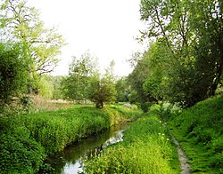
TheWoluwe(French:[wolywe];Dutch:[ˈʋoːlyu.ə]) is astreamthat goes through severalmunicipalitiesin the south-east and east ofBrussels,Belgium, and is a righttributaryof theSenneinVilvoorde.The Kleine (little) Maalbeek is a tributary of the Woluwe inKraainem.Manypondsformed along the stream over time, among which theMellaerts Pondsstill exist. The valley of the Woluwe crosses the municipalities ofAuderghem,Watermael-Boitsfort,Woluwe-Saint-Pierre,Woluwe-Saint-Lambert,Kraainem,Zaventem,MachelenandVilvoorde.
| Woluwe | |
|---|---|
 The Woluwe inWoluwe-Saint-Lambert | |
 | |
| Location | |
| Country | Belgium |
| Physical characteristics | |
| Mouth | Senne |
• coordinates | 50°53′N4°27′E/ 50.883°N 4.450°E |
| Length | 17.3 km (10.7 mi) |
| Basin features | |
| Progression | Senne→Dyle→Rupel→Scheldt→North Sea |
The towns of Woluwe-Saint-Pierre, Woluwe-Saint-Lambert andSint-Stevens-Woluwederive their name from it.
See also
editWikimedia Commons has media related toWoluwe.
References
editExternal links
editWikivoyage has a travel guide forWoluwe.