This article includes a list ofgeneral references,butit lacks sufficient correspondinginline citations.(March 2013) |
TheCamargue(/kæˈmɑːrɡ/,[3][4]alsoUK:/kəˈ-/,[5]US:/kɑːˈ-/,[6]French:[kamaʁɡ];Provençal:Camarga) is a coastal region in southern France located south of the city ofArles,between theMediterranean Seaand the two arms of theRhôneriver delta.The eastern arm is called the Grand Rhône; the western is thePetit Rhône.[7]
| Designations | |
|---|---|
| Official name | Camargue |
| Designated | 1 December 1986 |
| Reference no. | 346[1] |
| Official name | La Petite Camargue |
| Designated | 8 January 1996 |
| Reference no. | 786[2] |
Administratively, it lies within thedepartmentofBouches-du-Rhône(‘Mouths of the Rhône’); it spans portions of thecommunesof Arles,Saintes-Maries-de-la-MerandPort-Saint-Louis-du-Rhône.A further expanse of marshy plain, known as the "Petite Camargue" (Little Camargue), just to the west of the "Petit Rhône", lies within the department ofGard.
The Camargue was designated aRamsar siteas a "Wetlandof International Importance "on 1 December 1986. The Petite Camargue received this designation on 8 January 1996.
Geography
edit
With an area of over 930 km2(360 sq mi), the Camargue is one of western Europe's largest river deltas[citation needed].It is a vast plain comprising largebrinelagoonsorétangs,cut off from the sea by sandbars and encircled byreed-covered marshes. These are in turn surrounded by a large cultivated area.
Approximately a third of the Camargue is either lakes or marshland. The central area around the shoreline of theÉtang de Vaccarèshas been protected as aregional parksince 1927, in recognition of its great importance as a haven for wild birds. In 2008, it was incorporated into the largerParc naturel régional de Camargue.
-
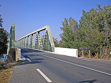 Former Sylvéréal bridge (2007) uponlepetit Rhône.
 -
 Shoreline of theÉtang de Vaccarès.


Flora and fauna
edit

The Camargue is home to more than 400 species of birds and has been identified as anImportant Bird Area(IBA) byBirdLife International.[8]Its brine ponds provide one of the few European habitats for thegreater flamingo.The marshes are also a prime habitat for many species of insects, notably (and notoriously) some of the most ferociousmosquitosto be found anywhere in France.Camargue horses(Camarguais) roam the extensive marshlands, along withCamargue cattle.
The native flora of the Camargue have adapted to the saline conditions.Sea lavenderandglasswortflourish, along withtamarisksand reeds.
Regional park
editOfficially established as a regional park and nature reserve in 1970, the Parc naturel régional de Camargue covers 820 km2(320 sq mi). This territory is some of the most natural and most protected in all of Europe. A roadside museum provides background on flora, fauna, as well as the history of the area.
Human influence
editHumans have lived in the Camargue for millennia, greatly affecting it with drainage schemes,dykes,ricepaddies andsalt pans.Much of the outer Camargue has been drained for agricultural purposes.
The Camargue has an eponymous horse breed, the whiteCamarguais.Camargue horses are ridden by thegardians(cowboys), who rear the region's cattle forfighting bullsfor regional use and for export to Spain, as well as sheep. Many of these animals are raised insemi-feralconditions, allowed to roam through the Camargue within amanade,or free-running herd. They are periodically rounded up for culling, medical treatment, or other events.


Few towns of any size have developed in the Camargue. Arles has been called its "capital", located at the extreme north of the delta where the Rhône forks into its two principal branches. The only other towns of note are along the seafront or near it:Saintes-Maries-de-la-Mer,which has also been dubbed its "capital", about 45 km (28 mi) to the southwest. The medieval fortress-town ofAigues-Mortesis located on the far western edge, in the Petite Camargue. Saintes-Maries-de-la-Mer is the destination of the annualRomanipilgrimage for the veneration ofSaint Sarah.
The Camargue was exploited in the Middle Ages byCistercianandBenedictinemonks. In the 16th–17th centuries, big estates, known locally asmas,were founded by rich landlords fromArles.At the end of the 18th century, they had the Rhône diked to protect the town and their properties from flooding. In 1858, the building of thedigue à la mer(dyke to the sea) achieved temporary protection of the delta from erosion, but it is a changing landform, always affected by waters and weather.
The north of the Camargue is agricultural land. The main crops are cereals, grapes and rice. Near the seashore, prehistoric man started extracting salt, a practice that continues today. Salt was a source of wealth for the Cistercian "salt abbeys" ofUlmet,FranquevauxandPsalmodyin the Middle Ages. Industrial salt collection started in the 19th century, and big chemical companies such asPéchineyand Solvay founded the "mining" city ofSalin-de-Giraud.
The boundaries of the Camargue are constantly altered by the Rhône as it transports huge quantities of mud downstream – as much as 20 million m3annually. Some of theétangsare the remnants of old arms and legs of the river. The general trend is for the coastline to move outwards as new earth is deposited in the delta at the river's mouth.Aigues-Mortes,originally built as a port on the coast, is now some 5 km (3.1 mi) inland. The pace of change has been modified in recent years by man-made barriers, such asdamson the Rhône and sea dykes, but flooding remains a problem across the region.
See also
editReferences
edit- ^"Camargue".RamsarSites Information Service.Retrieved25 April2018.
- ^"La Petite Camargue".RamsarSites Information Service.Retrieved25 April2018.
- ^"Camargue".Collins English Dictionary.HarperCollins.Retrieved7 May2019.
- ^"Camargue, the".Longman Dictionary of Contemporary English.Longman.Retrieved8 September2019.
- ^"Camargue".LexicoUK English Dictionary.Oxford University Press.Archived fromthe originalon 22 March 2020.
- ^"Camargue".Merriam-Webster Dictionary.Merriam-Webster.Retrieved7 May2019.
- ^Chisholm, Hugh,ed. (1911)..Encyclopædia Britannica(11th ed.). Cambridge University Press.
- ^"Camargue".Important Bird Areas factsheet.BirdLife International. 2013. Archived fromthe originalon 30 June 2007.Retrieved31 August2013.
Further reading
edit- Russell, Richard Joel (1942)."Geomorphology of the Rhone Delta".Annals of the Association of American Geographers.32(2): 149–255.doi:10.2307/2561087.JSTOR2561087.Retrieved9 October2011.–also in jstor (paywall)
External links
edit- Gardian Nationor the "Camargue Nation"