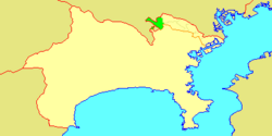
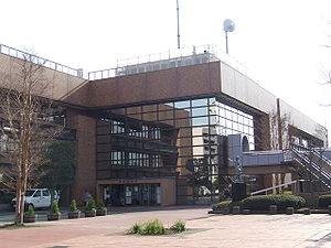
Asao-ku(Ma sinh khu)is one of the 7wardsof the city ofKawasakiinKanagawa Prefecture,Japan.As of 2010, the ward had an estimatedpopulationof 167,792 and adensityof 7,210 persons per km². The total area was 23.28 km².
Asao
Ma sinh khu | |
|---|---|
| Asao Ward | |
 Location of Asao inKanagawa | |
| Coordinates:35°36′14″N139°30′21″E/ 35.60389°N 139.50583°E | |
| Country | Japan |
| Region | Kantō |
| Prefecture | Kanagawa |
| Area | |
• Total | 23.28 km2(8.99 sq mi) |
| Population (March 2010) | |
• Total | 167,792 |
| • Density | 7,210/km2(18,700/sq mi) |
| Time zone | UTC+09:00(JST) |
| City hall address | 1-5-1 Manpukuji, Asao-ku Kawasaki-shi, Kanagawa-ken 215-8570 |
| Website | www |

Geography
editAsao Ward is located in eastern Kanagawa Prefecture, in the far western corner of the city of Kawasaki, bordering on Tokyo. It is bordered to the north by theTama River.In March 1913, a fossil tooth from a Parastegodon (similar to theStegodongenus) was found in what is nowYurigaoka2-19 in the upper sedimentary layers of mudstone. It is thought to have been from the latePlioceneperiod. Most of what is now the city of Kawasaki was under water during this period, so the fossil indicates that the Asao area was above water and perhaps marked the shoreline.[1]
Surrounding municipalities
editHistory
editRice was grown in the area as early as theYayoi period.The name “Asao” appears inHeian periodrecords, and as the name implies, the area was noted for its production ofhemp.UnderRitsuryōsystem, it was part ofMusashi Province.By theEdo periodIt was administered astenryōterritory controlled directly by theTokugawa shogunate,but administered through varioushatamoto,and was noted for its production ofcharcoal.After theMeiji Restoration,the area was divided between Tachibana District and Tsuzuki District in the newKanagawa Prefectureon April 1, 1889. These areas were annexed by the neighboring city of Kawasaki from 1938-1939.
The area became part of a huge government sponsored housing project from the 1950s and 1960s, resulting in the Yurigaoka Danchi and other suburban developments. The area became part of Tama Ward with the division of the city of Kawasaki into wards from April 1972. In July 1982, Asao Ward was separated from Tama Ward. A new Ward Office was completed in 1997.
Economy
editAsao Ward is largely a regional commercial center andbedroom communityfor central Kawasaki and Tokyo. Traditionally (through the Meiji period, the area was known for its production ofJapanese persimmons.
Company headquarters
editTransportation
editRailroads
edit- Keiō Corporation–Keiō Sagamihara Line
- Odakyu Electric Railway–Odakyū Odawara Line
- Odakyu Electric Railway–Odakyū Tama Line
Highways
editPrefecture roads
edit- Kanagawa Prefectural Road 3
- Kanagawa Prefectural Road 12
- Kanagawa Prefectural Road 19
- Kanagawa Prefectural Road 124
- Kanagawa Prefectural Road 137
Education
edit- Den-en Chofu University
- Showa Academia Musicae
- Tokyo City University– Department of Nuclear Engineering
The Kawasaki City Board of Education ( xuyên kỳ thị dục ủy ban ) operates municipal elementary and junior high schools.
Municipal junior high schools:[3]
- Asao (Ma sinh trung học giáo)
- Haruhino (はるひ dã trung học giáo)
- Kakio ( thị sinh trung học giáo )
- Kanahodo (Kim trình trung học giáo)
- Nagasawa (Trường trạch trung học giáo)
- Nishiikuta (Tây sinh điền trung học giáo)
- Ozenji Chuo (Vương thiền trong chùa nhờ làm trung gian trường học)
- Shiratori ( bạch điểu trung học giáo )
Former junior high schools:[3]
- Hakusan (Bạch trong núi trường học) - Closed March 31, 2008 (Heisei20)
- Ozenji (Vương thiền trong chùa trường học) - Closed March 31, 2008 (Heisei 20)
Municipal elementary schools:[4]
- Asao (Ma sinh tiểu học giáo)
- Chiyogaoka (Ngàn đại ヶ khâu tiểu học giáo)
- Haruhino (はるひ dã tiểu học giáo)
- Higashi Kakio ( đông thị sinh tiểu học giáo )
- Kakio ( thị sinh tiểu học giáo )
- Kanahodo ( kim trình tiểu học giáo )
- Katahira (Phiến bình tiểu học giáo)
- Kurigidai (Lật mộc đài tiểu học giáo)
- Minami Yurigaoka (Nam bách hợp khâu tiểu học giáo)
- Nagasawa ( trường trạch tiểu học giáo )
- Nijigaoka (Hồng ヶ khâu tiểu học giáo)
- Nishiikuta (Tây sinh điền tiểu học giáo)
- Okagami ( cương học tiểu học giáo )
- Ozenji Chuo (Vương thiền trong chùa ương tiểu học giáo)
- Shinpukuji ( thật phúc chùa tiểu học giáo )
- Yurigaoka (Bách hợp khâu tiểu học giáo)
Former elementary schools:[4]
- Hakusan (Bạch sơn tiểu học giáo) - Closed March 31, 2009 (Heisei 21)
- Ozenji ( vương thiền chùa tiểu học giáo ) - Closed March 31, 2009 (Heisei 21)
Noted people from Asao Ward
edit- Takefusa Kubo,football player
- Ayumi Shibata,singer
- Chinami Tokunaga,singer
References
edit- ^"パラステゴドン tượng xỉ hoá thạch".Archived fromthe originalon 2009-03-25.Retrieved2010-05-01.
- ^"Company Summary."Sigma Corporation.Retrieved on September 28, 2015
- ^ab"Ma sinh khu の trung học giáo một lãm".Kawasaki Combined Education Center.Retrieved2022-12-27.
- ^ab"Ma sinh khu の tiểu học giáo một lãm".Kawasaki Combined Education Center.Retrieved2022-12-27.


