Mountbatten(also known asMountbatten Estate)[1]is a neighbourhood located in the planning area ofMarine Parade,Singapore.
Mountbatten | |
|---|---|
Subzone ofMarine ParadePlanning Area | |
| Name transcription(s) | |
| •Chinese | Mông ba đăng |
| •Pinyin | Méngbādēng |
| •Malay | Mountbatten |
| •Tamil | மவுண்ட்பேட்டன் |
 | |
| Coordinates:1°18′51″N103°49′44″E/ 1.3142°N 103.8288°E | |
| Country | Singapore |
History
editThe neighbourhood is named afterLord Louis Mountbatten,the Supreme Allied Commander of theSouth East Asia Command,Governor General of Indiaand British Military Administrator ofMalayafrom 1945 to 1946.
Layout
editMountbatten Road is a major thoroughfare that stretches all the way from the junction withNicoll Highway,Guillemard Road and Sims Way (where Kallang Airport Way branches out from Sims Way) inKallangto Haig Road inKatongwhere it continues eastward as East Coast Road.[2][3]
Points of interest
edit- Chung Cheng High School (Main)
- Goodman Arts Centre (formerLASALLE College of the Arts)[4]
- Katong Community Centre (formally Mountbatten CC)[5]
- Katong Shopping Centre
- Katong Swimming Complex
- Sing Hoe Hotel (formerly Sin Hoe)[2]
- Singapore Sindhi Association[6]
Transportation
editMountbatten is served byMountbatten MRT stationandDakota MRT stationon theCircle MRT line.Both stations are situated under Old Airport Road.
Gallery
edit-
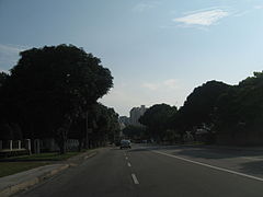 A view of Mountbatten Road in Singapore
 -
 A view of Mountbatten Road in Singapore
 -
 A view of Mountbatten Road in Singapore
 -
 A view of Mountbatten Road in Singapore
 -
 A view of Mountbatten Road in Singapore
 -
 The junction of Mountbatten Road, Nicoll Highway, Sims Way and Guillemard Road.


References
edit- ^"Mountbatten Estate | Infopedia".eresources.nlb.gov.sg.Retrieved26 March2021.
- ^abSingapore, Remember (6 September 2016)."The Old World Charm of Mountbatten".Remember Singapore.Retrieved26 March2021.
- ^Singapore Guide and Street Directory.University of Michigan.1972.
- ^"Goodman Arts Centre (former Laselle College of the Arts)".roots.gov.sg.Retrieved26 March2021.
- ^"onePA - Katong CC".onePA.Retrieved26 March2021.
- ^"Singapore Sindhi Association".Roots.gov.sg.
ThisSingaporelocation article is astub.You can help Wikipedia byexpanding it. |