TheRiver Wye(/waj/;Welsh:Afon Gwy[ɡʊɨ̯]) is thefourth-longest riverin the UK, stretching some 250 kilometres (155 miles) from its source onPlynlimoninmid Walesto theSevern Estuary.[1]The lower reaches of the river forms part ofthe border between England and Wales.TheWye Valley(lower part) is designated anArea of Outstanding Natural Beauty.[2][3]The Wye is important for nature conservation and recreation, but is affected by pollution.[4][5]
| River Wye | |
|---|---|
 The Wye at Hay-on-Wye | |
 | |
| Native name | Afon Gwy(Welsh) |
| Location | |
| Country | Wales,England |
| Physical characteristics | |
| Source | |
| • location | Plynlimon |
| • coordinates | 52°28′5.170″N3°45′56.282″W/ 52.46810278°N 3.76563389°W |
| • elevation | 690 m (2,260 ft) |
| Mouth | |
• location | Chepstow, Severn Estuary |
• coordinates | 51°36′36.086″N2°39′42.423″W/ 51.61002389°N 2.66178417°W |
• elevation | 0 m (0 ft) |
| Length | 250 km (155 mi) |
| Basin size | 4,136 km2(1,597 sq mi) |
| Basin features | |
| Tributaries | |
| • left | Marteg,Ithon,Lugg |
| • right | Elan,Irfon,Monnow,Trothy |

Etymology
editThe meaning of the river's name is not clear. Possibly the earliest reference to the name isGuoyin Nennius' early 9th CenturyHistoria Brittonumand the modernWelshname isGwy.The Wye was much later given a Latin name,Vaga,an adjective meaning 'wandering'.[6][7][8]TheTithe mapreferences a Vagas Field in both Whitchurch andChepstow.[9]Philologists such asEdward LyeandJoseph Bosworthin the 18th and early 19th centuries[10]suggested an Old English derivation fromwæġ,'wave'.
Description
editThesourceof the Wye is in the Welsh mountains atPlynlimon.It flows through or past several towns and villages, includingRhayader,Builth Wells,Hay-on-Wye,Hereford(the only city on the River Wye),Ross-on-Wye,Symonds Yat,MonmouthandTintern,meeting theSevernestuaryjust belowChepstow.The lower 16 miles (26 km) of the river fromRedbrookto Chepstow form the border between England and Wales.
Conservation
edit| Site of Special Scientific Interest | |
| Grid reference | ST544912toSO230429 |
|---|---|
| Interest | Biological/Geological |
| Area |
|
| Notification | 1978 |
| Natural England website | |
The River Wye is protected by twoSites of Special Scientific Interest,one covering the Upper Wye (Gwy Uchaf) above Hay-on-Wye,[11]and one covering the Lower Wye (Gwy Isaf) downstream to Chepstow.[12]The criteria for inclusion of the river as an SSSI include geology, topography, flora, mammals, invertebrates, fish and birdlife, as the river and its tributaries constitute a large linear ecosystem. The Lower Wye SSSI is itself divided into seven units of assessment set byNatural England,and administrative responsibilities are shared between the councils ofPowys,Herefordshire, Gloucestershire, and Monmouthshire.[12]The Wye abuts a range of other SSSIs in England and Wales, including theUpper Wye GorgeandLower Wye Gorge.
It is also aSpecial Area of Conservation[13][14]and one of the most important rivers in the UK for nature conservation. It is an important migration route and wildlife corridor, as well as a key breeding area for many nationally and internationally important species. The river supports a range of species and habitats covered byEuropean Directivesand those listed under Schedule 5 of theWildlife and Countryside Act 1981.[12]In Powys the river lies within the RadnorshireEnvironmentally Sensitive Area.Much ofthe lower valleyis anArea of Outstanding Natural Beauty.
Salmon
editThe Lower Wye has been designated as asalmonidfishery under the ECFreshwater Fish Directive.[12]
The Wye was particularly famous for its large "spring" salmon that had spent three or more years at sea before returning to spawn. They used to enter the river between January and June and sometimes reached weights of over 50 pounds (23 kg), the largest recorded being 59 lb 8 oz (27.0 kg) landed after a long fight by Miss Doreen Davey from the Cowpond Pool at Winforton on 13 March 1923. The last recorded 50 lb (23 kg) rod-caught salmon from the Wye was taken in 1963 by Donald Parrish and weighed 51 lb 8 oz (23.4 kg). Since the early 2000s the spring catch has been steadily recovering and salmon of over 35 lb (16 kg) have been reported every year since 2011.
Pollution
editPollution has severely affected the river; the Wye does not meet European and national standards on river health.[4][5]This has been happening for some time; a Nutrient Management Board (NMB) was established in 2014 to address the issues.[15]Pollution from chicken and dairy farms has become so bad the Wye has been used as an example of river pollution in the UK onCountryfileand in several national newspapers.[4][16][5][17]
The Wye is dying at astonishing, heartbreaking speed. When I canoed it 10 years ago, the stones were clean. Now they are so slimy that you can scarcely stand up. In hot weather, the entire river stinks of chicken sh**, from the 10 million birds being reared in the catchment..
This pollution causes algal blooms several times a year with increasing frequency and length, depleting the oxygen in the water causing fish such asbrown trout,chubandbarbelas well asaquatic invertebratesandplantsto suffocate to death.[16]Fish and aquatic invertebrates are the main food source forotters,kingfishers,herons,eelsand other protected species.
If this goes on, we will lose everything that we treasure about the Wye. It will turn a horrible, ugly green every time it gets sunny. The fish will go, and they will be followed by our kingfishers, ourdippersand our herons.
— Simon Evans, Wye and Usk Foundation[16]
Along with many other rivers the Wye is being heavily polluted by manure from the 10 million free range chickens for eggs and meat inintensive poultry units(IPUs) inPowysand Herefordshire, contaminating the Wye'stributaries.[16][17][19]As of April 2020, there were over 110 registered IPUs in Powys, each with over 40,000 birds (smaller IPUs need not be registered).[20]
In addition, runoff fromdairy farms,farm slurryandsilage liquorare entering the Wye. A study by theWelsh Governmentfound that only 1% of farm slurry stores in Wales met regulations and that farms were purposely spreading slurry on fields before high rainfall, leading to increased run off into waterways.[21]An investigation byGreenpeacefound thatEnvironment Agencystaff cuts from austerity had reduced pollution inspections by up to one third.[5]An internal report by the Environment Agency showed that the use of a “voluntary approach” by government was leading to increased levels of river pollution across the UK.[22]Powys County Councilapproved the construction of 20 new free-range chicken sheds in 2019 and as of February 2022 continues to license new chicken farms. In addition to problems with the riverine environment, this is causing air quality issues.[4][16][20]Pollution from the chicken factory farms is estimated to have killed 90% to 97% of the river’s watercrowfootbeds, and 3,000 tonnes (3,300 tons) morephosphatethan plants can absorb is released in the River Wye's catchment every year.[23]
In February 2022, it was declared at a meeting of the River Wye Nutrient Management Board[15]that
The River Wye will be in irreversibly worse condition within two years unless swift action is taken
— Simon Evans, Wye and Usk Foundation[24]
In March 2023, aHigh Courtclaim was brought against theEnvironment Agencyby environmental charity River Action for failing to take action to protect the Wye from environmental pollution, after aLancaster Universitystudy found that 60-70% of phosphates in the river come from agriculture.[25]
History
edit
The Romans constructed a bridge of wood and stone just upstream of present-day Chepstow, some remains of which were found in the river bed during an archaeological dig in 1911.[26]The River Wye is tidal from its junction with the River Severn for about 15 miles (24 km) to Bigsweir,[27]where a band of hard rock forms a natural weir across the river.[28]The tidal range on this lower section is huge, with water levels rising by up to 50 feet (15 m) on some spring tides, but despite the risks of navigating such a river, it has been used since Roman times to transport coal from the Forest of Dean, cider from Hereford, together with Italian wine, iron, stone and timber.[27]
When compared to many of the long rivers in Britain, the Wye is quite steep, with a rise of 1.93 feet per mile (0.365 m per km) between its junction with the River Severn and Monmouth, and a rise of 2.4 feet per mile (0.455 m per km) between there and Hereford. In the summer months, the river level at Hereford is 152 feet (46 m) aboveordnance datum(AOD), and Hereford is about 70 miles (110 km) from the river mouth. For navigation to occur, some form of management of river levels was required. Early records are fragmentary, but it appears that the river was used to transport iron from the Forest of Dean forEdward the Confessor's ships in the 11th century, and in 1171 and 1172, iron was supplied toHenry IIfor his invasion of Ireland. From the 13th century, the records are clearer, and iron from forges at Bicknor, Lydbrook, Monmouth and Carey Mills was transported by river. During the reign ofEdward I,a common right of navigation on the Wye was recorded, with the channel to be kept free of weirs and other obstructions. Where these already existed, they were to be demolished at the owner's expense.[29]Documents from 1561 and 1571 concerning water mills and weirs show that the river was used for navigation at the time.[30]
| Rivers Wye and Lugg Navigation Act 1662 | |
|---|---|
| Act of Parliament | |
 | |
| Long title | An Act for making navigable the Rivers of Wye and Lugg, and the Rivers and Brooks running into the same, in the Counties of Hereford, Gloucester, and Monmouth. |
| Citation | 14 Cha. 2.c.15 |
| Dates | |
| Royal assent | 19 May 1662 |
| Other legislation | |
| Repealed by | Gloucester Harbour Revision (Constitution) Order 2002 |
Status: Repealed | |
In 1622, a petition was raised by the counties of Gloucestershire, Herefordshire and Monmouthshire, together with the city of Hereford, that the river should be cleared of obstructions that made fishing and navigation difficult. A commission of sewers was appointed, but seems to have done very little, since most of the weirs belonged to the king. There were seven weirs on the river in 1641, to provide water power for mills and forges. DuringCromwell'sCommonwealth period, proposals were made to improve the river for navigation by buildingflash locksat the weirs, and dredging the channel to make it deeper. Although there were arguments for and against the proposals, SirWilliam Sandyswas appointed in 1662 to oversee making the Wye and the River Lugg navigable. He had previously worked on theWarwickshire Avonto make that navigable. Some £1,300 had already been raised in the country, but it is unclear what he did with the money.[31]He was assisted by Henry and Windsor Sandys, and they were given powers to construct a towing path, 4 feet (1.2 m) wide on both sides of the river, to allow boats to be hauled upstream. Although tolls could be charged, they also had to maintain the right of free passage which was long established on the river. Twenty Commissioners were appointed, ten from Hereford, five from Gloucester and five from Hereford. All weirs were to include an opening, so that salmon and other fish could migrate along the river.[32]
The scheme involved the construction of flash locks in channels cut to bypass the weirs, a system which Sandys had used with success on the Avon, but the Wye was a much faster flowing river, which meant that the solution was impracticable and very costly. It had been abandoned by 1668, as maintenance costs made the operation of boats unprofitable, and a new scheme, proposed by Lord Coningsby of Hampton Court, Herefordshire was to be implemented.[33]All fishing weirs and mill weirs would be bought and demolished, while Sandys locks would be abandoned. The river bed would also be deepened where necessary. The cost of buying the weirs would be raised by a tax on the county, and it was estimated that the river would be navigable for about 200 days per year. At the time there were weirs supplying six fulling mills and three corn mills at Hereford, and another nine elsewhere, at Fownhope, Hancox, Carey, Foy and Wilton. There were another nine derelict weirs above Monmouth, and five below the town.[34]
| Rivers Wye and Lugg Navigation Act 1695 | |
|---|---|
| Act of Parliament | |
 | |
| Long title | An Act for making navigable the Rivers of Wye and Lugg in the County of Hereford. |
| Citation | 7 & 8 Will. 3.c. 14 |
| Dates | |
| Royal assent | 7 March 1696 |
| Other legislation | |
| Repealed by | Gloucester Harbour Revision (Constitution) Order 2002 |
Status: Repealed | |
| Rivers Wye and Lugg Navigation Act 1726 | |
|---|---|
| Act of Parliament | |
 | |
| Long title | An Act for explaining and amending an Act passed in the Seventh and Eighth Years of the Reign of His late Majesty King William the Third, intituled, "An Act for making navigable the Rivers Wye and Lug, in the County of Hereford;" and for making the same more effectual. |
| Citation | 13 Geo. 1.c. 34 |
| Dates | |
| Royal assent | 15 May 1727 |
| Other legislation | |
| Repealed by | Gloucester Harbour Revision (Constitution) Order 2002 |
Status: Repealed | |
| Wye and Lugg Navigation and Horse Towing-path Act 1809 | |
|---|---|
| Act of Parliament | |
 | |
| Long title | An Act for amending several Acts for making navigable the Rivers Wye and Lugg, in the County of Hereford, and for making a Horse Towing Path on certain Parts of the Banks of the said River Wye. |
| Citation | 49 Geo. 3.c. lxxviii |
| Dates | |
| Royal assent | 20 May 1809 |
| Other legislation | |
| Repealed by | |
Status: Repealed | |
| Text of statute as originally enacted | |
Lord Coningsby's proposals were enshrined in anact of Parliament,theRivers Wye and Lugg Navigation Act 1695(7 & 8 Will. 3.c. 14), which authorised the County of Hereford to buy up and demolish the mills on the Wye and Lugg. All locks and weirs were to be removed, except that at New WeirforgebelowGoodrich,which survived until about 1815. By 1727, around £18,000 had been raised to carry out the work, and thirteen weirs in Herefordshire had been bought and removed. Some work had also been carried out on the Lugg, but much of it was damaged by flooding soon afterwards. One unexpected consequence of removing the weirs was that water levels dropped, resulting in there being a number of shoals that boats now had to negotiate.[35]Another act of Parliament was obtained, theRivers Wye and Lugg Navigation Act 1726(13 Geo. 1.c. 34), which appointed new trustees, and allowed them to authorise the construction of mills and weirs at locations which would assist navigation.[36]In 1763, James Taylor proposed the construction of 22 weirs, each with an associated pound lock, to make the river fully navigable, but the scheme was not implemented.[37]When it looked likely that theHerefordshire and Gloucestershire Canalwould not reach Hereford, there were calls to further improve the Wye. At the time, boats were hauled by gangs of ten or eleven men, but men were in short supply, and atowing pathfor horses was suggested.William Jessopcarried out a survey, and the towing path was authorised by theWye and Lugg Navigation and Horse Towing-path Act 1809(49 Geo. 3.c. lxxviii). A company was formed to build 37 miles (60 km) of path from Lydbrook to Hereford, and to maintain ferries at five points where the path crossed from one side of the river to the other.[38]
Evidence given inParliamentduring the passage of the bill stated that some 10,000 tons of coal were moved along the river to Hereford each year, with 3,000 tons of other commodities. Another 4,000 tons of lime and other goods were delivered to various points along the river. Progress on the project was rapid, and local newspapers announced the arrival of two barges in Hereford on 23 January 1811, each towed by two horses. Carriage of coal to Hereford became easier following the opening of theSevern and Wye Tramroadin 1813, which brought coal to the river bank at Bishop's Wood.[39]A steam tug was trialled on the river in 1825, but although it proved to be successful, it was sold due to the difficulty of finding suitable barges for it to tow. Passenger services became a feature of the river from 1835, with boats running between Ross, Monmouth and Chepstow, later extended to include Goodrich and Tintern.[40] The river was also navigable above Hereford, as far asHay-on-Wye,although only when there was sufficient water, and a system of ropes and pulleys were used to allow boats to negotiate the rapids at Monnington.[41]
Money was spent several times improving theRiver LuggfromLeominsterto its confluence with the Wye atMordiford,but its navigation is likely to have been difficult. The Herefordshire and Gloucestershire Canal reached Hereford in 1845, providing an alternative way to supply the town with coal, and trade tailed off with the opening of theNewport, Abergavenny and Hereford Railwayin 1854, and theHereford, Ross and Gloucester Railwayin the following year. After theWye Valley Railwayopened in 1876, the river ceased to be navigable above Brockweir, and as the river silted up, Tintern became the normal upper limit for navigation.[42]The river is still used by pleasure craft.
The river was unusual in that it was a Free Navigation from its source to Hay-on-Wye, a distance of 82 miles (132 km).[43]It ceased to be free after the modifications by Sandys in the 17th century, but this right was re-established by the 1695 act, which stated:
Therefore be it enacted that the rivers Wye and Lugg may be henceforth accounted, deemed and taken to be free and common rivers for all to make use of for carrying and conveying of all passenger goods, wares and commodities by boats, barges, lighters and other vessels whatsoever.[44]
| Wye Navigation Order 2002 | |
|---|---|
| Statutory Instrument | |
 | |
| Citation | SI 2002/1998 |
| Dates | |
| Made | 25 July 2002 |
| Commencement | 15 August 2002 |
| Other legislation | |
| Made under | Transport and Works Act 1992 |
| Text of the Wye Navigation Order 2002as in force today (including any amendments) within the United Kingdom, fromlegislation.gov.uk. | |
TheNational Rivers Authoritybrought a case before the High Court in 1995, to enable them to impose bylaws on the river. Shortly afterwards, they were replaced by theEnvironment Agency,and in 2002, theWye Navigation Order 2002(SI 2002/1998) was enacted. This confirmed the right of navigation on both the Wye and the Lugg, but established the Environment Agency as the navigation authority for the rivers. It also banned the construction of locks and weirs, so neither river is likely to be navigable by motor boats under normal circumstances.[27]Despite this, in 1989, Frank Barton and Pat Hucket successfully navigated a 124-foot (38 m) 230-ton barge up the river to Hereford.[45]Travelling time on the river was 20 hours, but this was spread over six months, as they had to wait for just the right water levels. The vessel was renamedWye Invaderduring the journey.[46]In March 2019, Barton returned to the river, navigating a narrowboat calledWye Invader Twofrom Sharpness to Monmouth Rowing Club and back again. The trip was possible because there was about 7 feet (2.1 m) of flood water in the river, enabling the boat to pass over the weirs and obstructions.[47]
Navigation and sport
edit
TheEnvironment Agencyis thenavigation authorityfor the river. The normal tidal limit (NTL) of the river isBigsweirand navigation below this point is under the control of theGloucester Harbour Trusteesas Competent Harbour Authority. There is a public right of navigation up toHay-on-Wye,[48]andcanoesare generally permitted on the next 5.5 miles (8.9 km) up toGlasbury,so long as they do not disturb anglers.[49]

The River Wye provides forcanoeingandkayakingas it has sections suitable for all ranges of skills and free access all the way downstream from Hay toHerefordandMonmouth,and the tidal Wye to Chepstow and theSevern Estuary.[50]There are a wide range of canoe hire and supervised trips, as well as campsites at key points on the river.Symonds Yathas a particularly popular series ofrapidsthat was purchased by theBritish Canoe Unionin 2003 to preserve the rapids for recreational use, canoe trips through the rapids stop next at Monmouth.[51]There are threerowingclubs on the river at Hereford, Ross-on-Wye andMonmouth.Annualregattasare held atRoss-on-Wyeand Monmouth for rowers and scullers of all abilities, next to the local rowing club. In 2017 more than 600 people took to the River Wye in inflatables ranging from dinghies to paddling pools during the event WYE FLOAT, opened by former Olympic ski jumperEddie the Eagle.[52]
Walkerscan take theWye Valley Walkwhich follows the route of the River Wye from Coed Hafren, near Plynlimon, to Chepstow along a series of well-maintainedway-markedpaths. A viewpoint near The Biblins on the Wye is known as 'Three Counties View', the meeting place of the counties ofHerefordshire,Gloucestershire andMonmouthshire.
Tributaries
editThe Wye'stributariesinclude theriver Lugg,Elan,Dulas,Irfon,Marteg,Monnow,Trothy,Ithon,Llynfi,Letton Lake,Tarennig (the Wye's first tributary) and Bidno. A fuller list is available at the relevant section of thelist of rivers of Wales
2020 floods
editIn February 2020, Wales and parts of England endured extremely heavy rainfall fromStorm Dennis,following shortly afterStorm Ciara.The central part of South Wales was particularly affected. The river over-topped its banks and causedfloodingin several areas, includingHay-on-Wye,Hereford,Ross-on-WyeandMonmouth.Much of Hereford was flooded, with homes inundated. Churches and leisure centres were opened to accommodate evacuated residents. The river at Monmouth reached its highest level ever recorded.[53][54]
2021 floods
editIn January 2021, the Wye catchment suffered flooding as a result ofStorm Christoph.[55]
Cultural references
editTheRomanticpoetWilliam Wordsworthincludes anapostropheto the Wye in his famous poem "Lines Written a Few Miles Above Tintern Abbey",published in 1798 inLyrical Ballads:
How oft, in spirit, have I turned to thee,
O sylvan Wye! thou wanderer thro' the woods,
How often has my spirit turned to thee!
Nelsontravelled down the Wye in 1802, along withLady Hamiltonand her husband,Sir William Hamilton.[56]They sailed fromRoss-on-Wyeto Monmouth, to be greeted by acannonadeand the band of theMonmouthshire MilitiaplayingSee, the Conquering Hero Comes.[56]Nelson expressed surprise that he was known at "such a little gut of a river as the Wye".[56]
Views of the river
edit-
 Ross-on-Wye,Herefordshire
 -

-
 Water transport atSymonds Yat
 -

-
 Landscape with View on the River Wye byThomas Jones
 -
 Eagle's Nest,Wyndcliff
 -
 A steam-hauled stone train crossing the River Wye after departing fromTintern railway stationin 1963


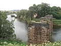
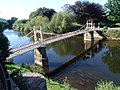
Bridges on the river
edit-
 The old railway bridge at Redbrook
 -
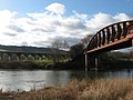 Monmouth Viaductand Duke of Beaufort Bridge atMonmouth
 -
-
 Chepstow Castleand bridge
 -
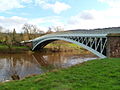
 Brockweir Bridge
 -

-
-
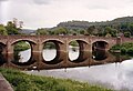
 Wilton Bridge,Ross on Wye
 -
 Chepstow Bridge at very high tide
 -
 Backney Bridge, nearBackney Halt,demolished under theBeeching Axe.
 -
 Victoria Bridge, Hereford
 -
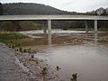
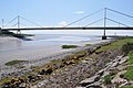 River Wye estuary andM48Wye road bridge


See also
editReferences
edit- ^"SSSI Citation River Wye (upper Wye)"(PDF).Natural Resources Wales.Retrieved14 November2020.
- ^"Natural England information on AONBs and map".Natural England.Retrieved5 October2012.
- ^"Natural England information on Wye Valley AONB".Natural England.Archived fromthe originalon 30 August 2014.Retrieved5 October2012.
- ^abcdMonbiot, George (12 August 2020)."The government is looking the other way while Britain's rivers die before our eyes | George Monbiot".The Guardian.ISSN0261-3077.Retrieved15 August2020.
- ^abcd"River Wye pollution linked to free-range poultry farming".Countryfile.Retrieved15 August2020.
- ^Richard Lovell Edgeworth; Maria Edgeworth (1816).Readings on Poetry.R. Hunter. pp.3.
- ^Izaak Walton (1833).The Complete Angler; Or, Contemplative Man's Recreation; Being a Discourse on Rivers, Ponds, Fish and Fishing. With Lives and Notes.Peter Pauper Press. p. 249.
- ^J. Thompson (12 March 2015).John Thelwall: Selected Poetry and Poetics.Springer. p. 338.ISBN978-1-137-34483-0.
- ^The Tithe map (1844)
- ^Joseph Bosworth(1838).A Dictionary of the Anglo-saxon Language.
- ^"Countryside Council for Wales Landscape & wildlife statement for River Wye (Upper Wye) / Afon Gwy (Gwy Uchaf)".Countryside Council for Wales.Archived fromthe originalon 12 November 2013.Retrieved18 August2012.
- ^abcd"Natural England SSSI information on River Wye (Lower Wye) or Afon Gwy (Gwy Isaf) SDdGA – citation, maps and unit details".Natural England.Retrieved18 August2012.
- ^"Information on River Wye Special Area of Conservation designation".Department for Environment, Food and Rural Affairs.Retrieved20 September2012.
- ^"Joint Nature Conservation Committee Listing of Special Areas of Conservation".Department for Environment, Food and Rural Affairs.Retrieved20 September2012.
- ^ab"Guidance- Nutrient Management Plan: River Wye".gov.uk.8 October 2014.Retrieved10 February2022.
- ^abcdeMcKie, Robin (20 June 2020)."'It's like pea soup': poultry farms turn Wye into wildlife death trap ".The Observer.ISSN0029-7712.Retrieved15 August2020.
- ^abUngoed-Thomas, Jon."Free-range egg farms choking life out of the Wye".The Times.ISSN0140-0460.Retrieved15 August2020.
- ^"RIVERCIDE live documentary [LIVE VERSION] with George Monbiot, Charlotte Church, B Zephaniah".youtube.14 July 2021.Retrieved10 February2022.
- ^Ecotipus (22 September 2019)."Open Letter: Intensive Poultry Units Pose Serious Public Health Risk".Ecotipus.Retrieved15 August2020.
- ^abColley, Claire (7 April 2020)."Life in the 'poultry capital' of Wales: enough is enough, say overwhelmed residents".The Guardian.ISSN0261-3077.Retrieved15 August2020.
- ^"Welsh slurry contractors say regulation is required on spreading".Fly Fishing & Fly Tying.Retrieved15 August2020.
- ^"Axe falls on dairy sector".Fly Fishing & Fly Tying.Retrieved15 August2020.
- ^"Factory farming is turning this beautiful British river into an open sewer | George Monbiot".The Guardian.10 June 2022.Retrieved12 June2022.
- ^Gavin McEwan (8 February 2022)."Race against time to stop River Wye being 'a sewer..."Retrieved10 February2022– via pressreader.
- ^Jones, Branwen (15 March 2023)."High Court review to look at River Wye pollution".WalesOnline.Retrieved19 March2023.
- ^Waters 1977.
- ^abcCumberlidge 2009,p. 340.
- ^Cohen 1956,p. 83.
- ^Cohen 1956,p. 86.
- ^Cohen 1956,pp. 86–87.
- ^Hadfield 1967,pp. 184–185.
- ^Cohen 1956,p. 87.
- ^Cohen 1956,pp. 88–89.
- ^Cohen 1956,p. 89.
- ^Hadfield 1967,pp. 185–186.
- ^Cohen 1956,p. 94.
- ^Cohen 1956,p. 95.
- ^Hadfield 1967,p. 187.
- ^Hadfield 1967,p. 188.
- ^Hadfield 1967,pp. 188–189.
- ^Hadfield 1967,p. 189.
- ^Hadfield 1967,pp. 189–190.
- ^Cumberlidge 2009,p. 339.
- ^Cohen 1956,p. 90.
- ^Wright 1990,pp. 78–79.
- ^Barton 2019.
- ^Barton 2019a.
- ^"Wye canoe?"(PDF).Environment Agency.
Upstream of Hay Bridge, the river can provide some good canoeing water but there is no established public right of navigation.
- ^"Canoeing in the Area".Hay-on-Wye Tourist Information Bureau.Archivedfrom the original on 24 January 2021.Retrieved30 November2013.
- ^"Boating along the River Wye".Waterscape. Archived fromthe originalon 17 April 2012.Retrieved10 April2012.
- ^"River rapids sold to canoeists".BBC News.15 March 2003.Retrieved22 May2010.
- ^Phillips, Jessica (14 August 2017)."Photos: 2017 Wye Float".Hereford Times.
- ^"Storm Dennis: Herefordshire flooding updates".Hereford Times.18 February 2020.
- ^"Storm Dennis: Flood warnings as River Wye reaches record high".BBC News.18 February 2020.
- ^"POTD: A comical corgi bloodbath and a miracle gas blast escape...floodwater in Hereford..."telegraph.co.uk.22 January 2021.Retrieved10 February2022.
- ^abcKissack 1975,p. 251.
Sources
edit- Barton, Frank (2019)."Wye Invader - The Impossible Journey?".Archivedfrom the original on 18 January 2021.
- Barton, Frank (2019a)."Log of Wye Invader to Monmouth"(PDF).Archived(PDF)from the original on 2 July 2021.
- Cohen, I (1956).The Non-Tidal Wye and its Navigation.Woolhope Naturalists Field Club.
{{cite book}}:|work=ignored (help) - Cumberlidge, Jane (2009).Inland Waterways of Great Britain (8th Ed.).Imray Laurie Norie and Wilson.ISBN978-1-84623-010-3.
- Hadfield, Charles (1967).The Canals of South Wales and the Border.David and Charles.ISBN978-0-7153-4027-1.
- Kissack, Keith(1975).Monmouth: The Making of a County Town.Chichester: Phillimore.ISBN978-0-85033-209-4.OCLC255539468.
- Paget-Tomlinson, Edward (2006).The Illustrated History of Canal and River Navigations.Landmark Publishing.ISBN978-1-84306-207-3.
- Waters, Ivor (1977).Chepstow Road Bridges.Moss Rose Press.ISBN978-0-906134-09-2.
- Wright, Ian (January 1990)."Barging up the Wye".Waterways World.Waterways World.ISSN0309-1422.Archivedfrom the original on 7 August 2020.
Further reading
edit- Cohen, I. "The non-tidal Wye and its navigation",Trans. Woolhope Nat. Fld. Club,34 (1955), pp. 83–101.
- Stockinger, V. (1996)The Rivers Wye and Lugg Navigation: A Documentary History 1555–1951,Logaston Press,ISBN978-18-738-27895
- King, P. "The River Teme and Other Midlands River Navigations",Journal of Railway and Canal Historical Society,35, 50 (July 2006), pp. 350–1.
- Chisholm, Hugh,ed. (1911)..Encyclopædia Britannica(11th ed.). Cambridge University Press.
External links
edit- Natural England(SSSI information)
- The Wye and Usk Foundationconservation charity
- Canoeists' guide to the River Wye
- River Wye Preservation Trust