Sturt Highwayis an Australiannational highwayinNew South Wales,Victoria, andSouth Australia.It is an importantroad linkfor the transport of passengers andfreightbetweenSydneyandAdelaideand the regions along the route.[8]
Sturt Highway –New South Wales | |
|---|---|
 | |
| B-double truckon Sturt Highway | |
 | |
| Coordinates | |
| General information | |
| Type | Highway |
| Length | 947 km (588 mi)[1] |
| Gazetted | August 1928(NSW, as Main Road 58)[2] August 1933(NSW, as State Highway 14)[3] July 1938(SA)[4] 1939(VIC)[5] |
| Route number(s) | |
| Former route number |
|
| Major junctions | |
| West end | Gawler, South Australia |
| East end | Tarcutta, New South Wales |
| Location(s) | |
| Region | Barossa Light and Lower North,Murray and Mallee,[6]Loddon Mallee,[7]Far West,Riverina,South Western Slopes |
| Major settlements | Nuriootpa,Renmark,Mildura,Balranald,Hay,Narrandera,Wagga Wagga |
| Highway system | |
Initially an amalgam oftrunk routes,the Sturt Highway was proclaimed a state highway in NSW in 1933. In 1955, the route was allocated a National Route number (20). It was included in the National Highway system in 1992, forming the Sydney-Adelaide Link. Sturt Highway is allocated as route A20 for its entire length, the majority of which is asingle carriageway,and freeway standard and 6-lane arterial road standard towards its western terminus in Gawler.[9]
Route
editThe highway is the shortest, highest-standard route between Sydney and Adelaide. It runs generally east–west, roughly aligned to the southern bank of theMurrumbidgee Riverin New South Wales. Following that river'sconfluencewith theMurray River,it is then roughly aligned to the Murray through north-western Victoria and eastern South Australia, before it heads towards the northern outskirts of Adelaide.[9]
The eastern terminus of Sturt Highway is at ajunctionwith Hume Highway atTarcutta,nearGundagai.Heading west, the highway passes through the city ofWagga Waggaand the towns ofNarrandera,Darlington Point,Hay,Balranald,andEuston,leaving New South Wales by crossing the Murray River into Victoria fromBurongatoMildura.The highway continues more or less due west through the northwest of Victoria before entering South Australia. In South Australia, Sturt Highway passesRenmark,Monash,Barmera,Waikerie,BlanchetownandNuriootpa,before reaching its western terminus at the interchange withGawler BypassandNorthern Expresswayon the outskirts ofGawler.
History
editThe route now known as Sturt Highway originated from stock routes cut across southern New South Wales through the 19th century: overlanders would travel from Sydney's Main South Road (nowHume Highway) toAlbury,and follow along the southern bank of theMurray RivertoAdelaide.Edward John Eyre,the English explorer, travelled from Limestone Plains (nowCanberra) to Adelaide via this route in 1837, as didCharles Sturtin 1838. Eyre on his second run to South Australia headed west, following the northern bank of theMurrumbidgee Riverinstead, crossing it at its junction with the Murray close toBoundary Bend,and travelled to Adelaide from there.[5]The road pioneered by Eyre in 1839 left Hume Highway atGundagaiand followed the northern bank of the Murrumbidgee through the sites of Wagga Wagga, Narrandera, Hay and Balranald, and the north bank of the Murray River through the sites of Euston andWentworth,passing north ofLake Victoriato the border with South Australia and onwards to Renmark. By 1852 a mail service by horseback operated from Wagga Wagga as far west as Balranald.[5]
The route used by coaches between Wagga Wagga and the South Australian border as late as 1914 ran along the northern bank of the Murrumbidgee to Darlington Point – a bridge was built across the river in 1905, replacing a punt service operating from 1886 – and then continued along the river's southern bank to Hay, crossing the river again (a bridge in Hay was opened in 1874 by SirHenry Parkes,replacing a ferry service operating since the 1850s).[5]The route then travelled the northern side of the Murrumbidgee throughMaudeand Balranald and onwards to Adelaide. By 1919 the route from Hay had been altered to travel the river's southern bank to Maude, before departing the water course for a more-direct route to Balranald, crossing the river there by a bridge opened in 1876.[5]By 1928, the route had shifted south of the Murrumbidgee River between Tarcutta and Narrandera.
The passing of theMain Roads Act of 1924[10]through theParliament of New South Walesprovided for the declaration of Main Roads, roads partially funded by the State government through theMain Roads Board(laterTransport for NSW). Main Road No. 4 was declared along this road from the intersection withHume Highwayfrom Lower Tarcutta to Wagga Wagga (and continuing eastwards via Tumut, Adaminaby, Cooma, and Bega to Tathra) as part ofMonaro Highway,[2]Main Road No. 6 was declared from Balranald via Euston and Wentworth to the state border with South Australia (and continuing eastwards via Oxley, Booligal, Gunbar, Rankins Springs, Wyalong and Cowra to Bathurst) as part ofMid-Western Highway,[2]and Main Road No. 58 was declared from Hay via Narranderra to Wagga Wagga (and continuing westwards via Maude to Oxley),[2]on the same day, 8 August 1928. With the passing of theMain Roads (Amendment) Act of 1929[11]to provide for additional declarations of State Highways and Trunk Roads, these were amended to State Highways 4 and 6 and Trunk Road 58 on 8 April 1929.
Mid-Western Highway was rerouted between Gunbar and Balranald to pass through Hay, and the western end of Trunk Road 58 was truncated to meet it at Hay, on 24 September 1929.[12]The route of the main road from Narrandera to Darlington Point had shifted to the southern side of the river at this stage, thus following the present route east from Balranald. On 16 September 1930, the road between Wagga Wagga and Hay (Trunk Road 58) was namedSturt Trunk Road,[13]in honour of CaptainCharles Sturtwho explored the area a century earlier and opened it up for agriculture.
TheDepartment of Main Roads,which had succeeded the MRB in the previous year, declaredSturt Highwayas State Highway 14 on 8 August 1933, from the intersection withHume Highwayat Lower Tarcutta via Wagga Wagga, Hay, Balranald, Euston and Wentworth to the state border with South Australia, subsuming the existing portions of Monaro Highway (State Highway 4) between Wagga Wagga and Lower Tarcutta, Sturt Trunk Road (Trunk Road 58) from Wagga Wagga to Hay, and Mid-Western Highway (State Highway 6) from Hay to the state border with South Australia.[14][15]eventually to Adelaide via Renmark;[3]the western end of Monaro Highway (todaySnowy Mountains Highway) was truncated to meet Hume Highway in Tarcutta, and the western end of Mid-Western Highway was truncated to meet Sturt Highway in Hay, as a result.[14]On 1 July 1938, the South Australian government decreed "the road from Gawler through Blanchetown to the border beyond Renmark will be known as the Sturt Highway", to join with the same road in New South Wales.[4]
In 1939,[5]Sturt Highway was rerouted to run viaMildura,using the former alignment ofMurray Valley Highway,to make it the most direct route to Adelaide. Murray Valley Highway had been constructed in 1927 to provide a shorter, all-weather road connection between Mildura and Renmark,[16][17]and was declared a State Highway by theCountry Roads Boardof Victoria in September 1932.[18]
Sturt Highway was signed National Route 20 across its entire length in 1955. TheWhitlam governmentintroduced the federalNational Roads Act 1974,[19]where roads declared as a National Highway were still the responsibility of the states for road construction and maintenance, but were fully compensated by the Federal government for money spent on approved projects.[19]: S7 As an important interstate link between the capitals of New South Wales and South Australia, Sturt Highway was declared aNational Highwayin 1992. With all three states' conversion to their newer Alpha numeric systems between the late 1990s to the early 2010s, its former route number was updated to A20 for the highway within Victoria (in 1997), South Australia (in 1998), and eventually the New South Wales section (in 2013).[20]
The passing of theRoads Act of 1993[21]through theParliament of New South Walesupdated road classifications and the way they could be declared within New South Wales. Under this act, Sturt Highway today retains its declaration as Highway 14, from the intersection with Hume Highway north of Tarcutta to the bridge over the Murray River at Mildura.[22]
The passing of theRoad Management Act 2004[23]through theParliament of Victoriagranted the responsibility of overall management and development of Victoria's major arterial roads toVicRoads:in 2004, VicRoads re-declaredSturt Highway(Arterial #6610) from the border withSouth AustraliaatMurray-Sunsetto the border withNew South WalesinMildura.[24]
Upgrades
editThis sectionneeds additional citations forverification.(January 2014) |
South Australia
editNone of the Sturt Highway was originally constructed asdual-carriageway.Work began in January 2007 to upgrade the highway to a four-lane, dual-carriageway road betweenGawler BypassandGreenockin the Barossa Valley. The project was completed in 2010 with budget savings directed towards further Sturt Highway improvements.[25]
Northern Expresswaywas built at the south-western end of Sturt Highway, as part of anAusLink/Government of South Australiaproject to build a new freeway-standard road, as part of theNorth–South Corridorproject, providing better access for road transport toPort Adelaideand the industrial areas west and northwest of Adelaide.[26]
Other projects in South Australia include a number ofovertaking lanesadded in the 2000s and 2010s to help make it safer with the high volume of traffic.[27]Major 'S'-bend curves nearWaikeriewere realigned, and further upgrades to the road were performed up to 2012.[28]
Significant route changes
editThe original route of Sturt Highway in theRiverlandpassing throughBerriandGlossopwas bypassed to pass throughMonashin 1995. The former alignment is now known as theOld Sturt Highway,route B201. The original route passed through the middle of theBarossa Valley,along what is now theBarossa Valley Way.[29][30]This first changed to a route passing to the north ofNuriootpa,around to the north and west of Gawler on theGawler BypassandMain North RoadtoGepps Cross.It later changed to use theNorthern Expresswayinstead. The more recent road duplication led to it bypassingDaveystonandShea-Oak Loginstead of passing through these small towns.
When theNorthern ExpresswayandNorthern Connectorwere assigned as route M2, route A20 reverted to followingMain North Roadsouth toGepps Cross.[31]
Truro bypass
editA new alignment is proposed to be built to the north of the town ofTruro,to remove the highway traffic from the main street of the town. The bypass is proposed to be funded by the Australian government for $161.6 million and state government $40.4 million. Construction is expected to start late in 2022 and be completed by the end of 2026.[32]The project will adjust the alignment to reduce the steep hill between the Murray Flats and Truro. It will be built to a standard suitable for tripleroad trains.[33]
Victoria
editThere is a proposed Mildura Truck Bypass, to be funded by Auslink 2.[34]
Major river crossings
editFrom east to west, the Sturt Highway follows much of the course of the Murrumbidgee River, on its southern banks, from the Sturt's eastern terminus with theHume Motorway.AtBalranald,the Sturt Highway crosses the Murrumbidgee, carrying the highway to the north of the river via the Balranald Bridge.[35]
To the west and south-west, Sturt Highwaycrosses the Murrayfour times:
- Between Buronga and Mildura, carrying the highway to the south of the Murray over theGeorge Chaffey Bridge,a high concrete-girder bridge that was opened in 1985.[36]
- BetweenParingaand Renmark, carrying the highway to the north of the Murray over theParinga Bridge,alift-span bridgewhich used to have a railway through the middle as well as vehicle carriageways on each side.[37]
- BetweenCobdoglaandKingston On Murray,carrying the highway to the south of the Murray over the Kingston Bridge, a high bridge from an embankment on the right bank to the cliffs on the left bank.[37]
- At Blanchetown, carrying the highway from east to west over the Murray, as the river flows south, over the Blanchetown Bridge, another high bridge to cliffs on the river's western bank.[37]
The bridge at Blanchetown was originally opened in 1964.[38]It replaced cable ferries, and was itself replaced in 1998[39]in response to concern about its ability to continue to carryB-doubletrucks. The bridge at Kingston On Murray was opened in 1973,[40]also replacing a very busy ferry crossing.
Major intersections
edit| State | LGA[41] | Location[1][24][42] | km[1] | mi | Destinations | Notes |
|---|---|---|---|---|---|---|
| South Australia | Light | Gawler Belt–Ward Beltboundary | 0.0 | 0.0 | Western terminus of highway, route A20 continues southwest along Gawler Bypass | |
| Westbound entrance to and eastbound exit from Northern Expressway only | ||||||
| Gawler Belt–Reid–Willastontripoint | 0.2 | 0.12 | Morgan railway line | |||
| Gawler Belt–Reid boundary | 1.4 | 0.87 | Weyland Road –Gawler,Mallala,Balaklava | Westbound entry and exit only | ||
| 2.0 | 1.2 | Redbanks Road –Gawler,Mallala,Balaklava | Eastbound entry and exit only | |||
| Gawler Belt–Hewettboundary | 2.9 | 1.8 | ||||
| Greenock | 23 | 14 | Greenock Road –Greenock,Kapunda | |||
| Nuriootpa | 31 | 19 | ||||
| Mid Murray | Truro | 42 | 26 | Truro Road –Kapunda | ||
| 44 | 27 | Eudunda Road –Eudunda | ||||
| Annadale | 65 | 40 | Halfway House Road –Sedan,Mannum | Heavy vehicle detour | ||
| River Murray | 91 | 57 | Blanchetown Bridge | |||
| Loxton Waikerie | Paisley | 92 | 57 | Hunter Road –Swan Reach,Mannum | ||
| Waikerie | 129 | 80 | Old Waikerie Road –Waikerie | |||
| Kingston On Murray | 166 | 103 | Kingston Road –Loxton | |||
| River Murray | 168 | 104 | Kingston Bridge | |||
| Berri Barmera | Barmera | 179 | 111 | |||
| Monash | 185 | 115 | ||||
| 194 | 121 | |||||
| River Murray | 211 | 131 | Paringa Bridge | |||
| Renmark Paringa | Pike River | 222 | 138 | Stanitzki Road –Loxton,Murray Bridge | ||
| State border | 234 | 145 | South Australia – Victoria state border | |||
| Victoria | Mildura | Neds Corner | 268 | 167 | Meringur North Road –Meringur | |
| Mildura | 343 | 213 | Concurrency with route A79 | |||
| 345 | 214 | |||||
| 347 | 216 | |||||
| 348 | 216 | Mildura railway line | ||||
| 349 | 217 | |||||
| State border | 351 | 218 | Victoria – New South Wales state border | |||
| New South Wales | Murray River | 353 | 219 | George Chaffey Bridge | ||
| Wentworth | Buronga | 352 | 219 | |||
| Balranald | Euston | 431 | 268 | Murray Valley Highway–Robinvale,Swan Hill | ||
| Murrumbidgee River | 509 | 316 | Balranald Bridge | |||
| Balranald | Balranald | 510 | 320 | Ivanhoe Road –Ivanhoe | ||
| 511 | 318 | Yanga Way –Tooleybuc,to | ||||
| Hay | Maude | 583 | 362 | Maude Road –Maude,Moulamein | ||
| Hay | 638 | 396 | Roundabout | |||
| Murrumbidgee | Darlington Point | 752 | 467 | |||
| Narrandera | Narrandera | 807 | 501 | Tocumwal railway line | ||
| 808 | 502 | Concurrency with route A39 | ||||
| 809 | 503 | |||||
| Wagga Wagga | Wagga Wagga | 899 | 559 | Concurrency with route A41 | ||
| 902 | 560 | |||||
| 904 | 562 | Main Southern railway line | ||||
| Tarcutta | 947 | 588 | Eastern terminus of highway and route A20 | |||
| ||||||
Towns on Sturt Highway
edit|
South Australia
|
Victoria
|
New South Wales
|
Gallery
edit-
 Sturt Highway marked as A20 nearGumly Gumly
 -
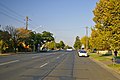 Sturt Highway throughWagga Wagga, New South Wales
 -
 Sturt Highway throughTruro, South Australia
 -
 The junction of the Sturt andOlympicHighways


See also
editReferences
edit- ^abc"Sturt Highway"(Map).Google Maps.Retrieved10 October2021.
- ^abcd"Main Roads Act, 1924-1927".Government Gazette of the State of New South Wales.No. 110. 17 August 1928. pp.3814–20.Archivedfrom the original on 3 August 2022.Retrieved1 August2022– via National Library of Australia.
- ^ab"State's Chief Highways Named".The Chronicle.Adelaide: National Library of Australia. 16 June 1938. p. 47.Retrieved9 September2014.
- ^ab"NEW MAIN ROADS SCHEDULE".The Advertiser.Adelaide: National Library of Australia. 15 June 1938. p. 25.Retrieved31 October2022.
- ^abcdef"Historical Roads of New South Wales"(PDF).NSW Main Roads.Sydney: OpenGov NSW. September 1954. pp.10–4.
- ^"Location SA Map viewer with regional layers".Government of South Australia.Retrieved16 June2022.
- ^"Victoria's Regions".Regional Development Victoria.Victoria State Government.11 August 2021.Retrieved16 June2022.
- ^Hema, Maps (2007).Australia Road and 4WD Atlas(Map). Eight Mile Plains Queensland: Hema Maps. pp.32–33, 69, 71.ISBN978-1-86500-456-3.
- ^ab"Sturt Highway".Ozroads.Retrieved25 May2008.[self-published source]
- ^State of New South Wales,An Act to provide for the better construction, maintenance, and financing of main roads; to provide for developmental roads; to constitute a Main Roads BoardArchived11 August 2022 at theWayback Machine10 November 1924
- ^State of New South Wales,An Act to amend the Main Roads Act, 1924-1927; to confer certain further powers upon the Main Roads Board; to amend the Local Government Act, 1919, and certain other Acts; to validate certain payments and other matters; and for purposes connected therewith.Archived12 August 2022 at theWayback Machine8 April 1929
- ^"Main Roads Act, 1924-1929".Government Gazette of the State of New South Wales.No. 132. National Library of Australia. 4 October 1929. p. 4084.Archivedfrom the original on 26 August 2022.Retrieved26 August2022.
- ^"Main Roads Act, 1924-1929".Government Gazette of the State of New South Wales.No. 139. National Library of Australia. 19 September 1930. p. 3707.Archivedfrom the original on 26 August 2022.Retrieved26 August2022.
- ^ab"Main Roads Act, 1924-1931".Government Gazette of the State of New South Wales.No. 131. National Library of Australia. 25 August 1933. p. 3093.Archivedfrom the original on 26 August 2022.Retrieved26 August2022.
- ^Kass, Terry (February 2006)."RTA Thematic History"(PDF)(2nd ed.).Roads & Traffic Authority.p. 84.Retrieved23 July2013.
- ^"THE MURRAY VALLEY ROAD".Murray Pioneer and Australian River Record.Renmark, SA:National Library of Australia.18 November 1927. p. 6.Retrieved17 June2014.
- ^"MURRAY VALLEY ROAD".Murray Pioneer and Australian River Record.Renmark, SA:National Library of Australia.6 April 1928. p. 4.Retrieved24 June2014.
- ^"Country Roads Board Victoria. Twentieth Annual Report: for the year ended 30 June 1933".Country Roads Board of Victoria.Melbourne: Victorian Government Library Service. 10 November 1933. pp. 4, 6.
- ^abNational Roads Act 1974(Cth)
- ^"Road number and name changes in NSW"(PDF).Roads & Maritime Services.Government of New South Wales. 2012. Archived fromthe original(PDF)on 25 March 2016.Retrieved7 November2016.
- ^State of New South Wales,An Act to make provision with respect to the roads of New South Wales; to repeal the State Roads Act 1986, the Crown and Other Roads Act 1990 and certain other enactments; and for other purposes.Archived11 August 2022 at theWayback Machine10 November 1924
- ^Transport for NSW(August 2022)."Schedule of Classified Roads and Unclassified Regional Roads"(PDF).Government of New South Wales. Archived fromthe original(PDF)on 25 August 2022.Retrieved1 August2022.
- ^State Government of Victoria."Road Management Act 2004"(PDF).Government of Victoria.Archived(PDF)from the original on 18 October 2021.Retrieved19 October2021.
- ^abVicRoads."VicRoads – Register of Public Roads (Part A) 2015"(PDF).Government of Victoria. p. 1002.Archivedfrom the original on 1 May 2020.Retrieved19 October2021.
- ^"Sturt Highway Upgrade".Department of Transport, Energy & Infrastructure.25 August 2008.Retrieved15 July2008.
- ^"Northern Expressway".Department of Transport, Energy & Infrastructure.11 September 2008.Retrieved13 September2008.
- ^"Sturt Highway – Riverland passing lanes".AusLink.Department of Transport and Regional Services. 20 July 2005. Archived fromthe originalon 18 May 2007.Retrieved11 June2006.
- ^"Sturt Highway – Upgrading Program".AusLink.Department of Infrastructure and Regional Development. 15 October 2012.Retrieved12 September2014.
- ^"THE LOWER MURRAY".The Riverine Grazier.Hay, NSW: National Library of Australia. 15 February 1949. p. 1.Retrieved9 September2014.
- ^South Australia. Highways and Local Government Dept; South Australian Government Tourist Bureau (1950),South Australia showing main road system and important district roads,Highways & Local Government Dept.: M.E. Sherrah, Government photolithographer,retrieved30 January2015
- ^"Road Route Numbers".Location SA Map Viewer.Retrieved18 September2020.
- ^"Truro Bypass".Australian GovernmentDepartment of Infrastructure, Transport, Regional Development and Communications.Retrieved17 March2022.
- ^"Truro Bypass Project".Government of South AustraliaDepartment for Infrastructure and Transport.Retrieved17 March2022.
- ^Mildura Truck Bypass – Auslink 2(PDF)
- ^"Map of Balranald, NSW".Bonzle Digital Atlas of Australia.Retrieved2 April2015.
- ^"George Chaffey Bridge over Murray River, Mildura".Heritage and conservation register.Roads & Maritime Services,Government of New South Wales. 17 April 2009.Retrieved2 April2015.
- ^abc"The river as a highway: Crossing the Murray".SA memory.State Library of South Australia,Government of South Australia. 31 March 2010. Archived fromthe originalon 31 March 2015.Retrieved2 April2015.
- ^"The Official opening of Blanchetown Bridge by the Honourable Sir Thomas Playford G.C.M.G., M.P., Premier of South Australia, on Friday, 24th April, 1964: souvenir".Highways Department.Government of South Australia. 1964.Retrieved8 September2014.
- ^"From one side to the other, to commemorate the opening of the new bridge, November 1998".Blanchetown Bulletin Committee. 1998.Retrieved8 September2014.
- ^"Official opening, Kingston Bridge, River Murray by His Excellency the Governor Sir Mark Oliphant, K.B.E. 21st. Feb., 1973".Highways Department.Government of South Australia. 1973.Retrieved8 September2014.
- ^"Location SA Map viewer with LGA layers".Government of South Australia.Retrieved16 June2022.
- ^"Location SA Map viewer with suburb layers".Government of South Australia.Retrieved16 June2022.