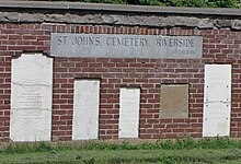
TheLost Villageswere ten communities (nine conventional villages and a populated island) in theCanadian provinceofOntario,in the formertownshipsofCornwallandOsnabruck(nowSouth Stormont) nearCornwall,which were permanently submerged by the creation of theSaint Lawrence Seawayin 1958.[1]


The flooding was expected and planned for as the result of theMoses-Saunders Power Damconstruction, which began in August 1954. In the weeks and months leading up to the inundation, families and businesses in the affected communities were moved to the new planned communities ofLong Sault and Ingleside.[1]These negotiations were controversial, however, as many residents of the communities felt that market value compensation was insufficient since the Seaway plan had already depressed property values in the region.[2]
The town ofIroquoiswas also flooded, but was relocated 1.5 kilometres (0.93 mi) north rather than being abandoned. Another community,Morrisburg,was partially submerged as well, but the area to be flooded was moved to higher ground within the same townsite. In all, approximately 6,500 people were displaced by the project,[2]530 buildings moved, and countless other homes, schools, and businesses demolished. A portion of the provincialHighway 2in the area was flooded; the highway was rebuilt along aCanadian National Railwayright-of-way in the area.
At 8 a.m. on 1 July 1958, a largecofferdamwas demolished, allowing the flooding to begin.[1]Four days later, all of the former townsites were fully underwater. Parts of theNew Yorkshoreline were flooded by the project as well, but no communities were lost on theAmericanside of the river.
Legacy
editA museum inAult Parknear Long Sault is devoted to the Lost Villages, including several historic buildings salvaged from the communities. Other buildings from the villages were moved to the site ofUpper Canada Villagein Morrisburg. The flooded area also includesCrysler's Farm,where a major battle was fought during theWar of 1812.A monument commemorating the battle was also moved from Crysler's Farm to Upper Canada Village.
AlthoughSave Ontario Shipwrecksgenerally surveys shipwrecks, chapters also explored several of the Lost Villages sites. Guard Lock 21, which was constructed in 1885/86, was flooded in 1936 as headwater for the Hydro dam atCornwall.Lock 21 of the formerCornwall Canal(since replaced by the St. Lawrence Seaway) is a popularscuba divingsite, a few feet from the shore along the Parkway.[3]Mille Roches Power House (1901) atCornwallwas demolished prior to inundation in 1955 with the new powerdam and seaway nearing completion.[4]
In some locations, a few remnants of sidewalks and building foundations can still be seen under the water, or even on the shoreline when water levels are sufficiently low.[2]In 2013, the photographer Louis Helbig documented the presence of some of these features using aerial photography.[5]Some high points of land in the flooded area remained above water as islands, and are connected by theLong Sault Parkway.
The Lost Villages
editThe "Lost Villages" were:
References
edit- ^abc"The Lost Villages"Archived2012-11-04 at theWayback Machine.Ottawa Citizen,28 June 2008.
- ^abc"Our own Three Gorges"Archived2012-10-08 at theWayback Machine.Toronto Star,June 29, 2008.
- ^"Lock 21".Save Ontario Shipwrecks.Archived fromthe originalon March 24, 2014.
- ^"Mille Roches Power House".Save Ontario Shipwrecks.Archived fromthe originalon July 2, 2015.
- ^"Sunken Villages".Archivedfrom the original on 2016-08-21.Retrieved2016-07-30.
External links
edit- Explore the Lost Villages- A multimedia documentary recreating the Lost Villages, by Tony Atherton, Jessey Bird, and the team at the Ottawa Citizen. Includes interactive maps, short documentaries on each village, and an underwater tour of what is left.
- The Lost Villages Historical Society