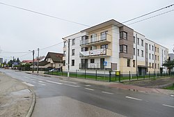
Brzeziny, Warsaw
Appearance
Brzeziny | |
|---|---|
 | |
 Location of Brzeziny within the district ofBiałołęka,in accordance to theMunicipal Information System. | |
| Coordinates:52°19′23″N21°01′58″E/ 52.32306°N 21.03278°E | |
| Country | |
| Voivodeship | Masovian Voivodeship |
| City county | Warsaw |
| District | Białołęka |
| Time zone | UTC+1(CET) |
| • Summer (DST) | UTC+2(CEST) |
| Area code | +48 22 |
Brzeziny[a]is aneighbourhood,and an area of theMunicipal Information System,in the city ofWarsaw,Poland,located within the district ofBiałołęka.[1]
History
[edit]
In the 19th century, the area of Brzeziny was settled byOlęders,a group of people ofGermanorigin.[2][3]
By 1880, Brzeziny was a small village located near the city ofWarsaw.[4][5]
In 1941, during theoccupation of PolandinSecond World WarbyNazi Germany,the Olęder inhabitants of the area were forcefully removed and relocated, most likely to theProvince of Pomerania,Germany. TheBrzeziny Evangelical Cemeteryis the remainder of the Olęder presence in the area. Following their expulsion, the cemetery had been closed.[2][3]
On 15 May 1951, Brzeziny had been incorporated into the city ofWarsaw.[6]
Citations
[edit]Notes
[edit]- ^Polishpronunciation:[bʐɛˈʑinɨ]
References
[edit]- ^"Obszary MSI. Dzielnica Białołęka".zdm.waw.pl(in Polish).
- ^abRys historyczny cmentarzy ewangelickich na Białołęce,In:Protokół z posiedzenia Komisji Dialogu Społecznego ds. Ochrony Dziedzictwa Kulturowego przy Biurze Stołecznego Konserwatora Zabytków Urzędu m.st. Warszawy w dniu 22 września 2009 roku.Warsaw. 2009.
- ^abJacek Baliński (1 November 2014)."Nieznane stołeczne cmentarze".politykawarszawska.pl/(in Polish). Archived fromthe originalon 2019-03-26.
- ^Brzeziny (2),In:Geographical Dictionary of the Kingdom of Poland,vol. 1:Aa – Dereneczna,Warsaw, 1880, p. 416.
- ^Brzeziny (1),In:Geographical Dictionary of the Kingdom of Poland,vol. 15, part 1:Abablewo – Januszowo,Warsaw, 1900, p. 245.
- ^Rozporządzenie Rady Ministrów z dnia 5 maja 1951 r. w sprawie zmiany granic miasta stołecznego Warszawy.In:1951 Journal of Laws,no. 27, position 199. Warsaw. 1951.
