
Prignitz
Prignitz | |
|---|---|
 Flag  Coat of arms | |
 | |
| Country | Germany |
| State | Brandenburg |
| Founded | 1993 |
| Capital | Perleberg |
| Government | |
| • District admin. | Christian Müller (SPD) |
| Area | |
| • Total | 2,123 km2(820 sq mi) |
| Population (31 December 2022)[1] | |
| • Total | 76,045 |
| • Density | 36/km2(93/sq mi) |
| Time zone | UTC+01:00(CET) |
| • Summer (DST) | UTC+02:00(CEST) |
| Vehicle registration | PR |
| Website | landkreis-prignitz.de |
Prignitz(German:[ˈpʁiːɡnɪts]) is aKreis(district) in northwesternBrandenburg,in northeasternGermany.Neighboring districts, clockwise from the north, areLudwigslust-Parchim(inMecklenburg-Western Pomerania),Ostprignitz-Ruppin(Brandenburg),Stendal(Saxony-Anhalt), andLüchow-Dannenberg(Lower Saxony).
Geography
[edit]The term Prignitz originally meant the region north of the confluence of theElbeandHavelrivers. This region is larger than the district. It also includes the town ofHavelbergin Saxony-Anhalt and large portions of the neighbouring district ofOstprignitz-Ruppin.
The Elbe river forms the southwestern border of the district.
History
[edit]The historical region Prignitz consisted of the following eleven districts, established in the 13th century:Wittenberge,Lenzen,Perleberg,Putlitz,Kyritz,Nitzow,Wittstock,Pritzwalk,Havelberg,WusterhausenandGrabow.
The present district of Prignitz was created in 1993 by merging the previous districts of Pritzwalk and Perleberg and a few municipalities from the district Kyritz. The westernmost part of the district was previously part of Mecklenburg-Western Pomerania and became part of Brandenburg on August 1, 1992.
The earlier district of Prignitz was the buffer between Brandenburg and Mecklenburg. It was resettled by Germans, especially from the Bremen area, following the FirstWendish Crusadeof 1147. The rate of German settlement increased over the following decades. The eastern half was dominated by the pro-German countsvon Plothowho brought their own vassals such as thevon Blumenthalandvon Grabowfamilies with them. The western half was dominated by robber barons, especially theGans zu Putlitzfamily and their vassals, thevon Quitzows.In 1319 the territory was briefly controlled byMecklenburg.[2]When Frederick, Count of Zollern was appointed Margrave in 1411, he faced an uprising of theWendishnobility, supported by the Wendish Duke of Mecklenburg. However, he was able to put down the revolt at the battle of theCremmer Dam,with the support of the German nobility. Families who had stayed loyal were rewarded. Ottovon Blumenthal,for example, was made Captain of the Prignitz from 1415 to 1422 and ofLenzenfrom 1420.
Demography
[edit]-
 Development of population since 1875 within the current Boundaries (Blue Line: Population; Dotted Line: Comparison to Population development in Brandenburg state; Grey Background: Time ofNazi Germany;Red Background: Time of communistEast Germany)
 -
 Recent Population Development and Projections (Population Development before Census 2011 (blue line); Recent Population Development according to theCensus in Germanyin 2011 (blue bordered line); Official projections for 2005-2030 (yellow line); for 2014-2030 (red line); for 2017-2030 (scarlet line)
|
|
|
Coat of arms
[edit]
The coat of arms shows a goose preparing for flight, the symbol of theGans zu Putlitzfamily (GansisGermanfor goose), who in the 12th century were one of a number of families (such as thevon Plotho,von Blumenthalandvon Arnimfamilies) who introduced Christianity and German culture to Prignitz. The pearls around the goose symbolize Perleberg (which translates toPearl Mountain). The wolf at bottom stands for the former administrative seat, Pritzwalk, aswalkderives from theSlavonicwolkmeaning wolf. The wavy separation between the top and bottom symbolizes the river Elbe; the colors red and white are those of Brandenburg.
Towns and municipalities
[edit]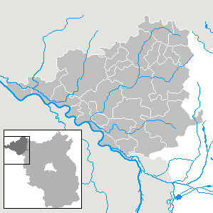
| Amt-free towns | Ämter | |
|---|---|---|
|
|
||
| 1seat of the Amt;2town | ||
References
[edit]- ^"Bevölkerungsentwicklung und Bevölkerungsstandim Land Brandenburg Dezember 2022"(PDF).Amt für Statistik Berlin-Brandenburg(in German). June 2023.
- ^Rymar, Edward (1979). "Rywalizacja o ziemię lubuską i kasztelanię międzyrzecką w latach 1319–1326, ze szczególnym uwzględnieniem stosunków pomorsko-śląskch".Śląski Kwartalnik Historyczny Sobótka(in Polish).XXXIV(4). Wrocław:Zakład Narodowy im. Ossolińskich,WydawnictwoPolskiej Akademii Nauk:477.
- ^Detailed data sources are to be found in the Wikimedia Commons.Population Projection Brandenburg at Wikimedia Commons
External links
[edit]| Urban districts | |
|---|---|
| Rural districts | |