
Interstate 395 (Virginia–District of Columbia)
This articleneeds additional citations forverification.(April 2019) |
Interstate 395 | |||||||
|---|---|---|---|---|---|---|---|
 I-395 highlighted in red | |||||||
| Route information | |||||||
| Auxiliary route ofI-95 | |||||||
| Maintained byVDOTandDDOT | |||||||
| Length | 13.79 mi[1](22.19 km) | ||||||
| Existed | 1977–present | ||||||
| NHS | Entire route | ||||||
| Restrictions | Nohazardous materialsor vehicles over 13 ft (4.0 m) in the3rd Street Tunnel | ||||||
| Major junctions | |||||||
| South end | |||||||
| |||||||
| North end | |||||||
| Location | |||||||
| Country | United States | ||||||
| States | Virginia,District of Columbia | ||||||
| Counties | VA:Fairfax,City of Alexandria,Arlington DC:City of Washington | ||||||
| Highway system | |||||||
| |||||||

Interstate 395(I-395) inVirginiaandWashington, D.C.,is a 13.79-mile-long (22.19 km)spur routeofI-95that begins at an interchange with I-95 inSpringfieldand ends at an interchange withUS Route 50(US 50) inNorthwest Washington, D.C.It passes underneath theNational Mallnear theUS Capitoland ends at a junction with US 50 atNew York Avenue,roughly one mile (1.6 km) north of the 3rd Street Tunnel. Despite its proximity toI-395inMaryland,the route is unrelated and unconnected.
I-395 is known by three different names over its various segments. The Virginia portion is part of the largerShirley Highwaythat continues southward on I-95 beyond the terminus of I-395. In the District of Columbia, it is known as theSouthwest Freewayfrom the14th Street bridgesto the Southeast Freeway interchange (I-695) and the Center Leg orCenter Leg Freewayfrom the Southeast Freeway interchange to New York Avenue. The Southwest and Center Leg freeways are collectively denominated as the Dwight D. Eisenhower Freeway. I-395 is planned to be rerouted off of the Center Leg and onto I-695 with the latter route being decommissioned. The Center Leg will then be designatedI-195.
Route description[edit]
| mi[1] | km | |
|---|---|---|
| VA | 9.91 | 15.95 |
| DC | 3.88 | 6.24 |
| Total | 13.79 | 22.19 |
Virginia[edit]
The intersection where I-395, I-95, and the I-495 (Capital Beltway) meet is called theSpringfield Interchange.Unofficially, this interchange is referred to as the "Mixing Bowl". This moniker causes confusion, because the intersection of I-395, Washington Boulevard, andState Route 244(SR 244; Columbia Pike) several miles north was historically known by that name and continues to be recognized by theVirginia Department of Transportation(VDOT) as such.
I-395 contains a third roadway: reversible, barrier-separatedVirginia high-occupancy toll (HOT) laneswith their own entrances and exits, also known locally as the "express lanes", between South Eads Street nearthe PentagoninArlington CountyandSR 610(Garrisonville Road) inStafford County.[2]During morning and evening rush hour, traffic on this roadway flows in the direction of rush-hour traffic.
This third roadway was built as a single-lanebusway,the first in the US, before being expanded and converted tohigh-occupancy vehicle(HOV) use. A 2007 survey found that during the morning rush hour, the HOV lanes carry about 65 percent of travelers on I-395 (61,000 commuters), including 32,000 in transit busses and 29,000 in private vehicles with two or more people. The other 33,000 commuters (35 percent of total users) drove alone.[3]
I-395 andUS 1cross thePotomac Riverfrom Virginia to Washington DC on three parallel four-lane bridges, together known as the14th Street bridges.Potomac River crossings for theWashington Metro'sYellow Lineand for a majorCSX Transportationrailroad line are immediately downstream here. This site has long been a major Potomac River crossing, with the first bridge constructed here in 1809. Of the present highway spans, the eastern one was built in 1950, the western one in 1962, and the central one in 1972.
District of Columbia[edit]
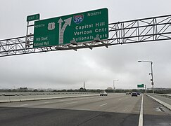
After crossing the 14th Street bridges, the freeway has a left-side exit allowing access toUS 1(exit 1). The southbound side of I-395 has no access to northbound US 1 here. I-395 crossesEast Potomac Park(exit 2) and a second bridge, theFrancis Case Memorial Bridgeover theWashington Channel.Here, the route bends from a generally northeast direction to a due east direction, interchanging (exit 3) with the9th and 12th Street Expressways,two tunnels that carry traffic under theNational Mall.A series of complex interchanges (numbered 4, 5, 6, and 7) provide partial access to Maine Avenue and C Street Southwest, as well as connections toI-695.Immediately after I-695, the freeway makes a hard turn to the due north to follow the3rd Street Tunnelimmediately underUnion Square,just to the west of theUS Capitolbuilding and underneathits reflecting pooland theFrances Perkins Building.I-395 follows a depressed roadway (the Center Leg Freeway), which was placed underground in 2019, that has three more partial interchanges (exits 8, 9, and 10) with local streets before terminating atNew York Avenue/US 50.
- Images from I-395, from south to north
-
 Southern terminus of I-395 at the Springfield Interchange
 -
 I-395 in Alexandria
 -
 I-395 northbound at Glebe Road in Arlington
 -
 Cars on I-395, leaving Washington DC (in distance) and passing by the Pentagon in Arlington
 -
 US 1 exit on I-395 northbound, just after crossing the 14th Street bridges into the District of Columbia
 -
 I-395 northbound along the Southwest Freeway at exit 3
 -
 Entrance to the 3rd Street Tunnel under the National Mall
 -
 I-395 northbound along the Center Leg Freeway at exit 10


History[edit]
Shirley Highway[edit]
The portion of I-395 betweenthe Pentagonin Arlington, Virginia, and the interchange withI-95and the Capital Beltway inSpringfieldis part of the Henry G. Shirley Memorial Highway, named forthe Virginia Highway Commissionerwho died on July 16, 1941, just a few weeks after approving work on the new expressway. OriginallySR 350,the full length of the Henry G. Shirley Memorial Highway was opened on September 6, 1949, from south of the Pentagon toWoodbridge, Virginia,[4]along what is now better known as the I-95 corridor. The Henry G. Shirley Memorial Highway featured the nation's firstreversiblebus lanes, a precursor to today's HOV lanes.
During an evening rush-hour snowstorm in 1982,Air Florida Flight 90crashed on takeoff from what was then known asWashington National Airport,hitting the easternmost of the three highway bridges known as the 14th Street bridges. The oldest span, formerly named theRochambeau,is now named the Arland D. Williams Jr. Memorial Bridge, in honor ofa passenger of Flight 90who survived the crash, escaped from the sinking aircraft, and perished in the Potomac River while saving others from the icy waters. The center span is now called the Rochambeau Bridge and the western span the George Mason Memorial Bridge, aftera US delegateto theConstitutional Convention.
Interstate Highway through Washington DC[edit]
Original plans called for I-95 to travel throughWashington DCandPrince George's County, Maryland,toward the northeastern portion of theCapital Beltway,from which I-95 presently continues its northbound route. However, neighborhood opposition in DC halted this plan in 1977, diverting planned funding toward construction of theWashington Metro.The only remnant of the Maryland extension is a series oframp stubsnearCollege Park,which now lead to apark and ride.The portion of I-95 within the beltway became I-395, while the eastern half of the beltway was redesignated I-95 (and, later,cosignedI-95/I-495). I-395 terminates in Washington DC at a traffic signal atUS 50,which isNew York Avenue,nearMount Vernon Square.
Center Leg Freeway development/Capitol Crossing[edit]
The DC government finalized a deal in 2010 withLouis Dreyfus Companyto construct a 2.1-million-square-foot (200,000 m2)mixed-use developmentin theairspaceover the Center Leg Freeway portion of I-395. The $425-million (equivalent to $580 million in 2023[5]) office, residential, and retail project at the east end of theJudiciary Squareneighborhood will also restore the area's originalL'Enfant Planstreet grid by reconnecting F and G streets over the freeway. The project was awaiting final regulatory approval and expected to be complete by 2016.[6]
In 2015, work began on I-395 in conjunction withCapitol Crossing,a major real-estate project in DC, part of which lies on top of the highway. The work involves adding a $200-million (equivalent to $251 million in 2023[5]) concrete platform that connects neighborhoods that have been severed by the freeway, creating a better community atmosphere in the eastern edge of downtown. TheDistrict Department of Transportation(DDOT) expected the work would take up to four years.[7]
Express lanes conversion[edit]
In 2015, the commonwealth of Virginia announced that the HOV lanes between the Turkeycock Run bridge and Eads Street (at the Pentagon) would be converted to toll lanes as part of the I-395 Express Lanes Extension project. The existing HOV lanes, which ran in both directions in some areas, became reversibleHOTlanes for the entire scope of this project, spanning eight miles (13 km).[8]
Part of the project involved the reconfiguring of the Pentagon interchange to provide greater access to Army Navy Drive, as well as the closing of the onramp—from the southbound HOV lanes to the mainline Interstate southbound—located just west of the Pentagon interchange. All existing HOV interchanges within the project's scope became tolled.[9]
Vehicles carrying three or more passengers are still able to use the former HOV lanes for free if they haveE-ZPassFlex transponders in HOV mode.[10][11]The express lanes opened on November 17, 2019.[12]The lanes are operated byTransurban.The reversible portion runs toward the District of Columbia in the morning and toward Virginia in the afternoon.[11]
Exits 9 and 10A - Boundary Channel Drive Construction[edit]
In December 2023, VDOT permanently closed Exit 9 for Clark St as part of construction on Boundary Channel Drive.[13]As part of the project, VDOT is converting Exit 10 to adumbbell interchangeto "improve traffic operations and safety."[14]VDOT is also building new pedestrian and bicycle paths to connectCrystal CitytoLong Bridge Park,theMount Vernon Trail,and thePentagon.Construction is expected to be completed in 2024.[15]
Future[edit]
I-195 redesignation[edit]

I-395'sturn-off-to-stay-onmovement into the 3rd Street Tunnel causes confusion among drivers who intend to continue straight on the Southeast Freeway, but do not realize that they need to follow the posted "Exit 5" for I-695 to do so.WTOPtraffic reporters monitor the area with their own cameras, and note numerous incidents of dangerous weaving, as well as trucks – which may be over-height or prohibited from the tunnel – reversing up the exit ramp to continue on the Southeast Freeway.[16]In January 2021, theAmerican Association of State Highway and Transportation Officials(AASHTO) approved a request by the District of Columbia to eliminate the entirety of I-695 and renumber it as an extension of I-395. I-395's previous route along theCenter Leg Freewayis to be renumbered as a new I-195.[17]Although theFederal Highway Administration(FHWA) also approved the request on April 23,[18]DDOT subsequently delayed updating signage in the area. This prompted renewed pressure on DDOT from the FHWA in September 2023, as both printed and digital maps were beginning to show the long-since-approved but still unsigned designations. Though the FHWA stated at the time they would work with DDOT to start resigning work before the end of 2023, it is still yet to commence as of February 2024[update].[16]
14th Street bridges rehabilitation[edit]
Plans to rehabilitate theArland D. Williams Jr. Memorial Bridge,which carries northbound I-395 andUS 1over thePotomac River,have been in the works since inspections between 2005 and 2009 revealed that the bridge was deteriorating. A small $27-million (equivalent to $36.1 million in 2023[5]) project was done between 2010 and 2011, but a 2014 inspection revealed that the bridge still had problems. However, DDOT pushed the date to fix the problems until 2020 due to the expense and the need to replace or repair several deficient bridges elsewhere in DC.[19]On April 13, 2023, DDOT announced theUS Department of Transportationhad provided $72 million to help fund the rehabilitation project. The $90-million project, which will also be funded in part by the DC government, would start with preliminary engineering and the environmental review for the project later that spring, with the preliminary design expected to be completed later that year. Construction is estimated to take two years.[20]
Exit list[edit]
Exits in Washington DC were unnumbered until 2008.[citation needed]In 2014, in conjunction with the rebuilding of the11th Street Bridgesand theSoutheast Freeway,some exit numbers were converted to amileage-based numbering system.[21]
| State/district | County | Location | mi[22][21] | km | Old exit | New exit[23] | Destinations | Notes |
|---|---|---|---|---|---|---|---|---|
| Virginia | Fairfax | Springfield | 0.00 | 0.00 | 1A | Southern terminus; part ofSpringfield Interchange | ||
| — | South end of I-395 Express lanes; part ofSpringfield Interchange | |||||||
| 1B | Part ofSpringfield Interchange;southbound exit and northbound entrance | |||||||
| — | Part ofSpringfield Interchange;southbound exit and northbound entrance for Express lanes only | |||||||
| 1C | Part ofSpringfield Interchange;southbound exit and northbound entrance | |||||||
| 1D | Part ofSpringfield Interchange;southbound exit and northbound entrance | |||||||
| 0.40 | 0.64 | 2 | Signed as exits 2A (east) and 2B (west); access to Industrial Park northbound | |||||
| 1.10 | 1.77 | — | ||||||
| CityofAlexandria | 2.00 | 3.22 | 3 | Signed as exits 3A (east) and 3B (west) northbound; access to Quantrell Avenue southbound | ||||
| 3.70 | 5.95 | 4 | Seminary Road (SR 420) | Includes full access to and from Express lanes | ||||
| 4.60 | 7.40 | 5 | ||||||
| Arlington | Shirlington | 5.40 | 8.69 | 6 | Shirlington | Southbound access is part of exit 7; includes exit ramp to Quaker Lane | ||
| — | Shirlington | Southbound exit and northbound entrance via Express lanes only | ||||||
| 5.90 | 9.50 | 7 | Signed as exits 7A (south) and 7B (north/Marymount) northbound; southbound exit includes exit ramp to Quaker Lane | |||||
| Arlington Ridge | 6.90 | 11.10 | 8A | SR 244 (Columbia Pike) signed northbound only; Pentagon South Parking/South Arlington Ridge Road signed southbound only | ||||
| Pentagon City | — | Northbound exit and southbound entrance via Express lanes only | ||||||
| 7.50 | 12.07 | 8B | Northbound exit and southbound entrance | |||||
| — | Eads Street -Pentagon,Pentagon City | Express Lanes only | ||||||
| 8.00 | 12.87 | 9 | 8B | Southbound exit and northbound entrance | ||||
| Crystal City | 8.40 | 13.52 | 8C | Southern terminus of concurrency with US 1; left exit southbound; northbound signed as "To US 1" | ||||
| 8.50 | 13.68 | — | Northbound exit and southbound entrance | |||||
| 8.70 | 14.00 | 10 | 9 | Clark Street | Exit closed in 2023 | |||
| Long Bridge Park | 8.90– 9.00 | 14.32– 14.48 | 10A | Boundary Channel Drive –Pentagon North Parking | ||||
| Virginia–D.C.line | Arlington– line | 11 | 10B-C | Signed as exits 10B (south) and 10C (north) | ||||
| 14th Street BridgesoverPotomac River | ||||||||
| District of Columbia | Washington | 9.91 | 15.95 | 1 | Northern terminus of US 1 concurrency; northbound exit and southbound entrance; includes access to/from HOV lanes | |||
| 10.01 | 16.11 | 2 | Potomac Park,U.S. Park Police | Access viaOhio Drive | ||||
| 10.21 | 16.43 | — | Northern terminus of I-395 Express Lanes | |||||
| Francis Case Memorial Bridge | ||||||||
| 10.31 | 16.59 | 3 | 12th Street Expresswaynorth –Capital One Arena | No entrance ramps; southbound exit is part of exit 4 | ||||
| 9th Street Expressway | No exit ramps | |||||||
| 10.71 | 17.24 | 4 | Maine Avenue–Southwest Waterfront,Nationals Park | No entrance ramps | ||||
| 10.91 | 17.56 | 5 | 6th Street SW /7th Street SW–L'Enfant Promenade | Southbound exit and northbound entrance | ||||
| Northbound left exit and southbound left entrance; future I-395 north | ||||||||
| I-395 north from this point on is futureI-195(Center Leg Freeway) | ||||||||
| 11.01 | 17.72 | 2B | 6 | C Street SW –U.S. Capitol,The House | Northbound exit only | |||
| 11.31 | 18.20 | 2A | 7 | Southbound left exit and northbound entrance; western terminus of I-695; future I-395 north | ||||
| Southern end ofThird Street Tunnel | ||||||||
| 11.61 | 18.68 | 2B | 8 | U.S. Capitol | Southbound exit and northbound entrance; via 2nd Street SW | |||
| 11.81 | 19.01 | 9 | U.S. Senate | Northbound exit and southbound entrance; via 1st Street SW | ||||
| 12.11 | 19.49 | 10 | Northbound exit and southbound entrance | |||||
| Northern end of Third Street Tunnel | ||||||||
| 12.81– 13.79 | 20.62– 22.19 | — | At-grade intersection | |||||
1.000 mi = 1.609 km; 1.000 km = 0.621 mi
| ||||||||
Related highways[edit]
9th Street Expressway and 12th Street Expressway | |
|---|---|
| Location | Washington, D.C. |
| Length | 0.9 mi[24][25](1,400 m) |

The9th Street Expresswayand the12th Street Expresswayare aone-way pairof freeway spurs connecting I-395 (Southwest Freeway) with US 1 and US 50 (Constitution Avenue) in Washington, D.C. The expressways also provide connections to theL'Enfant PromenadeandIndependence Avenue.Both highways pass through tunnels under theNational Malland are named for the streets that extend northward from their respective northern termini. The 9th Street Expressway and the 12th Street Expressway run southbound and northbound, respectively, between I-395 and Constitution Avenue.
The 9th Street Expressway begins at the intersection of Constitution Avenue and 9th Street Northwest. The highway heads southbound along the east side of theNational Museum of Natural Historyand descends into the 9th Street Tunnel under the National Mall. The 9th Street Expressway emerges from the tunnel just north of L'Enfant Plaza and receives a ramp from Independence Avenue. At the south end of L'Enfant Plaza, ramps for northbound I-395 and southbound I-395 split from the roadway; the southbound I-395 also provides access toMaine Avenuein the direction of theTidal Basin.The highway continues south beyond I-395 to an intersection with Maine Avenue atThe Wharf (Washington, D.C.).[24]
The 12th Street Expressway begins as a flyover ramp from northbound I-395 as the Interstate crosses theFrancis Case Memorial Bridge.Southbound I-395 also has a ramp to the expressway as part of its ramp to Maine Avenue. The two ramps both have exits for the L'Enfant Promenade, specifically D Street Southwest. The expressway's ramps from both directions of I-395 merge and the highway descends into the 12th Street Tunnel, before which the highway receives a ramp from Independence Avenue. The 12th Street Expressway passes under the National Mall and then ascends to the west of the National Museum of Natural History to its terminus at the intersection of Constitution Avenue and 12th Street Northwest.[25]
See also[edit]
References[edit]
- ^abStarks, Edward (January 27, 2022)."Table 2: Auxiliary Routes of the Dwight D. Eisenhower National System of Interstate and Defense Highways".FHWA Route Log and Finder List.Federal Highway Administration.RetrievedJanuary 14,2023.
- ^Kozel, Scott M. (March 1, 2004)."Virginia Freeway HOV Lanes".Roads to the Future.RetrievedOctober 5,2014.[self-published source]
- ^Quintana, Kala (September 10, 2007)."Many More People Commuting Along I-395/Route 1 Corridor Inside The Beltway Are Using HOV And Transit Than Driving Alone"(Press release). Virginia Department of Rail and Public Transportation. Archived fromthe originalon January 29, 2013.RetrievedFebruary 18,2013.
- ^London, John (September 7, 1949). "Shirley Road Saves Time, Test Reveals".The Washington Post.p. B1.ProQuest152105125.
- ^abcJohnston, Louis; Williamson, Samuel H. (2023)."What Was the U.S. GDP Then?".MeasuringWorth.RetrievedNovember 30,2023.United StatesGross Domestic Product deflatorfigures follow theMeasuringWorthseries.
- ^Farmer, Liz (October 19, 2010)."Major development over I-395 moves closer to reality".The Washington Examiner.Archived fromthe originalon July 17, 2012.RetrievedNovember 2,2011.
- ^Lazo, Luz (June 23, 2015)."Major work for Capitol Crossing project is set to begin on I-395".The Washington Post.RetrievedAugust 21,2016.
- ^Virginia Department of Transportation(July 25, 2017)."I-395 Express Lanes Extension".Virginia Department of Transportation.RetrievedJuly 30,2017.
- ^Virginia Department of Transportation (2016)."I-395 Express Lanes Northern Extension"(PDF).Virginia Department of Transportation. pp. 7, 16–17.RetrievedJuly 30,2017.
- ^Smith, Max (November 4, 2019)."Transurban: I-395 tolling will start Nov. 17 in Northern Va. - WTOP News".WTOP News.RetrievedNovember 27,2022.
- ^ab"Opening date of 395 Express Lanes now set for Nov. 17".Washington Post.November 4, 2019.ISSN0190-8286.RetrievedNovember 27,2022.
- ^"Express Lanes on I-395 Open".Alexandria Living Magazine.November 17, 2019.RetrievedNovember 27,2022.
- ^"Problematic I-395 interchange ramps close for good as part of major VDOT project | ARLnow.com".ARLnow.com | Arlington, Va. local news.December 6, 2023.RetrievedDecember 18,2023.
- ^"Boundary Channel Drive Interchange Project".www.arlingtonva.us.RetrievedDecember 18,2023.
- ^"Boundary Channel Drive at I-395 Interchange Improvements in Arlington County | Virginia Department of Transportation".www.vdot.virginia.gov.RetrievedDecember 18,2023.
- ^abDildine, Dave (September 19, 2023)."Freeway frenzy on I-395 persists amid yearslong delay in updating DC signs".WTOP News.
- ^Dildine, Dave (January 11, 2021)."Move over, I-395: Southeast Freeway, 3rd Street Tunnel to be renumbered".Washington, DC:WTOP-FM.
- ^Dildine, Dave (July 7, 2021)."EXCLUSIVE: Feds sign off on biggest DC interstate renumbering in decades".Washington, DC: WTOP-FM.
- ^Dildine, Dave (June 25, 2015)."DDOT details area's structurally deficient bridges".WTOP.RetrievedSeptember 1,2015.
- ^Drain, Aja (April 13, 2023)."DC's 14th Street Bridge To Get Overhaul Thanks To Federal Grant".DCist.Archivedfrom the original on April 14, 2023.RetrievedApril 26,2023.
- ^abGoogle(December 26, 2013)."Interstate 395 in Washington, D.C."(Map).Google Maps.Google.RetrievedDecember 26,2013.
- ^Google (December 26, 2013)."Interstate 395 in Virginia"(Map).Google Maps.Google.RetrievedDecember 26,2013.
- ^Virginia Department of Transportation (October 14, 2012)."Virginia Interstate Exits: I-395".Virginia Department of Transportation.RetrievedAugust 21,2016.
- ^abGoogle(December 4, 2016)."9th Street Expressway"(Map).Google Maps.Google.RetrievedDecember 4,2016.
- ^abGoogle (December 4, 2016)."12th Street Expressway"(Map).Google Maps.Google.RetrievedDecember 4,2016.
External links[edit]
- Kurumi - I-395 Washington, D.C.; Virginia
- HOV in Northern Virginia, from the Va. Dept. of Transportation
- Springfield Interchange reconstruction, from the Va. Dept. of Transportation
- Shirley Highway (I-395) at Steve Anderson's DCRoads
- Southwest Freeway (I-395) at Steve Anderson's DCRoads
- Center Leg Freeway (I-395) at Steve Anderson's DCRoads
| ||
- Auxiliary Interstate Highways
- Interstate Highways in Washington, D.C.
- Interstate Highways in Virginia
- Interstate 95
- Northern Virginia
- Transportation in Fairfax County, Virginia
- Transportation in Alexandria, Virginia
- Springfield, Virginia
- Transportation in Arlington County, Virginia
- Tunnels in Washington, D.C.
- Road tunnels in the United States