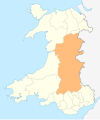
A4221 road
Appearance
| A4221 | ||||
|---|---|---|---|---|
 A4221 nearCoelbren | ||||
| Route information | ||||
| Length | 3 mi (4.8 km) | |||
| Major junctions | ||||
| Northwest end | Abercraf | |||
| Southeast end | Banwen | |||
| Location | ||||
| Country | United Kingdom | |||
| Constituent country | Wales | |||
| Road network | ||||
| ||||
TheA4221is an A road which linksBanwenwithAbercrafinWales.
Route[edit]
The roads begins just south of Abercraf at the junction with the A4067. It then heads eastwards throughCaehopkinand then bypassesCoelbren.It joins the A4109 just west of Banwen.


