A47 road
This articlemay contain an excessive amount of intricate detail that may interest only a particular audience.(September 2021) |
| A47 | ||||
|---|---|---|---|---|
 | ||||
| Route information | ||||
| Length | 192 mi (309 km) | |||
| Major junctions | ||||
| From | ||||
| To | ||||
| Location | ||||
| Country | United Kingdom | |||
| Primary destinations | Nuneaton Hinckley/Earl Shilton Leicester Peterborough Wisbech King's Lynn Swaffham Dereham Norwich Great Yarmouth Gorleston-on-Sea Lowestoft | |||
| Road network | ||||
| ||||
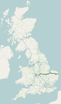
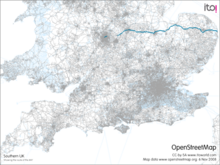
TheA47is a major trunk road inEnglandlinkingBirminghamtoLowestoft,Suffolk,maintained and operated byNational Highways.Most of the section betweenBirminghamandNuneatonis now classified as theB4114.FromPeterborougheastwards, it is atrunk road(sections west of theA1 roadhave been downgraded as alternative roads have been built).
History[edit]

The original (1923) route of the A47 was Birmingham to Great Yarmouth, but there were some changes made to its route in the early years. At its eastern end, the A47 originally ran throughFilbyandCaister-on-Sea,with theAcle Straightbearing the number B1140.
A change took place in 1925. The original route of the A47 betweenGuyhirnandWisbechin theIsle of Elywas viaWisbech St Mary,with the direct route being part of the A141. This is because there was no road bridge over theRiver Neneat Guyhirn, and hence no junction between the A47 and the A141. In April 1925 a steel road bridge was opened, and the A47 and the A141 swapped routes between Guyhirn and Wisbech.[1]
The A47 was rerouted along the Acle Straight in 1935, with the old route being renumbered as the A1064 (Acleto Caister-on-Sea) and part of the A149 (Caister to Great Yarmouth). Another change also dates from 1935. The A47 originally ran viaDownham Market,not King's Lynn. In 1935,[citation needed]it was rerouted via King's Lynn, replacing part of the A141 (Wisbech to King's Lynn) and part of the A17 (King's Lynn toSwaffham). The old route via Downham Market was renumbered as the A1122 (Outwellto Swaffham) and part of the A1101 (Wisbech to Outwell).
Major improvements were made from the late 1970s until early in the 1990s. The 7 mile (11.3 km) £5 million part-dual-carriagewayEast DerehamBypass built on part of the disused railway line was opened in spring 1978 followed by a five-mile (8 km) part-dual-carriageway Swaffham Bypass, costing £5 million which was opened in June 1981. Bypasses for Uppingham (£1.4 million) and Blofield (£4 million) were opened in 1982 and 1983 respectively. The southern section of the Great Yarmouth Western Bypass was opened in May 1985 and the northern section in March 1986 at a cost of £19 million followed by improvements to the one mile (1.6 km)Postwick-Blofieldsection (£1.2 million) which was opened in November 1987. In 1989 Acle Bypass was completed as a cost of £7.1 million and the £1.2 million East Norton Bypass was opened in December 1990. The three mile (4.8 km) £9 million East Dereham-North TuddenhamImprovement opened in August 1992 and the £62 million Norwich southern Bypass in September 1992.
Escalatingroad protestsstarting withTwyford Downin 1992 and culminating with theNewbury bypassin 1996 (at which over 1,000 people were arrested)[2]led to over 300 road schemes being cancelled in November 1995[3]and to the cancellation of further schemes including the Thorney bypass[4]by the newLabour government in 1997.[5][6]
In 2002 the government announced a new road building programme[7]which included the three mile (4.8 km) dual-carriageway Thorney bypass which opened on 14 December 2005.
In February 2017 theHighways Agencyre-designated the stretch of theA12 roadbetween Great Yarmouth and Lowestoft as the A47.[8]
Proposed improvements[edit]
Acle Straight (New Road)[edit]
 Route of the proposed A47 Acle Straight scheme | |
| Location | Norfolk |
|---|---|
| Proposer | Norfolk County Council |
| Geometry | KML |
A study on the A47 which concluded in 2001 looked at improving New Road, i.e. the section of the A47 between Acle and Great Yarmouth known as the Acle Straight.[9]The improvement of the Acle Straight has become a point of contention between interested parties due to its passage throughthe Norfolk Broads,an area of important ecological and conservation significance that limits development. The study which recommended widening rather than dualling of the Acle Straight was opposed by theBroadland District Council,Great Yarmouth Borough Council,Norfolk Police Authorityand the majority of local respondents who believed that dualling of the road is necessary to improve road safety, decrease journey time and support the economic development of Great Yarmouth. Dualling was however strongly opposed by theEnvironment Agency,theCouncil for National Parks (CNP)and theBroads Authoritydue to its impact on biodiversity and internationally important wildlife sites. These parties did cautiously support further investigation into the option for widening following further investigation of its environmental impact.[10]
Acle Straight safety improvement scheme[edit]
In 2006 a programme of safety improvement for the Acle Straight were announced. This would include road resurfacing, better road markings, improved visibility and the installation of safety cameras at an estimated total cost of £1.6 million. The result would then be monitored while long-term improvements, such as widening, are considered.[11]In October 2009 after it was announced that a £40,000 feasibility study, to see whether roadside ditches along the nine-mile stretch could be moved further back without disturbing delicate marshland habitat had been delayed until autumn 2010 at the earliest.[12]
Norwich Northern Distributor Road[edit]
A£117 million road scheme to the north ofNorwich,linking theA1067andNorwich International Airportto the A47, sponsored and managed byNorfolk County Council.It was priority scheme for Norfolk County Council and it attracted strong opposition both locally and from environmental groups.[13]On 2 June 2015 the scheme was given the go ahead, in 2017 parts of the road were opened with the complete road opened in early 2018.
Norwich Western Link[edit]
In 2007 Norfolk County Council started developing a proposal for a link road between the A47 andA1067in the area betweenHockeringandLenwade.[14]Five different route options were considered which ranged from 1.5 km to 3.4 km of new road construction and an estimated construction cost of between £5.8 million – £9.1 million.[15]Public consultation on the proposal was held between July and September 2007 with the most support given to Option 1 with positive responses from residents, businesses and Parish and District Councils. Although costing more than £5 million the scheme did not meet any of the targets of theLocal Transport Planand so did not qualify for regional funding. Funding for the scheme would therefore have to be found by the County Council. [16]The scheme was not progressed.
In April 2017 however Norfolk County Council voted to make theNorwich Western Linkone of its three top highway priorities. The scheme would connect the A47 atEastonwith the A1067 atAttlebridgeat the end of the Norwich Northern Distributor Road and consultants have been brought in to progress the scheme.
Other proposed improvements[edit]
In 2012 Norfolk County Council launched the strategic route prospectus which detailed improvement schemes along the A47 between Peterborough and King's Lynn.[17]The list of improvements, costing a total £526 million, included dualling sections of the road and other junction improvements. The sections of the road to be dualled were the Acle straight, Blofield toBurlingham,North Tuddenham to Easton and theEast Winch/Middleton bypass. Other improvements detailed were four schemes at Great Yarmouth, including a £112 million third river crossing, four junction improvements along the Norwich Southern Bypass and improvements to the three junctions at King's Lynn.
On 8 October 2012 it was the announced that improvements to the A1/A47 junction at Wansford and the roundabout at Honingham would be approved for pinch point funding.[18]On 1 December 2014 it was announced that a package of improvements to the A47 worth a total of £300 million would be funded during the 2015-20 parliament.[19]Shadow chancellorEd Ballssaid that the proposed improvements would be honoured by any incoming Labour government.[20]The proposed improvements consisted of
- dualling the section between Blofield and North Burlingham
- dualling the section between Easton and Tuddenham
- dualling the section between Wansford and Sutton
- improvements to the A47/A141junction at Guyhirn
- improvements to the A47/A11Thickthorn junction
- safety improvements to the Acle Straight
- improvements to the A47/A149junction at Great Yarmouth
Route[edit]

Birmingham[edit]
The Birmingham end of the A47 starts one mile from the centre of Birmingham at the junction with theA4540Middleway. The traffic light controlled junction was laid out in 2018–19 following the infilling of the Ashted Circus roundabout.[21][22]The road runs north-east through Vauxhall as Nechells Parkway and then Saltley Road. (Historically it started in the City Centre on High Street.) The road continues north east following theCross Country RouteandRiver Reaas first Heartlands Parkway and then Fort Parkway. The Birmingham section of the road terminates atSpitfire Island,aroundabouton theA452halfway between the M6 Junction 5 and A38 Tyburn Island.
The route between Birmingham and Nuneaton was known as the A47 until 1986, when it was renumbered, mainly as the B4114, following the completion of the M42.[23]
Nuneaton – Leicester[edit]

AtNuneatonthe road re-emerges as Hinckley Road from a junction with theA444,near therailway station.Leaving Nuneaton, it passesNorth Warwickshire and Hinckley Collegeon the left, it meets the A4254 at a roundabout and theA5Watling Streetnear the Longshoot Hotel. It follows the A5 for a half-mile enteringLeicestershireand the district ofHinckley and Bosworth,then leaves at a roundabout to bypass Hinckley to the north as Dodwells Road then Normandy Way which was completed in the summer of 1994.[citation needed]This section passes through a large industrial estate and close to aTescodistribution centre, crossing theAshby-de-la-Zouch Canal.It meets a roundabout near theTriumphmotorbike factory. It bypassesEarl Shiltonon its southern side as a single carriageway road. It then runs throughLeicester Foreston a line parallel with theM69.It entersLeicester Forest Eastcrossing theM1near theservice stationand continues on into the City of Leicester at the B5380 junction. The road continues into the city centre crossing theA563outer ring-road before becoming part of the inner ring road.

Leicester – A1[edit]

Leaving Leicester the road becomesHumberstone Road,thenUppingham Road.It passes under theMidland Main Lineand meets the B6146St Barnabas Roadto the south, then passes over the formerLeicester Belgrave RoadtoPeterborough Northsection of theGreat Northern Railwaywhich follows the road as far asHoughton on the Hill.At theA6030crossroads, it becomes part of the Leicester outer ring road inNorth Evington.AtHumberstone,beyond theA563(outer ring road) andGoodwood Road(projected extension of the outer ring road) crossroads, the road meets the B667Spencefield Laneto the south, forEvington.Between theDowning Drivejunction and Thurnby Hill it enters Leicestershire and the district ofHarborough.AtThurnbyit meetsStation Roadto the north, forScraptoft.LeavingBushbyit climbs Winkadale Hill into the countryside.

The road travels throughHoughton on the Hill,with crossroads forLeicester Airport(to the south) andOld Ingarsby(to the north) next to theRose and CrownandJETHoughton Garage,and heads down Palace Hill with a right turn forGaulby,a left turn for Tilton on the Hill, then crosses theRiver Sence.The two-mile £2.5 million three-laneBillesdonBypass opened in October 1986, passing north of the village, with staggered crossroads. It meets theB6047north-southMarket HarboroughtoMelton Mowbrayroad (forTilton on the Hill) at staggered crossroads at the highest point of the A47, at around 670 feet. It passes throughSkeffingtonwith a right turn forRollestonthen heads throughTugby,which is traversed by theMidshires WayandNational Cycle Route 63.It winds its way towards the one-kilometre £1.2 millionEast NortonBypass, which opened in December 1990, passing south of the village, with a left turn forLoddingtonand right turn forHallaton.Leaving the village, after rejoining the former route, it passes the formerrailway station.It heads down a hill as three lanes and crosses theEye Brookand from here the next ten miles are inRutland,and three lanes become two.

There is a left turn forBelton-in-Rutlandand a right turn forAllexton(in Leicestershire) where the road is crossed by the Leicestershire Round andMacmillan Way.The two-mile £1.9 millionWardleyHill Improvement opened in October 1987, and there is a right turn (only) for Wardley, where the road is crossed by the Rutland Round. The road improvement took a less-crooked route closer to the village, with a less steep incline avoiding the top of Wardley Hill. The one-and-a-half-mile £1.4 millionUppinghamBypass opened in June 1982, taking a shorter route north of the town, which is the home ofUppingham School.It meets theA6003(forOakham) at a roundabout, and meets the formerGlaston Roadroute and crossroads forBisbrooke,to the south. It passes throughGlaston,with crossroads forWing(to the north) andSeaton(to the south) near theOld Pheasant.It passes over the tunnel of theOakham to Kettering Line.EnteringMorcottit passes Redwings Lodge, a formerTravelodge,and a new cafe restaurant, the Country Lounge originally aLittle Chef,on the left and there is a left turn for Morcott, where the road is crossed by the Rutland Round. It meets theA6121(forStamford) and B672 (forCaldecott) where it crosses a tunnel of a former railway. At a right turn forBarrowdenthere is Morcott Windmill, and the road is again crossed by the Rutland Round. There is a crossroads forSouth LuffenhamandBarrowden.

From Shire Oaks (Coppice Leys) throughTixover,the road has been straightened, and to the right is the Welland Valley (Rutland – Northamptonshire boundary). At Tixover there is a crossroads, where the Rutland Round follows the road to the east. The road crosses theRiver Welland,where theJurassic Waycrosses the road. TheDuddingtonBypass, where the road enters the district ofNorth Northamptonshire,opened in 1975. This section has a busy roundabout where it meets the south-west/north-east corridorA43.On the northern edge of Collyweston Great Wood, it meetsKingscliffe RoadforCollyweston,at the west gate ofRAF Wittering.It follows the perimeter fence of the airfield toCollyweston Cross Roads(now no longer crossroads due to the airfield), where there is a right turn forKings Cliffe.The woodland here is the northern edge of the historicRockingham Forest.The road towards Wittering Lodge has been straightened, and crosses theCity of Peterboroughboundary (former Northamptonshire, thenCambridgeshire). At Toll Bar Cottage, there is a left turn forWittering,oppositeBedford Purlieus National Nature Reserve.The road meets theA1.
A1 – Kings Lynn[edit]
The road formerly went through Wansford, further to the south. The £250,000 dual-carriagewayWansfordNorth Bypass opened in January 1965. There is a right-turn forSutton.It is crossed by theRoman roadErmine Street.The dual-carriageway £9 millionAilsworth-CastorBypass opened in September 1991. Around Peterborough, the Peterborough LongthorpeGrade separated junction(GSJ) opened in December 1987 where it meets the A1260. There is a GSJ forBrettonand aSainsbury's,and it passes thePeterborough City Hospital.The £1.2 million PeterboroughWestwoodGSJ opened in January 1987 nearRavensthorpe.This section of road is called theSoke Parkway(named after theSoke of Peterborough). When this was first built, in the mid-1970s, the A47 followed what is now the A15Paston Parkway.
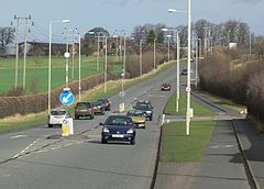
It crosses theEast Coast Main Lineand meets theA15atNew Englandnear to aMorrisons(formerSafeway), and Boulevard and Brotherhood retail parks atWaltonto the north andNew Englandto the south. There is another GSJ nearPastonto the north and it meets the other strand of the A15 at a GSJ nearGunthorpe.It meets the southern terminus of the newA16alignment before meeting the A1139 at a roundabout and crossing theCar Dyke.The 3-mile (4.8 km) £7.2 millionEyeBypass opened asEye Roadin October 1991, diverting traffic from thePaston Parkway,and partly built on the formerPeterborough to Wisbech railway.There is a local access roundabout atEye Greennear theEssoEye Green Service Station,aTravelodgeand the Peterborough Eye formerLittle Chefon the right, where it becomesThorney Road,The Causeway.The landscape becomes very flat known asThe Fens.A 3-mile (4.8 km) dual-carriageway bypass ofThorneyopened on 14 December 2005. The road meets the B1040 and B1167 at roundabouts. NearThorney Toll,the road entersCambridgeshireand the district ofFenlandnear theNew Toll Service Station.The straight road finishes at Guyhirn, meeting the B1187 and crossing on theTiddy Munbridge and following theRiver Neneand the Nene Way. The1⁄2-mile (0.80 km) £3.7 millionGuyhirnDiversion opened in October 1990. The road heads north-east, following the east bank of the River Nene. The 5-mile (8.0 km) £6 millionWisbech/West Walton Bypass opened in autumn 1984. The former route leaves as the B198 at a roundabout. It meets alevel crossing,and it entersNorfolkand the district ofKing's Lynn and West Norfolkjust before a roundabout with the A1101 forElmandEmnethat the Elme Hall Hotel. It passes theTotalWisbech Servicesand then meets the old route (B198) at a roundabout and becomes the 6-mile (9.7 km) £23 million dual-carriagewayWalpole Highway/Tilney High End Bypass which opened in summer 1996. There is an exit for Walpole Highway, and another forTerrington St John.It passes nearTilney High End.NearTilney All Saints,it meets the old route at a roundabout, becoming the single carriagewayMain Road,thenPullover Road.It meets the end of theA17at the "Pullover Roundabout" where theWest LynnLittle Chef is located.
King's Lynn – Great Yarmouth[edit]
This section needs to beupdated.(February 2017) |


From King's Lynn, the road goes over theRiver Great OuseandFen Rivers Way,near to formersugar beetfactory site on a very busy concrete dual-carriageway built in 1975. It meets the A148 at a GSJ. TheA10and theA149have their terminus here, at theHardwick Flyover(opened on 30 October 2003[24]) near the large Hardwick Industrial Estate (formerly home ofCampbell's Soup) and a Ramada Hotel. It becomesConstitution Hill,passingNorth RunctonthenMiddleton,where it passes the Crown public house and St Mary's church as "Lynn Road".
Next isEast Winch,where it passes All Saints's church, thenWest Bilneywhere it passes St Cecilia's church. The former King's Lynn-Swaffham railway crossed at this point. There is a right-turn forPentneyand it meets the B1153 forEast Walton.The half-mile £2.8 millionNarboroughBypass, opened in November 1992, where the road crosses theRiver Narand enters the district ofBreckland.There is a straight section to where it meets the A1122 (forRAF Marham) at a roundabout at the start of the five-mile £5 million part-dual-carriagewaySwaffhamBypass, which opened in June 1981. There is an exit for Swaffham, and a GSJ with theA1065(forFakenham).
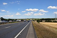
It passes some wind turbines and there is a roundabout where it joins the former route just before it is crossed by thePeddars Way.There is a left turn forSporleand it passesNectonthen heads north-west throughLittle Fransham,passing theCanary and Linnet,with a left turn forCrane's Corner.The seven-mile £5 million part-dual-carriageway East Dereham Bypass opened in spring 1978, which was built on part of the disused railway line. It passes nearWendlingand St Peter and St Paul church then meets the B1146 (for Dereham) and A1075 (forShipdham) near aTescosupermarket and B1135. The B1147 leaves forSwanton Morley.The three-mile £9 million East Dereham-North Tuddenham Improvement opened in August 1992, which passes North Tuddenham. It bypassesHockering.It enters the district ofBroadlandat the start of the bypass ofHoningham,where it crosses theRiver Tud.Just before the roundabout atEaston,it enters the district ofSouth Norfolk.The dual-carriageway £62 million Norwich Bypass opened in September 1992. At theLongwaterIntersection, the A1074 follows the former route through Norwich near the Longwater Retail Park andSainsbury's.NearBawburgh,it crosses theRiver Yare.There is a GSJ with the B1108, forLittle MeltonandColney.AtCringleford,it meets theA11at the Thickthorn Interchange andThickthorn Servicesand crosses theBreckland Line.Near Keswick Hall, it meets theA140at a GSJ at Harford Bridge, south ofNorwich,near a Tesco, then crosses theGreat Eastern Main Line.It is crossed byBoudica's Way,then meets theA146at a GSJ. It crosses the River Yare again at thePostwick Viaductand enters the district of Broadland. It crosses theWherry Lineand meets the A1042 at a GSJ. The section from the end of this bypass toBlofield,the one-mile £1.2 millionPostwick-Blofield Dualling, was opened in November 1987. There is a left turn toGreat Plumstead.The one-mile £4 million dual-carriageway Blofield Bypass opened in February 1983, which starts at a roundabout forBrundall.It becomes single carriageway and passesNorth Burlinghamnear the staggeredWhite Housecrossroads with the B1140. The three-mile £7.1 million dual-carriageway Acle Bypass opened in March 1989, which ends at a roundabout with the A1048 near aTravelodge,becoming the single carriagewayNew Road.From Acle, the road enters the Acle Straight which is nearly seven miles of straight and level single carriageway to Great Yarmouth, with just one curve at Road House Diner. The road is notorious for congestion, especially during the holiday season, and also for the number of accidents, which due to the drainage ditches on either side of the road are often fatal, and demands for dualling have been heard for many years, although there are no current plans to go ahead with this. It enters the district of Great Yarmouth, then passes close toBreydon Water.The northern section of the two-mile £19 million Great Yarmouth Western Bypass (A47) opened in March 1986, and the southern section opened in May 1995.
Great Yarmouth - Lowestoft[edit]


From theAcle Straight,the A47 meets the Vauxhall Roundabout inGreat Yarmouthwhere it intersects with theA149.The A47 follows a route south acrossBreydon Bridgewhich spans the estuary where the RiversYareandBuremeetBreydon Water.It meets at the Gapton Hall Roundabout, which intersects with the A1243. The route continues South, meeting with the Harfrey's Roundabout, which connects the A47 to Great Yarmouth's Herring Bridge. From there the A47 is formed of theGorlestonBypass, a 2.6KM stretch of dual carriageway with a single slip-road connecting it toGorlestonvia theA143.After this, a small section of the A47 runs south past the regions main A&E, theJames Paget University Hospital.Approx 5.5 KM of dual carriageway then takes the A47 to NorthLowestoft,which connects the A47 to the coastal villages ofHoptonandCortonvia 3 roundabouts. The A47 entersSuffolkas its route heads south intoLowestoft,along restricted 30MPH roads. As the A47 intersects with theA1144in the centre of Lowestoft, it branches off into two routes. The main A47 branches past thetowns docks,where it enters a section of 3 lanes controlled bylane tidal flow lights,which predetermine which of the three lanes is open for north or southbound travel over the Bascule Bridge. The secondary A47 branches through the centre of the town, passingLowestoft Railway Stationand meeting the main A47 by the docks just before the bridge. The A47 then terminates at the Bascule Bridge, where theA12begins.[25][26]
Transit service[edit]
- Between Leicester and Uppingham, the A47 is serviced by bus route 747 Uppingham–Leicester.
- First Eastern Counties 'Excel' service X1 follows much of the A47 between Norwich and Great Yarmouth.
First Eastern Counties run an 'Excel' service, with 4 branded routes - A, B, C and D, which primarily serve population centres along the A47, with some routes going as far as Peterborough. [27]
References[edit]
- ^"Guyhirn Bridge – Roader's Digest: The SABRE Wiki".sabre-roads.org.uk.Retrieved3 April2021.
- ^"Environmental protest groups".The Making for the Modern World.Retrieved16 January2008.
- ^"Protest Culture – history".Protest Culture. Archived fromthe originalon 13 October 2007.Retrieved17 January2008.
- ^"Thorney bypass".Archived fromthe originalon 1 December 2008.Retrieved6 November2008.
- ^"A new deal for transport: better for everyone".Department for Transport.Archivedfrom the original on 30 January 2008.Retrieved1 February2008.
- ^Docherty, Iain; Shaw, Jon, eds. (August 2003).A New Deal for Transport: The UK's Struggle with the Sustainable Transport Agenda.Blackwell.ISBN1-4051-0631-X– via archive.org.
- ^"Select Committee on Transport, Local Government and the Regions Eighth Report".House of Commons.Archivedfrom the original on 18 January 2008.Retrieved16 January2008.
- ^Hewett, Emily (7 February 2017)."Why has the A12 between Great Yarmouth and Lowestoft become the A47?".Eastern Daily Press.Retrieved7 February2017.
- ^ "A47 Acle Straight".Highways Agency.Archived fromthe originalon 4 July 2008.Retrieved14 November2008.
- ^ "A47 Norwich to Great Yarmouth Study".Norfolk County Council.Archived fromthe originalon 2 October 2011.Retrieved14 November2008.
- ^"£1.6 Million package of safety measures to improve the A47 Acle Straight in Norfolk".Government News. Archived fromthe originalon 26 July 2011.Retrieved14 November2008.
- ^"Angers over Acle Straight safety study".
- ^"Northern Distributor Road".Norfolk County Council. Archived fromthe originalon 17 September 2008.Retrieved8 November2008.
- ^ "A47 to A1067 Link Road".Norfolk County Council.Retrieved2 July2009.[permanent dead link]
- ^ "The Link Options".Norfolk County Council.Retrieved2 July2009.[permanent dead link]
- ^"A47-A1067 Link Improvement"(PDF).Norfolk County Council.28 January 2008.Retrieved2 July2009.[permanent dead link]
- ^"A47 Strategic Route Prospectus".Norfolk County Council. Archived fromthe originalon 13 January 2013.Retrieved9 June2013.
- ^"A47 Honingham junction to be improved".wayland news. Archived fromthe originalon 20 June 2013.Retrieved9 June2013.
- ^"The full list of road projects in the East".ITV. December 2014.Retrieved22 December2014.
- ^"Ed Balls in vow over A47 upgrade work".Eastern Daily Press. 15 December 2014.Retrieved22 December2014.
- ^"Ashted Circus improvement scheme completed".www.birmingham.gov.uk.6 March 2019.Retrieved14 May2024.
- ^Young, Graham (15 April 2018)."Death of a subway: Famous underground tunnels bite the dust".Birmingham Live.Retrieved14 May2024.
- ^"Oddities and anomalies".Chris Marshall. Archived fromthe originalon 10 March 2013.Retrieved10 June2013.
- ^"Highways Agency – A47 Hardwick roundabout flyover, Kings Lynn [1]".6 September 2008. Archived fromthe originalon 6 September 2008.
- ^"Detailed maps & routes to explore across the UK | OS Maps".explore.osmaps.com.Retrieved5 October2023.
- ^"Work completed early as part of the A12 becomes the A47".GOV.UK.Retrieved5 October2023.
- ^"747 timetable"(PDF).29 August 2021.Archived(PDF)from the original on 11 October 2021.Retrieved11 February2022.

