
Aichi Prefecture
Aichi Prefecture
Ái tri huyện | |
|---|---|
| Japanese transcription(s) | |
| •Japanese | Ái tri huyện |
| •Rōmaji | Aichi-ken |
     Clockwise from top: | |
 Flag  Symbol | |
| Anthem:Warera ga Aichi | |
 | |
 | |
| Coordinates:35°10′43″N136°54′50″E/ 35.17861°N 136.91389°E | |
| Country | |
| Region | Chūbu(Tōkai) |
| Island | Honshu |
| Capital | Nagoya |
| Subdivisions | Districts:7,Municipalities:54 |
| Government | |
| •Governor | Hideaki Ōmura(since February 2011) |
| Area | |
| • Total | 5,172.92 km2(1,997.28 sq mi) |
| • Rank | 27th |
| Population (1 October 2019) | |
| • Total | 7,552,873 |
| • Rank | 4th |
| • Density | 1,500/km2(3,800/sq mi) |
| GDP | |
| • Total | JP¥40,911 billion US$375.3 billion (2019) |
| ISO 3166 code | JP-23 |
| Website | www |
| Symbols of Japan | |
| Bird | Oriental scops owl(Otus sunia japonicus) |
| Fish | Kuruma prawn(Penaeus japonicus) |
| Flower | Kakitsubata(Iris laevigata) |
| Tree | Hananoki (Acer pycnanthum) |
Aichi Prefecture(Ái tri huyện,Aichi-ken,pronounced[aitɕi̥ꜜkeɴ])is aprefectureofJapanlocated in theChūbu regionofHonshū.[2]: 11, 126 Aichi Prefecture has a population of 7,552,873 (as of 1 October 2019[update]) and a geographic area of 5,172.92square kilometres(1,997.28sq mi) with a population density of 1,460 inhabitants per square kilometre (3,800/sq mi). Aichi Prefecture bordersMie Prefectureto the west,Gifu PrefectureandNagano Prefectureto the north, andShizuoka Prefectureto the east.Nagoyais the capital and largest city of the prefecture.
Overview
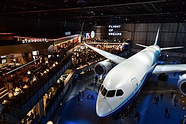
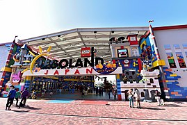
[edit]Nagoya is the capital and largest city of Aichi Prefecture, and the fourth-largest city in Japan. Other major cities includeToyota,Okazaki,andIchinomiya.Aichi Prefecture and Nagoya form the core of theChūkyō metropolitan area,thethird-largest metropolitan area in Japanand one of the largestmetropolitan areasin the world.[2]: 685 Aichi Prefecture is located on Japan'sPacific Oceancoast and forms part of theTōkai region,asubregionof the Chūbu region andKansai region.Aichi Prefecture is home to theToyota Motor Corporation.Aichi Prefecture had many locations with theHigashiyama Zoo and Botanical Gardens,TheChubu Centrair International Airport,and theLegoland Japan Resort.
Geography
[edit]
Government Ordinance Designated CityCityTownVillage


Located near the center of the Japanese main island ofHonshu,Aichi Prefecture faces theIseandMikawa Baysto the south and bordersShizuoka Prefectureto the east,Nagano Prefectureto the northeast,Gifu Prefectureto the north, andMie Prefectureto the west. It measures 106 km (66 mi) east to west and 94 km (58 mi) south to north and forms a major portion of theNōbi Plain.With an area of 5,172.48 square kilometres (1,997.11 sq mi) it accounts for approximately 1.36% of the total surface area of Japan. The highest spot isChausuyamaat 1,415 m (4,642 ft) above sea level.
The western part of the prefecture is dominated byNagoya,Japan's third largest city, and its suburbs, while the eastern part is less densely populated but still contains several major industrial centers. Due to its robust economy, for the period from October 2005 to October 2006, Aichi was the fastest growing prefecture in terms of population, beatingTokyo,at 7.4% and around with afterSaitama Prefecture.
As of 1 April 2012,[update]23% of the total land area of the prefecture was designated asNatural Parks,namely theAichi Kōgen,Hida-Kisogawa,Mikawa Wan,andTenryū-OkumikawaQuasi-National Parks along with seven Prefectural Natural Parks.[3]
Cities
[edit]Thirty-eight cities are located in Aichi Prefecture.


Towns and villages
[edit]These are the towns and villages in eachdistrict:


Demographics
[edit]
| Year | Pop. | ±% p.a. |
|---|---|---|
| 1890 | 1,473,099 | — |
| 1903 | 1,752,042 | +1.34% |
| 1913 | 2,073,224 | +1.70% |
| 1920 | 2,089,762 | +0.11% |
| 1925 | 2,319,494 | +2.11% |
| 1930 | 2,567,413 | +2.05% |
| 1935 | 2,862,701 | +2.20% |
| 1940 | 3,166,592 | +2.04% |
| 1945 | 2,857,851 | −2.03% |
| 1950 | 3,390,585 | +3.48% |
| 1955 | 3,769,209 | +2.14% |
| 1960 | 4,206,313 | +2.22% |
| 1965 | 4,798,653 | +2.67% |
| 1970 | 5,386,163 | +2.34% |
| 1975 | 5,923,569 | +1.92% |
| 1980 | 6,221,638 | +0.99% |
| 1985 | 6,455,172 | +0.74% |
| 1990 | 6,690,603 | +0.72% |
| 1995 | 6,868,336 | +0.53% |
| 2000 | 7,043,300 | +0.50% |
| 2005 | 7,254,704 | +0.59% |
| 2010 | 7,410,719 | +0.43% |
| 2015 | 7,484,094 | +0.20% |
| Source: Statistics Bureau, Ministry of Internal Affairs and Communications[4] | ||
As of 2001, Aichi Prefecture's population was 50.03% male and 49.97% female. 139,540 residents (nearly 2% of the population) are of foreign nationality.
Population by age (2001)
[edit]| Age | % population | % male | % female |
|---|---|---|---|
| 0–9 | 10.21 | 10.45 | 9.96 |
| 10–19 | 10.75 | 11.02 | 10.48 |
| 20–29 | 15.23 | 15.71 | 14.75 |
| 30–39 | 14.81 | 15.31 | 14.30 |
| 40–49 | 12.21 | 12.41 | 12.01 |
| 50–59 | 15.22 | 15.31 | 15.12 |
| 60–69 | 11.31 | 11.22 | 11.41 |
| 70–79 | 6.76 | 6.01 | 7.52 |
| Over 80 | 3.12 | 2.01 | 4.23 |
| Unknown | 0.38 | 0.54 | 0.23 |
Mergers
[edit]History
[edit]Originally, the region was divided into two provinces ofOwariandMikawa.[2]: 780 After theMeiji Restoration,Owari and Mikawa were united into a single entity. In 1871, after theabolition of the han system,Owari, with the exception of theChita Peninsula,was established as Nagoya Prefecture, while Mikawa combined with the Chita Peninsula and formedNukata Prefecture.Nagoya Prefecture was renamed to Aichi Prefecture in April 1872 and was united with Nukata Prefecture on November 27 of the same year.
The government of Aichi Prefecture is located in theAichi Prefectural Government Officein Nagoya, which is the old capital of Owari. TheAichi Prefectural Policeand its predecessor organisations have been responsible for law enforcement in the prefecture since 1871.
TheExpo 2005World Expositionwas held inSetoandNagakute.
Etymology
[edit]In the third volume of theMan'yōshūthere is a poem by Takechi Kurohito that reads: "The cry of the crane, calling to Sakurada; it sounds like the tide, draining from Ayuchi flats, hearing the crane cry". Ayuchi is the original form of the nameAichi,and theFujimae tidal flatis all that remains of the earlier Ayuchi-gata. It is now a protected area.[5][6]
For a time, an Aichi Station existed on theKansai Line(at the time the Kansai Railway) betweenNagoyaandHattastations, but its role was overtaken bySasashima-raibu Stationon theAonami LineandKomeno Stationon theKintetsuNagoya Line.
Economy
[edit]
Gross domestic product(2018) is the second largest in Japan, the shipment value of manufactured goods (2018) is the first in Japan, annual product sales (2019) is the third largest in Japan, and its agricultural output (2018) is eighth in Japan. Aichi's agriculture industry and commerce are all ranked high in Japan, and the industrial structure is well-balanced.
- Main industry
Companies headquartered in Aichi include the following.
| Aichi Steel | Tōkai |
| Aisin Seiki | Kariya |
| Brother Industries, Ltd. | Nagoya |
| Central Japan Railway Company | Nagoya |
| Denso Corporation | Kariya |
| Eisaku Noro Company | Ichinomiya |
| Kanesue Corporation | Ichinomiya |
| Makita Corporation | Anjō |
| Matsuzakaya | Nagoya |
| Mizkan Corporation | Handa |
| Nagoya Railroad | Nagoya |
| Nippon Sharyo | Nagoya |
| Noritake | Nagoya |
| Okuma Corporation | Ōguchi |
| Sumitomo Riko | Komaki[7] |
| Toyota Motor Corporation | Toyota |
Companies such asFuji Heavy Industries,Mitsubishi Motors,Pfizer,Sony,Suzuki,Bodycote,andVolkswagen Groupalso operate plants or branch offices in Aichi.
International relations
[edit]
Sister Autonomous Administrative division
[edit] Victoria,Australia– May 2, 1980
 Jiangsu,China– July 28, 1980
 Bangkok,Thailand– July 9, 2012
- Guangdong,China– November 25, 2013
 Gyeonggi Province,South Korea– November 10, 2015
 Texas,United States– April 22, 2016
 Ho Chi Minh City,Vietnam– September 13, 2016
- Washington,United States– October 18, 2016
 Brussels,Flemish Region,Wallonia,Belgium– May 15, 2017
- Indiana,United States– September 15, 2017
- Kentucky,United States– October 23, 2017
 Occitanie,France– June 5, 2018
 São Paulo,Brazil– September 10, 2018
Transport
[edit]Rail
[edit]


 JR Central
 Tokaido Shinkansen
- ■Tokaido Line
- ■Chūō Main Line
- ■Kansai Line
- ■Taketoyo Line
- ■Iida Line
 Meitetsu
- NHNagoya Line
- IYInuyama Line
- KMKomaki Line
- TACentrair Line
- TATokoname Line
- STSeto Line
- TKToyokawa Line
- GNGamagori Line
- TTToyota Line
- KCChita Line
- MUMYMikawa Line
- TBBisai Line
- CHChikko Line
- TBTsushima Line
 Kintetsu
- ENagoya Line
 Aonami Line
 Nagoya Municipal Subway
 Higashiyama Line
 Meijo Line
 Tsurumai Line(connecting to Meitetsu Toyota and Inuyama Line)
 Sakura-dori Line
 Meiko Line
 Kamiiida Line(connecting to Meitetsu Komaki Line)
 Toyohashi Railroad
 Aichi Loop Line
People movers and tramways
[edit]- Nagoya Guideway Bus
- Linimo
- Toyohashi Railroad
Road
[edit]Expressways and toll roads
- Chuo Expressway
- Higashi-Meihan Expressway(East Meihan Expressway)
- Isewangan Expressway(Ise Bayside Expressway)
- Meishin Expressway
- Mei-Nikan Expressway
- Nagoya Expressway
- Shin-Meishin Expressway
- Shin-Tōmei Expressway
- Tokai-Hokuriku Expressway
- Tomei Expressway
- Chita Peninsula Road
- South Chita Road
- Chubu International Airport Connecting Road
- Chita across Road
- Nagoya Seto Road
National highways
- Route 1
- Route 19(Nagoya-Kasugai-Tajimi-Nagiso-Matsumoto-Nagano)
- Route 22(Nagoya-Ichinomiya-Gifu)
- Route 23(Ise-Matsuzaka-Suzuka-Yokkaichi-Nagoya-Toyoake-Chiryu-Gamagori-Toyohashi)
- Route 41(Nagoya-Komaki-Inuyama-Gero-Takayama-Toyama)
- Route 42
- Route 151
- Route 153
- Route 154
- Route 155(Tokoname-Chita-Kariya-Toyota-Seto-Kasugai-Komaki-Ichinomiya-Tsushima-Yatomi)
- Route 247
- Route 248
- Route 257(Hamamatsu-Shinshiro-Toyota-Ena-Nakatsugawa-Gero-Takayama)
- Route 259
- Route 301
- Route 302
- Route 362
- Route 363
- Route 366
- Route 419
- Route 420
- Route 473(Gamagori-Okazaki-Toyota-Shitara-Hamamatsu)
- Route 474
- Route 475
Airports
[edit]Ports
[edit]- Nagoya Port– International Container hub and ferry route toSendaiandTomakomai, Hokkaido
- Mikawa Port – mainly automobile and car parts export and part of inport base
- Kinuura Port – Handa and Hekinan
Education
[edit]Universities
[edit]National universities
- Aichi University of Education
- Graduate University for Advanced Studies- Okazaki Campus (National Institute for Basic Biology, Japan,National Institute for Physiological Sciences, Japan)
- Nagoya Institute of Technology
- Nagoya University
- Toyohashi University of Technology


Public universities


Private universities
- Aichi Bunkyo University
- Aichi Gakuin University
- Aichi Gakusen University
- Aichi Institute of Technology
- Aichi Medical University
- Aichi Mizuho College
- Aichi Sangyo University
- Aichi Shukutoku University
- Aichi Toho University
- Aichi University
- Aichi University of Technology
- Chubu University
- Chukyo University
- Daido University
- Doho University
- Fujita Health University
- Globis University Graduate School of Management– Nagoya Campus
- Japanese Red Cross Toyota College of Nursing
- Kinjo Gakuin University
- Meijo University
- Nagoya Bunri University
- Nagoya College of Music
- Nagoya Gakuin University
- Nagoya Keizai University
- Nagoya Sangyo University
- Nagoya University of Arts
- Nagoya University of Arts and Sciences
- Nagoya University of Commerce & Business
- Nagoya University of Foreign Studies
- Nagoya Women's University
- Nagoya Zokei University
- Nanzan University
- Nihon Fukushi University
- Ohkagakuen University
- Okazaki Women's Junior College
- Seijoh University
- Seisa University– Nagoya Schooling Campus
- Shigakkan University
- Shubun University
- Sugiyama Jogakuen University
- Tokai Gakuen University
- Tokyo University of Social Welfare– Nagoya Campus
- Toyohashi Sozo College
- Toyota Technological Institute
- University of Human Environments


Senior high schools
[edit]This sectionneeds expansion.You can help byadding to it.(October 2015) |
Sports
[edit]
(NagoyaHigashi-ku)

(Toyota)

(Kariya)

(NagoyaMinato-ku)

(NagoyaMizuho-ku)
The sports teams listed below are based in Aichi.
Baseball
[edit]Soccer
[edit]- Tokai Regional League
Basketball
[edit]- SAN-EN NeoPhoenix(ToyohashiandHamamatsu)
- SeaHorses Mikawa(Kariya)
- Nagoya Diamond Dolphins(Nagoya)
- Toyotsu Fighting Eagles Nagoya(Nagoya)
- Aisin AW Areions Anjo (Anjō)
Volleyball
[edit]- Toyoda Gosei Trefuerza(Inazawa)
- JTEKT Stings(Kariya)
- Denso Airybees(Nishio)
- Toyota Auto Body Queenseis(Kariya)
Rugby
[edit]Futsal
[edit]Football
[edit]- Nagoya Cyclones(Nagoya)
- Kirix Toyota Bull Fighters (Toyota)
- Aichi Golden Wings (NagoyaandToyota)
- AFL
Tourism
[edit]


Notable sites in Aichi include theMeiji Muraopen-air architectural museum inInuyama,which preserves historic buildings from Japan'sMeijiandTaishōperiods, including the reconstructed lobby ofFrank Lloyd Wright's oldImperial Hotel(which originally stood in Tokyo from 1923 to 1967).
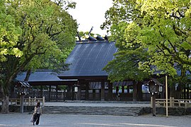
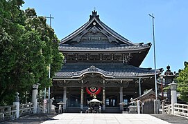
Other popular sites in Aichi include the tour ofToyotacar factory in the city by the same name, the monkey park in Inuyama, and the castles inNagoya,Okazaki,Toyohashi,and Inuyama.
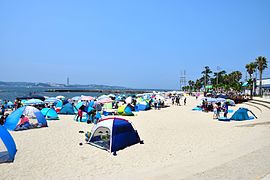
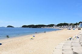
Aichi Prefecture has many wonderful beaches. For example,HimakajimaBeach, Shinojima Beach, Akabane Beach and Utsumi Beach.
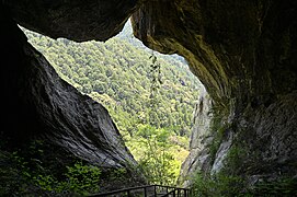
-
-
-

-
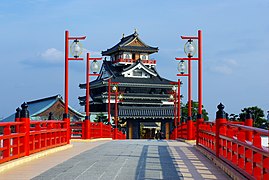 Kiyosu Castleand Kiyosu Castle Park in Kiyosu
 -

-
-

-

-
-
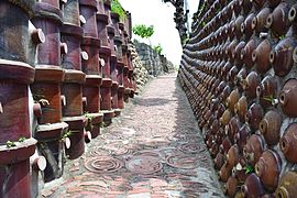 Tokonamepottery footpath
 -
-
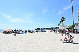 Utsumi Beach(Chidorigahama)
 -
-
-
 Sakushima
 -
 Nishiura Onsen
 -
 Site of Expo 2005
 -
 Field Mustard, Tahara
 -
-

-
-
 Mount Hōraiji
 -
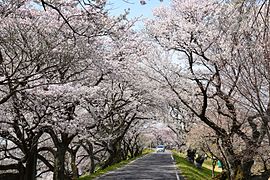
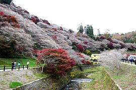 Obara shikizakura
 -
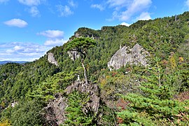
 ChausuyamaPlateau
 -
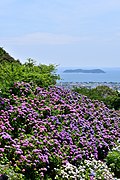 Katahara Onsen(Hydrangea Park)
 -
 The ruins ofMatsudaira
 -
 Sakurabuchi Park
 -
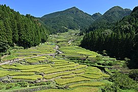 Thousand Rice Paddies of Yotsuya
 -
 Kisogawazutsumi
 -

-
 View ofCape Iragofrom Irago Ocean Resort
 -


Notable people from Aichi
[edit]This sectionneeds expansion.You can help byadding to it.(June 2021) |
- Manabu Kubota(born 1981),footballplayer who played forYokohama FCandNew Wave Kitakyushu.[citation needed]
- F Chopper Koga(Japanese:FチョッパーKOGA,romanized:Efu Choppā Koga), bass player and leader of the rock bandGacharic Spin[citation needed]
- Yūki Ishikawa( thạch xuyên hữu hi ), professional volleyball player, Japan National Team, Power Volley Milano Italy Super Lega
- Takahiro Sakurai(born 1974), Japanese actor, narrator and radio personality
- Syoh Yoshida(born 1984), Japanese artist
- Yuki Yamada(actor) (born 1990), Japanese actor
- Yoshiaki Katayama(born 1993), racing driver
- Tatsuya Kataoka(born 1975), racing driver
- Haruna Ono(musician), lead vocals and rhythm guitarist for the rock band Scandal
- Mami Sasazaki(musician), lead guitar and vocalist for the rock band Scandal
- Suzuki Ichiro,professional baseball player, member ofJapan national baseball teamand 2x timeWorld Baseball ClassicChampion
- Koji Kondo(born 1961),composerandpianistborn inNagoyawho works onvideo game soundtracksforNintendo
- Kazuchika Okada(born 1987),professional wrestlerfromAnjō
- Akira Toriyama(born 1955),manga artistand character designer fromKiyosu[8]
- Aoi Morikawa(born 1995), actress and model[9]
- Sato Keigo (born 1998), singer, member ofJO1
- Kimata Syoya (born 2000), singer, member ofJO1
- Kimura Masaya (born 1997), singer, dancer, member ofINI (Japanese boy group)
- Sakurai Miu (born 2002), singer, member ofMe:I
- Kato Cocoro (born 2000), singer, member ofMe:I
- Maria Makino,idol singer and member ofMorning Musume
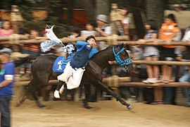
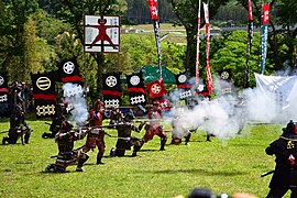
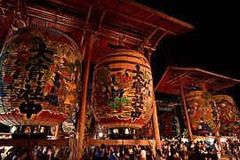
Festival and events
[edit]- Owari TsushimaTenno Matsuri(Aisai,Tsushima)
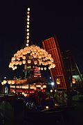
- Inuyama Festival (Inuyama)
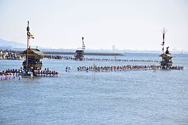
- Kamezaki Shiohi Festival (Handa)
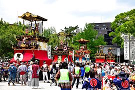
- Chiryu Festival (Chiryū)
- Sunari Festival (Ama DistrictKanie)
-
 Owari Tsushima Tennōsai (eve)
 -
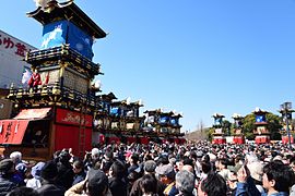 Inuyama Festival
 -
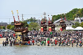 Kamezaki Shiohi Festival
 -
 Chiryu Festival
 -
 Sunari Festival


- Others
- Nagoya Festival (Nagoya City)
- Tsutsui-chō/Dekimachi Tennō Festival (NagoyaHigashi-ku)
- Miya Festival (Gamagōri)
- Toyohama Sea bream Festival (Chita DistrictMinamichita Town)
- Okkawa Festival (Handa)
- Hōnen Matsuri(Komaki)
- Omanto festival (Takahama)
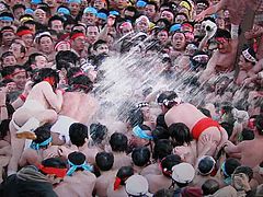
- KōnomiyaHadaka Matsuri(Inazawa)
- Tezutsu Matsuri (Toyohashi,Toyokawa)
- Nagashino festival (Shinshiro)
- Mando festival (Kariya)
- Isshiki Lantern Festival (Nishio)
- Toba Fire Festival (Nishio)
- Owari Tsushima Autumn Festival (Tsushima)
-
 Nagoya Festival
 -
 Tsutsui-chō/Dekimachi Tennō Festival
 -
 Miya Festival
 -
 Toyohama Sea bream Festival
 -
 Okkawa Festival
 -

-
 Omanto festival
 -
 KōnomiyaHadaka Matsuri
 -
 Toyokawa Tezutsu Matsuri
 -
 Nagashino festival
 -
 Mando festival
 -
 Isshiki Lantern Festival
 -
 Toba Fire Festival
 -
 Owari Tsushima Autumn Festival


References
[edit]- ^"2020 niên độ quốc dân kinh tế kế toán ( 2015 niên cơ chuẩn ・2008SNA ): Kinh tế xã hội tổng hợp nghiên cứu sở - nội các phủ".Nội các phủ ホームページ(in Japanese).Retrieved2023-05-18.
- ^abcFrédéric, Louis(31 May 2002).Japan Encyclopedia.Translated by Roth, Käthe.Harvard University Press.ISBN978-0674007703.OCLC58053128.OL7671330M.
- ^"General overview of area figured for Natural Parks by prefecture"(PDF).Government of Japan.Ministry of the Environment.1 April 2014.Archived(PDF)from the original on 5 November 2020.Retrieved11 November2020.
- ^"Statistics Bureau Home Page".Ministry of Internal Affairs and Communications.Statistics Bureau.n.d.Archivedfrom the original on 8 November 2020.Retrieved12 November2020.
- ^"Summary of Aichi Prefecture".Aichi Prefectural Government Official Site.Aichi Prefectural Government Office. n.d.Archivedfrom the original on 29 October 2020.Retrieved11 November2020.
- ^Sadamichi, Kato (1 July 2000). "Rediscovering an Ancient Poem to Save a Tidal Flat".International Studies in Literature and Environment.7(2).Oxford University Press:189–197.doi:10.1093/isle/7.2.189.eISSN1759-1090.ISSN1076-0962.OCLC819414712.
- ^"Business Locations".Sumitomo Riko.Archivedfrom the original on 12 November 2020.Retrieved11 November2020.
- ^Yoon, John; Notoya, Kiuko (8 March 2024)."Akira Toriyama, Creator of 'Dragon Ball,' Dies at 68".The New York Times.Retrieved21 March2024.
- ^"STモデル プロフィール: Sâm xuyên quỳ ( もりかわ あおい ) Aoi Morikawa|Seventeen(セブンティーン)".SeventeenOn Line(in Japanese). Archived fromthe originalon 29 March 2015.Retrieved19 June2015.
- ^"Yama, Hoko, Yatai, float festivals in Japan".Website of the Convention for the Safeguarding of the Intangible Cultural Heritage.UNESCO.Secretariat of the Convention for the Safeguarding of the Intangible Cultural Heritage.n.d.Archivedfrom the original on 10 July 2020.Retrieved12 November2020.
External links
[edit] Aichitravel guide from Wikivoyage
- Official website
- Aichi Now-Official Site for Tourism Aichi
- Aichi, HOME of the Samurai SpiritArchived2013-11-27 at theWayback Machine
| Nagoya |
| |||
|---|---|---|---|---|
| Core cities | ||||
| Special city | ||||
| Cities | ||||
| Districts | ||||
| Former Districts | ||||

| International | |
|---|---|
| National | |
| Geographic | |
| Academics | |
| Other | |
Host cities ofAsian Games | ||
|---|---|---|
| Summer | ||
| Winter | ||