
Apatin
Apatin
Abthausen | |
|---|---|
    From top: Freedom Square,Our Lady Catholic Church,Town Hall, Apatin Brewery | |
 Coat of arms | |
 Location of the municipality of Apatin within Serbia | |
| Coordinates:45°40′N18°59′E/ 45.667°N 18.983°E | |
| Country | |
| Province | |
| Region | Bačka(Podunavlje) |
| District | West Bačka |
| Municipality | Apatin |
| Settlements | 5 |
| Government | |
| • Municipal president | Dubravka Korać (SNS) |
| Area | |
| • Town | 112.93 km2(43.60 sq mi) |
| • Municipality | 379.00 km2(146.33 sq mi) |
| Elevation | 82 m (269 ft) |
| Population (2022 census)[3] | |
| • Town | 14,613 |
| • Town density | 130/km2(340/sq mi) |
| • Municipality | 23,155 |
| • Municipality density | 61/km2(160/sq mi) |
| Time zone | UTC+1(CET) |
| • Summer (DST) | UTC+2(CEST) |
| Postal code | 25260 |
| Area code | +381 25 |
| Car plates | SO |
| Website | www |
Apatin(Serbian Cyrillic:Апатин,Hungarian:Apatin,Croatian:Apatin) is a town and municipality located in theWest Bačka Districtof the autonomous province ofVojvodina,Serbia.As of 2022 census, the population of the town is 14,613, while the municipality has 23,155 inhabitants.
Name[edit]
InSerbian,the town is known asApatin(Апатин), while the same name is also used inRomanian,Croatian(Šokac), andHungarian.InGermanit was calledAbthausen.According to some claims, the nameApatinis derived from the old formOpaty,by which the town was first mentioned in the 11th century.[4]
Geography[edit]
The Municipality of Apatin is located on the left bank of theDanuberiver between the municipalities ofSombor(to the northeast) andOdžaci(to the southeast).
Apatin is situated in the north-western part of the spacious plain inBačka,on the left side of theDanube.It is in the autonomous province ofVojvodina.
History[edit]
The favourable geographic position, proximity to the Danube, and natural wealth of this area (fruitful ground, woods next to the river, abundance of fish in swampy regions and backwaters, and game in woods) attracted people through all ages and made them settle here. Because of these reasons, even in pre-historic times, cultures such as theSarmatians,theCelts,theGothsand many others were replacing each other within this region, one by one.
In the first century, during the Roman conquest, the settlement was turned into a military trench with fortifications, and played an important role in the defense of thePannoniaprovince. Subsequently, the area came under control of theHuns,GepidsandAvars.In the sixth century theSlavssettled,[5]and in the ninth century, the area was included into theBulgarian Empire.Bulgarian dukeSalanwho had residence inTitelruled over region ofBačka.In the tenth century theHungarianscame to Central Europe, thereby establishing a state, which was populated by both, Hungarians and Slavs.
The first mentioning of Apatin in any written script was in the year 1011, by the Abbey ofKalocsaBishopric. According to other source, Apatin was firstly mentioned in 1407. During this time, settlement was part of theBodrogiensis Countywithin the medievalKingdom of Hungary.
During the 14th and 15th centuries, the area became feudalistic, and in exchange for lands, the vassals would need to complete military service to the lord of the property. Many fishermen, hunters, and millers then began to settle down in this area.
In 1417, Apatin is mentioned as a property ofStefan Lazarević,who was crowned as the Despot of Serbia in 1402.[6]In 1526-1527 it belonged to the short-lived Serb state ofEmperor Jovan Nenad,and soon after (in 1541) this area became part of theOttoman Empire.During the Ottoman administration Apatin was part of theSanjak of Segedinand was mainly populated by ethnic Serbs.
In the end of the 17th century it became part of theHabsburg monarchy.Many of the refugees during the massive migration of Serbs led byArsenije Čarnojevićin 1690, came to Apatin,SomborandPrigrevica,thus the Serb population in this area increased. A new wave of colonisation occurred in 1748 when many German colonists settled in Apatin, pushing out the Serbs mostly by force, who then evacuated towardsStapar.

The German colonists came from many different regions. The gathering centre was inUlm,Germany and from that point they were transported by the Danube to Apatin, which became the main base of the German expansion in Vojvodina. The church was built near the port and the city square was also built at this time. The real estate value of buildings, such as schools, fishermen's station, hand craft's workshops, began to rise.
The Chamber of Court decided to put forth economic objectives to better the economy, and in 1756 the brewery and distillery were built. In 1764 a large textiles factory was built. In 1760 Apatin was officially proclaimed a town and a main trade centre with a special status.
At the end of the 18th century, a catastrophic flood destroyed the old town square, and ruined half of the settlement. The new square was built north-westward from the brewery. The town as seen today, began to take shape. During the 18th and in the early part of 19th century, Apatin had prospered economically, mostly because of developed trade, handcraft and shipbuilding.
During the initial years of the Habsburg administration, Apatin was administratively a part of theBatsch Countywithin theHabsburg Kingdom of Hungary.Subsequently, it was included into the newly formedBatsch-Bodrog County.In 1848-1849 Apatin was part of theSerbian Voivodship,a Serb autonomous region withinAustrian Empire,and between 1849 and 1860 it was part of theVoivodeship of Serbia and Banat of Temeschwar,a separate Austrian province. After abolishment of the voivodeship, in 1860 it was again included intoBatsch-Bodrog Countywithin the HabsburgKingdom of Hungary,which became one of two autonomous parts of the Monarchy after 1867.

In the year of 1869 numerous banks and saving-banks were established, and that opened the door to industrial development. A great number of brickyards produced brick and tile, which were used to construct many buildings inViennaand almost all inPest.In 1912 Apatin was connected to Sombor and Sonta by the railroad, and the following year, a shipyard was founded. Today, the shipyard has been modernized as it the only shipyard on the whole Danube which has a special lift for quickly drawing boats out onto the docks. According to 1910 census, most of the inhabitants of Apatin spoke the German language.
In 1918, as part ofBanat, Bačka and Baranja,Apatin became part of theKingdom of Serbia,which later together with theKingdom of Montenegroand theState of Slovenes, Croats and Serbsformed theKingdom of Serbs, Croats and Slovenes(renamed toYugoslaviain 1929). In 1918–1919, Apatin was part of theBanat, Bačka and Baranjaregion and also (from 1918 to 1922) part of theNovi SadDistrict. Between 1922 and 1929, the town was part of theBačka Oblastand between 1929 and 1941, part of theDanube Banovina,one of the provinces of theKingdom of Yugoslavia.
WhenAxis Powersinvaded, occupied and partitionedYugoslaviain 1941, Apatin was included intoBács-Bodrog Countywithin theHorthy'sHungary.The town remained under Axis control until 1944. During theBattle of Batina,the front was stretched all the way to Apatin andBogojevo,and these places became military bases overnight. YugoslavPartisansentered Apatin on October 24, 1944, and since then Apatin was part of the Yugoslav Autonomous Province ofVojvodina,which (from 1945) was part of the People's Republic ofSerbiawithin the new SocialistYugoslavia.
In 1944, as a consequence of World War II events in Yugoslavia, one part of Yugoslav citizens of German ethnicity left from the area, together with defeated German army. The antifascist council for deliberation of Yugoslavia (AVNOJ) declared the remaining German population as public enemies and sent them to communist prison camps, where one part of them died from disease, cold and malnutrition. The death toll among the German population of Apatin amounts to 2,074 people known by name. This figure includes the victims of deportation to the USSR.[7]After prison camps were dissolved (in 1948), most of the remaining German population left Yugoslavia in subsequent decades, mainly because of economic reasons. After the war, Apatin was populated by (mainly Serb) settlers from other parts of Yugoslavia, largely fromLika.Population censuses conducted after World War II recorded Serbs as the largest ethnic group in the town.
Between 1992 and 2003, Apatin was part of theFederal Republic of Yugoslavia,between 2003 and 2006 part of the State Union ofSerbia and Montenegro,and since 2006 it is part of an independentSerbia.
Inhabited places[edit]


Apatin municipality includes the city of Apatin and the following villages:
Demographics[edit]
| Year | Pop. | ±% p.a. |
|---|---|---|
| 1948 | 31,145 | — |
| 1953 | 32,612 | +0.92% |
| 1961 | 34,836 | +0.83% |
| 1971 | 34,279 | −0.16% |
| 1981 | 33,843 | −0.13% |
| 1991 | 32,999 | −0.25% |
| 2002 | 32,813 | −0.05% |
| 2011 | 28,929 | −1.39% |
| Source:[8] | ||
According to the last official census done in 2011, the municipality of Apatin has 28,929 inhabitants.
Ethnic groups in the municipality[edit]
As many as 24ethnic groupslive in the Apatin municipality, including:[9]
- Serbs= 18,164 (62.79%)
- Hungarians= 3,102 (10.72%)
- Croats= 3,015 (10.42%)
- Romanians= 1,148 (3.97%)
- Romani= 654 (2.26%)
- Others (includingMontenegrins,(Macedonians)Bulgarians,Bosniaks,Germans,Slovaks,etc.).
Settlements by ethnic majority[edit]
Settlements with aSerbethnic majority are Apatin and Prigrevica. The settlement with aCroat/Šokacethnic majority is Sonta. Settlements withHungarianethnic majority are Kupusina and Svilojevo.
Ethnic groups in the town[edit]
- Serbs = 13,990 (72.41%)
- Romanians = 967 (5.01%)
- Hungarians = 848 (4.39%)
- Croats = 658 (3.41%)
- Yugoslavs = 612 (3.17%)
- Roma = 369 (1.91%)
- Germans = 142 (0.74%)
- Montenegrins = 100 (0.52%)
- Others.
Spa[edit]
Near the city of Apatin lies the Junaković spa. It is a modern and well-equipped rehabilitation and recreation centre with sports fields, outdoor pools, indoor therapy, and saunas.
Buildings[edit]
Major buildings in Apatin include the newOrthodox Christiancathedral, theCatholicchurchof TheAssumption of Mary(built in the 18th century), theApatin city hall,and theSpeiser mausoleum.
Economy[edit]
As of September 2017, Apatin has one of 14free economic zonesestablished in Serbia.[10]It covers 160 hectares of ground next to riverDanube,and forms so called "Free Port Apatin" (Serbian:"Slobodna zona Apatin").
The largest companies in Apatin today are theApatin Brewery,"Jedinstvo" (agricultural company) and "Apatin Shipyard" (formerly known as Boris Kidrič Shipyard).
The following table gives a preview of total number of registered people employed in legal entities per their core activity (as of 2018):[11]
| Activity | Total |
|---|---|
| Agriculture, forestry and fishing | 559 |
| Mining and quarrying | 1 |
| Manufacturing | 1,613 |
| Electricity, gas, steam and air conditioning supply | 19 |
| Water supply; sewerage, waste management and remediation activities | 60 |
| Construction | 177 |
| Wholesale and retail trade, repair of motor vehicles and motorcycles | 799 |
| Transportation and storage | 338 |
| Accommodation and food services | 227 |
| Information and communication | 22 |
| Financial and insurance activities | 75 |
| Real estate activities | 11 |
| Professional, scientific and technical activities | 169 |
| Administrative and support service activities | 223 |
| Public administration and defense; compulsory social security | 321 |
| Education | 416 |
| Human health and social work activities | 396 |
| Arts, entertainment and recreation | 63 |
| Other service activities | 101 |
| Individual agricultural workers | 220 |
| Total | 5,812 |
Tourist attraction[edit]
Apatin has popular tourist location, and because of its proximity to the Danube river and the forests, it is gathering place for fishermen and hunters. There is also an annual gathering calledApatinske ribarske večeri(Apatin Fishermen Nights), which has taken place for the last forty some years.Ribarske večeriusually starts on July 1, and lasts five or seven days.
Sport[edit]
Apatin has a rich history in sports.Željko Rebračais by far the most famous athlete from this area, but in the past, Apatin has had athletes represent Yugoslavia (and now Serbia) on the international stage. Today, some of the well known professional sports clubs are:
- FK Mladost- member of the Serbia First League Soccer Association
- RK Apatin- member of the Serbia Second League Handball Association
Notable natives and residents[edit]
- Paul Abraham,composer of Jewish-Hungarian descent
- Frank Dancevic,Serbian-Canadian tennis player whose father hails from Apatin[12]
- Nenad Medić,poker player
- Gyula Pártos,Hungarian architect
- Lajos Szűcs,Hungarian footballer
- Željko Rebrača,basketball player
- Ervin Šinko,writer of Croatian–Hungarian descent
See also[edit]
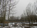
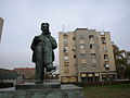
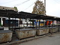
Gallery[edit]
-
 Apatin's fishermen nights (main event pictured, fish soup contest)
 -
 Apatin
 -
 Apatin
 -
 Apatin
 -
 Apatin
 -
 Apatin
 -
 Apatin, Danube
 -
 Apatin
 -
 Apatin
 -
 Apatin
 -
 Apatin česma
 -
 Apatin
 -
 Apatin


References[edit]
- ^"Municipalities of Serbia, 2006".Statistical Office of Serbia.Retrieved2010-11-28.
- ^"Насеља општине Апатин"(PDF).stat.gov.rs(in Serbian). Statistical Office of Serbia. Archived fromthe original(PDF)on 6 March 2016.Retrieved24 October2019.
- ^"2022 Census of Population, Households and Dwellings: Ethnicity (data by municipalities and cities)"(PDF).Statistical Office of Republic Of Serbia, Belgrade. April 2023.ISBN978-86-6161-228-2.Retrieved2023-04-30.
- ^DATANET.RS Galerija Meander/Gallery MeanderArchivedMarch 15, 2012, at theWayback Machine
- ^"Photographic image of map"(JPG).Andrzejb.net.Retrieved2017-08-28.
- ^"Zvanična prezentacija Opštine Apatin - Istorija Apatina".Archived fromthe originalon 2012-04-16.Retrieved2012-05-07.
- ^Arbeitskreis Dokumentation: Verbrechen an den Deutschen in Jugoslawien 1944–1948, Die Stationen eines Völkermordes, 2000, Munich
- ^"2011 Census of Population, Households and Dwellings in the Republic of Serbia"(PDF).stat.gov.rs.Statistical Office of the Republic of Serbia.Retrieved12 December2017.
- ^"Population by ethnicity – Apatin".Statistical Office of the Republic of Serbia (SORS).Retrieved23 February2013.
- ^Mikavica, A. (3 September 2017)."Slobodne zone mamac za investitore".politika.rs(in Serbian).Retrieved17 March2019.
- ^"MUNICIPALITIES AND REGIONS OF THE REPUBLIC OF SERBIA, 2019"(PDF).stat.gov.rs.Statistical Office of the Republic of Serbia.25 December 2019.Retrieved28 December2019.
- ^"Odbegla misica reprizirala venčanje u zavičaju".Blic.rs.27 November 2015.Retrieved2017-08-28.
Further reading[edit]
- Rajić, Rade, and Dragan Radonić. Apatin i despot Stefan Lazarević. Opštinski kulturni centar, 2002.
External links[edit]
Cities, towns and villages in theWest Bačka District | ||
|---|---|---|
| Sombor |  | |
| Apatin | ||
| Kula | ||
| Odžaci | ||
boldaremunicipalities or cities | ||


| Spas (thermal, mud and air) |
|  |
|---|---|---|
| Unregulated, undeveloped and former spas |
| |
| International | |
|---|---|
| National | |