
Argen
| Argen | |
|---|---|
 The Argen upstream of the suspension bridge betweenKressbronn am BodenseeandLangenargen | |
 | |
| Location | |
| Country | Germany |
| State | Baden-Württemberg |
| Districts | RavensburgandBodenseekreis |
| Physical characteristics | |
| Source | |
| • location | Confluence ofUntere ArgenandObere Argen,betweenNeukirchand Neuravensburg |
| • coordinates | 47°39′17″N9°44′40″E/ 47.65472°N 9.74444°E |
| • elevation | 496 m (1,627 ft) |
| Mouth | |
• location | IntoLake ConstancebetweenKressbronn am BodenseeandLangenargen |
• coordinates | 47°35′14″N9°33′19″E/ 47.58722°N 9.55528°E |
• elevation | 395 m (1,296 ft) |
| Length | 23.2 km (14.4 mi) (withObere Argen 73.2 km or 45.5 mi)[1][2] |
| Basin size | 654 km2(253 sq mi)[1][2] |
| Discharge | |
| • average | 20.5 m3/s (720 cu ft/s) |
| Basin features | |
| Progression | Lake Constance→Rhine→North Sea |
| Tributaries | |
| • right | Bollenbach |
TheArgenis a river in Baden-Württemberg, Germany. It flows intoLake ConstancebetweenKressbronn am BodenseeandLangenargenas the third largest tributary to the lake. It is 23.4 kilometres (14.5 mi) long; if one includes theObere Argenand its source river Seelesgraben, the combined length is 73.2 kilometres (45.5 mi).[1][2]
Course
[edit]The headwaters of the Argen arise in theAllgäu.There are two headwaters: the Obere Argen and the Untere Argen. The two arms wrap around theGroße KreisstadtofWangen im Allgäuand meet each other in the Neuravensburg district of Wangen im Allgäu.
Untere Argen
[edit]The origin of theUntere Argenis the confluence of Börlasbach and Stixnerbach at the western entrance toMissenat about 850 metres (2,790 ft) above sea level in the Allgäu region of Bavaria. From the confluence, it first flows north toIsny im Allgäu,then northwest toWaltershofen,then southwest to Primisweiler. Past Primisweiler, it merges with the Obere Argen.
The main tributaries are theWengener Argenand theHaslach.
The Federal highwayA96crosses it a number of times.
Obere Argen
[edit]TheObere Argenoriginates in a marshy area north-west ofOberstaufenin the Allgäu. It initially flows through theEistobelgorge, then underneath theArgentobelbrücke,and pastGrünenbachtowards Wangen im Allgäu. From there it flows on via Neuravensburg to Pflegelberg, where it is united with the Untere Argen.
Lower reaches
[edit]
Geomorphologically,the Argen has cut a deep and wide valley into the landscape, leading to such place names asGitzensteig.In some places, the valley is over a kilometre wide. The edges of the valley occasionally rise steeply up to 100 metres (330 ft), and the valley floor is at the level of Lake Constance.
Further down its course, the river bed becomes increasingly broader. The river here flows past the villages ofLaimnau,Apflauand Badhütten. In the lower part of its course, the Argen was straightened out considerably. It no longer hasoxbow lakesbecause of the intensive valley agriculture. In recent years the massive concrete walls alongside the river have been replaced with large boulders in most of the shallower zones. Near theestuaryat Kressbronn, gravel is mined in larger quantities, creating new lakes along the river.
Ruins
[edit]The ruins of several castles and palaces flank the lower reaches of the Argen:Altsummerau,Neusummerau,the late medievalGießen Castleat Kreisbrunn,Achberg CastleandNeuravensburg Castle.Remains of an ancienthill fortcan be found in the woods above the river.
Mouth
[edit]The mouth intoLake Constanceis flanked on both sides by small harbours for pleasure boats. On the left is a camping grounds nameGohren.There is another camping grounds with restaurant at Laimnau. At its mouth, the Argen is 30 metres (98 ft) wide. To prevent flooding, several protective walls have been constructed along the river.
Kayakingis possible; bathing facilities are available.
Level
[edit]
About 200 metres (660 ft) below theGießenbrückebridge in Kressbronn (river km 5.8), a water level measuring station exists on the Kressbronn side of the river. It is operated by the "Flood Forecasting Centre Baden-Württemberg," the "State Institute for Environment, Measurements and Nature Conservation Baden-Württemberg," and by theRegierungsbezirkTübingen.The zero level for this station is at an elevation of 420.13 metres (1,378.4 ft).
Statistical values
[edit]- Mean lowest water level 1980–2003: 0.29 metres (0.95 ft), 4.87 cubic metres per second (172 cu ft/s)
- Average water level in the years 1980–2003: 0.57 metres (1.9 ft), 20.50 cubic metres per second (724 cu ft/s)
- Historical record levels, flooding on 22 May 1999: 3.58 metres (11.7 ft)
Nature reserve
[edit]
An area of approximately 296 hectares (730 acres) flanking the Argen was declared anature reserveby the regional council of Tübingen on 16 December 1997. Its official name isNaturschutzgebiet Argenand it is registered as reserve number 4282. The reserve covers the area between the confluence of the Obere and Untere Argen and the mouth into Lake Constance. It includes the river, steep slopes, floodplain forest and swamp forests, valleys and flood embankments. Of the total, 234.8 hectares (580 acres) of the reserve are in theBodenseekreisdistrict and 61.54 hectares (152.1 acres) in theRavensburgdistrict.[3]
History
[edit]InAlamannia,aCarolingiancounty namedArgungowe(i.e.Argen County) was recorded from the end of the 8th century.
Marathon
[edit]The roads along the Argen between Argensteg and Gießenbrücke are used in the annualBodensee-Marathon.Runners must run on the road on the Kressbronn side to Gießenbrücke, cross the bridge and run along the river on the Langenargen side to Argensteg, then via Gohren to the finish at Kressbronn Lakeside Sports Hall.
Gallery
[edit]-
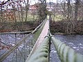
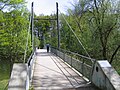 Argensteg
 -
 Lake Constance Belt Railway Bridge
 -
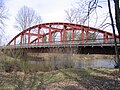 Kocher Bridge
 -
 Federal Road B 467
 -
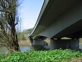
 Gießen Bridge
 -
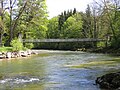 Bridge at Heggelbach
 -
 Bridge atAchberg Castle


See also
[edit]Further reading
[edit]- Norbert Kruse:Die Argen und ihre Namen,in:Im Oberland,issue 2, 2002, pp. 55–64.
- Hermann Vogelmann (1988),Die Argen. Von den Quellen bis zur Mündung,Eppe,ISBN3-89089-009-1.
References
[edit]- ^abcComplete table of the Bavarian Waterbody Registerby the Bavarian State Office for the Environment (xls, 10.3 MB)
- ^abcMap services of the Baden-Württemberg State Office for the Environment, Survey and Conservation (Landesanstalt für Umwelt, Messungen und Naturschutz Baden-Württemberg)
- ^"Home".lubw.baden-wuerttemberg.de.
External links
[edit]- Pictures around the Argen
- Data from the level measuring station below Gießen Bridge
- Vibrational modes of the suspension bridge over the Argen at Achberg


| International | |
|---|---|
| National | |