
Bayannur
Bayannur
Ba ngạn náo nhĩ thị •ᠪᠠᠶᠠᠨᠨᠠᠭᠤᠷ ᠬᠣᠲᠠ | |
|---|---|
 Linhe District, the seat of Bayannur | |
 Location of Bayannur City jurisdiction in Inner Mongolia | |
 Bayannur Location of the city centre in Inner Mongolia | |
| Coordinates (Bayannur municipal government):40°44′35″N107°23′13″E/ 40.743°N 107.387°E | |
| Country | People's Republic of China |
| Region | Inner Mongolia |
| Municipal seat | Linhe District |
| Government | |
| • CPC Secretary | Nashunmenghe |
| • Mayor | He Yonglin |
| Area | |
| •Prefecture-level city | 65,788 km2(25,401 sq mi) |
| • Urban (2017)[1] | 80.51 km2(31.09 sq mi) |
| •Districts[1] | 2,354.0 km2(908.9 sq mi) |
| Population (2010) | |
| •Prefecture-level city | 1,669,915 |
| • Density | 25/km2(66/sq mi) |
| •Urban (2017)[1] | 385,700 |
| • Urban density | 4,800/km2(12,000/sq mi) |
| • Districts[1] | 608,000 |
| GDP[2] | |
| •Prefecture-level city | CN¥88.7 billion US$14.2 billion |
| • Per capita | CN¥ 52,987 US$ 8,507 |
| Time zone | UTC+8(China Standard) |
| Postal code | 015000 |
| Area code | 0478 |
| ISO 3166 code | CN-NM-08 |
| Website | bynr.gov.cn |
| Bayannur | |||||||||||
|---|---|---|---|---|---|---|---|---|---|---|---|
| Chinese name | |||||||||||
| Simplified Chinese | Ba ngạn náo nhĩ | ||||||||||
| Traditional Chinese | Ba ngạn náo nhĩ | ||||||||||
| |||||||||||
| Mongolian name | |||||||||||
| Mongolian Cyrillic | Баяннуур хот | ||||||||||
| Mongolian script | ᠪᠠᠶᠠᠨᠨᠠᠭᠤᠷ ᠬᠣᠲᠠ | ||||||||||
| |||||||||||
BayannurorBayannao'er(Chinese:Ba ngạn náo nhĩ thị;pinyin:bāyànnàoěr;Mongolian:![]() Bayannaɣur qota,Mongolian CyrillicБаяннуур хот) is a prefecture-level city in westernInner Mongolia,People's Republic of China. Until 1 December 2003, the area was calledBayannurLeague.
Bayannaɣur qota,Mongolian CyrillicБаяннуур хот) is a prefecture-level city in westernInner Mongolia,People's Republic of China. Until 1 December 2003, the area was calledBayannurLeague.
Bayannur has an administrative area of 65,788 km2(25,401 sq mi). The name of the city in Mongolian means "Rich Lake". As of the 2010 census, the population of Bayannur was 1,669,915; while the city proper, Linhe District, had 520,300 inhabitants.[3]
The city is served by theBayannur Tianjitai Airport.
History
[edit]TheZhao dynasty(403 BCE–222 BCE) controlled an area including modern-day Bayannur, while theWestern Han dynasty(206 BCE–24 CE) established a hierarchical Chinese administrative structure. TheQing dynasty(1644–1912) designated this area as part of "Inner Mongolia", but after its overthrow by theRepublic of China (1912–1949),Bayannur was assigned toSuiyuan Province.Because ofMongol-Chinesecooperation with theCommunistfaction in theChinese Civil War(stalled since 1950), Suiyuan was annexed to the newInner Mongolia Autonomous Regionfrom 1954, although not without controversy because of the province's large and longstandingethnic Hanmajority.[citation needed]
Geography and climate
[edit]Bayannur is located in the western part of inner Mongolia Autonomous region. Neighbouring prefectures are:
It also borders Mongolia to the north. The whole area of the prefecture is 65,788 km2(25,401 sq mi) at present and the total population is nearly 1.7 million. Bayannur features adesert climate(KöppenBWk), marked by long, cold and very dry winters, very warm, somewhat humid summers, and strong winds, especially in spring. Most of the rain falls between July and September, with very little snow in winter.
| Climate data for Bayannur (Linhe District), elevation 1,041 m (3,415 ft), (1991–2020 normals, extremes 1956–2010) | |||||||||||||
|---|---|---|---|---|---|---|---|---|---|---|---|---|---|
| Month | Jan | Feb | Mar | Apr | May | Jun | Jul | Aug | Sep | Oct | Nov | Dec | Year |
| Record high °C (°F) | 12.3 (54.1) |
16.9 (62.4) |
24.2 (75.6) |
33.3 (91.9) |
36.6 (97.9) |
39.1 (102.4) |
39.4 (102.9) |
37.9 (100.2) |
36.0 (96.8) |
29.9 (85.8) |
20.2 (68.4) |
12.4 (54.3) |
39.4 (102.9) |
| Mean daily maximum °C (°F) | −3.1 (26.4) |
2.5 (36.5) |
10.0 (50.0) |
18.5 (65.3) |
24.8 (76.6) |
29.4 (84.9) |
31.1 (88.0) |
28.9 (84.0) |
23.8 (74.8) |
16.1 (61.0) |
6.2 (43.2) |
−1.4 (29.5) |
15.6 (60.0) |
| Daily mean °C (°F) | −9.4 (15.1) |
−4.7 (23.5) |
2.9 (37.2) |
11.3 (52.3) |
17.8 (64.0) |
22.9 (73.2) |
24.8 (76.6) |
22.5 (72.5) |
16.7 (62.1) |
8.8 (47.8) |
0.2 (32.4) |
−7.1 (19.2) |
8.9 (48.0) |
| Mean daily minimum °C (°F) | −14.5 (5.9) |
−10.4 (13.3) |
−3.1 (26.4) |
4.3 (39.7) |
10.7 (51.3) |
16.2 (61.2) |
18.7 (65.7) |
16.7 (62.1) |
10.7 (51.3) |
3.1 (37.6) |
−4.3 (24.3) |
−11.6 (11.1) |
3.0 (37.5) |
| Record low °C (°F) | −35.3 (−31.5) |
−32.4 (−26.3) |
−19.1 (−2.4) |
−10.3 (13.5) |
−3.1 (26.4) |
5.5 (41.9) |
9.0 (48.2) |
5.1 (41.2) |
−2.0 (28.4) |
−9.6 (14.7) |
−20.0 (−4.0) |
−27.0 (−16.6) |
−35.3 (−31.5) |
| Averageprecipitationmm (inches) | 0.8 (0.03) |
1.3 (0.05) |
3.5 (0.14) |
4.7 (0.19) |
14.4 (0.57) |
21.7 (0.85) |
28.4 (1.12) |
37.6 (1.48) |
23.3 (0.92) |
6.6 (0.26) |
2.5 (0.10) |
0.9 (0.04) |
145.7 (5.75) |
| Average precipitation days(≥ 0.1 mm) | 1.0 | 0.8 | 1.5 | 1.6 | 3.7 | 5.1 | 7.0 | 7.0 | 5.0 | 1.9 | 1.0 | 1.0 | 36.6 |
| Average snowy days | 2.0 | 1.4 | 1.3 | 0.4 | 0.1 | 0.0 | 0.0 | 0.0 | 0.0 | 0.3 | 1.2 | 1.7 | 8.4 |
| Averagerelative humidity(%) | 53 | 44 | 37 | 31 | 34 | 41 | 52 | 56 | 54 | 50 | 53 | 52 | 46 |
| Mean monthlysunshine hours | 213.8 | 218.0 | 259.0 | 279.9 | 313.5 | 306.6 | 304.5 | 291.6 | 260.3 | 261.5 | 217.1 | 201.7 | 3,127.5 |
| Percentpossible sunshine | 71 | 72 | 69 | 70 | 70 | 68 | 67 | 69 | 71 | 77 | 74 | 70 | 71 |
| Source 1:China Meteorological Administration[4][5] | |||||||||||||
| Source 2: Weather China[6] | |||||||||||||
Demographics
[edit]In 2000, there were 1,682,662 inhabitants:
| Ethnic group | no. of inhabitants | share |
|---|---|---|
| Han | 1,579,969 | 93.9% |
| Mongols | 76,368 | 4.54% |
| Hui | 19,835 | 1.18% |
| Manchu | 4,231 | 0.25% |
| Tujia | 560 | 0.03% |
| Tibetans | 393 | 0.02% |
| Miao | 224 | 0.01% |
| Koreans | 211 | 0.01% |
| Yi | 178 | 0.01% |
| Daur | 166 | 0.01% |
| Other | 527 | 0.03% |
At the end of 2004, the population was at around 1.79 million inhabitants.
Administrative subdivisions
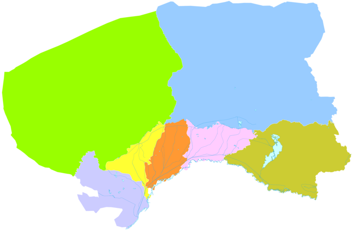
[edit]Bayannur is divided into one district, two counties and fourbanners:
| Map | |||||||
|---|---|---|---|---|---|---|---|
| Name | Mongolian | Hanzi | Hanyu Pinyin | Population (2010) | Area (km2) | Density (/km2) | |
| Linhe District | ᠯᠢᠨᠾᠧ ᠲᠣᠭᠣᠷᠢᠭ (Linhė toɣoriɣ) |
Lâm hà khu | Línhé Qū | 541,721 | 2,354 | 230 | |
| Wuyuan County | ᠦᠶᠤᠸᠠᠨ ᠰᠢᠶᠠᠨ (Üyuvan siyan) |
Ngũ nguyên huyện | Wǔyuán Xiàn | 260,480 | 2,493 | 104 | |
| Dengkou County | ᠳ᠋ᠧᠩᠺᠧᠦ ᠰᠢᠶᠠᠨ (Dėŋḵėü siyan) |
Đặng khẩu huyện | Dèngkǒu Xiàn | 117,091 | 4,167 | 28 | |
| Urad Front Banner (Urad Omnod Banner) |
ᠤᠷᠠᠳ ᠤᠨ ᠡᠮᠦᠨᠡᠳᠦ ᠬᠣᠰᠢᠭᠤ (Urad-un Emünedü qosiɣu) |
Ô lạp đặc tiền kỳ | Wūlātè Qián Qí | 293,269 | 7,476 | 39 | |
| Urad Middle Banner (Urad Dundad Banner) |
ᠤᠷᠠᠳ ᠤᠨ ᠳᠤᠮᠳᠠᠳᠤ ᠬᠣᠰᠢᠭᠤ (Urad-un Dumdadu qosiɣu) |
Ô lạp đặc trung kỳ | Wūlātè Zhōng Qí | 134,204 | 22,606 | 6 | |
| Urad Rear Banner (Urad Hoit Banner) |
ᠤᠷᠠᠳ ᠤᠨ ᠬᠣᠶᠢᠲᠤ ᠬᠣᠰᠢᠭᠤ (Urad-un Qoyitu qosiɣu) |
Ô lạp đặc hậu kỳ | Wūlātè Hòu Qí | 65,207 | 24,925 | 2 | |
| Hanggin Rear Banner (Hanggin Hoit Banner) |
ᠬᠠᠩᠭᠢᠨ ᠬᠣᠶᠢᠲᠤ ᠬᠣᠰᠢᠭᠤ (Qaŋɣin Qoyitu qosiɣu) |
Hàng cẩm hậu kỳ | Hángjǐn Hòu Qí | 257,943 | 1,767 | 145 | |
Cuisine
[edit]Located in Hetao Plain, Bayannaoer is the largest agricultural hub in Inner Mongolia. Bayannaoer is famous for "Bameng braised dishes" (Ba minh quái thái), meaning "braised dishes".
References
[edit]- ^abcdMinistry of Housing and Urban-Rural Development,ed. (2019).China Urban Construction Statistical Yearbook 2017.Beijing: China Statistics Press. p. 46. Archived fromthe originalon 18 June 2019.Retrieved11 January2020.
- ^Nội mông cổ tự trị khu thống kế cục, quốc gia thống kế cục nội mông cổ điều tra tổng đội (2016).《 nội mông cổ thống kế niên giám -2016》.Trung quốc thống kế xuất bản xã.ISBN978-7-5037-7901-5.
- ^2010 niên ba ngạn náo nhĩ thị đệ lục thứ toàn quốc nhân khẩu phổ tra chủ yếu sổ cư công báo(in Chinese (China)). Bayannur People's Government. 16 May 2011. Archived fromthe originalon 23 September 2015.Retrieved15 January2012.
- ^1991-2020 normals"Climate averages from 1991 to 2020".China Meteorological Administration.Archived fromthe originalon 17 April 2023.
- ^1981-2010 extremesTrung quốc khí tượng sổ cư võng – WeatherBk Data(in Simplified Chinese).China Meteorological Administration.Retrieved14 April2023.
- ^Lâm hà - khí tượng sổ cư - trung quốc thiên khí võng(in Chinese). Weather China.Retrieved29 November2022.
External links
[edit]Inner Mongoliatopics | |
|---|---|
| General | |
| Geography | |
| Education | |
| Culture | |
| Cuisine | |
| Visitor attractions | |
Major cities along theYellow River | ||
|---|---|---|
| Province-level subdivisions | Cities(from upper reaches to lower reaches) |  |
| Gansu | ||
| Ningxia | ||
| Inner Mongolia | ||
| Shanxi | ||
| Shaanxi | ||
| Henan | ||
| Shandong | ||
| International | |
|---|---|
| National | |
| Geographic | |