Beni-Chougrane
Appearance
| Beni-Chougrane Range | |
|---|---|
| جبال بني شقران | |
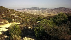
 View of the range fromSig,1973 | |
| Highest point | |
| Elevation | 932 m (3,058 ft) |
| Coordinates | 35°30′0″N0°13′0″E/ 35.50000°N 0.21667°E[1] |
| Dimensions | |
| Area | 1,618 km2(625 sq mi) |
| Geography | |
| Parent range | Tell Atlas |
| Geology | |
| Orogeny | Alpine orogeny |
| Type of rock | Limestone,clay |

TheBeni-Chougrane Range(Arabic:جبال بني شقران,French:Monts des Beni-Chougrane) is a mountain range in the northwest ofAlgeria,part of theAtlas Mountain System.
Geography
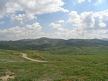
[edit]The mountains of Beni-Chougrane belong to theTell Atlaschain located between the Plain of Habra-Sig in the north and thePlain of Ghrissin the south.[2]They are characterized by aMediterranean climateand a semi-arid terrain, which promoteserosion.The range's average altitude is 700 m and rises to 932 m in the vicinity ofEl Bordj.
Several dams are located in the mountain range. as well as rich plains and majorwadissuch asEl HammamandFergoug.The area is currently undergoingreforestation.[3]The total area is 1618 km2or 32% of the area ofMascarawilaya.
See also
[edit]References
[edit]- ^Google Earth
- ^Monographie de la wilaya de Mascara, sur le site de la Chambre Algérienne de Commerce et d'IndustrieArchivedDecember 11, 2011, at theWayback Machine
- ^Marc Côte,Guide d'Algérie: paysages et patrimoine,Média-Plus, 1996, 319 p. (ISBN9961-922-00-X), p. 69

