Blegdamsvej
 Blegdamsvej | |
| Length | 1,340 m (4,400 ft) |
|---|---|
| Location | Copenhagen,Denmark |
| Quarter | Østerbro |
| Postal code | 2100, 2400 |
| Nearest metro station | Trianglen Station |
| Coordinates | 55°41′48″N12°34′18″E/ 55.69667°N 12.57167°E |
Blegdamsvejis a street inCopenhagen,Denmark,connectingSankt Hans TorvinNørrebrotoTriangleninØsterbro.The busy artery Fredensgade separates the Nørrebro and Østerbro sections of the street from each other. The north side of the street is dominated by thePanum BuildingandRigshospitalet,located on either side ofTagensvej.
History
[edit]The bleaching ponds and Blegdam Common
[edit]
Blegdamsvej is first mentioned in 1694 and takes its name after the 24 ponds on the west side ofSortedam and Peblinge Lake,which was used fortextile bleaching.They were established in about 1772 and had numbers from south to north, beginning at present day Sankt Hans Torv.[1]On the other side of the ponds was Blegedam Common, the oldest of Copenhagen'scommons,where the bleachers left the cloth to bleach in the sun. Lined with trees on both sides, mainlyhorse chestnut,willowandlime trees.
Early industry
[edit]
From the middle of the 19th century, the narrow lots came into other use, first for construction of smaller industrial enterprises and later apartment buildings, although the last bleacher did not disappear until 1867.[2]
Jørgen Ernst Meyerestablished one of the first factories at the street in 1842. Another early industrial enterprise was L. C. Warburg's stockings factory.[3]O.F. Asp established a candle factory at the street in 1880.[4]
Notable buildings and residents
[edit]Sankt Hans Torv to Fredensgade
[edit]
Completed in 1861,St. John's Church(No. 1) was the first church to be built in the new districts which developed after Copenhagen'sBastioned Fortificationswere decommissioned.[5]TheNeo-Gothicchurch was designed by Theodor Sørensen and remains the largest church building in the Nørrebro district.

ThePanum Institute(No 3) is part ofUniversity of Copenhagen'sNorth Campus.ThePanum Buildingwas constructed in the 1970s. The Mærck Tower was added in 2018.
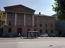
Blegdamsvej Prison(No. 6) is the oldest prison still in use in Denmark. It was designed byMichael Gottlieb Bindesbølland inaugurated in 1848 but has later been expanded and modernized several times.
Fredensgade to Trianglen
[edit]Rigshospitalet(No. 9) dominates the north side of the Østerbro section of the street. The current hospital is from 1960-1978 and was designed by Kaj Boeck-Hansen and Jørgen Stærmose. An extension designed by3XNwent under construction in 2017.
TheNiels Bohr Institute(No. 15-17) from 1922 has housed the work of severalNobel Prize-winners. No. 23, roughly from the same time, is theFreemasons' Hall.The Danish branch of theRed Crosshas its head office at No. 25–27. The building was built in 1952 and is the former headquarters ofCopenhagen County.It has more recently been expanded byCOBE Architects.

No. 60 is a former machine factory,Nielsen & Winther.The building is from 1899 and was designed byAxel Berg.Its neighbor (No. 62), slightly older and designed byLudvig Fenger,was originally a public school but later taken over by Nielsen & Winther.

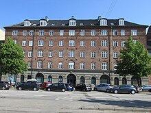
Håndværkerstiftelsen (No. 74) was built to provide affordable housing for old, indigent craftsmen and their widows. The National Romantic building is from 1901-1902 and was designed byEmil Jørgensen.

No. 104 is a former candle manufactury,Asp-Holmblad,which was in use until the 1940s but has now been converted into apartments. No. 124 was designed by Frederik Lauritz Levy for the companySiemens-Schuckert.[6]
No. 132 (Trianglen) is a former tram remise built by De kjøbenhavnske Sporvejes in 1900-02 to design byVilhelm Friederichsen.It was converted into an after school activity centre in the 1980s.
Public art
[edit]At Rigshospitalet, on the corner of Blegdamsvej with Fredensgade, isRudolph Tegner's large group sculptureTowards the Light.It was installed in 1909 as a memorial to the physician and scientistNiels Ryberg Finsenwho won theNobel PrizeinMedicine and Physiologyin 1903.[7]
In the small garden in front of the Niels Bohr Institute stands a 7-8 metre tall granite sculpture by the Swedish sculptorClaes Hake.It was unveiled in 1999.
Transport
[edit]Triangelen Station at the eastern end of the street will open when theCity Circle Lineis inaugurated in September 2019.
Movia bus 3A runs through the full length of the street on its way betweenNordhavn stationin the northeast andValbyparkenin the southwest.
ABRTline betweenNørreport stationin the city centre andRyparken stationonRingbanencrosses the street at Fredensgade. It is served by up to 47 busses per hour per direction transporting approx. 30,000 passengers per day.[8]One of the stations of the under constructionCity Circle Linewill be located on the corner of Nørre Allé andJagtvejat Vibenhus Eunddel.
See also
[edit]References
[edit]- ^"Blegdamsvej"(in Danish). Selskabet for Københavns Historie. Archived fromthe originalon 2013-10-30.Retrieved2013-09-17.
- ^"Blegdamme på Blegdamsvej"(in Danish). Østerbro Avis.Retrieved13 June2019.
- ^"FH. L. C. WARBURG & SØN´s EFTERFØLGENDE VED M. JOHANSEN".coneliand.dk(in Danish).Retrieved13 June2019.
- ^"J.C.A. Bock"(in Danish).Dansk Biografisk Leksikon.Retrieved13 June2019.
- ^"Sankt Johannes Kirke".Sankt Johannes Kirke.Retrieved2011-01-17.
- ^"Klub 37 - Siemens 100 år"(PDF)(in Danish). Klub 37.Retrieved2013-09-17.
- ^"Towards the Light".Copenhagen Municipality.Retrieved2013-09-17.
- ^"New BRT line on Northern Campus In Copenhagen".EMTA.Retrieved28 January2015.
