
Plombières
(Redirected fromBleiberg)
Plombières
So-on-Mont-d'-Plomb(Walloon) | |
|---|---|
 Place Communale | |
 Coat of arms | |
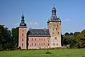
Location of Plombières  | |
 Plombières Location in Belgium
Location of Plombières in the province of Liège  | |
| Coordinates:50°44′N05°57′E/ 50.733°N 5.950°E | |
| Country | |
| Community | French Community |
| Region | Wallonia |
| Province | Liège |
| Arrondissement | Verviers |
| Government | |
| • Mayor | Marie Stassen (OCP) |
| • Governing party/ies | Ouverture Citoyenne Plombières (OCP) - @ctions |
| Area | |
| • Total | 53.17 km2(20.53 sq mi) |
| Population (2018-01-01)[1] | |
| • Total | 10,401 |
| • Density | 200/km2(510/sq mi) |
| Postal codes | 4850-4852 |
| NIS code | 63088 |
| Area codes | 087 |
| Website | www.plombieres.be |
Plombières(French pronunciation:[plɔ̃bjɛʁ];German:BleybergorBleiberg,Dutch:Blieberg;Walloon:So-on-Mont-d'-Plomb) is amunicipalityofWallonialocated in theprovince of Liège,Belgium.
On 1 January 2006, Plombières had a total population of 10,401. The total area is 53.17 km2which gives apopulation densityof 200 inhabitants per km2.[2]
The municipality consists of the following districts:Gemmenich,Hombourg,Montzen,Moresnet,andSippenaeken.[3]
The local language isLow Dietsch,a bridge dialect between EastLimburgishandRipuarian.[4]
Gallery
[edit]-
 Sippenaeken, view to the village
 -
 Beusdael Castle in Sippenaeken
 -
 Gemmenich street
 -
 Gemmenich, church Saint-Hubert
 -
 Notre-Dame de l'Assomption church
 -
 Church (l´église Agnus Dei) outside Hombourg
 -
 German border


See also
[edit]References
[edit]- ^"Wettelijke Bevolking per gemeente op 1 januari 2018".Statbel.Retrieved9 March2019.
- ^"Wettelijke Bevolking per gemeente op 1 januari 2018".Stat Bel.Retrieved10 December2021.
- ^"Tout savoir sur..."Royal Syndicat d'initiative K.V.V. - K.V.V.V.(in Dutch, French, and German).Retrieved10 December2021.
- ^Jan Goossens."Platdietse streek".Nieuwe Encyclopedie van de Vlaamse Beweging(in Dutch).Retrieved10 December2021.
External links
[edit] Media related toPlombièresat Wikimedia Commons
Places adjacent to Plombières | ||||||||||||||||
|---|---|---|---|---|---|---|---|---|---|---|---|---|---|---|---|---|
| ||||||||||||||||
Municipalities in theprovince of Liège,Wallonia | ||
|---|---|---|
| Huy |  | |
| Liège | ||
| Verviers | ||
| Waremme | ||
| ||
| International | |
|---|---|
| National | |
| Geographic | |
ThisLiège Provincelocation article is astub.You can help Wikipedia byexpanding it. |