
Boekel
You can helpexpand this article with text translated fromthe corresponding articlein Dutch.(October 2018)Click [show] for important translation instructions.
|
Boekel | |
|---|---|
 Boekel town hall | |
 Flag  Coat of arms | |
 Location in North Brabant | |
| Coordinates:51°36′N5°40′E/ 51.600°N 5.667°E | |
| Country | Netherlands |
| Province | North Brabant |
| Government | |
| • Body | Municipal council |
| •Mayor | Pierre Bos(CDA) |
| Area | |
| • Total | 34.52 km2(13.33 sq mi) |
| • Land | 34.51 km2(13.32 sq mi) |
| • Water | 0.01 km2(0.004 sq mi) |
| Elevation | 16 m (52 ft) |
| Population (January 2021)[4] | |
| • Total | 10,959 |
| • Density | 318/km2(820/sq mi) |
| •Uden-Veghel | 175,119 |
| Time zone | UTC+1(CET) |
| • Summer (DST) | UTC+2(CEST) |
| Postcode | 5427–5428 |
| Area code | 0492 |
| Website | www |

Boekel(Dutch pronunciation:[ˈbukəl]) is a municipality and a town in the southernNetherlands.
Etymology
[edit]Previously it was assumed the name Boekel referred to the forest ( "loo" in Dutch) of the lords Boc, similar to places likeBoxmeerandBoxtel.The lords Boc were the first lords ofBoxmeer,but have no connection to the other two places.
Currently, it is presumed that the name derives fromBeukeloo,which is a type ofbeechforest.
Population centres
[edit]- Boekel
- Huize Padua
- Venhorst
History
[edit]Land van Herpen
[edit]Boekel was founded at some point in theMiddle Agesas a settlement with a number of farms.
In the 13th century Boekel was part of deheerlijkheidUden.In 1233 a separation took place between theLand van Cuijkand theLand van Herpenand Uden. At that time Uden, together with Herpen, formed a unit of government called aheerlijkheid.Until the foundation of the city ofRavenstein,Herpenwas the main city of this region.Rutger van Herpensold or leased in 1313 or 1314 the community rights (gemene gronden) to the residents of Boekel andVolkel.When the noble lord wanted to improve his cash position, he charged the use of any of its soil, beginning with the wasteland in hisheerlijkheid.Thiscommon landwas mainly marshy land and barren higher grounds, such as heaths.
Land of Ravenstein
[edit]In 1324 theheerlijkheidofUdenadministratively belonged to the Land of Ravenstein, under the rule of the House of Valkenburg until 1396.
From the aldermenHerpenandUdentheHeikantsgerichtwas created in 1339. These stretched across the entire formerheerlijkheidof Uden, consisting ofUden,Boekel andZeeland.Of these aldermen, which in total had seven members, two were from Boekel.
Reinoud of Valkenburg (married to Elisabeth van Kleef) died childless so the Duke of Brabant Adolf van Kleef gained Herpen, Ravenstein and Uden, so in 1397 Kleef's territory was enlarged. Afterwards the area came under the rule of Neuburg-Palts in 1629. Under the Neubergers' rule, the area had religious freedom.
Because the neighboring provinces of Brabant and Gelderland from 1648 officially fell under theStates-General,thisLand van Ravensteinmore and more was seen as "foreign". The religious freedom provided opportunities for Catholics in the States of Brabant. The Catholics ofErpbuilt their own barn church on the border with Boekel. Due to the religious freedom several Catholic religious orders also settled in the Land of Ravenstein. In 1741 members of the Brothers Penitent, from theHandelse Kluisthemselves wanted to settle in Boekel. Led byDaniël de Brouwerthe brothers laid the foundation for the Psychiatric HospitalHuize Padua.
From the 17th century various conflicts arose among the villages of Boekel,UdenandGemertaround the demarcation lines between the Ravenstein, Cuijk and Gemert areas. In 1663 the boundary dispute with theVrije Heerlijkheid Gemertwas settled. In 1729, a similar problem with Uden was settled.
See also
[edit]
Notable people
[edit]- Hans Gruyters(1925 in Boekel – 1980) a Dutch criminal, bankrobber, burglar and escaped convict
- Leontien van Moorsel(born 1970 in Boekel) a Dutch retired racing cyclist, four time gold medallist at the2000&2004 Olympic Games
- Mirella van Melis(born 1979 in Venhorst) a retired female track and road racing cyclist
- Hannes van Asseldonk(born 1992 in Boekel) is a Dutch racing driver
Gallery
[edit]-
 Boekel kapel achter kerk
 -
 T.T Boerderij Berkhoek, Boekel
 -
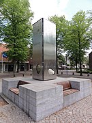 Venhorst, monument op kerkplein zijden
 -
 Sint-Josef kerk, Venhorst, Boekel
 -
 Boekel Standerdmolen


References
[edit]- ^"Samenstelling college van B&W"[Members of the board of mayor and aldermen] (in Dutch). Gemeente Boekel. Archived fromthe originalon 2 May 2014.Retrieved2 May2014.
- ^"Kerncijfers wijken en buurten 2020"[Key figures for neighbourhoods 2020].StatLine(in Dutch).CBS.24 July 2020.Retrieved19 September2020.
- ^"Postcodetool for 5427AB".Actueel Hoogtebestand Nederland(in Dutch). Het Waterschapshuis.Retrieved2 May2014.
- ^"Bevolkingsontwikkeling; regio per maand"[Population growth; regions per month].CBS Statline(in Dutch).CBS.1 January 2021.Retrieved2 January2022.
External links
[edit]Places adjacent to Boekel | |
|---|---|

| Authority control databases:Geographic |
|---|