
Boston Harbor


Boston Harboris a naturalharborandestuaryofMassachusetts Bay,located adjacent toBostonMassachusetts.It is home to thePort of Boston,a major shipping facility in theNortheastern United States.[1]
History
[edit]
Since its discovery to Europeans byJohn Smithin 1614,[2]Boston Harbor has been an important port in American history. Early on, it was recognized by Europeans as one of the finest natural harbors in the world due to its depth and natural defense from the Atlantic as a result of themany islandsthat dot the harbor. It was also favored due to its access to theCharles River,Neponset RiverandMystic Riverwhich made travel from the harbor deeper into Massachusetts far easier.[3]It was the site of theBoston Tea Partyin 1773, as well as almost continuous building of wharves, piers, and new filled land into the harbor until the 19th century. By 1660, almost all imports came to the greater Boston area and the New England coast through the waters of Boston Harbor. A rapid influx of people transformed Boston into an exploding city.
Pollution and cleanup efforts
[edit]The health of the harbor quickly deteriorated as the population of Boston increased. As early as the late 19th century Boston citizens were advised not to swim in any portion of the Harbor. In the 19th century, two of the first steam sewage stations were built (one in East Boston and one later on Deer Island). With these mandates, the harbor was seeing small improvements, but raw sewage was still continuously pumped into the harbor. In 1919, the Metropolitan District Commission was created to oversee and regulate the quality of harbor water. However, not much improvement was seen and general public awareness of the poor quality of water was very low. In 1972, theClean Water Actwas passed in order to help promote increased national water quality.

Since the mid-1970s organizations within the Boston community have battled for a cleaner Boston Harbor. More recently, the harbor was the site of the $4.5 billion Boston Harbor Project. Failures at the Nut Islandsewage treatmentplant inQuincyand the companionDeer Islandplant adjacent toWinthrophad far-reachingenvironmentaland political effects.Fecal coliform bacterialevels forced frequent swimming prohibitions along the harbor beaches and theCharles Riverfor many years.[4]The city of Quincy sued theMetropolitan District Commission(MDC) and the separateBoston Water and Sewer Commissionin 1982, charging that unchecked systemic pollution of the city's waterfront contributed to the problem. That suit was followed by one byConservation Law Foundationand finally by theUnited States government,resulting in the landmark[5]court-ordered[6]cleanup of Boston Harbor.[7]

The lawsuits forced then-Massachusetts GovernorMichael Dukakisto propose separating the water and sewer treatment divisions from the MDC, resulting in the creation of theMassachusetts Water Resources Authorityin 1985. The slow progress of the cleanup became a key theme of the1988 U.S. presidential electionasGeorge H. W. Bushdefeated Dukakis partly through campaign speeches casting doubt on the governor's environmental record,[8]which Dukakis himself had claimed was better than that of Bush.[9]The court-ordered cleanup continued throughout the next two decades and is still ongoing.[7][10]
Before the clean-up projects, the water was so polluted thatThe Standellsreleased a song in 1965 called "Dirty Water"which referred to the sorry state of the Charles River.Neal Stephenson,who attendedBoston Universityfrom 1977 to 1981, based his second novel,Zodiac,around pollution of the harbor.
Since the writing of the song, the water quality in both the Harbor and the Charles River has significantly improved, and the projects have dramatically transformed Boston Harbor from one of the filthiest in the nation to one of the cleanest. Today, Boston Harbor is safe for fishing and for swimming nearly every day, though there are still beach closings after even small rainstorms, caused by bacteria-laden storm water and the occasional combined sewer overflow.
In 2022, pieces of plastic transmission line used in rock explosives, (known as explosive shock tubing) began washing up on coastal shores ofCape CodandRhode Island.[1]This led to an investigation that was conducted by theU.S. Army Corps of Engineers,it was suspected to have been related to a concluded Boston Harbor dredging project. The outcome was to seek to find methods to prevent future environmental impacts from reoccurring.
Geography
[edit]

Boston Harbor is a large harbor which constitutes the western extremity ofMassachusetts Bay.The harbor is sheltered from Massachusetts Bay and the openAtlantic Oceanby a combination of theWinthrop PeninsulaandDeer Islandto the north, the hookedNantasket Peninsulaand Point Allerton to the south, and the harbor islands in the middle. The harbor is often described as being split into an inner harbor and an outer harbor.[11][12][13]The harbor itself comprises 50 square miles (130 km2) with 180 miles (290 km) of shoreline and 34 harbor islands.
Inner harbor
[edit]The inner harbor was historically the main port of Boston and is still the site of most of its port facilities as well as the Boston waterfront, which has been redeveloped for residential and recreational uses. The inner harbor extends from the mouths of theCharles Riverand theMystic River,both of which empty into the harbor, toLogan International AirportandCastle Island,the latter now connected by land in 1928 to Boston, where the inner harbor meets the outer harbor.
Outer harbor
[edit]The outer harbor stretches to the south and east of the inner harbor. To its landward side, and moving in acounterclockwisedirection, the harbor is made up of the three small bays ofDorchester Bay,Quincy BayandHingham Bay.To seaward, the two deep water anchorages of President Roads and Nantasket Roads are separated byLong Island.The outer harbor is fed by several rivers, including theNeponset River,theWeymouth Fore River,theWeymouth Back Riverand theWeir River.[11][12][13]
Dredged deepwater channels stretch from President Roads to the inner harbor, and from Nantasket Roads to the Weymouth Fore River and Hingham Bay viaHull Gutand West Gut. Some commercial port facilities are located in the Fore River area, an area which has a history ofshipbuildingincluding the notableFore River Shipyard.[11][12][13]
Land fill
[edit]In the 1830s, members of the maritime community observed physical decay in the harbor. Islands in the outer harbor were visibly deteriorating and erosion was causing weathered materials and sediment to move from where it was protecting the harbor to where it would do the most harm. Recent shoaling experiences and comparisons with old charts caused observers to insist that the inner harbor was also filling and created widespread anxiety about the destruction of the Boston Harbor. Although the scientific understanding of hydraulics was still in its infancy and there were high degrees of uncertainty regarding the meeting of land and water, scientists and engineers began to describe the Boston Harbor as a series of channels created and maintained by the scouring force of water moving in and out of the harbor, river systems, and tidal reservoirs. This interpretation came to be known as the theory ofTidal scour.This understanding of the harbor as a dynamic landscape assuaged concerns some had over the negative impacts of land fill operations of land and real estate developers.[14]
As the 19th century progressed, the acceleration of urban growth dramatically increased the need for more land. The Ordinance of 1641 extended the property rights of riparian owners from the line oflow tideto a maximum distance of 100rods(1,600 ft; 500 m) from the line of high tide. Generally, other states drew the line of private property athigh tide.However, extending shore lines into bordering bodies of water was not unique to Boston. Chicago built into Lake Michigan, New York extended itself into the Hudson and East rivers, and San Francisco reclaimed sections of its bay. The Boston Harbor's unique geography inspired the law that made land reclamation such a widespread activity in Boston. By the end of the nineteenth century, the city had created more land in two generations than it had in the previous two centuries.[15]
Harbor Islands
[edit]
Boston Harbor contains a considerable number of islands, 34 of which have been part of theBoston Harbor Islands National Recreation Areasince its establishment in 1996. The following islands exist within the harbor, or just outside it in Massachusetts Bay:


- Bumpkin Island
- Button Island
- Calf Island
- Castle Island
- Deer Island
- Gallops Island
- Georges Island
- Grape Island
- Great Brewster Island
- Green Island
- Hangman Island
- Langlee Island
- Little Brewster Island
- Little Calf Island
- Long Island
- Lovells Island
- Middle Brewster Island
- Moon Island
- Nixes Mate
- Outer Brewster Island
- Peddocks Island
- Raccoon Island
- Ragged Island
- Rainsford Island
- Sarah Island
- Shag Rocks
- Sheep Island
- Slate Island
- Snake Island
- Spectacle Island
- Spinnaker Island
- The Graves
- Thompson Island
Two former islands,Castle IslandandDeer Island,still exist in a recognizable form. Castle Island was joined to the mainland byland reclamation,while Deer Island ceased to be an island when the channel which formerly separated it from the mainland was filled in by theNew England Hurricane of 1938.
Nut Islandis a small former island in Boston Harbor that was joined by landfill to theHoughs Neckpeninsula in northeastern Quincy by the 1940s so it could be used as the site of a sewage treatment facility.[16]
Two other former islands,Apple IslandandGovernors Island,have been subsumed into land reclamation forLogan International Airport.
The Harbor Islands have made up Boston's least populated electoral area, Ward 1, Precinct 15, since 1990, though thepolling placeis on the mainland atColumbia Point.Since 1920, Boston must pass legislation to redistrict. As of 2018, there were two active voters, staff at theThompson Island Outward Bound Educational Center.There were previously registered voters at a recovery center and a homeless shelter on Long Island, but few voted and they have closed.[17][18]
Aquaculture
[edit]In 1996, theBoston Globereported that MayorThomas MeninoandMITengineer Clifford Goudey were planning a program to use the great tanks on Moon Island as a fish farm or a temporary home for tuna or lobster in an attempt to implement a recirculatingaquaculturesystem in Boston Harbor.[19][20][21]The prices of both these fish types vary by season. The plan was to collect and store fish in the tanks and sell the fish at higher prices when they were out of season. Nothing has come of this plan to date.
Lights and other aids to navigation
[edit]- Boston Light
- Deer Island Light
- Egg Rock Light
- Long Island Head Light
- Lovells Island Range Lights
- Nixes Mate
- Spectacle Island Range Lights
- The Graves Light
Images
[edit]-
 "South East View of the Great Town of Boston," by John Carwitham, c. 1765
 -
 View from Beacon Hill, c. 1770s (Library of Congress Prints and Photographs Division Washington)
 -
 Boston Harbor, c. 18th century, by Nathaniel Dearborn afterPaul Revere(Museum of Fine Arts, Boston)
 -
 Boat Race, Boston Harbor, by A. A. Lawrence, 1852 (Museum of Fine Arts, Boston)
 -
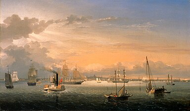 Boston Harbor byFitz Hugh Lane,1854
 -
 Boston harbor and East Boston fromState Street Block,byJohn P. Soule,19th century
 -
 USS Constitution,2005
 -
 Boston's skyline fromSpectacle Island
 -
 Container and cruse terminals and dry dock #3 in 2019


See also
[edit]References
[edit]- ^Boston Harbor Islands National Recreation Area – Massachusetts. Owned by Madilyn ZabackiArchivedDecember 27, 2016, at theWayback Machine,U.S. National Park Service
- ^Stark, James Henry (1901).Stark's Antiqve views of ye towne of Boston.Morse-Purce Co. p. 11.OCLC4452192.RetrievedJuly 17,2009.
- ^Library of Congress
- ^"A Spatial and Temporal Analysis of Boston Harbor Microbiological Data"(PDF).Technical Report No. 91-3.Massachusetts Water Resources Authority. June 1991.RetrievedJune 11,2009.
- ^G. Buonomo, Lo scudo di cartone, Rubbettino, 2015,ISBN9788849844405,p. 41, note 69.
- ^MATTHEW L. WALD, Special toThe New York Times.1986. "JUDGE SETS A TIMETABLE TO CLEAN BOSTON HARBOR." New York Times, The (NY), January 2. 20. NewsBank – Archives, EBSCOhost (accessed December 10, 2015).
- ^abMazzone, Hon. A. David."Mazzone, Judge A. David: Chamber Papers on the Boston Harbor Clean Up Case, 1985–2005".Archived fromthe originalon June 10, 2010.RetrievedJune 11,2009.
- ^FOX BUTTERFIELD, ecial to The New York Times. 1991. "Boston Harbor Cleanup Haunts a New Governor." New York Times, The (NY), April 6. 6. NewsBank – Archives, EBSCOhost (accessed December 10, 2015).
- ^Butterfield, Fox (April 6, 1991)."Boston Harbor cleanup haunts a new governor".The New York Times.RetrievedJune 11,2009.
- ^"The Boston Harbor Case".MWRA Online.Massachusetts Water Resources Authority. June 19, 2019.RetrievedJune 29,2019.
MWRA is currently required to submit bi-annual compliance and progress reports through December 2020.
- ^abc"Boston".GlobalSecurity.org.RetrievedOctober 12,2006.
- ^abc"Through the Eyes of a Mariner: Touring the Port of Boston".Massachusetts Office of Coastal Zone Management. Archived fromthe originalon September 6, 2008.RetrievedOctober 12,2006.
- ^abc"Boston Harbor and Approaches."Coast Pilot 1 – 43rd Edition, 2015.NOAA Office of Coast Survey. Accessed April 25, 2016.
- ^Rawson, Michael (2009). "What Lies Beneath: Science, Nature, and the Making of Boston Harbor". In Penna, Anthony N.; Wright, Conrad Edick (eds.).Remaking Boston: An Environmental History of the City and its Surroundings.Pittsburgh: University of Pittsburgh Press. pp. 33–55.
- ^Ibid.
- ^Levy, Paul F. (March 1, 2001)."The Nut Island Effect: When Good Teams Go Wrong".Harvard Business Review.79(3). Boston: Harvard Business School Publishing: 51–9, 163.PMID11246924.Archived fromthe originalon July 15, 2009.RetrievedJune 11,2009.
- ^Herwick III, Edgar B. (October 24, 2018)."A Quest To Find The Last Two Active Voters In Boston's 'Phantom Electoral Precinct'".GBH News.
- ^Ryan, Andrew (November 3, 2009)."Phantom precinct shows city's arcane voting laws".The Boston Globe.
- ^Anand, Geeta,"Harbor island studied for fish farm Mayor envisions raising flounder, tuna and lobsters"ArchivedApril 11, 2009, at theWayback Machine,The Boston Globe, October 13, 1996. Quoting from the article: "The Boston mayor and the MIT engineer were talking fish. With the city's skyline in the distance, they stood beside one of four long trenches on Moon Island that may soon be teeming with lobsters, bluefin tuna and summer flounder. For nearly two years, Mayor Thomas M. Menino and MIT engineer Clifford Goudey have shared a dream. Now they are wedded to a plan. Together, they are trying to turn the century-old sewage trenches on the harbor island into one of the largest fish farms in the country. 'This could be the new industry for the city,' the mayor said. 'We have the ocean, we have the reservoirs for the fish, we have what we need to make this work.'"
- ^Best, Neil A.,"Preliminary Design of a Recirculating Aquaculture System in Boston Harbor"ArchivedJune 4, 2011, at theWayback Machine,Masters Thesis, Ocean Engineering, MIT, February 1997. Technical Advisor, Clifford A. Goudey.
- ^Marcus, John,"Scientists Test Once-Polluted Harbor’s Crop Potential",Los Angeles Times, Sunday, January 11, 1998
External links
[edit]- Save the Harbor / Save the Bay
- The Boston Harbor Association
- NOAA Soundings Map of Boston Harbor
- Flickr.com,Photos, January 2009.
- Flickr.com,Photos, November 2009.
- Flickr.com,Photos, February 2010.
- Dutton, E.P.Chart of Boston Harbor and Massachusetts Bay with Map of Adjacent Country.ArchivedMay 12, 2009, at theWayback MachinePublished 1867. A good map of a proposed build-out of infrastructure into the Boston Harbor.
- Judge A. David Mazzone chambers papers on the Boston Harbor Cleanup Case, 1985–2005,University Archives and Special Collections, Joseph P. Healey Library,University of Massachusetts Boston
| Campus |
|  |
|---|---|---|
| Chancellors |
| |
| Miscellaneous | ||
Italicsindicates interim chancellor | ||
| National | |
|---|---|
| Other | |