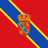
Castildelgado
- العربية
- Aragonés
- Asturianu
- Mân nam ngữ / Bân-lâm-gú
- Brezhoneg
- Català
- Cebuano
- Deutsch
- Español
- Esperanto
- Euskara
- فارسی
- Français
- Galego
- Hawaiʻi
- Interlingua
- Interlingue
- Italiano
- Ladin
- Lombard
- Magyar
- مصرى
- Bahasa Melayu
- Nederlands
- Нохчийн
- Occitan
- Polski
- Português
- Русский
- Svenska
- Татарча / tatarça
- Українська
- Vèneto
- Tiếng Việt
- Winaray
- Trung văn
Appearance
From Wikipedia, the free encyclopedia
This articleneeds additional citations forverification.Please helpimprove this articlebyadding citations to reliable sources.Unsourced material may be challenged and removed. Find sources:"Castildelgado"–news·newspapers·books·scholar·JSTOR(April 2024)(Learn how and when to remove this message) |
Municipality and town in Castile and León, Spain
Castildelgado | |
|---|---|
Municipalityand town | |
 | |
| Country | Spain |
| Autonomous community | |
| Province | |
| Comarca | Montes de Oca |
| Area | |
| • Total | 5 km2(2 sq mi) |
| Elevation | 770 m (2,530 ft) |
| Population (2018)[1] | |
| • Total | 36 |
| • Density | 7.2/km2(19/sq mi) |
| Time zone | UTC+1(CET) |
| • Summer (DST) | UTC+2(CEST) |
| Postal code | 09259 |
| Website | http://www.castildelgado.es/ |
Castildelgadois amunicipalityand town located in theprovince of Burgos,Castile and León,Spain. According to the 2004census(INE), the municipality has a population of 70 inhabitants.
References
[edit]- ^Municipal Register of Spain 2018.National Statistics Institute.
42°26′N3°05′W/ 42.433°N 3.083°W/42.433; -3.083
This article about a location in the province of Burgos, Spain is astub.You can help Wikipedia byexpanding it. |
Hidden categories:
- Pages using gadget WikiMiniAtlas
- Articles needing additional references from April 2024
- All articles needing additional references
- Articles with short description
- Short description is different from Wikidata
- Pages using infobox settlement with no map
- Pages using infobox settlement with no coordinates
- Coordinates on Wikidata
- All stub articles
- Pages using the Kartographer extension


