Chhattisgarh is one of the fastest-developing states in India.[16]ItsGross State Domestic Product (GSDP)is₹5.09 lakh crore(US$61 billion) (2023–24 est.),[8]with aper capitaGSDP of₹152,348(US$1,800)[8](2023–24 est.). A resource-rich state, it has the third largestcoalreserves in the country and provides electricity, coal, and steel to the rest of the nation.[17][18]It also has the third largest forest cover in the country afterMadhya PradeshandArunachal Pradeshwith over 40% of the state covered by forests.
There are several theories as to the origin of the nameChhattisgarh,which in ancient times was known asDakshina Kosala(South Kosala),[19]the native place ofRama's motherKausalya."Chhattisgarh" was popularised later during the time of theMaratha Empireand was first used in an official document in 1795.[20]
The most popular theory claims that Chhattisgarh takes its name from the 36 ancient forts (fromchhattismeaning thirty-six andgarhmeaningfort) in the area.[citation needed]The old state had 36 demesnes (feudal territories):Ratanpur,Vijaypur, Kharound, Maro, Kautgarh,Nawagarh,Sondhi, Aukhar, Padarbhatta, Semriya, Champa, Lafa, Chhuri, Kenda, Matin, Aparora, Pendra, Kurkuti-kandri, Raipur, Patan, Simaga, Singarpur, Lavan, Omera, Durg, Saradha, Sirasa, Menhadi, Khallari, Sirpur, Figeswar, Rajim, Singhangarh, Suvarmar, Tenganagarh and Akaltara.[21]However, most historians disagree with this theory as 36 forts have not been found and identified.
According to the opinion of Hiralal, it is said that at one time there were 36 strongholds in this area, that is why its name was Chhattisgarh. But even after the increase in the number of strongholds, there was no change in the name, Chhattisgarh is theState of Indiawhich has been given the status of 'Mahtari' (Mother).[citation needed]There are two regions in India which are named for special reasons – one was 'Magadha' which became "Bihar"due to the abundance ofBuddhismviharas and the other was 'Dakshina Kosala' which became "Chhattisgarh" due to the inclusion of thirty-six strongholds.[citation needed]
Another view, more popular with experts and historians, is that Chhattisgarh is the corrupted form ofChedisgarhmeaningRajor "Empire of the Chedis".[citation needed]In ancient times, Chhattisgarh region had been part of theChedi dynastyofKalinga,in modernOdisha.In the medieval period up to 1803, a major portion of present eastern Chhattisgarh was part of theSambalpur KingdomofOdisha.
During post Vedic period the Chhattisgarh region south-east toDaśārṇaswas referred asPulinda.Pulinda tribe were dominating tribe in this region.[22]
SurgujaDistrict of Chhattisgarh is notable for finding of Mauryan and Nanda period coins. Few gold and silver coins of the Nanda-Mauryan ages, picked up at Akaltara and Thathari of the adjacent district ofBilaspur.[23]Another major discovery wasSirpurof Chhattisgarh.[24][25]
Sitabenga cavesare one of the earliest examples oftheatrearchitecture in India located onRamgarh hillof Chhattisgarh dated to Mauryan period of 3rd century BCE.[26]
Line1Poets venerable by nature kindle the heart, who(.... lost....) Line2At the swing-festival of the vernal full-moon, when frolics and music abound, people thus tie (....lost...) thick with jasmine flowers.
Jogimara cavescontain ancient Brahmi inscription and the oldest painting known in India. The inscription can be translated as either a love proclamation by a girl or a dancer-painter creating a cave theatre together.[28]In ancient times, this region was known asDakshina Kosala.This area is also mentioned in Ramayana and Mahabharata.One of the earliest statues ofVishnuhas been excavated fromShungaperiod site atMalhar.
Carved statue in the medieval city of Sirpur6th 7th century Bhima Kichak Temple, Malhar Chhattisgarh India
Eventually most of Chhattisgarh was consolidated under theHaihaiyavanshi Kingdom,who ruled central Chhattisgarh and held smallerkingdoms like Kankerunder their authority.[31][32][33]The Haihaiyavanshis continued to rule the region for 700 years until they wereinvaded by the Marathasin 1740 and came under their authority. Chhattisgarh was directly annexed to the MarathaNagpur Kingdomin 1758 on the death ofMohan Singh,the last independent ruler of Chhattisgarh.[34][35]
Chhattisgarh was underMaratha Rule(Bhonsles of Nagpur) from 1741 to 1845. It came under British rule from 1845 to 1947 as theChhattisgarh Divisionof theCentral Provinces.Raipur gained prominence over the capital Ratanpur with the advent of the British in 1845. In 1905, theSambalpur districtwas transferred to Odisha and the estates of Surguja were transferred from Bengal to Chhattisgarh.
The area constituting the new state merged into Madhya Pradesh on 1 November 1956, under theStates Reorganisation Act, 1956,and remained a part of that state for 44 years. Prior to that, the region was part of theCentral Provinces and Berar(CP and Berar) under British rule. Some areas constituting the Chhattisgarh state wereprincely statesunderBritish rule,but were later on merged into Madhya Pradesh.[36]
The demand for Chhattisgarh to be a separate state first rose in the 1920s, with similar demands appearing at regular intervals; however, a well-organised movement was never initiated. Several all-party platforms were created and usually resolved around petitions, public meetings, seminars, rallies and strikes.[37]The demand was raised by the Raipur Congress unit in 1924 and was also discussed in the Indian Congress atTripuri.A discussion about forming a Regional Congress organisation for Chhattisgarh took place. In 1954, when the State Reorganisation Commission was set up, the demand was put forward but was rejected. In 1955, the demand was raised in the Nagpur assembly ofMadhya Bharat.[37]
In the 1990s, the demand became more prominent, resulting in the formation of a statewide political forum known as the Chhattisgarh Rajya Nirman Manch. The forum was led by Chandulal Chadrakar and several successful region-wide strikes and rallies were organised under it, all of which were supported by major political parties, such as theIndian National Congressand theBharatiya Janata Party.[37]
The new National Democratic Alliance government sent the Separate Chhattisgarh Bill for approval by the Madhya Pradesh Assembly, where it was unanimously approved and then submitted to theLok Sabha.The bill was passed in the Lok Sabha and theRajya Sabha,which allowed the creation of the state of Chhattisgarh.K. R. Narayanangave his consent to theMadhya Pradesh Reorganisation Acton 25 August 2000 and the government of India set 1 November 2000 as the day Chhattisgarh would be separated from Madhya Pradesh.[37]As such, Chhattisgarh was formed from Madhya Pradesh.[15]
The northern and southern parts of the state are hilly, while the central part is a fertileplain.The highest point in the state is the Gaurlata near Samri, Balrampur-Ramanujganj district.[38]Deciduous forests of the Eastern Highlands Forests cover roughly 44% of the state.[39]
In the north lies the edge of the greatIndo-Gangetic plain.TheRihand River,a tributary of theGanges,drains this area. The eastern end of theSatpura Rangeand the western edge of theChota Nagpur Plateauform an east–west belt of hills that divide theMahanadi Riverbasin from the Indo-Gangetic plain. The outline of Chhattisgarh is like a sea horse.
The central part of the state lies in the fertile upper basin of theMahanadiand its tributaries, of whichShivnath Riveris a major one running around 300 km long. This area has extensive rice cultivation. The upper Mahanadi basin is separated from the upperNarmadabasin to the west by theMaikal Hills(part of the Satpuras) and from the plains of Odisha to the east by ranges of hills. The southern part of the state lies on theDeccan plateau,in the watershed of theGodavari Riverand its tributary, theIndravati River.The Mahanadi is the chief river of the state. The other main rivers areHasdeo(a tributary of Mahanadi),Rihand,Indravati,Jonk,Arpa andShivnath.[40]
The state has the third largest forest by area in India. The state animal is thevan bhainsa,or wild Asian buffalo. The state bird is thepahari myna,or hill myna. The state tree is theSal (Sarai)found in Bastar division.
Chhattisgarh has the 3rd largest forest cover in the country. The state is surrounded by the forests inMadhya Pradesh(1st),Odisha(4th),Maharashtra(5th),JharkhandandTelanganamaking it India's largest covered forests across state boundaries. There are multiple National Parks, Tiger Reserves across the state.Achanakmar-Amarkantak Biosphere ReserveisUNESCOrecognisedBiospherewith total area of 383,551 hectares (3,835.51 square kilometres; 1,480.90 square miles)
Chhattisgarh has a tropicalclimate.It is hot and humid in the summer because of its proximity to theTropic of Cancerand its dependence on themonsoonsfor rains. Summer temperatures in Chhattisgarh can reach up to 49 °C (120 °F).[42]The monsoon season is from late June to October and is a welcome respite from the heat. Chhattisgarh receives an average of 1,292 millimetres (50.9 in) of rain. Winter is from November to January. Winters are pleasant with low temperatures and less humidity. Ambikapur, Mainpat, Pendra Road, Samri and Jashpur are some of the coldest places in the state.[43]
Chhattisgarh has four-lane or two-lane roads that provide connectivity to major cities. A total of 20 national highways pass through the state, together measuring 3,078 km. Many national highways exist only on paper and are not fully converted into four-lane, let alone six-lane or eight-lane, highways. These include:
NH 130A New
NH 130B New
NH 130C New
NH 130D New
NH 149B New
NH 163A New
NH 343 New
NH 930 New
NH 53
NH 16
NH 43
NH 12A
NH 78
NH 111
NH 200
NH 202
NH 216
NH 217
NH 221
NH 30
NH 930 New.
Thestate highwaysand major district roads constitute another network of 8,031 km.
Almost the entire railway network spread over the state comes under the geographical jurisdiction of theSouth East Central RailwayZone of Indian Railways centred aroundBilaspur,which is the zonal headquarters of this zone. Almost 85% of tracks are electrified, the non-electrified route is Maroda–Bhanupratappur line from Durg–Bhanupratappur branch line, which is 120 km long. The main railway junctions areBilaspur Junction,Durg Junctionand Raipur, which is also a starting point of many long-distance trains. These three junctions are well-connected to the major cities of India and also these station comes under the top 50 booking stations in India.[44]
The state has the highest freight loading in the country, and one-sixth of Indian Railway's revenue comes from Chhattisgarh. The length of the rail network in the state is 1,108 km, while a third track has been commissioned between Durg and Raigarh.[45]Construction of some new railway lines include Dalli–Rajhara–Jagdalpur rail line, Pendra Road–Gevra Road rail line, Raigarh–Mand Colliery to Bhupdeopur rail line and Barwadih–Chirmiri rail line.[46]Freight/goods trains provide services mostly to coal and iron ore industries in east–west corridor (Mumbai–Howrah route). There is a lack of passenger services to north and south of Chhattisgarh.
The air infrastructure in Chhattisgarh is gradually improving.Swami Vivekananda AirportinRaipuris the primary airport (domestic) and is well connected to all major cities of India. Besides this, the smallerBilaspur Airport,Jagdalpur AirportandAmbikapur Airportare regionally connected with scheduled commercial services. A massive reduction in sales tax on aviation turbine fuel (ATF) from 25 to 4% in Chhattisgarh in 2003 contributed to a sharp rise in passenger flow. The passenger flow increased by 58% between 2011 and November 2012.[47]
The State Legislative assembly is composed of 90 members of the Legislative Assembly. There are 11 members of the Lok Sabha from Chhattisgarh. TheRajya Sabhahas five members from the state
All values, unless otherwise stated, are inUS dollars.
Chhattisgarh's nominal gross state domestic product (GSDP) is estimated at₹5.09 lakh crore(US$61 billion) in 2023–24, the17thlargest state economy in India. The economy of Chhattisgarh recorded a growth rate of 11.2% in 2023–24.[8]Chhattisgarh's success factors in achieving high growth rate are growth in agriculture and industrial production.
Agriculture is counted as the chief economic occupation of the state. According to a government estimate, net sown area of the state is 4.828 million hectares and the gross sown area is 5.788 million hectares.[50]Horticulture and animal husbandry also engage a major share of the total population of the state.[51]About 80% of the population of the state is rural and the main livelihood of the villagers is agriculture and agriculture-based small industry.
The majority of the farmers are still practicing the traditional methods of cultivation, resulting in low growth rates and productivity. The farmers have to be made aware of modern technologies suitable to their holdings. Providing adequate knowledge to the farmers is essential for a better implementation of the agricultural development plans and to improve productivity.[52]
Considering this and a very limited irrigated area, the productivity of not only rice but also other crops is low, hence the farmers are unable to obtain economic benefits from agriculture and it has remained as subsistence agriculture till now.
Chloroxylon is used for pest management in organic rice cultivation in Chhattisgarh
Medicinal rice of Chhattisgarh used as an immune booster
The main crops are rice, maize,[53]kodo-kutkiand other small millets and pulses (tuar[54]andkulthi); oilseeds, such as groundnuts (peanuts), soybeans[55]and sunflowers, are also grown. In the mid-1990s, most of Chhattisgarh was still a monocrop belt. Only one-fourth to one-fifth of the sown area was double-cropped. When a very substantial portion of the population is dependent on agriculture, a situation where nearly 80% of a state's area is covered only by one crop, immediate attention to turn them into double crop areas is needed. Also, very few cash crops are grown in Chhattisgarh, so there is a need to diversify the agriculture produce towards oilseeds and other cash crops. Chhattisgarh is also called the "rice bowl of central India".[50]
Kodo Millet is used as a life saving medicine in Chhattisgarh
In Chhattisgarh, rice, the main crop, is grown on about 77% of the net sown area. Only about 20% of the area is under irrigation; the rest depends on rain. Of the three agroclimatic zones, about 73% of the Chhattisgarh plains, 97% of the Bastar plateau and 95% of the northern hills are rainfed. The irrigated area available for double cropping is only 87,000 ha in Chhattisgarh plains and 2300 ha in Bastar plateau and northern hills. Due to this, the productivity of rice and other crops is low, hence the farmers are unable to obtain economic benefits from agriculture and it has remained as subsistence agriculture till now, though agriculture is the main occupation of more than 80% of the population.[52]
In Chhattisgarh region, about 22% of net cropped area was under irrigation as compared to 36.5% in Madhya Pradesh in 1998–99, whereas the average national irrigation was about 40%. The irrigation is characterised by a high order of variability ranging from 1.6% in Bastar to 75.0% in Dhamtari. Based on an average growth trend in the irrigated area, about 0.43% additional area is brought under irrigation every year as compared to 1.89% in Madhya Pradesh and 1.0% in the country as a whole. Thus, irrigation has been growing at a very low rate in Chhattisgarh and the pace of irrigation is so slow, it would take about 122 years to reach the 75% level of net irrigated area in Chhattisgarh at the present rate of growth.[52]
Chhattisgarh has a limitedirrigationsystem, with dams andcanalson some rivers. Average rainfall in the state is around 1400 mm and the entire state falls under the rice agroclimatic zone. The Large variation in the yearly rainfall directly affects the production of rice. Irrigation is the prime need of the state for its overall development and therefore the state government has given top priority to development of irrigation.[50]
A total of four major, 33 medium and 2199 minor irrigation projects have been completed and five major, nine medium and 312 minor projects are under construction, as of 31 March 2006.[needs update]
Chhattisgarh is one of the few states of India where the power sector is effectively developed. Based on the current production of surplus electric power, the position of the State is comfortable and profitable. The Chhattisgarh State Electricity Board (CSEB) is in a strong position to meet the electricity requirement of the state and is in good financial health. According toCentral Electricity Authority(CEA), Chhattisgarh provides electricity to several other states because of surplus production.[56]
In Chhattisgarh,National Thermal Power Corporation Limited(NTPC) hasSipat Thermal Power Stationwith a capacity of 2,980 MW at Sipat, Bilaspur;LARA Super Thermal Power Stationwith a nameplate capacity of 1600MW andKorba Super Thermal Power Stationwith a capacity of 2,600 MW at Korba, while CSEB's units have a thermal capacity of 1,780 MW and hydel capacity of 130 MW. Apart from NTPC and CSEB, there are a number of private generation units of large and small capacity. The state government has pursued a liberal policy with regard to captive generation which has resulted in a number of private companies coming up.[57]
The state has a potential of 61,000 MW of additional thermal power in terms of availability of coal for more than 100 years and more than 2,500 MW hydel capacity. To use this vast potential, substantial additions to the existing generation capacity are already underway.[57]
The steel industry is one of the biggest heavy industries of Chhattisgarh.Bhilai Steel Plant, Bhilaioperated bySAIL,with a capacity of 5.4 million tonnes per year, is regarded as a significant growth indicator of the state. More than 100 steel rolling mills, 90 sponge iron plants and ferro-alloy units are in Chhattisgarh. Along with Bhilai, today Raipur, Bilaspur, Korba and Raigarh have become the steel hub of Chhattisgarh. Today, Raipur has become the centre of the steel sector, the biggest market for steel in India.[58]
Gevra, Dipka, Kusmundaopen cast coal mines inKorbaare largest in India and biggest men-made structure visible in satellite images of India. Major coal companies areSECL,Adani,Jindalwhich operates multiple coal mines across north east Chhattisgarh.
TheCentral India Coalfieldsare spread over the districts ofSurguja,Koriya(both in Chhattisgarh),ShahdolandUmaria(both in Madhya Pradesh). The group covers an area of about 5,345 square kilometres (2,064 sq mi) with estimated reserves of 15,613.98 million tonnes. The deposits are at a depth of 0–1200 meters. Therefore, extraction is mainly amenable to underground mining except a few blocks in eastern part of these coalfields which have opencast potential.[59]
Jhilimili Coalfieldlocated inSurguja districtis spread over an area of 180 square kilometres (69 sq mi). Estimated total reserves are 215.31 million tonnes, out of which about half have been indicated to be Grade I.[60]According to theGeological Survey of India,total reserves of non-coking coal (as of 1 January 2004) in Jhilimili Coalfield (up to a depth of 300m) was 267.10 million tonnes.[61]
TheSonhatis a large coal field representing one of the largestcoalreserves inIndiahaving estimated reserves of 2.67 billion tonnes ofcoal.[62]
Bisrampur coal fieldrepresents one of the largestcoalreserves inIndiahaving estimated reserves of 1.61 billion tonnes ofcoal.[62]
Chirimiri Coalfieldis located in the valley of theHasdeo River,a tributary of theMahanadi.Opened in 1930 with production starting in 1932, and has been owned by several companies and owners such as Chirimiri Colliery Company Pvt. Ltd., Dababhoy's New Chirimiri Ponri Hill Company (Private) Limited, United Collieries Limited, K.N. Dhady and Indra Singh & Sons (Private) Limited. These were nationalized in 1973.[citation needed]
This coal field is spread over 125 square kilometres (48 sq mi) of hilly country and includes both the sections – Kurasia and Chirimiri. Total reserves in Chirimiri coalfield have been estimated to be around 312.11 million tonnes.[63][64]According toGeological Survey of Indiareserves of non-coking coal up to a depth of 300 m in Chirimiri Coalfield was 362.16 million tonnes.[65]
TheSouth Chhattisgarh Coalfieldsare made up of the Mand Raigarh, Korba and Hasdo Arand coalfields. Of at least twelve seams in the Mand Valley, the Mand and Taraimar seams are important.[66]
Mand Raigarh Coalfieldincludes the areas earlier known as North Raigarh, South Raigarh and Mand River Coalfields and is located inRaigarh districtand lies in the valley of theMand River,a tributary of theMahanadi.This coalfield is spread over an area of 520 square kilometres (200 sq mi). The field has a potential for mining of power grade coal, much of which can be extracted through open cast mining. Gare block has been identified for captive mining by private companies.[67][68]
According to theGeological Survey of Indiatotal reserves (including proved, indicated and inferred reserves) of non-coking coal in the Mand Raigarh Coalfield is 18,532.93 million tonnes. Out of this 13,868.20 million tonnes is up to depth of 300 metres, 4569.51 million tonnes is at a depth of 300-600 meres and 95.22 million tonnes is at a depth of 600–1200 m.[69]
Chhattisgarh is rich in minerals. It produces 50% of the country's total cement production. Due to proximity to the western States of Maharashtra and Gujarat it has the highest producingcoal minesin India. It has the highest output of coal in the country with second-highest reserves. It is third in iron ore production and first in tin production.Limestone,dolomiteandbauxiteare abundant. It is the onlytinore-producing state in India. Other commercially extracted minerals includecorundum,garnet,quartz,marble,alexandriteand diamonds.
Rowghat iron ore deposits are located in the Antagarh Tahsil ofKanker districtand contain the largestiron oredeposits after the Bailadila Iron Ore Mine. Rowghat Mines' reserves have been assessed at 731.93 Mn tonnes. Bailadila has reserves assessed at 1.343 Bn tonnes.[70]Iron ore deposits in Rowghat were discovered in 1899 and in 1949Geological Survey of Indiainvestigated the area.[71]
Rowghat deposit is 29 km (18 mi) NNW of Narayanpur, and about 140 km (87 mi) fromJagdalpur.Fe content varies in the various blocks - A Block (62.58% Fe), B Block (50.29% Fe), C Block (57.00% Fe), D Block (60.00% Fe), E Block (52.93% Fe), and F Block (59.62% Fe).
In recent years, Chhattisgarh is also receiving exposure ininformation technology(IT) projects and consultancy. Its government is also promoting IT and has set up a body to take care of IT solutions. The body, known as CHiPS, is providing large IT projects such as Choice, Swan, and so forth.
Chhattisgarh's total exports were US$353.3 million in 2009–10. Nearly 75% of exports comes from Bhilai and the remaining from Urla, Bhanpuri, and Sirgitti. The major exports products include steel, handicrafts, handlooms, blended yarn, food and agri-products, iron, aluminium, cement, minerals, and engineering products. CSIDC (Chhattisgarh State Industrial Development Corporation Limited) is the nodal agency of the government of Chhattisgarh for export promotion in the state.
As of 2018 Chhattisgarh state had aHuman Development Indexvalue of 0.613 (medium), ranks 31st in Indian states & union territories. The national average is 0.647 according to Global Data lab.[73]
The standard of living in Chhattisgarh is extremely imbalanced. The cities such asDurg,Raipur, Bhilai and Bilaspur have a medium to high standard of living, while the rural and forested areas lack even the basic resources and amenities. For example, Bhilai has a literacy rate of 86%, whileBastarhas a literacy rate of 54%.[74]
Raipur, the capital of Chhattisgarh, is one of the fastest developing cities in India.[75]Atal Nagar(FormerlyNaya Raipur[76]) is the new planned city that is touted to become the financial hub of theCentral Indian region.New world class educational institutions and hospitals have already been established in the city.[77]
Chhattisgarh has an Education Index of 0.526 according to the 2011 NHDR, which is higher than that of the states of Bihar, Jharkhand, Uttar Pradesh, Rajasthan. The Average Literacy rate in Chhattisgarh for Urban regions was 84.05 percent in which males were 90.58% literate while female literacy stood at 73.39%. Total literates in the urban region of Chhattisgarh were 4,370,966.[citation needed]
Among the marginalized groups, STs are at the bottom of the rankings, further emphasizing the lack of social development in the state. Bastar and Dantewada in south Chhattisgarh are the most illiterate districts and the dropout ratio is the highest among all the districts. The reason for this is the extreme poverty in rural areas.
As per census 2011, the State has population of 25.5 million and six medical colleges (five Government and one private) with intake capacity of 700 students and doctor patient ratio of 1:17,000.[79]
Under The NITI Aayog released Health Index report titled, "Healthy States, Progressive India", Chhattisgarh has an index of 52.02 Out of 100, which is better than states such as Madhya Pradesh, Haryana, Rajasthan, Odisha, Bihar, Assam and Uttar Pradesh.[80]
Despite different health-related schemes and programs, the health indicators such as the percentage of women with BMI<18.5, Under Five Mortality Rate and underweight children, are poor. This may be due to the difficulty in accessing the remote areas in the state. The prevalence of female malnutrition in Chhattisgarh is higher than the national average—half of the ST females are malnourished. The performance of SCs is a little better than the corresponding national and state average. The Under Five Mortality Rate among STs is significantly higher than the national average.
Chhattisgarh is one of the emerging states with relatively high growth rates of net state domestic product (NSDP) (8.2% vs. 7.1% All India over 2002–2008) and per capita NSDP (6.2% vs. 5.4% All India over 2002–2008). The growth rates of the said parameters are above the national averages and thus it appears that Chhattisgarh is catching up with other states in this respect. However, the state still has very low levels of per capita income as compared to the other states.
Out of the total population of Chhattisgarh, 23.24% live in urban regions. The total population living in urban areas is 5,937,237, of which 3,035,469 are males and the remaining 2,901,768 are females.
Raipur, Durg, Bhilai Nagar, Bilaspur, Korba, Jagdalpur, Rajnandgaon, Ambikapur and Raigarh are some of the urban towns and cities in the region.[81]
There are more than 13 million males and 12.9 million females in Chhattisgarh, which constitutes 2.11% of the country's population. Thesex ratioin the state is one of the most balanced in India with 991 females per 1,000 males, as is the child sex-ratio with 964 females per 1,000 males (Census 2011)
Chhattisgarh has a fairly high fertility rate (2.4) as of 2017 compared to All India (2.2) and the replacement rate (2.1). It has a rural fertility rate of 2.6 and urban fertility rate of 1.9
With the exception of the hilly states of the north-east, Chhattisgarh has one of highest shares of Scheduled Tribe (ST) populations within a state, accounting for about 10 percent of the STs in India. Scheduled Tribes make up 30.62% of the population. The tribals are an important part of the state population and mainly inhabit the dense forests of Bastar and other districts of south Chhattisgarh. The percentage increase in the population of the scheduled list of tribals during the 2001–2011 decade had been at the rate of 18.23%. The Scheduled Caste (SC) population of Chhattisgarh is 2,418,722 as per 2001 census constituting 11.6 percent of the total population (20,833,803). The proportion of Scheduled Castes has increased from 11.6 percent in 2001 to 12.8% in 2011.
TenduPatta (Leaf) collection in Chhattisgarh, India.
The incidence of poverty in Chhattisgarh is very high. The estimated poverty ratio in 2004–05 based on uniform reference period consumption was around 50 per cent, which is approximately double the all India level. The incidence of poverty in the rural and urban areas is almost the same.
More than half of the rural STs and urban SCs are poor. In general, the proportion of poor SC and ST households in the state is higher than the state average and their community's respective national averages (except for rural SC households). Given that more than 50 percent of the state's population is ST and SC, the high incidence of income poverty among them is a matter of serious concern in the state.
This indicates that the good economic performance in recent years has not percolated to this socially deprived group, which is reflected in their poor performance in human development indicators.
In terms of access to improved drinking water sources, at the aggregate level, Chhattisgarh fared better than the national average and the SCs of the state performed better than the corresponding national average. Scheduled Tribes are marginally below the state average, but still better than the STs at the all India level.
The proportion of households with access to improved sources of drinking water in 2008–09 was 91%. This proportion was over 90% even in states like Bihar, Chhattisgarh, Madhya Pradesh and Uttar Pradesh. This was largely because these states had over 70% of their households accessing tube wells/hand-pumps as sources of drinking water.
Sanitation facilities in the state were abysmally low with only about 41 percent having toilet facilities before theSwachh Bharat Missionwas Launched by the Government of India. The Urban areas of Chhattisgarh attained the title of open defecation free on 2 October 2017 and the rural areas have achieved a 90.31% sanitation coverage. What sets Chhattisgarh apart from other states of India is an approach to bring in behavioural change in order to get open defecation free status. In Chhattisgarh, people don't get toilet incentives, they have to construct the toilet with their own money, after using the toilet for 3 months they are entitled for the incentive amount.[82]
Across states, it has been found thatteledensity(telephone density) was below 10 percent in 2010 for Chhattisgarh and Jharkhand, reflecting a lack of access to telephones in these relatively poorer states. But due to development of new technology the teledensity in 2017 is 68.08 percent which shows improvement of telecom infrastructure. On the other hand, for states like Delhi and Himachal Pradesh and metropolitan cities like Kolkata, Mumbai and Chennai, teledensity was over 100 percent in 2010 implying that individuals have more than one telephone connection.
The total density of National Highways (NHs) in Chhattisgarh is at 23.4 km per 1,000 km2out of the total length of 3,168 km in the State, the Central Government has informed.
Chhattisgarh Government had completed construction of 5,266 cement concrete (CC) roads having a total length of 1,530 km in various villages of the State as on 31 May 2016 under 'Mukhyamantri Gram Sadak Yojana'.[85]
To bring about social reforms and with a view to discourage undesirable social practices, Chhattisgarh government has enacted the Chhattisgarh Tonhi Atyachar (Niwaran) Act, 2005 against witchery.[citation needed]Much has to be done on the issue of law enforcement by judicial authorities to protect women in this regard, bringing such persecution to an end.[86]
Some sections of tribal population of Chhattisgarh state believe inwitchcraft.[86]Women are believed to have access to supernatural forces and are accused of being witches (tonhi) often to settle personal scores.
As of 2010, they are still hounded out of villages on the basis of flimsy accusations by male village sorcerers paid to do so by villagers with personal agendas, such as property and goods acquisition.[86]According toNational GeographicChannel's investigations, those accused are fortunate if they are only verbally bullied and shunned or exiled from their village.
Chhattisgarh has an urban population of 23.4% (around 5.1 million people in 2011) residing in urban areas. According to a report by the government of India,[89]at least 34% areScheduled Tribes,12% areScheduled Castesand over 50% belong to the official list ofOther Backward Classes.The plains are numerically dominated by castes such asTeli,SatnamiandKurmi;while forest areas are mainly occupied by tribes such asGond,Halba,Kamar/Bujia andOraon.There is also a largeOdiapopulation. A community ofBengalishas existed in major cities since the times of theBritish Raj.They are associated with education, industry and services.
According to the 2011 census, 93.25% of Chhattisgarh's population practised Hinduism, while 2.02% followedIslam,1.92% followed Christianity and smaller number followedBuddhism,Sikhism,Jainismor other religions.[90]
Hindus are the majority in the state and are the dominant religion in all districts of the state. One sect particular to Chhattisgarh are the Satnamis, who followGuru Ghasidas,a saint who promoted bhakti towards God and against the caste system. Chhattisgarh has many famous pilgrimage sites, such as theBambleshwari TempleinDongargarhandDanteshwari templein theDantewada,one of the Shakti Peethas. Buddhism was once a major religion in Chhattisgarh.
Islam is the second-largest religion, concentrated in the urban centres. Most Christians are tribals from the Surguija region.
The official language of the state isHindi,withChhattisgarhibeing the additional official language. Chhattisgarhi is spoken and understood by the majority of people in Chhattisgarh and is the dominant language in the Chhattisgarh plain. Chhattisgarhi is called Khaltahi by tribals and Laria inOdia.Chhattisgarhi is itself divided into many dialects, one of the most distinct beingSurgujiafrom the Surguja region, which is sometimes considered its own language. Near the Uttar Pradesh border this dialect merges intoBhojpuri,while it merges withBaghelinear the Madhya Pradesh border. Surgujia also merges intoSadriin the northeast along the border with Jharkhand.Hindiis spoken by many migrants from outside the state, and is a major language in the cities and industrial centres, while many whose language is actually Chhattisgarhi record their speech as Hindi in the census.Odiais widely-spoken in eastern Chhattisgarh especially near the Odisha border. Telugu and Marathi speaking minorities can be found along the Telangana and Maharashtra borders respectively. In the eastern Bastar region,HalbiandBhatriare major languages.
In addition, Chhattisgarh has several indigenous languages.KurukhandKorwaare both spoken in the Surguja region.Gondiis a major language in southern Chhattisgarh: Bastar and the adjoining districts. Gondi has many dialects, such asMuriain north Bastar, which transitions toMadiafurther south and Dorli, transitional between Gondi andKoya,along the borders of Andhra Pradesh and Telangana. In the east of Bastar. Most Gonds in the north and east of Bastar, as well as the rest of the state, speak regional languages and have largely forgotten their original tongue.[92][93][94][95]
Chhattisgarh has a high female-malesex ratio(991)[96]ranking at the fifth position among other states of India. Although this ratio is small compared to other states, it is unique in India because Chhattisgarh is the 10th-largest state in India.
The gender ratio (number of females per 1,000 males) has been steadily declining over 20th century in Chhattisgarh. But it is conspicuous that Chhattisgarh always had a better female-to-male ratio compared with national average.
Year
1901
1911
1921
1931
1941
1951
1961
1971
1981
1991
2001
2011
India
972
964
955
950
945
946
941
930
934
927
933
940
Chhattisgarh
1046
1039
1041
1043
1032
1024
1008
998
998
985
989
991
Rural women, although poor, are independent, better organised, and socially outspoken. According to another local custom, women can choose to terminate a marriage relationship through a custom calledchudi pahanana,if she desires. Most of the old temples and shrines followShaktismand are goddess-centric (e.g.,Shabari,Mahamaya,Danteshwari) and the existence of these temples gives insight into historical and current social fabric of this state. However, a mention of these progressive local customs in no way suggests that the ideology of female subservience does not exist in Chhattisgarh. On the contrary, the male authority and dominance is seen quite clearly in the social and cultural life.[97]
A carving in the 10th- or 11th-century Hindu temple of Malhar village. This area, 40 km from Bilaspur, was supposedly a major Buddhist centre in ancient times.PandwaniRaut NachaSuwa Nacha at Khudmudi Village, ChhattisgarhNatya Samaroh by IPTARed Velvet Mite is used as medicine in traditional healing in Chhattisgarh
The state hosts many religious sects such asSatnampanth,Kabirpanth,Ramnami Samajand others.Champaranis a small town with religious significance as the birthplace of the saintVallabhacharya,increasingly important as a pilgrimage site for the Gujarati community.
Chhattisgarh has a significant role in the life of the LordRama.Lord Rama along with his wife Sita and his younger brotherLakshmanahad started hisVanvas(exile) in the Bastar, then known as Dandakarayna. They lived more than 10 of their 14 years of Vanvas in different places of Chhattisgarh. One of the remarkable places isShivrinarayanwhich is nearbyBilaspurdistrict of Chhattisgarh. Shivrinarayan was named after an old ladyShabari.When Ram visited Shabari she said "I do not have anything to offer other than my heart, but here are some berry fruits. May it please you, my Lord."[This quote needs a citation]Saying so, Shabari offered the fruits she had meticulously collected to Rama. When Rama was tasting them, Lakshmana raised the concern that Shabari had already tasted them and therefore unworthy of eating. To this Rama said that of the many types of food he had tasted, "nothing could equal these berry fruits, offered with such devotion. You taste them, then alone will you know. Whomsoever offers a fruit, leaf, flower or some water with love, I partake it with great joy."[This quote needs a citation]
TheOdia cultureis prominent in the eastern parts of Chhattisgarh bordering Odisha.
Chhattisgarh is a storehouse of literature, performing arts and crafts—all of which derives its substance and sustenance from the day-to-day life experiences of its people. Religion, mythology, social and political events, nature and folklore are favourite motifs. Traditional crafts include painting, woodcarving, bell metal craft, bamboo ware, and tribal jewellery. Chhattisgarh has a rich literary heritage with roots that lie deep in the sociological and historical movements of the region. Its literature reflects the regional consciousness and the evolution of an identity distinct from others in Central India.
Chhattisgarh is known for "Kosa silk" and "Dhokra or Bell metal art". Besides saris and salwar suits, the fabric is used to create lehengas, stoles, shawls and menswear including jackets, shirts, achkans and sherwanis. Works by the internationally renowned sculptor, Sushil Sakhuja's Dhokra Nandi, are available at the government's Shabari Chhattisgarh State Emporium, Raipur.
Panthi, Raut Nacha, Pandwani, Chaitra, Kaksar, Saila, Khamb-swang, Bhatra Naat, Rahas, Raai, Maao-Pata and Soowa are the several indigenous dance styles of Chhattisgarh.
Panthi, the folk dance of the Satnami community, has religious overtones. Panthi is performed on Maghi Purnima, the anniversary of the birth ofGuru Ghasidas.The dancers dance around a jaitkhamb set up for the occasion, to songs eulogising their spiritual head. The songs reflect a view ofnirvana,conveying the spirit of their guru's renunciation and the teachings of saint poets likeKabir,Ramdas and Dadu. Dancers with bent torsos and swinging arms dance, carried away by their devotion. As the rhythm quickens, they perform acrobatics and form human pyramids.[98]
Pandavaniis a folk ballad form performed predominantly in Chhattisgarh. It depicts the story of the Pandavas, the leading characters in the epic Mahabharata. The artists in the Pandavani narration consist of a lead artist and some supporting singers and musicians. There are two styles of narration in Pandavani, Vedamati, and Kapalik. In the Vedamati style, the lead artist narrates in a simple manner by sitting on the floor throughout the performance. The Kaplik style is livelier, where the narrator actually enacts the scenes and characters. Padma Shri, Padma Bhushan, and Padma VibhushanTeejan Baiis most popular artist of Pandavani[99]
Raut Nacha, the folk dance of cowherds, is a traditional dance of Yaduvanshis (clan ofYadu) as symbol of worship toKrishnafrom the 4th day of Diwali (Goverdhan Puja) till the time of Dev Uthani Ekadashi (day of awakening of the gods after a brief rest) which is the 11th day after Diwali according to the Hindu calendar. The dance closely resembles Krishna's dance with the gopis (milkmaids).[100][101]
In Bilaspur, the Raut Nach Mahotsav folk dance festival is organised annually since 1978. Tens of hundreds of Rautt dancers from remote areas participate.[102]
Soowa or Suwa tribal dance in Chhattisgarh is also known as Parrot Dance. It is a symbolic form of dancing related to worship. Dancers keep a parrot in a bamboo-pot and form a circle around it. Then performers sing and dance, moving around it with clapping. This is one of the main dance form of tribal women of Chhattisgarh.[103]
Tribal groups like Gonds, the Baigas and the Oraons in Chhattisgarh have the Karma dance as part of their culture. Both men and women arrange themselves in two rows and follow the rhythmic steps, directed by the singer group. The Karma tribal dance marks the end of the rainy season and the advent of spring season.[clarification needed][104][105]
Theater is known asGammatin Chhattisgarh. Pandavani is one of the lyrical forms of this theatre. Several acclaimed plays ofHabib Tanvir,such asCharandas Chor,are variations of Chhattisgarhi theatre.
Mohammed Rafisang a song for Chhattisgarhi film. He had also sung songs for various Chhattisgarhi films like Ghardwaar,Kahi Debe Sandesh,Punni Ke Chanda, etc.[106][107]
Chhattisgarh is known as the rice bowl of India and has a rich tradition of food culture.
The typical Chhattisgarhithaliconsists of roti, bhat, dal or kadhi, curry, chutney and bhaji. Few Chhattisgarhi dishes are Aamat, Bafauri, Bhajia, Chousela, Dubkikadhi, Farra, Khurmi, Moong Bara, Thethari, and Muthia.[108][109][110][111][112][113]
Chhattisgarh, situated in the heart of India, is endowed with a rich cultural heritage and attractive natural diversity. The state is full of ancient monuments, rare wildlife, exquisitely carved temples,Buddhistsites,palaces,waterfalls,caves, rock paintings, and hill plateaus.
According to the census of 2011, Chhattisgarh's literacy, the most basic indicator of education, was at 71.04 percent. Female literacy was at 60.59 percent.
Chad Bauman, "Identifying the Satnam: Hindu Satnamis, Indian Christians and Dalit Religion in Colonial Chhattisgarh, India (1868–1947) (Ph.D. dissertation, Princeton Theological Seminary, 2005)
^Dr. Bhagvan Singh Verma,Chhattisgarh ka Itihas(A History of Chhattisgarh – in Hindi), Madhya Pradesh Hindi Granth Academy, Bhopal (M.P.), 4th edition (2003), p.7
^Shukla, Hira Lal (2002).Archaeology of the Indian cave theatre: a study of Ramgarh Hill, of Chhattisgarh.Internet Archive. Delhi: B.R. Pub. Corp.; New Delhi: Distributed by BRPC (India) Ltd. p. 17.ISBN978-81-7646-260-0.few gold and silver coins of the Nanda-Maurya ages, picked up at Akaltara and Thathari of the adjacent district of Bilaspur, indicate the Mauryan influence in Surguja (Surguja District Gazetteer, 1989, p. 36).
^Hira Lal 1986,p. 160-165.sfn error: no target: CITEREFHira_Lal1986 (help)
^Oudhia, P. (1999) Allelopathic effects of Lantana camara L. on germination of soybean. Legume Research 22(4): 273–274.
^Oudhia, P. (2000). Positive (inhibitory) allelopathic effects of some obnoxious weeds on germination and seedling vigour of pigeonpea (Cajanus cajan L.). Research on Crops. 1 (1):116–118.
^Oudhia, P. (2001). Stimulatory allelopathic effects of Ageratum conyzoides L. on soybean. Agric. Sci. Digest. 21 (1):55–56.
^Shri Kamal Sharma, Spatial Framework and Economic Development, Northern Book Centre, 4221/1 Daryaganj, Ansari Road, New Delhi 110 002, 2000, p. 158,ISBN81-7211-111-8
^Oudhia, P. (1999) Chhattisgarh farmer's response on control of weeds in direct seeded rice. Agril. Sci. Digest. 19(4): 261–263.
^Das, G.K. and Oudhia, P. (2001). Rice as the medicinal plant in Chhattisgarh (India): A survey. Agric. Sci. Digest. 21(3):204–205.
^Oudhia, P. (2002). Rice-Acorus intercropping: A new system developed by innovative farmers of Chhattisgarh (India). International Rice Research Notes (IRRN).27(1):56.
^"Chhattisgarh".mapsofindia.com.Archivedfrom the original on 2 August 2011.Retrieved22 July2011.
^"Rice Bowl of India"(PDF).India Water Portal.Archived(PDF)from the original on 15 December 2017.Retrieved29 September2018.


 Chloroxylon is used for pest management in organic rice cultivation in Chhattisgarh
 Medicinal rice of Chhattisgarh used as an immune booster
 Aloe vera farming in Chhattisgarh
 Herbal farming in Chhattisgarh: Gulbakawali


 Kodo Millet is used as a life saving medicine in Chhattisgarh
 Bastar beer prepared from Sulfi


 Mineral deposits in the Maikal Hills
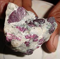 Mineral Wealth from Chandidongri


 Definitionsfrom Wiktionary
 Mediafrom Commons
 Newsfrom Wikinews
 Quotationsfrom Wikiquote
 Textsfrom Wikisource
 Textbooksfrom Wikibooks
 Resourcesfrom Wikiversity
 Travel informationfrom Wikivoyage
 Geographic data related toChhattisgarhatOpenStreetMap