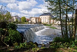
Clain
Appearance
| Clain | |
|---|---|
 | |
 | |
| Location | |
| Country | France |
| Physical characteristics | |
| Source | |
| • location | Poitou |
| Mouth | |
• location | Vienne |
• coordinates | 46°46′52″N0°32′26″E/ 46.78111°N 0.54056°E |
| Length | 144 km (89 mi) |
| Basin size | 3,145 km2(1,214 sq mi) |
| Basin features | |
| Progression | Vienne→Loire→Atlantic Ocean |

TheClain(French pronunciation:[klɛ̃];Occitan:Clen) is a 144 km (89 mi) long river in western France, a left tributary of the riverVienne.[1]Its source is nearHiesse,Charente.
The Clain flows generally north, through the followingdepartmentsand towns:
It joins the Vienne nearChâtellerault,Cenon-sur-Vienne.
Among its tributaries are theBoivre,theClouèreand theVonne.
References
[edit]Wikimedia Commons has media related toClain.
