
Clintwood, Virginia
Clintwood, Virginia | |
|---|---|
 Clintwood | |
 Seal | |
| Motto: "The county seat of Virginia's baby"[1] | |
 Location of Clintwood, Virginia | |
| Coordinates:37°9′0″N82°27′24″W/ 37.15000°N 82.45667°W | |
| Country | United States |
| State | Virginia |
| County | Dickenson |
| Founded by | John Wesley Mullins Jr |
| Government | |
| • Mayor | Danny Lambert |
| • Sheriff | Jeremy Fleming |
| Area | |
| • Total | 2.08 sq mi (5.39 km2) |
| • Land | 2.08 sq mi (5.39 km2) |
| • Water | 0.00 sq mi (0.01 km2) |
| Elevation | 1,755 ft (535 m) |
| Population (2010) | |
| • Total | 1,414 |
| • Estimate (2019)[3] | 1,284 |
| • Density | 617.31/sq mi (238.37/km2) |
| Time zone | UTC−5(Eastern (EST)) |
| • Summer (DST) | UTC−4(EDT) |
| ZIP code | 24228 |
| Area code | 276 |
| FIPS code | 51-17552[4] |
| GNISfeature ID | 1498468[5] |
| Website | www |
Clintwoodis a town inDickenson County,Virginia,United States. The population was 1,377 at the2020 census.[6]It is thecounty seatof Dickenson County.[7]
Although originally called "Holly Creek" after a small stream that runs through the town, it was later named "Clintwood" after Major Henry Clinton Wood, aConfederateofficer in the37th Virginia Infantry Regiment.[8]
History
[edit]Clintwood, Virginia was founded in 1829 byJohn "Holly Creek John" Mullins.[9]In June 1948, the town of Clintwood elected an all-female town council for the period from 1948 to 1950. The "Petticoat Government",as it was nicknamed, implemented change in many areas, including cleanup of the town, eliminating parking problems, organizing a systematic garbage disposal system, eliminating several traffic hazards, organizing the town's fire department, and purchasing a fire truck. The" Petticoat Government "received the attention ofLady Astor,a member of the British Parliament who expressed a desire to visit Clintwood to see how the experiment was going. The town was also featured in broadcasts by theVoice of America.[10][11]
Geography
[edit]Clintwood is located in northwestern Dickenson County at37°9′0″N82°27′24″W/ 37.15000°N 82.45667°W(37.150054, −82.456698).[12]Virginia State Route 83passes through the town, leading east 11 miles (18 km) toClinchcoand west 9 miles (14 km) toPound.
According to theUnited States Census Bureau,Clintwood has a total area of 1.9 square miles (4.9 km2), all of it land.[13]
Climate
[edit]Owing to its altitude, Clintwood has anoceanic climate(Köppen climate classificationCfb).
| Climate data for Clintwood, Virginia (1991–2020 normals, extremes 1993–present) | |||||||||||||
|---|---|---|---|---|---|---|---|---|---|---|---|---|---|
| Month | Jan | Feb | Mar | Apr | May | Jun | Jul | Aug | Sep | Oct | Nov | Dec | Year |
| Record high °F (°C) | 76 (24) |
78 (26) |
85 (29) |
90 (32) |
92 (33) |
97 (36) |
97 (36) |
95 (35) |
94 (34) |
89 (32) |
82 (28) |
73 (23) |
97 (36) |
| Mean daily maximum °F (°C) | 42.5 (5.8) |
46.5 (8.1) |
55.9 (13.3) |
67.5 (19.7) |
74.1 (23.4) |
79.5 (26.4) |
81.8 (27.7) |
80.7 (27.1) |
75.9 (24.4) |
66.4 (19.1) |
55.4 (13.0) |
45.5 (7.5) |
64.3 (17.9) |
| Daily mean °F (°C) | 32.1 (0.1) |
35.3 (1.8) |
42.7 (5.9) |
52.5 (11.4) |
60.9 (16.1) |
67.7 (19.8) |
71.2 (21.8) |
70.3 (21.3) |
64.3 (17.9) |
53.1 (11.7) |
42.6 (5.9) |
35.4 (1.9) |
52.3 (11.3) |
| Mean daily minimum °F (°C) | 21.7 (−5.7) |
24.1 (−4.4) |
29.4 (−1.4) |
37.6 (3.1) |
47.8 (8.8) |
55.9 (13.3) |
60.7 (15.9) |
59.9 (15.5) |
52.8 (11.6) |
39.9 (4.4) |
29.7 (−1.3) |
25.3 (−3.7) |
40.4 (4.7) |
| Record low °F (°C) | −19 (−28) |
−23 (−31) |
0 (−18) |
18 (−8) |
28 (−2) |
36 (2) |
45 (7) |
41 (5) |
31 (−1) |
20 (−7) |
8 (−13) |
−4 (−20) |
−23 (−31) |
| Averageprecipitationinches (mm) | 3.72 (94) |
3.91 (99) |
4.42 (112) |
4.56 (116) |
4.94 (125) |
5.12 (130) |
5.31 (135) |
4.06 (103) |
3.25 (83) |
2.83 (72) |
2.80 (71) |
4.25 (108) |
49.17 (1,249) |
| Average snowfall inches (cm) | 11.5 (29) |
10.5 (27) |
6.6 (17) |
0.8 (2.0) |
0.0 (0.0) |
0.0 (0.0) |
0.0 (0.0) |
0.0 (0.0) |
0.0 (0.0) |
0.3 (0.76) |
1.1 (2.8) |
7.6 (19) |
38.4 (98) |
| Average precipitation days(≥ 0.01 in) | 15.5 | 14.8 | 14.8 | 13.5 | 14.9 | 14.3 | 14.2 | 12.0 | 9.6 | 10.5 | 11.8 | 14.9 | 160.8 |
| Average snowy days(≥ 0.1 in) | 7.7 | 6.7 | 4.2 | 0.9 | 0.0 | 0.0 | 0.0 | 0.0 | 0.0 | 0.2 | 1.7 | 5.4 | 26.8 |
| Source:NOAA[14][15] | |||||||||||||
Demographics
[edit]| Census | Pop. | Note | %± |
|---|---|---|---|
| 1900 | 255 | — | |
| 1910 | 342 | 34.1% | |
| 1920 | 400 | 17.0% | |
| 1930 | 729 | 82.3% | |
| 1940 | 1,106 | 51.7% | |
| 1950 | 1,366 | 23.5% | |
| 1960 | 1,400 | 2.5% | |
| 1970 | 1,320 | −5.7% | |
| 1980 | 1,369 | 3.7% | |
| 1990 | 1,542 | 12.6% | |
| 2000 | 1,549 | 0.5% | |
| 2010 | 1,414 | −8.7% | |
| 2019 (est.) | 1,284 | [3] | −9.2% |
| U.S. Decennial Census[16] | |||
As of thecensus[4]of 2000, there were 1,549 people, 672 households, and 426 families residing in the town. Thepopulation densitywas 812.0 people per square mile (313.5 people/km2). There were 756 housing units at an average density of 396.3 per square mile (153.0/km2). The racial makeup of the town was 98.52%White,0.19%African American,0.19%Native American,0.13%Asian,and 0.97% from two or more races.HispanicorLatinoof any race were 0.52% of the population.
There were 672 households, out of which 21.9% had children under the age of 18 living with them, 44.8% weremarried couplesliving together, 15.5% had a female householder with no husband present, and 36.5% were non-families. 33.8% of all households were made up of individuals, and 17.7% had someone living alone who was 65 years of age or older. The average household size was 2.10 and the average family size was 2.65.
In the town, the population was spread out, with 16.5% under the age of 18, 8.3% from 18 to 24, 23.2% from 25 to 44, 27.8% from 45 to 64, and 24.3% who were 65 years of age or older. The median age was 46 years. For every 100 females, there were 84.4 males. For every 100 females age 18 and over, there were 81.5 males.
The median income for a household in the town was $22,663, and the median income for a family was $30,833. Males had a median income of $29,844 versus $21,250 for females. Theper capita incomefor the town was $16,323. About 16.0% of families and 21.6% of the population were below thepoverty line,including 30.5% of those under age 18 and 16.7% of those age 65 or over.
Education
[edit]- Ridgeview High School (Grades 9 – 12)
- Ridgeview Middle School (Grades 6 – 8)
- Clintwood Elementary School (Grades Pre-K – 5)
- Dickenson Center for Education and Research
- Dickenson County Career Center
Industry
[edit]- Serco North America
- Range Resources
- Dickenson Research and Education Center (many businesses also have offices here)
- Appalachian Power
- Marty Materials
Recreation
[edit]- Bear Pen Recreation Area (includes pool, park, picnic shelters, walking track, field for activities, and Pound River)
- Cranes Nest River and Recreation/Camping Area (includes fishing spots, multiple playgrounds, campground with RV sites, and walking/biking/horseback riding trails)
Area attractions
[edit]- Breaks Interstate Park
- John W. Flanagan Dam and Reservoir
- Ralph Stanley Museum
- Birch Knob Tower
- Jettie Baker Center
- Dickenson County Historical Society
- Cranes Nest Riverand camping/recreation area
- Jefferson National Forest
- Dickenson County Courthouse
- Dickenson County Art Center & Gallery
- Mountain Music Festival
- Dickenson County Visitor's Center & Dr. Phipps Museum
- Phipps Family Memorial Park
Notable persons
[edit]Singer, songwriter and multi-instrumentalistMark Linkous(Sparklehorse) has family ties to Clintwood, and for a short time called Clintwood home.
Justin Hamiltonwas a former star atClintwood High School,defensive back for the Virginia Tech Hokies and former member of the National Football League'sCleveland BrownsandWashington Redskinsfootball organizations.
Bluegrass musicianRalph Stanleywas from Dickenson County and lived on Sandy Ridge in the mountains that surround Clintwood. A museum honoring his musical legacy is located in the historic district of downtown.
References
[edit]- ^Town of Clintwood official website
- ^"2019 U.S. Gazetteer Files".United States Census Bureau.RetrievedAugust 7,2020.
- ^ab"Population and Housing Unit Estimates".United States Census Bureau. May 24, 2020.RetrievedMay 27,2020.
- ^ab"U.S. Census website".United States Census Bureau.RetrievedJanuary 31,2008.
- ^"US Board on Geographic Names".United States Geological Survey.October 25, 2007.RetrievedJanuary 31,2008.
- ^"Explore Census Data".data.census.gov.RetrievedApril 30,2024.
- ^"Find a County".National Association of Counties. Archived fromthe originalon May 31, 2011.RetrievedJune 7,2011.
- ^Tennis, Joe (2004).Southwest Virginia Crossroads: An Almanac of Place Names and Places to See.The Overmountain Press. p. 6.ISBN978-1-57072-256-1.
- ^"About Us".Town of Clintwood.RetrievedAugust 6,2022.
- ^Little, Herb (June 27, 1948)."Virginia Town's Males Vote in Petticoat Rule".Asheville Citizen-Times.Asheville, North Carolina. p. 2-B.Archivedfrom the original on November 20, 2018.RetrievedNovember 20,2018– vianewspapers.com.
- ^Short, Martha (February 14, 2000)."Petticoat Government".Archivedfrom the original on June 12, 2008.
- ^"US Gazetteer files: 2010, 2000, and 1990".United States Census Bureau.February 12, 2011.RetrievedApril 23,2011.
- ^"Geographic Identifiers: 2010 Demographic Profile Data (G001): Clintwood town, Virginia".American Factfinder.U.S. Census Bureau. Archived fromthe originalon February 13, 2020.RetrievedJanuary 13,2016.
- ^ "NowData – NOAA Online Weather Data".National Oceanic and Atmospheric Administration.RetrievedJune 28,2021.
- ^ "Station: Clintwood 1W, VA".U.S. Climate Normals 2020: U.S. Monthly Climate Normals (1991-2020).National Oceanic and Atmospheric Administration.RetrievedJune 28,2021.
- ^"Census of Population and Housing".Census.gov.RetrievedJune 4,2015.
External links
[edit]Municipalities and communities ofDickenson County, Virginia,United States | ||
|---|---|---|
| Towns | 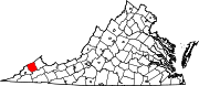 | |
| CDPs | ||
| Unincorporated communities | ||
| Footnotes | ‡This populated place also has portions in an adjacent county or counties | |
| International | |
|---|---|
| National | |