Cole Green Way
| Cole Green Way | |
|---|---|
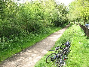
 Path at the old Cole Green station | |
| Length | 6 mi (9.7 km) |
| Location | Hertfordshire,England |
| Trailheads | Welwyn Garden City 51°47′27″N0°10′05″W/ 51.7908°N 0.1681°W Hertford 51°47′32″N0°05′10″W/ 51.7921°N 0.0861°W |
| Use | Hiking,Running,Cycling,Horseriding |
TheCole Green Wayis arail trailwhich runs east-west from the eastern edge ofWelwyn Garden CitytoHertfordinHertfordshire.Part ofNational Cycle NetworkRoute 61, and theLea Valley Walk,it runs for more than six miles along the former Hertford, Luton & Dunstable branch line fromWelwyn Garden City railway stationtoHertford North railway station.
History
[edit]The original line opened on March, 1, 1858[1]and operated passenger traffic until June, 18, 1951. It was never a busy branch line, and numbers decreased quickly after theHertford Loop Linewas added to theGreat Northern LinefromLondon King's Cross,which gave faster access toHertford North railway station.Prior to the Loop opening, trains on this branch terminated atHertford Cowbridge.It closed completely to goods traffic on 1 August 1962 and the track was lifted shortly afterwards.
The former trackbed has been used as apublic footpathsince and was refurbished by the local council to provide better facilities, including a public car park at what was Cole Green railway station. The route is largely flat, which makes it popular with walkers, horse riders and cyclists.
At the far end of the car park and associated picnic area, almost hidden in the undergrowth are the remains of buffers, presumably from station sidings.
The woodland associated with the car park and picnic area has a number of items carved from standing wood.[2]
The route forms part ofRoute 61of theNational Cycle Network.[3]
Route
[edit]Starting on the eastern edge of Welwyn Garden City at Cole Green Lane, the route heads east towards the household recycling centre by theA414with an underpass to allow access to the formerCole Green railway station.There are bridges at Station Road by Cole Green and Chapel Lane nearLetty Green.A further bridge was filled in further along, which means users must cross a country lane before rejoining the trail. At St. Mary's Lane there is another bridge just short of what wasHertingfordburyrailway station, now a private residence, and then the trail finishes by Hertford Town Football Club and the viaduct south ofHertford North railway station.
Other rail trails
[edit]The Cole Green Way is one of three rail trails in theWelwyn Hatfieldarea. The other two are theAlban Way,fromHatfieldtoSt. Albans,and theAyot Greenway,which connectsWelwyn Garden CitytoWheathampstead.
References
[edit]- ^"Cole Green Station".Disused Stations.Retrieved22 November2015.
- ^Amy McDonnell."The Cole Green Way - on foot or by bike - Walks - Hertfordshire".Hertfordshire.greatbritishlife.co.uk.Retrieved22 November2015.
- ^"The Cole Green Way".Ware Visitor Information.Retrieved22 November2015.
