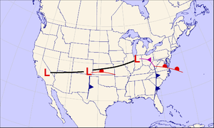
Colorado low

AColorado lowis alow-pressure areathat forms in southeasternColoradoor northeasternNew Mexico,typically in the winter. After forming, the system moves across theGreat Plains.[1]Colorado lows can produce heavy wintryprecipitation,and have a general east to northeast movement, impacting regions as far north asWinnipegand as far east as the Atlantic coast. If upper-level conditions are right, thejet streamcan push the low farther south, bringing wintry precipitation as far as Texas. When pushed this far south, the system is often referred to as a "blue norther".[citation needed]On the more typical track, a Colorado low can be similar to anAlberta clipper.[2]In the winter Colorado lows are responsible for a majority of the snow that theMidwestreceives; however, summer systems can trigger long-lastingconvective systems,includingsevere weather.[3]Spring and early summer Colorado lowcyclogenesiscan result in significanttornado outbreaksover the Great Plains and Midwest.
See also
[edit]References
[edit]- ^National Weather Service."Colorado Low".National Weather Service Glossary.Retrieved21 October2011.
- ^American Meteorological Society."Colorado low".Glossary of Meteorology.Archived fromthe originalon 30 March 2012.Retrieved21 October2011.
- ^Baker, D. James (2008).Weather: The Ultimate Book of Meteorological Events.Andrews McMeel Publishing. p. 34.ISBN978-0-7407-6989-4.
External links
[edit]

