
Jefferson County, Mississippi
Jefferson County | |
|---|---|
 | |
 Location within the U.S. state ofMississippi | |
 Mississippi's location within theU.S. | |
| Coordinates:31°44′N91°02′W/ 31.73°N 91.03°W | |
| Country | |
| State | |
| Founded | 1799 |
| Named for | Thomas Jefferson |
| Seat | Fayette |
| Largest city | Fayette |
| Area | |
| • Total | 527 sq mi (1,360 km2) |
| • Land | 520 sq mi (1,300 km2) |
| • Water | 7.3 sq mi (19 km2) 1.4% |
| Population (2020) | |
| • Total | 7,260 |
| • Density | 14/sq mi (5.3/km2) |
| Time zone | UTC−6(Central) |
| • Summer (DST) | UTC−5(CDT) |
| Congressional district | 2nd |
| Website | www |
Jefferson Countyis acountylocated in theU.S. stateofMississippi;its western border is formed by the Mississippi River. As of the2020 census,the population was 7,260,[1]making it the fourth-least populous county in Mississippi. Its firstcounty seatwas located atOld Greenvilleuntil 1825, which no longer exists,[2]before moving toFayette.[3]The county is named forU.S. PresidentThomas Jefferson.[4]
One of the first of two counties organized in theMississippi Territoryin 1798 along withAdams County,it was first named Pickering County and included what would becomeClaiborne County.[5]Originally developed as cotton plantations in theantebellum era,the rural county has struggled with a declining economy and reduced population since the mechanization of agriculture and urbanization of other areas. In 2020, its population of 7,260 was roughly one-third of the population peak in 1900. Within the United States, in 2009 rural Jefferson County had the highest percentage ofAfrican-Americansof any county. It was the fourth-poorest county in the nation.[6]
Geography
[edit]According to theU.S. Census Bureau,the county has a total area of 527 square miles (1,360 km2), of which 520 square miles (1,300 km2) is land and 7.3 square miles (19 km2) (1.4%) is water.[7]
Major highways
[edit]Adjacent counties
[edit]- Claiborne County(north)
- Copiah County(northeast)
- Lincoln County(southeast)
- Franklin County(south)
- Adams County(southwest)
- Tensas Parish, Louisiana(west)
National protected areas
[edit]- Homochitto National Forest(part)
- Natchez Trace Parkway(part)
Demographics
[edit]| Census | Pop. | Note | %± |
|---|---|---|---|
| 1800 | 2,940 | — | |
| 1810 | 4,001 | 36.1% | |
| 1820 | 6,822 | 70.5% | |
| 1830 | 9,755 | 43.0% | |
| 1840 | 11,650 | 19.4% | |
| 1850 | 13,193 | 13.2% | |
| 1860 | 15,349 | 16.3% | |
| 1870 | 13,848 | −9.8% | |
| 1880 | 17,314 | 25.0% | |
| 1890 | 18,947 | 9.4% | |
| 1900 | 21,292 | 12.4% | |
| 1910 | 18,221 | −14.4% | |
| 1920 | 15,946 | −12.5% | |
| 1930 | 14,291 | −10.4% | |
| 1940 | 13,969 | −2.3% | |
| 1950 | 11,306 | −19.1% | |
| 1960 | 10,142 | −10.3% | |
| 1970 | 9,295 | −8.4% | |
| 1980 | 9,181 | −1.2% | |
| 1990 | 8,653 | −5.8% | |
| 2000 | 9,740 | 12.6% | |
| 2010 | 7,726 | −20.7% | |
| 2020 | 7,260 | −6.0% | |
| 2023 (est.) | 6,941 | [8] | −4.4% |
| U.S. Decennial Census[9] 1790-1960[10]1900-1990[11] 1990-2000[12]2010-2013[13] | |||
| Race | Num. | Perc. |
|---|---|---|
| White | 891 | 12.27% |
| Black or African American | 6,138 | 84.55% |
| Native American | 10 | 0.14% |
| Asian | 14 | 0.19% |
| Pacific Islander | 5 | 0.07% |
| Other/Mixed | 128 | 1.76% |
| HispanicorLatino | 74 | 1.02% |
As of the2020 United States Census,there were 7,260 people, 2,448 households, and 1,488 families residing in the county.
Education
[edit]Jefferson County School Districtoperates public schools in all of the county.[15]
Communities
[edit]City
[edit]- Fayette(county seat)
Unincorporated communities
[edit]Ghost towns or defunct
[edit]Politics
[edit]Jefferson County is overwhelmingly Democratic, and has supported Democratic candidates in presidential elections with at least 80% of the vote since Bill Clinton in 1992, who won 79%. Republicans have not garnered even 25% of the vote in presidential elections since 1972 (when Jefferson was one of only three counties in Mississippi to vote forGeorge McGovern).
The last Republican to win the county wasBarry Goldwater.Although Goldwater lost nationally in a landslide, he carried the state of Mississippi (and also Jefferson County) in a landslide, winning over 87% of the vote and carrying every county.[note 1]Jefferson County supported him with 95% of the vote. Goldwater's lopsided victory was the result of Mississippi'sdecades-long suppression of the voting rights of African Americans,which only began to be reversed with the passage of theVoting Rights Act of 1965.[note 2]
| Year | Republican | Democratic | Third party | |||
|---|---|---|---|---|---|---|
| No. | % | No. | % | No. | % | |
| 2020 | 531 | 13.59% | 3,327 | 85.13% | 50 | 1.28% |
| 2016 | 490 | 12.69% | 3,337 | 86.45% | 33 | 0.85% |
| 2012 | 468 | 10.56% | 3,951 | 89.13% | 14 | 0.32% |
| 2008 | 551 | 12.30% | 3,883 | 86.71% | 44 | 0.98% |
| 2004 | 630 | 18.16% | 2,821 | 81.32% | 18 | 0.52% |
| 2000 | 600 | 17.61% | 2,786 | 81.75% | 22 | 0.65% |
| 1996 | 489 | 15.68% | 2,531 | 81.15% | 99 | 3.17% |
| 1992 | 562 | 15.96% | 2,796 | 79.39% | 164 | 4.66% |
| 1988 | 702 | 20.64% | 2,693 | 79.18% | 6 | 0.18% |
| 1984 | 856 | 21.88% | 3,049 | 77.94% | 7 | 0.18% |
| 1980 | 751 | 20.17% | 2,871 | 77.09% | 102 | 2.74% |
| 1976 | 782 | 22.83% | 2,562 | 74.78% | 82 | 2.39% |
| 1972 | 1,131 | 43.37% | 1,457 | 55.87% | 20 | 0.77% |
| 1968 | 147 | 4.35% | 2,121 | 62.75% | 1,112 | 32.90% |
| 1964 | 1,258 | 94.80% | 69 | 5.20% | 0 | 0.00% |
| 1960 | 137 | 12.52% | 229 | 20.93% | 728 | 66.54% |
| 1956 | 189 | 19.65% | 440 | 45.74% | 333 | 34.62% |
| 1952 | 610 | 53.09% | 539 | 46.91% | 0 | 0.00% |
| 1948 | 14 | 1.41% | 15 | 1.51% | 967 | 97.09% |
| 1944 | 25 | 3.16% | 766 | 96.84% | 0 | 0.00% |
| 1940 | 7 | 0.87% | 801 | 99.13% | 0 | 0.00% |
| 1936 | 9 | 1.01% | 884 | 98.88% | 1 | 0.11% |
| 1932 | 24 | 3.07% | 753 | 96.29% | 5 | 0.64% |
| 1928 | 63 | 7.05% | 830 | 92.95% | 0 | 0.00% |
| 1924 | 50 | 9.14% | 497 | 90.86% | 0 | 0.00% |
| 1920 | 14 | 3.15% | 430 | 96.63% | 1 | 0.22% |
| 1916 | 3 | 0.65% | 456 | 99.13% | 1 | 0.22% |
| 1912 | 2 | 0.46% | 408 | 94.66% | 21 | 4.87% |
Notable people
[edit]- Abijah Hunt,merchant who lived in Old Greenville during theTerritorial Period,and owned a chain of stores and public cotton gins along theNatchez Trace[20]
- David Hunt,Antebellum planter who lived on Woodlawn Plantation in Jefferson County, and became one of 12 planter millionaires in the Natchez District before the American Civil War.
- Zachary Taylor,U.S. president, planter, and soldier who often stayed on his plantation, Cypress Grove in Jefferson County, between 1840 and 1848.
See also
[edit]- Cypress Grove Plantation
- National Register of Historic Places listings in Jefferson County, Mississippi
- Prospect Hill Plantation
- Springfield Plantation (Fayette, Mississippi)
- Woodland Plantation (Church Hill, Mississippi)
- Wyolah Plantation
Notes
[edit]- ^the statewide popular vote for Barry was 356,528, or 87.14%. Jefferson county saw 94.8% of its voters vote for Goldwater.[16][17]
- ^"Despite all of this progress, the South remained segregated, especially when it came to the polls, where African Americans faced violence and intimidation when they attempted to exercise their constitutional right to vote. Poll taxes and literacy tests designed to silence Black voters were common. Without access to the polls, political change in favor of civil rights was slow-to-non-existent. Mississippi was chosen as the site of the Freedom Summer project due to its historically low levels of African American voter registration; in 1962 less than 7 percent of the state's eligible Black voters were registered to vote."[18]
References
[edit]- ^"Census - Geography Profile: Jefferson County, Mississippi".United States Census Bureau.RetrievedJanuary 9,2023.
- ^https://msgw.org/jefferson/
- ^"Find a County".National Association of Counties. Archived fromthe originalon May 31, 2011.RetrievedJune 7,2011.
- ^Gannett, Henry (1905).The Origin of Certain Place Names in the United States.Govt. Print. Off. p. 168.
- ^https://msgw.org/jefferson/
- ^"King: They'll take small victories in struggling Mississippi county."CNN.September 25, 2009, Retrieved September 26, 2009.
- ^"2010 Census Gazetteer Files".United States Census Bureau. August 22, 2012. Archived fromthe originalon September 28, 2013.RetrievedNovember 4,2014.
- ^"Annual Estimates of the Resident Population for Counties: April 1, 2020 to July 1, 2023".United States Census Bureau.RetrievedApril 5,2024.
- ^"U.S. Decennial Census".United States Census Bureau.RetrievedNovember 4,2014.
- ^"Historical Census Browser".University of Virginia Library.RetrievedNovember 4,2014.
- ^"Population of Counties by Decennial Census: 1900 to 1990".United States Census Bureau.RetrievedNovember 4,2014.
- ^"Census 2000 PHC-T-4. Ranking Tables for Counties: 1990 and 2000"(PDF).United States Census Bureau.Archived(PDF)from the original on March 27, 2010.RetrievedNovember 4,2014.
- ^"State & County QuickFacts".United States Census Bureau. Archived fromthe originalon June 7, 2011.RetrievedSeptember 3,2013.
- ^"Explore Census Data".data.census.gov.RetrievedDecember 9,2021.
- ^"2020 CENSUS - SCHOOL DISTRICT REFERENCE MAP: Jefferson County, MS"(PDF).U.S. Census Bureau.Archived(PDF)from the original on July 31, 2022.RetrievedJuly 31,2022.-Text list
- ^https://uselectionatlas.org/RESULTS/datagraph.php?fips=28&year=1964&off=0&elect=0&f=0
- ^https://uselectionatlas.org/RESULTS/state.php?fips=28&year=1964&off=0
- ^https://www.history.com/topics/black-history/freedom-summer
- ^Leip, David."Dave Leip's Atlas of U.S. Presidential Elections".uselectionatlas.org.RetrievedMarch 4,2018.
- ^A Guide to the Abijah Hunt Papers, 1800-1821, 1880,The University of Texas at Austin:Briscoe Center for American History
External links
[edit] Media related toJefferson County, Mississippiat Wikimedia Commons
Places adjacent to Jefferson County, Mississippi | ||||||||||||||||
|---|---|---|---|---|---|---|---|---|---|---|---|---|---|---|---|---|
| ||||||||||||||||
Municipalities and communities ofJefferson County, Mississippi,United States | ||
|---|---|---|
| City | 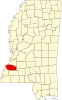 | |
| Unincorporated communities | ||
| Ghost towns | ||
31°44′N91°02′W/ 31.73°N 91.03°W
| International | |
|---|---|
| National | |
| Other | |