
Doddridge, Arkansas
Doddridgeis anunincorporated communityin southernMiller County,Arkansas,United States,[1]approximately five miles north of theLouisianaborder. Doddridge is located at the junction ofArkansas Highway 160andU.S. Route 71,andI-49(formerHighway 549) passes through the area, connecting it to Texarkana and Louisiana, as well as the confluence of theSulphurandRedrivers. Although unincorporated, Doddridge has apost office,with theZIP codeof 71834.[2]
The community is part of theTexarkana, TX–Texarakana, ARMetropolitan Statistical Area.
It is within theFouke School District.It was previously served by theBright Star School District,which operated the Bright Star School in Doddridge.[3]On July 1, 2004, the Bright Star School District was merged into the Fouke School District.[4]
References
[edit]- ^U.S. Geological Survey Geographic Names Information System: Doddridge, Arkansas
- ^Zip Code LookupArchivedJune 15, 2011, at theWayback Machine
- ^Home.Bright Star School District. October 20, 2001. Retrieved on May 14, 2018. "Rt. 1 Box 222 Doddridge, AR 71834"
- ^"Consolidation/Annexations of LEA's (1983-2010)."()Arkansas Department of Education.Retrieved on March 6, 2011.
Municipalities and communities ofMiller County, Arkansas,United States | ||
|---|---|---|
| Cities | 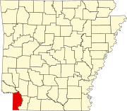 | |
| Town | ||
| CDP | ||
| Other unincorporated communities | ||
33°05′30″N93°54′30″W/ 33.09167°N 93.90833°W
This article about a location inMiller County,Arkansasis astub.You can help Wikipedia byexpanding it. |