Dzari
Dzari
| |
|---|---|
Village | |
| Coordinates:42°17′36″N43°52′19″E/ 42.29333°N 43.87194°E | |
| Country | |
| De facto state | South Ossetia[n 1] |
| Population (2015)[1] | |
| • Total | 178 |
| Time zone | UTC+4(Georgian Time) |
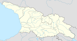
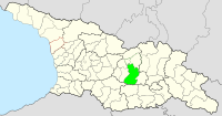
Dzari(Georgian:ძარი,Ossetian:ЗарZar,Russian:Зар) is a settlement at the head of the river Kornisistskali (left tributary of theEastern Fron) in theTskhinvali District[2]ofSouth Ossetia,Georgia.[3]It is located 12 kilometerswestofTskhinvali.Community center, villages: Brili, Gardanta, Dampaleti, Zemo Dodoti, Kverneti, Mebrune, Rustavi, Kvemo Dodoti, Chelekhsata, Jabita.
Geography
[edit]Located onShida Kartliplain. 1200 meters (4,049 foot) above sea level.
History
[edit]According to 1847 data, Dzari was included in the villages of the Kornisi Valley and was inhabited by ethnic Ossetians. Until 1991 it was part of the Tskhinvali region. It has been occupied by Russia since 2008 and de facto controlsRepublic of South Ossetia.
On May 20, 1992, on the road from the village, theZar tragedyoccurred — during which a column ofOssetianrefugees were shot and killed byGeorgianmilitants.
The village is famous for the "Zarskaya bypass road", or "The road of life" from Tskhinvali toVladikavkaz.A memorial complex to the victims of the war was built on the territory of the village.
See also
[edit]Notes
[edit]- ^South Ossetia's status is disputed. It considers itself to be an independent state, but this is recognised byonly a few other countries.TheGeorgiangovernment and most of the world's other states consider South Ossetiade jurea part of Georgia's territory.
References
[edit]- ^"RESULTS GENERAL POPULATION CENSUS REPUBLIC OF SOUTH OSSETIA"(PDF).ugosstat.ru.2015.Retrieved2023-10-26.
- ^Dzari, GeorgiaMindat.org
- ^Президиум Верховного Совета Грузинской Советской Социалистической Республики (1988).Грузинская ССР. Административно-территориальное деление на 1 января 1987 г.Тбилиси: Сабчота Сакартвело. p. 272.


