
Ensign, Kansas
Ensign, Kansas | |
|---|---|
 Location withinGray CountyandKansas | |
 | |
| Coordinates:37°39′11″N100°13′58″W/ 37.65306°N 100.23278°W[1] | |
| Country | United States |
| State | Kansas |
| County | Gray |
| Founded | 1880s |
| Platted | 1886 (Lone Lake) |
| Incorporated | 1929 |
| Named for | G.L. Ensign |
| Area | |
| • Total | 0.29 sq mi (0.75 km2) |
| • Land | 0.29 sq mi (0.75 km2) |
| • Water | 0.00 sq mi (0.00 km2) |
| Elevation | 2,720 ft (830 m) |
| Population | |
| • Total | 166 |
| • Density | 570/sq mi (220/km2) |
| Time zone | UTC-6(CST) |
| • Summer (DST) | UTC-5(CDT) |
| ZIP code | 67841 |
| Area code | 620 |
| FIPS code | 20-21400 |
| GNIS ID | 2394694[1] |
| Website | cityofensign.com |
Ensignis a city inGray County,Kansas,United States.[1]As of the2020 census,the population of the city was 166.[3]It is located alongU.S. Route 56highway.
History
[edit]Ensign was originally calledLone Lake,and under the latter name laid out about 1886. It was renamedEnsignin 1888 in honor of its founder, G. L. Ensign.[4][5]
Geography
[edit]According to theUnited States Census Bureau,the city has a total area of 0.29 square miles (0.75 km2), all of it land.[6]
Demographics
[edit]| Census | Pop. | Note | %± |
|---|---|---|---|
| 1930 | 244 | — | |
| 1940 | 202 | −17.2% | |
| 1950 | 227 | 12.4% | |
| 1960 | 255 | 12.3% | |
| 1970 | 237 | −7.1% | |
| 1980 | 209 | −11.8% | |
| 1990 | 192 | −8.1% | |
| 2000 | 203 | 5.7% | |
| 2010 | 187 | −7.9% | |
| 2020 | 166 | −11.2% | |
| U.S. Decennial Census | |||
2020 census
[edit]The2020 United States censuscounted 166 people, 61 households, and 48 families in Ensign.[7][8]The population density was 570.4 per square mile (220.2/km2). There were 70 housing units at an average density of 240.5 per square mile (92.9/km2).[8][9]The racial makeup was 63.86% (106)whiteorEuropean American(57.83%non-Hispanic white), 0.0% (0)blackorAfrican-American,0.0% (0)Native AmericanorAlaska Native,0.0% (0)Asian,0.0% (0)Pacific IslanderorNative Hawaiian,18.07% (30) fromother races,and 18.07% (30) fromtwo or more races.[10]HispanicorLatinoof any race was 37.95% (63) of the population.[11]
Of the 61 households, 36.1% had children under the age of 18; 60.7% were married couples living together; 21.3% had a female householder with no spouse or partner present. 21.3% of households consisted of individuals and 8.2% had someone living alone who was 65 years of age or older.[8]The average household size was 1.9 and the average family size was 2.1.[12]The percent of those with a bachelor’s degree or higher was estimated to be 7.8% of the population.[13]
23.5% of the population was under the age of 18, 11.4% from 18 to 24, 21.7% from 25 to 44, 21.1% from 45 to 64, and 22.3% who were 65 years of age or older. The median age was 39.0 years. For every 100 females, there were 95.3 males.[8]For every 100 females ages 18 and older, there were 104.8 males.[8]
The 2016-2020 5-yearAmerican Community Surveyestimates show that the median household income was $58,333 (with a margin of error of +/- $17,626) and the median family income was $62,500 (+/- $31,265).[14]Males had a median income of $45,179 (+/- $22,844) versus $30,500 (+/- $8,376) for females. The median income for those above 16 years old was $33,036 (+/- $9,058).[15]Approximately, 0.0% of families and 3.3% of the population were below thepoverty line,including 0.0% of those under the age of 18 and 4.3% of those ages 65 or over.[16][17]
2010 census
[edit]As of thecensus[18]of 2010, there were 187 people, 76 households, and 52 families living in the city. Thepopulation densitywas 644.8 inhabitants per square mile (249.0/km2). There were 86 housing units at an average density of 296.6 per square mile (114.5/km2). The racial makeup of the city was 88.2%White,1.6%African American,1.6%Native American,5.9% fromother races,and 2.7% from two or more races.HispanicorLatinoof any race were 28.3% of the population.
There were 76 households, of which 27.6% had children under the age of 18 living with them, 56.6% weremarried couplesliving together, 7.9% had a female householder with no husband present, 3.9% had a male householder with no wife present, and 31.6% were non-families. 27.6% of all households were made up of individuals, and 14.5% had someone living alone who was 65 years of age or older. The average household size was 2.46 and the average family size was 3.02.
The median age in the city was 41.5 years. 24.1% of residents were under the age of 18; 8% were between the ages of 18 and 24; 21.9% were from 25 to 44; 32.6% were from 45 to 64; and 13.4% were 65 years of age or older. The gender makeup of the city was 48.1% male and 51.9% female.
2000 census
[edit]
As of thecensus[19]of 2000, there were 203 people, 72 households, and 55 families living in the city. The population density was 727.1 inhabitants per square mile (280.7/km2). There were 77 housing units at an average density of 275.8 per square mile (106.5/km2). The racial makeup of the city was 90.64%White,0.99%Asian,6.90% fromother races,and 1.48% from two or more races.HispanicorLatinoof any race were 21.18% of the population.
There were 72 households, out of which 33.3% had children under the age of 18 living with them, 69.4% weremarried couplesliving together, 4.2% had a female householder with no husband present, and 23.6% were non-families. 16.7% of all households were made up of individuals, and 12.5% had someone living alone who was 65 years of age or older. The average household size was 2.82 and the average family size was 3.22.
In the city, the population was spread out, with 26.6% under the age of 18, 8.9% from 18 to 24, 25.6% from 25 to 44, 26.1% from 45 to 64, and 12.8% who were 65 years of age or older. The median age was 36 years. For every 100 females, there were 97.1 males. For every 100 females age 18 and over, there were 98.7 males.
As of 2000 the median income for a household in the city was $48,438, and the median income for a family was $56,250. Males had a median income of $31,071 versus $17,292 for females. Theper capita incomefor the city was $35,637. About 5.8% of families and 11.0% of the population were below thepoverty line,including 17.8% of those under the age of eighteen and 20.7% of those 65 or over.
Economy
[edit]TheGray County Wind Farmnear Ensign is the largest wind farm in Kansas.
Education
[edit]The community is served byCimarron–Ensign USD 102public school district. Ensign had its own high school until 1984.[20]The Ensign High School mascot was Ensign Wildcats.[21]
Notable people
[edit]- John Crutcher,former Lieutenant Governor ofKansas.
References
[edit]- ^abcdU.S. Geological Survey Geographic Names Information System: Ensign, Kansas
- ^"2019 U.S. Gazetteer Files".United States Census Bureau.RetrievedJuly 24,2020.
- ^ab"Profile of Ensign, Kansas in 2020".United States Census Bureau.Archivedfrom the original on November 27, 2021.RetrievedNovember 26,2021.
- ^Kansas State Historical Society (1916).Biennial Report of the Board of Directors of the Kansas State Historical Society.Kansas State Printing Plant. p. 197.
- ^"Profile for Ensign, Kansas".ePodunk.Archived fromthe originalon July 14, 2014.RetrievedJune 10,2014.
- ^"US Gazetteer files 2010".United States Census Bureau.Archived fromthe originalon January 25, 2012.RetrievedJuly 6,2012.
- ^"US Census Bureau, Table P16: HOUSEHOLD TYPE".data.census.gov.RetrievedJanuary 2,2024.
- ^abcde"US Census Bureau, Table DP1: PROFILE OF GENERAL POPULATION AND HOUSING CHARACTERISTICS".data.census.gov.RetrievedJanuary 2,2024.
- ^Bureau, US Census."Gazetteer Files".Census.gov.RetrievedDecember 30,2023.
{{cite web}}:|last=has generic name (help) - ^"US Census Bureau, Table P1: RACE".data.census.gov.RetrievedJanuary 2,2024.
- ^"US Census Bureau, Table P2: HISPANIC OR LATINO, AND NOT HISPANIC OR LATINO BY RACE".data.census.gov.RetrievedJanuary 2,2024.
- ^"US Census Bureau, Table S1101: HOUSEHOLDS AND FAMILIES".data.census.gov.RetrievedJanuary 2,2024.
- ^"US Census Bureau, Table S1501: EDUCATIONAL ATTAINMENT".data.census.gov.RetrievedJanuary 2,2024.
- ^"US Census Bureau, Table S1903: MEDIAN INCOME IN THE PAST 12 MONTHS (IN 2020 INFLATION-ADJUSTED DOLLARS)".data.census.gov.RetrievedJanuary 2,2024.
- ^"US Census Bureau, Table S2001: EARNINGS IN THE PAST 12 MONTHS (IN 2020 INFLATION-ADJUSTED DOLLARS)".data.census.gov.RetrievedJanuary 2,2024.
- ^"US Census Bureau, Table S1701: POVERTY STATUS IN THE PAST 12 MONTHS".data.census.gov.RetrievedJanuary 2,2024.
- ^"US Census Bureau, Table S1702: POVERTY STATUS IN THE PAST 12 MONTHS OF FAMILIES".data.census.gov.RetrievedJanuary 2,2024.
- ^"U.S. Census website".United States Census Bureau.RetrievedJuly 6,2012.
- ^"U.S. Census website".United States Census Bureau.RetrievedJanuary 31,2008.
- ^"Kansas K-12 Reports".Kansas State Department of Education.RetrievedDecember 31,2016.
- ^"Ensign Cats Nudge Ingalls", Garden City Telegram, 10 February 1962, p.15.
Further reading
[edit]External links
[edit]- City website
- Ensign - Directory of Public Officials
- USD 102,local school district
- Ensign City Map,KDOT
Municipalities and communities ofGray County, Kansas,United States | ||
|---|---|---|
| Cities | 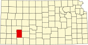 | |
| Unincorporated communities | ||
| Townships | ||