
Entebbe
Entebbe | |
|---|---|
 Overview of Entebbe | |
 Entebbe Location in Uganda  Entebbe Entebbe (Africa) | |
| Coordinates:00°03′00″N32°27′36″E/ 0.05000°N 32.46000°E | |
| Country | |
| Region | Central Uganda |
| District | Wakiso District |
| Government | |
| • Mayor | Vincent Kayanja[2] |
| Area | |
| • Total | 56.2 km2(21.7 sq mi) |
| • Water | 20 km2(8 sq mi) |
| Elevation | 1,180 m (3,870 ft) |
| Population (2014 Census) | |
| • Total | 69,958[1] |
Entebbeis a city inCentralUgandawhich is located onLake Victoriapeninsula, approximately 36 kilometres (22 mi) southwest of the Ugandan capital city,Kampala.[3]Entebbe was once the seat of government for the Protectorate of Uganda prior to independence, in 1962. The city is the location ofEntebbe International Airport,Uganda's largest commercial and military airport, which gained worldwide attention in 1976Israeli rescueof 100 hostages kidnapped by the militant group of thePFLP-EOandRevolutionary Cells (RZ)organizations. Entebbe is also the location ofState House,the official office and residence of thePresident of Uganda.[4][5]
Etymology[edit]
The word came fromLuganda languagee ntebewhich means 'seat' / 'chair'. Entebbe was a cultural site for the Mamba clan and it was called "entebbe za Mugula" - Mugula was the title of a chief of a subdivision of the Mamba clan - and is now the location of the official office and residence of thePresident of Uganda,as it was for British governors before independence. Entebbe was the former seat of power in the country, but has now been replaced by Kampala.[6]
Location[edit]
Entebbe sits on the northern shores ofLake Victoria,Africa's largestlake.The town is situated inWakiso District,approximately 34 kilometres (21 mi) south ofKampala,Uganda'scapitaland largest city.[7]The metropolis is located on a peninsula into Lake Victoria, covering a total area of 56.2 square kilometres (21.7 sq mi), out of which 20 km2(7.7 sq mi) is water. The coordinates of Entebbe are:0°03'00.0 "N, 32°27'36.0" E (Latitude:0.0500; Longitude:32.4600).[8]Neighborhoods within Entebbe City include Bugonga, Katabi, Nakiwogo, Nsamizi, Kitooro, Lunnyo andLugonjo.[9]
Population[edit]
During the 2002 national census, Entebbe's population was estimated at 55,100 people. In 2010, the Uganda Bureau of Statistics (UBOS) estimated the population of the town at 76,500. In 2011, UBOS estimated the population of Entebbe at approximately 79,700.[10]On 27 August 2014, the national population census put Entebbe's population at 69,958.[1]
| Year | Pop. | ±% |
|---|---|---|
| 1969 | 21,096 | — |
| 1980 | 21,289 | +0.9% |
| 1991 | 42,763 | +100.9% |
| 2002 | 55,086 | +28.8% |
| 2014 | 70,219 | +27.5% |
| source:[11] | ||
History[edit]
"Entebbe", in the localLuganda language,means a "seat" and was probably named that because it was the place where aBagandachief sat to adjudicate legal cases. It first became aBritish colonialadministrative and commercial centre in 1893 whenSir Gerald Portal,a colonial Commissioner, used it as a base.[12]Port Bellwent on to become Kampala's harbour. Although no ships dock there now, there is still ajetty,which was used byLake Victoria ferries.
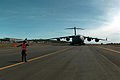
Entebbe International Airport, the main international airport of Uganda, has been the site of some well known events, making it famous in Europe and abroad. It was from this airport thatQueenElizabeth IIdeparted Africa to return to England in 1952 when she learned of her father's death and that she had become Queen. The airport was the scene ofOperation Entebbe,a hostage rescue on 4 July 1976, when soldiers from theSayeret Matkal,Paratroopers BrigadeandGolani Brigadeunits of theIsraeli Armyfreed over 100 hostages following ahijackingby a group ofPalestinianand German militia.
The city of Entebbe also hosted final resolution talks to end theM23 rebellion.[13]
Biomedical research hub[edit]

Entebbe is home to theUganda Virus Research Institute(UVRI), aUgandan governmentorganization which provides space to conduct research to the International AIDS Vaccine InitiativeHIV vaccineprogram, theUK Medical Research Centre Laboratories(MRC), the USCentre for Disease Control(CDC) and theNational Institutes of Health(NIH).[14]Most research performed at UVRI isinfectious disease-oriented and focuses onHIV,tuberculosis,malariaandhelminthinfections.[15]It is also home for the headquarters ofUganda National Medical Stores,until the new headquarters and main warehouse building inKajjansiis completed, then the headquarters will relocate to Kajjansi.[16]
Tourist attractions[edit]
- The extensiveNational Botanical Gardens,laid out in 1898, are located in Entebbe.
- Entebbe is the home of theUganda Virus Research Institute(UVRI)
- Entebbe is the location of theUganda Wildlife Education Centre(UWEC)[17]The centre also serves as the nationalzoo.The entrance to the centre is located near the jetty. Foreign visitors have noted the seeming incongruity of wild monkeys sitting in the trees over the centre's paths.
- Entebbe is the location ofNkumba University,one of the more than thirty licensed institutions oftertiary educationin Uganda.
- State House,the official residence of thePresident of Uganda,is located in Entebbe.[18]
- Entebbe is also home to one of the historical site in Kigungu where the first catholic missionaries Brother Amans and Father Mon Maple Lourdel landed to establish the catholic faith in Uganda.
-
 Sunset over Entebbe
 -
-
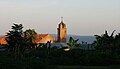 Bugonga Church in Entebbe
 -
 Entebbe sits on the northern shores of Lake Victoria
 -
 Entebbe along Lake Victoria


- Entebbe is home of the oldest golf course in East Africa calledEntebbe Golf Club,which was established in 1900. Entebbe Golf Club is surrounded by the Uganda Wildlife Education Centre, (formerly Entebbe Zoo), on its south side.
Government and infrastructure[edit]
The head office of the UgandanCivil Aviation Authorityis on the property ofEntebbe International Airport.[19]TheUganda Ministry of Agriculture, Animal Industry and Fisheriesmaintains its headquarters in Entebbe.[20]
The Special Forces Command, a specialized unit of theUganda People's Defense Forces,responsible for the security of the president of Uganda, his immediate family, constitutional monarchs, state guests and vital national assets, including the national oil fields, maintains its headquarters in Entebbe.[21]
Other points of interest[edit]
Other points of interest within the city limits or close to its edges include the offices of Entebbe City Council and several branches of foreign and indigenous commercial banks. The supermarket chain,Shoprite,maintains a branch in Entebbe.[22]In 2014, the American fast-food chainKFCopened a franchise in the town.[23]
Entebbe is home to theEntebbe Children's Surgical Hospital,a children's hospital, center of excellence for pediatric surgery, owned and operated byEmergency,an internationalNGOthat offers "free medical treatment to the victims of war, poverty and landmines".[24]
Geography[edit]
Climate[edit]
Entebbe experiences atropical rainforest climate(Af) according to theKöppen climate classificationas the city has no real dry season throughout the year. Its driest month is July with precipitation averaging 72 millimetres or 2.83 inches, while the wettest is April with precipitation averaging 264 millimetres or 10.39 inches. The temperature is moderated by the altitude. The hottest month is February with an average temperature of 22.8 °C (73.0 °F), while the coolest is July with an average temperature of 20.6 °C (69.1 °F).
| Climate data for Entebbe, Uganda (1961–1990) | |||||||||||||
|---|---|---|---|---|---|---|---|---|---|---|---|---|---|
| Month | Jan | Feb | Mar | Apr | May | Jun | Jul | Aug | Sep | Oct | Nov | Dec | Year |
| Record high °C (°F) | 31.3 (88.3) |
31.7 (89.1) |
30.6 (87.1) |
30.0 (86.0) |
28.9 (84.0) |
27.8 (82.0) |
28.1 (82.6) |
28.9 (84.0) |
29.8 (85.6) |
29.6 (85.3) |
31.7 (89.1) |
29.5 (85.1) |
31.7 (89.1) |
| Mean daily maximum °C (°F) | 26.3 (79.3) |
27.3 (81.1) |
26.7 (80.1) |
26.0 (78.8) |
25.4 (77.7) |
25.2 (77.4) |
25.3 (77.5) |
25.9 (78.6) |
26.5 (79.7) |
26.5 (79.7) |
26.0 (78.8) |
26.5 (79.7) |
26.1 (79.0) |
| Mean daily minimum °C (°F) | 18.0 (64.4) |
18.3 (64.9) |
18.5 (65.3) |
18.4 (65.1) |
18.0 (64.4) |
17.8 (64.0) |
17.2 (63.0) |
17.4 (63.3) |
17.4 (63.3) |
17.7 (63.9) |
17.9 (64.2) |
17.8 (64.0) |
17.9 (64.2) |
| Record low °C (°F) | 13.0 (55.4) |
10.7 (51.3) |
14.4 (57.9) |
12.2 (54.0) |
14.3 (57.7) |
14.0 (57.2) |
10.0 (50.0) |
12.0 (53.6) |
13.2 (55.8) |
13.9 (57.0) |
14.3 (57.7) |
13.8 (56.8) |
10.0 (50.0) |
| Average rainfall mm (inches) | 86.7 (3.41) |
84.4 (3.32) |
184.5 (7.26) |
264.4 (10.41) |
253.8 (9.99) |
116.2 (4.57) |
72.1 (2.84) |
77.8 (3.06) |
79.0 (3.11) |
127.6 (5.02) |
171.7 (6.76) |
120.6 (4.75) |
1,638.8 (64.52) |
| Average rainy days(≥ 1.0 mm) | 7.3 | 7.3 | 13.1 | 16.8 | 16.2 | 9.4 | 6.9 | 6.3 | 7.1 | 10.7 | 13.6 | 10.2 | 124.9 |
| Averagerelative humidity(%) | 76 | 76 | 77 | 79 | 79 | 78 | 77 | 78 | 76 | 75 | 76 | 76 | 77 |
| Mean monthlysunshine hours | 234 | 204 | 205 | 181 | 191 | 187 | 197 | 194 | 194 | 205 | 202 | 214 | 2,408 |
| Source 1:World Meteorological Organization[25] | |||||||||||||
| Source 2:Deutscher Wetterdienst(extremes and humidity),[26]Danish Meteorological Institute(sun, 1931–1960)[27] | |||||||||||||
See also[edit]
References[edit]
- ^abUBOS (27 August 2014)."The Population of The Regions of the Republic of Uganda And All Cities And Towns of More Than 15,000 Inhabitants".Citypopulation.de Quoting Uganda Bureau of Statistics (UBOS).Retrieved12 December2015.
- ^Ssebuyira, Martin (26 May 2011)."New Entebbe Mayor Faces Sh600 Million Debt Hurdle".Daily Monitorvia AllAfrica.com.Retrieved17 April2014.
- ^Google(30 August 2021)."Road Distance Between Central Kampala, Uganda And Entebbe City, Uganda"(Map).Google Maps.Google.Retrieved30 August2021.
- ^Ampurire, Paul (22 May 2019)."Cabinet Approves Phased Creation Of Nine New Cities Beginning 2020".Kampala: SoftPower Uganda.Retrieved22 May2019.
- ^Uganda Radio Network (21 May 2019)."Cabinet approves creation of nine cities".Daily MonitorQuotingUganda Radio Network.Kampala.Retrieved22 May2019.
- ^Visit Entebbe (28 December 2020)."Our History".Entebbe, Uganda: Visitentebbe.net.Retrieved28 December2020.
- ^Google(28 December 2020)."Distance between Central Kampala, Uganda and Entebbe Town, Uganda"(Map).Google Maps.Google.Retrieved28 December2020.
- ^Google(2 July 2015)."Location of Entebbe At Google Maps"(Map).Google Maps.Google.Retrieved2 July2015.
- ^Eve Muganga (26 September 2018)."Lugonjo never goes to sleep".Daily Monitor.Kampala.Retrieved25 March2019.
- ^"Estimated Population of Entebbe In 2002, 2010 & 2011"(PDF).Uganda Bureau of Statistics. Archived fromthe original(PDF)on 7 July 2014.Retrieved17 April2014.
- ^Entebbe population statistics
- ^Britannica,Entebbe,britannica.com, USA, accessed on July 7, 2019
- ^Burt (2018-02-20)."A little This 'n That about Entebbe".Gately Inn Entebbe.Retrieved2024-05-25.
- ^"NIH International Center for Excellence in Research".Johns Hopkins Bloomberg School of Public Health.Retrieved14 October2017.
- ^"Research on Endemic, Neglected, Emerging and Re-emerging infections (ENERI), MRC/UVRI".MRC/UVRI.Retrieved14 October2017.
- ^Deo Wasswa (10 May 2018)."National Medical Store to shift base to Kajjasi".Kampala: Capital Radio Uganda.Retrieved23 April2021.
- ^"UWEC Homepage".Uganda Wildlife Education Centre.Retrieved18 April2014.
- ^"Homepage of State House Entebbe".State House Entebbe.Retrieved18 April2014.
- ^Airport-technology.com (2019)."Entebbe International Airport Expansion".Copyright 2019 Verdict Media Limited.Retrieved15 June2019.
- ^Uganda Ministry of Agriculture (2019)."Uganda Ministry of Agriculture, Animal Industry and Fisheries: Contact Details".Entebbe:Ministry of Agriculture, Animal Industry and Fisheries (Uganda).Retrieved15 June2019.
- ^Global Security (18 May 2016)."About the Special Forces Command (SFC)".Washington DC:GlobalSecurity.org.Retrieved15 June2019.
- ^Uganda Business News (8 September 2017)."Shoprite to open a fourth store at Victoria Mall".Kampala: Uganda Business News.Retrieved25 March2019.
{{cite web}}:|author=has generic name (help) - ^Ogwal, Lawrence (31 July 2014)."KFC Opens New Branch At Victoria Mall In Entebbe".Daily Monitor.Kampala.Retrieved3 September2014.
- ^The Observer (22 April 2021)."Free Children's Surgical hospital begins operations in Entebbe".The Observer (Uganda).Kampala.Retrieved26 April2021.
- ^ "World Weather Information Service – Entebbe".World Meteorological Organization.Retrieved1 September2016.
- ^ "Klimatafel von Entebbe (Flugh.) / Uganda"(PDF).Federal Ministry of Transport and Digital Infrastructure.Retrieved14 June2016.
- ^
"STATIONSNUMMER 63705"(PDF).Ministry of Energy, Utilities and Climate. Archived from the original on January 16, 2013.Retrieved14 June2016.
{{cite web}}:CS1 maint: unfit URL (link)
External links[edit]
- Updated Website: A guide to Entebbe CityArchived2022-02-11 at theWayback Machine
- Profile of Entebbe Town In August 2012Archived2016-06-04 at theWayback Machine
- UVRI-IAVI HIV Vaccine Program in EntebbeArchived2019-11-02 at theWayback Machine
- MRC/UVRI Uganda Research Unit on AIDS
![]() Media related toEntebbeat Wikimedia Commons
Media related toEntebbeat Wikimedia Commons
| International | |
|---|---|
| National | |
