
Europa Point

Europa Point(SpanishandLlanito:Punta de EuropaorPunta Europa), is the southernmost point ofGibraltar.Although not thesouthernmost point of the Iberian Peninsula,Europa Point defines the boundary between theStraits of Gibraltarin theAtlantic Ocean,and theAlboran Seawithin theMediterranean.At the end of theRock of Gibraltar,the area is flat and occupied by such features as a playing field and a few buildings. On a clear day, views ofNorth Africacan be seen across theStrait of GibraltarincludingCeutaand theRif MountainsofMorocco;as well as theBay of Gibraltarand theSpanishtowns along its shores. It is reached from the old town byEuropa Road.
Overview
[edit]There are five notable buildings,Harding's Battery,theIbrahim-al-Ibrahim Mosque,theRoman CatholicShrine of Our Lady of Europe,theEuropa Point Lighthouseand theNun's Well.Europa Point is also the location of Gibraltar's only dedicated cricket oval[1]where theGibraltar national cricket teamplay and since 2013 Europa Point has been the location of theSikorski Memorial.
Europa Point is linked with theEastern side of the Rock,includingSandy BayandCatalan Bay,viaDudley Ward Tunnel.The tunnel re-opened in 2010 after eight years closure following a fatalrockfall.
TheGovernment of Gibraltarspent£4.4 million on refurbishing Europa Point in 2011 and it was opened by the thenChief Minister of GibraltarPeter Caruana.[2]In 2013 an originalRML 12.5 inch 38 ton gunwas mounted on a custom made replica carriage at Hardings's Battery and the memorial to GeneralWladislaw Sikorskiwas relocated here fromSir Herbert Miles Road.
Notable buildings
[edit]Harding's Battery
[edit]
Europa has been the site of Spanish and Moorish fortifications as well as those constructed by the British which added to the cliffs which were part of Gibraltar's natural defences. Additions included walls, the scarping of the rocks to remove foot and handholds and a large number of batteries supported by a local barracks.[3]Today,Harding's Batteryis central to the land at the end of the point. Built in the 19th century, this battery shows the scale of guns that could fire 800 pound projectiles over a foot in diameter over to the other side of theStraits of Gibraltar.TheEuropa Sunken Magazinethat contained this ammunition is now a visitor centre.
Lighthouse
[edit]
The Europa Point Lighthouse was built byGovernorSir Alexander Woodfordbetween 1838 and 1841. It was fully automated in February 1994 and its loom can be seen over a distance of 27 km (17 mi). It is the southernmost lighthouse for whichTrinity Houseis responsible,[4]and the only one outside theBritish Isles.
Gibraltariansrefer to it as "la farola"when conversing inLlanito. The Gibraltar Amateur Radio operators transmit from the area of the lighthouse.[5]

Ibrahim-al-Ibrahim Mosque
[edit]Themosque,also known as theKing Fahd bin Abdulaziz al-Saud Mosqueor theMosque of the Custodian of the Two Holy Mosques,was a gift fromKing FahdofSaudi Arabiaand took two years to build at a cost of around£5 million. It was officially inaugurated on 8 August 1997. The mosque complex also contains aschool,library,andlecture hall.It is the only purpose-built mosque in Gibraltar to serve theMuslimsin the territory who number over 1,000.[6]
Shrine of Our Lady of Europe
[edit]
On 20 August 1462, onSt. Bernard of Clairvaux's feastday, the Spaniards under DonRodrigo Ponce de León,recaptured Gibraltar from theMoors.They found a little mosque at Europa Point and converted it into a Christian shrine in honour of Our Lady as Patroness of Europe, with devout intention of consecrating to God, through Mary, the whole continent, from a place of prayer and worship at its southernmost point.
They built a largechapelat right angles to the mosque's east wall and the whole area became the Shrine of Our Lady of Europe. A statue of the Virgin and Child was installed in this shrine. The statue was quite small, only.6 m (2.0 ft) in height, carved in wood and polychromed in royal red, blue and gold. The Virgin was seated in a simple chair, with the Child Jesus on her lap. Both were crowned and the Virgin held in her right hand asceptrewith three flowers denoting Love, Truth and Justice. The shrine prospered in fame and popularity, for well over two centuries. Ships passing through the Strait saluted Our Lady as they passed Europa Point and mariners often came ashore with gifts to the shrine. Provisions were made by them for a constant supply of oil so that a light could be kept burning not only in front of the image but also in the tower.
In 1979Pope John Paul IIofficially approved the title of Our Lady of Europe as Patroness of Gibraltar, and subsequently, the shrine was restored.
Nun's Well
[edit]
Nun's Wellis an old underground water store opposite the end of theKeightley Way Tunnel.The water was used in the nineteenth century to make beer. In 1988 the buildings were repaired in order that it could be used by visitors to Gibraltar.[7]
Gallery
[edit]-

-
-
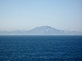
 Europa Point toward Mediterranean sea
 -

-
 An aerial view.


See also
[edit]Literature
[edit]- Ferrer‐Gallardo, X., & Van Houtum, H. (2013). Europe without an Endpoint. Period. Tijdschrift voor economische en sociale geografie, 104(2), 243-249.[8]
References
[edit]- ^Gibraltar OvalArchived2013-08-10 at theWayback Machine,Cricket Europe, accessed December 2012
- ^Oliva, F (21 October 2011)."CARUANA OPENS £4.4m Refurbishment of Europa Point Leisure zone".Gibraltar Chronicle.Archived fromthe originalon 13 April 2014.Retrieved24 April2013.
- ^Ehlen, Judy; Harmon, Russell S. (2001).The environmental legacy of military operations.Geological Society of America. p. 110.ISBN978-0-8137-4114-7.Retrieved2 April2013.
- ^Rowlett, Russ."Lighthouses of Gibraltar".The Lighthouse Directory.University of North Carolina at Chapel Hill.Retrieved18 December2012.
- ^Gibraltar Amateur RadioArchived2006-06-13 at theWayback Machine,accessed December 2012
- ^The World Factbook
- ^"Nun's Well « Things To See « Gibraltar".Gibraltar.costasur.com.Retrieved2012-12-19.
- ^Ferrer-Gallardo, Xavier (2013). "Europe without an Endpoint. Period".Tijdschrift voor economische en sociale geografie.104(2): 243–249.doi:10.1111/tesg.12013.hdl:2066/112057.
External links
[edit]![]() Media related toEuropa Pointat Wikimedia Commons
Media related toEuropa Pointat Wikimedia Commons
