Fajardo is the hub of much of the recreational boating in Puerto Rico and a popular launching port toCulebra,Vieques,and theU.S.andBritish Virgin Islands.It is also home to the largest marina in the Caribbean, calledPuerto del Rey.The town contains various hotels and inns.
Offshore, near Fajardo, a few islets can be found. These areIcacos,Isla Palomino,Palominito, and Diablo, among other uninhabited coral islands and barrier reefs.
Fajardo was founded in 1760, 1773 or 1774 (depending on the authority) asSantiago de Fajardo.It was one of the locations used by the American troops toinvade Puerto Rico.On August 1, 1898 theUSS Puritanunder the command of CaptainFrederic W. Rodgers,sailed the coastline near the city of Fajardo when he spotted theFaro de Las Cabezas de San Juan(Cape San Juan lighthouse), which was supposed to be the landing site for theUS Armyin Puerto Rico. Rodgers ordered some of his men ashore, including Puerto Rican volunteers, with the mission to post theAmerican flagatop the lighthouse.
On November 14, 1824, in what was dubbed the"Foxhardo" Affair,US Naval OfficerDavid Porterlanded at Fajardo with 200 seamen and marines, threatening to destroy Fajardo because one of his men had been arrested in Puerto Rico. For taking this action without US approval, Porter was later court-martialed.[2]
On September 20, 2017Hurricane Mariastruck the island of Puerto Rico. In Fajardo, the hurricane triggered numerous landslides with its strong winds and significant amount of rainfall.[4][5][6]
Like all municipalities of Puerto Rico, Fajardo is subdivided intobarrios.The municipal buildings, central square and large Catholic church are located in a barrio referred to as"el pueblo".[8][9][10][11]
Barrios (which are, in contemporary times, roughly comparable tominor civil divisions)[12]and subbarrios,[13][14][15]are further subdivided into smaller areas calledsectores(sectorsin English). The types ofsectoresmay vary, from normallysectortourbanizacióntorepartotobarriadatoresidencial,among others.[16][17][18]
Comunidades Especiales de Puerto Rico(Special Communities of Puerto Rico) are marginalized communities whose citizens are experiencing a certain amount ofsocial exclusion.A map shows these communities occur in nearly every municipality of the commonwealth. Of the 742 places that were on the list in 2014, the following barrios, communities, sectors, or neighborhoods were in Fajardo: Obrera neighborhood, Roosevelt neighborhood, Mansión del Sapo, Maternillo, Media Luna, Sector Camacho, Vevé Calzada, and Vieques en el Aire.[19]
Fajardo has 46 beaches.[20]Fajardo's beaches are bounded by calm, clear water ideal forsnorkeling.Seven Seas Beachoffers plentiful water sports facilities, offshore points forsailing,snorkeling and plenty ofscuba diving.
Fajardo is also home to one of the fewBioluminescent Lagoonsin the world. Nightly trips are offered by kayak by local companies who give educational tours.
To stimulate local tourism, thePuerto Rico Tourism Companylaunched theVoy Turistiendo( "I'm Touring" ) campaign, with a passport book and website. The Fajardo page listsReserva Natural de Las Cabezas de San Juan,Cayo Icacos,andHacienda Chocolat,as places of interest.[21]
Street scene near Fajardo plaza and squareReserva Natural Cabezas de San Juan
Las Cabezas de San Juan LightHouse - One of the oldest lighthouses in Puerto Rico. Only one used for nautical reasons in the entire island.
El Conquistador Resort - An historic 700+ room resort and convention center with its own private island (Palomino Island), water park (El Coqui Water Park), and3 ft 10 in(1,168 mm)narrow gauge[23]funicularrailway connecting its main hotel building with its marina. It was closed in 2017 afterHurricane Maria,and has been reopening in phases since Fall 2020.[24]
Fajardo celebrates itspatron saintfestival in July. TheFiestas Patronales de Santiago Apostolis a religious and cultural celebration that generally features parades, games, artisans, amusement rides, regional food, and live entertainment.[26][7]The festival has featured live performances by well-known artists such asTito Nieves,Johnny VenturaandSonora Ponceña.[27]
Other festivals and events celebrated in Fajardo include:
In 2007, the team returned once again to theBSN.The team known as the "Titanes de Morovis" was moved to Fajardo, and was renamed "Cariduros de Fajardo". Unlike theNBAand other sports leagues in the United States, Puerto Rican franchises rarely leave the original name of the franchise when they move to a different city.
Once, there was a basketball team for the Puerto Rican Basketball League known as the "Conquistadores de Fajardo".
Fajardo also has a AA Amateur Baseball Team Los Cariduros de Fajardo and have won over 10 sectional championships, 3 time national runners-up in 1974, 2003 and 2005, and 3 times national champions in 1954, 2004 and 2010.
Bridge on PR-971 between Fajardo and Ceiba nearLas Tinajas, Charco FrioandHacienda Tinajas,two tourist attractions located just inside the eastern side of theEl Yunque National Forest
Fajardo's flag is a tricolor triband. The upper band is gules (red), symbolizing the color of the shield's border. Silver (white), the center band, stands for the color of the main pieces that appear in the shield and the crown. Azure (blue), the lower band, represents the color of the sky and the sea of Fajardo. Centered is the coat of arms of the village (villa) in natural colors.[40]
The coat of arms is formed as a square with a rounded base and stamped at the top with a crown mural of three towers. It is supported by two dolphins, and underneath the base a banner with the inscription “Santiago de Fajardo”.[40]
Calle Hermanos Avila - Parcelas BeltránHermanos Ávila Esperanza- Military (Andrés; Pedro; Norberto; Justino; Guillermo y Tomás) - A street in Fajardo (Parcelas Beltrán) andCulebra(PR-251) is named after the Ávila Brothers. These six soldiers were honored for their exceptional work in the Korean and Vietnam wars and for returning home to Puerto Rico alive.
^ab"Fajardo Municipality".enciclopediapr.org.Fundación Puertorriqueña de las Humanidades (FPH).Archivedfrom the original on August 23, 2020.RetrievedMarch 20,2019.
^Rivera Quintero, Marcia (2014),El vuelo de la esperanza: Proyecto de las Comunidades Especiales Puerto Rico, 1997-2004(first ed.), San Juan, Puerto Rico Fundación Sila M. Calderón,ISBN978-0-9820806-1-0
^"Leyes del 2001".Lex Juris Puerto Rico(in Spanish).Archivedfrom the original on September 14, 2018.RetrievedJune 24,2020.
^Rivera Quintero, Marcia (2014),El vuelo de la esperanza:Proyecto de las Comunidades Especiales Puerto Rico, 1997-2004(Primera edición ed.), San Juan, Puerto Rico Fundación Sila M. Calderón, p. 273,ISBN978-0-9820806-1-0
^Pasaporte: Voy Turisteando(in Spanish). Compañia de Turismo de Puerto Rico. 2021.
^abSoler-López, Luis R."Laguna Grande Limnology".USGS Caribbean Water Projects.Archivedfrom the original on February 23, 2019.RetrievedFebruary 23,2019.
^ab"FAJARDO".LexJuris (Leyes y Jurisprudencia) de Puerto Rico(in Spanish). February 19, 2020.Archivedfrom the original on February 19, 2020.RetrievedSeptember 17,2020.


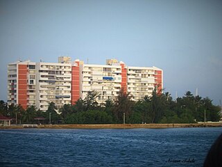 Condos on Isleta Marina, a private island of Fajardo
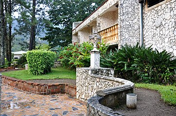 Paved walkway and building in Fajardo
 Beach in Fajardo
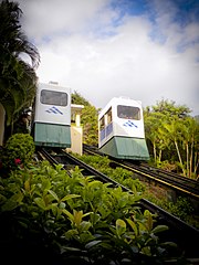 Funicular at El Conquistador Resort in Fajardo
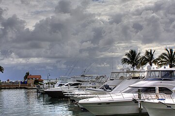 Pier at Cabezas
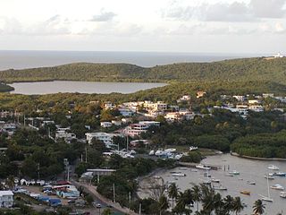 Las Croabas


