Flakavatnet
Appearance
From Wikipedia, the free encyclopedia
Lake in Norway
| Flakavatnet | |
|---|---|
 | |
| Location | Ulvik,VestlandandHol,Buskerud |
| Coordinates | 60°38′50″N7°35′22″E/ 60.6471°N 7.5895°E/60.6471; 7.5895 |
| Basincountries | Norway |
| Max. length | 4.5 kilometres (2.8 mi) |
| Max. width | 2.1 kilometres (1.3 mi) |
| Surface area | 3.43 km2(1.32 sq mi) |
| Shore length1 | 16.47 kilometres (10.23 mi) |
| Surface elevation | 1,453 metres (4,767 ft) |
| References | NVE |
| 1Shore length isnot a well-defined measure. | |
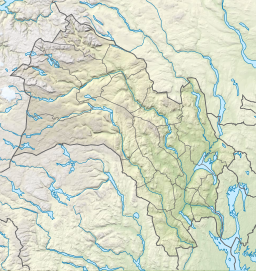
Flakavatnetis analpine lakeon the border ofVestlandandBuskerudcounties inNorway.The 3.43-square-kilometre (1.32 sq mi) lake lies in the municipalities ofUlvik(in Vestland) andHol(in Viken) and the lake lies entirely within theHallingskarvet National Park.The village ofFinselies about 5 kilometres (3.1 mi) southwest of the lake.[1]
The lake is one of the largest lakes in Europe that lies in the transition to the high-alpinezone, where vegetation is minimal or absent and influence of permanent snow patches and glaciers are evident.
See also
[edit]References
[edit]- ^"Flakavatnet"(in Norwegian).yr.no.Retrieved2014-05-25.
Hidden categories:
- Pages using gadget WikiMiniAtlas
- CS1 Norwegian-language sources (no)
- Articles with short description
- Short description matches Wikidata
- Coordinates on Wikidata
- Articles using infobox body of water without alt
- Articles using infobox body of water without pushpin map alt
- Articles using infobox body of water without image bathymetry
- All stub articles


