
Freel Peak
| Freel Peak | |
|---|---|
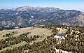
 Freel Peak from theTahoe Rim Trail | |
| Highest point | |
| Elevation | 10,886 ft (3,318 m)NAVD 88[1] |
| Prominence | 3,146 ft (959 m)[2] |
| Isolation | 22.95 mi (36.93 km)[2] |
| Listing |
|
| Coordinates | 38°51′27″N119°54′01″W/ 38.857537042°N 119.900142906°W[1] |
| Geography | |
 Freel Peak  Freel Peak | |
| Location | El DoradoandAlpinecounties,California,U.S. |
| Parent range | Carson Range |
| Topo map | USGSFreel Peak |
| Climbing | |
| Easiest route | Scramble,class 2[3] |
Freel Peakis a mountain located in theCarson Range,a spur of theSierra Nevada,nearLake TahoeinCalifornia.[4]
The peak is on the boundary betweenEl Dorado CountyandAlpine County;and the boundary between theEldorado National Forestand theHumboldt-Toiyabe National Forest.[5] At 10,886 feet (3,318 m), it is the tallest summit in the Carson Range, El Dorado County, and the Tahoe Basin.[2]Due to its elevation, most of the precipitation that falls on the mountain is snow.[6]
In 1893, theU.S. Geological Surveyassigned the name Freel Peak to what was then known as Jobs Peak. James Freel was an early settler in the area.[7][8]
-
 Freel Peak and Lake Tahoe
 -
 Freel Peak seen fromJobs Sister
 -
 Freel Peak, Jobs Sister, and Jobs Peak seen fromHawkins Peak.


Climate
[edit]According to theKöppen climate classificationsystem, Freel Peak is located in analpine climatezone.[9]Mostweather frontsoriginate in thePacific Ocean,and travel east toward the Sierra Nevada mountains. As fronts approach, they are forced upward by the peaks (orographic lift), causing them to drop their moisture in the form of rain orsnowfallonto the range.
| Climate data for Freel Peak 38.8613 N, 119.9011 W, Elevation: 10,404 ft (3,171 m) (1991–2020 normals) | |||||||||||||
|---|---|---|---|---|---|---|---|---|---|---|---|---|---|
| Month | Jan | Feb | Mar | Apr | May | Jun | Jul | Aug | Sep | Oct | Nov | Dec | Year |
| Mean daily maximum °F (°C) | 33.2 (0.7) |
31.8 (−0.1) |
34.1 (1.2) |
38.4 (3.6) |
46.5 (8.1) |
56.6 (13.7) |
65.8 (18.8) |
65.1 (18.4) |
59.0 (15.0) |
49.2 (9.6) |
38.7 (3.7) |
32.8 (0.4) |
45.9 (7.8) |
| Daily mean °F (°C) | 24.3 (−4.3) |
22.3 (−5.4) |
24.3 (−4.3) |
27.4 (−2.6) |
34.8 (1.6) |
43.9 (6.6) |
52.2 (11.2) |
51.4 (10.8) |
46.1 (7.8) |
37.4 (3.0) |
29.3 (−1.5) |
24.2 (−4.3) |
34.8 (1.5) |
| Mean daily minimum °F (°C) | 15.4 (−9.2) |
12.8 (−10.7) |
14.4 (−9.8) |
16.3 (−8.7) |
23.1 (−4.9) |
31.2 (−0.4) |
38.7 (3.7) |
37.8 (3.2) |
33.1 (0.6) |
25.5 (−3.6) |
20.0 (−6.7) |
15.5 (−9.2) |
23.6 (−4.6) |
| Averageprecipitationinches (mm) | 6.57 (167) |
5.85 (149) |
5.51 (140) |
2.94 (75) |
2.43 (62) |
0.94 (24) |
0.49 (12) |
0.49 (12) |
0.74 (19) |
2.18 (55) |
3.79 (96) |
6.57 (167) |
38.5 (978) |
| Source: PRISM Climate Group[10] | |||||||||||||
References
[edit]- ^ab"Freel Peak".NGS Data Sheet.National Geodetic Survey,National Oceanic and Atmospheric Administration,United States Department of Commerce.Retrieved2009-01-21.
- ^abcd"Freel Peak, California".Peakbagger.com.Retrieved2009-02-25.
- ^ab"Tahoe OGUL Peaks List".Retrieved2024-01-06.
- ^"Freel Peak".SummitPost.org.Retrieved2021-10-24.
- ^ Freel Peak quadrangle, California(Map). 1:24000. 7.5 Minute Topographic.USGS.Retrieved2009-12-23.
- ^ "Subsection M261Et - Carson Range".U.S. Forest Service. Archived fromthe originalon 2007-08-13.Retrieved2014-02-22.
- ^Gudde, Erwin G. (1949).California Place Names.Berkeley: Univ. of California Press. p. 121.
- ^"Freel Peak".Geographic Names Information System.United States Geological Survey,United States Department of the Interior.Retrieved2012-12-17.
- ^"Climate of the Sierra Nevada".Encyclopædia Britannica.
- ^"PRISM Climate Group, Oregon State University".PRISM Climate Group, Oregon State University.RetrievedOctober 2,2023.
To find the table data on the PRISM website, start by clickingCoordinates(underLocation); copyLatitudeandLongitude figuresfrom top of table; clickZoom to location;clickPrecipitation, Minimum temp, Mean temp, Maximum temp;click30-year normals, 1991-2020;click800m;clickRetrieve Time Seriesbutton.
| Mountains |
| |||||||||||
|---|---|---|---|---|---|---|---|---|---|---|---|---|
| Passes | ||||||||||||
| Rivers | ||||||||||||
| Lakes | ||||||||||||
| Protected areas |
| |||||||||||
| Communities | ||||||||||||
| Ski areas | ||||||||||||
| Trails | ||||||||||||

ThisAlpine County, California-related article is astub.You can help Wikipedia byexpanding it. |
ThisEl Dorado County, California–related article is astub.You can help Wikipedia byexpanding it. |
- Mountains of the Sierra Nevada (United States)
- Mountains of El Dorado County, California
- Mountains of Alpine County, California
- Eldorado National Forest
- Humboldt–Toiyabe National Forest
- Mountains of Northern California
- North American 3000 m summits
- Sierra Nevada geography stubs
- El Dorado County, California geography stubs